Related Research Articles

The Caribbean Sea is an American Mediterranean Sea of the Atlantic Ocean in the tropics of the Western Hemisphere. It is bounded by Mexico and Central America to the west and south west, to the north by the Greater Antilles starting with Cuba, to the east by the Lesser Antilles, and to the south by the north coast of South America.

A mangrove is a shrub or small tree that grows in coastal saline or brackish water. The term is also used for tropical coastal vegetation consisting of such species. Mangroves occur worldwide in the tropics and subtropics, mainly between latitudes 25° N and 25° S. The total mangrove forest area of the world in 2000 was 137,800 square kilometres (53,200 sq mi), spanning 118 countries and territories.

The Central American river turtle, also known locally as the hickatee or tortuga blanca, is the only living species in the family Dermatemydidae. Its closest relatives are only known from fossils with some 19 genera described from a worldwide distribution from the Jurassic and Cretaceous. The species is currently found in the Atlantic drainages of Central America, specifically southern Mexico, Belize and Guatemala. It is a relatively large-bodied species, with historical records of 60 cm (24 in) stright carapace length and weights of 22 kg (49 lb); however, more recent records have found few individuals over 14 kg (31 lb) in Mexico or 11 kg (24 lb) in Guatemala.

The Gulf or Bay of Honduras is a large inlet of the Caribbean Sea, indenting the coasts of Belize, Guatemala, and Honduras. From north to south, it runs for approximately 200 km from Dangriga, Belize, to La Ceiba, Honduras.
Adaptive management (AM), also known as adaptive resource management (ARM) or adaptive environmental assessment and management (AEAM), is a structured, iterative process of robust decision making in the face of uncertainty, with an aim to reducing uncertainty over time via system monitoring. In this way, decision making simultaneously meets one or more resource management objectives and, either passively or actively, accrues information needed to improve future management. Adaptive management is a tool which should be used not only to change a system, but also to learn about the system. Because adaptive management is based on a learning process, it improves long-run management outcomes. The challenge in using the adaptive management approach lies in finding the correct balance between gaining knowledge to improve management in the future and achieving the best short-term outcome based on current knowledge. This approach has more recently been employed in implementing international development programs.

Hopkins Village is a coastal village in eastern Belize.
The University of Belize (UB) is an English-speaking multi-locational institute for higher education, and the national university of the Belize. The institution offers certificates, diplomas, associate degrees, bachelor degrees, and a graduate degree. The UB Central Campus is in Belmopan City.

The 1820 Settlers National Monument, which honours the contribution to South African society made by the British 1820 Settlers, overlooks Grahamstown in the Eastern Cape. A living monument, it commemorates the English language as much as the Settlers themselves. The building was designed by John Sturrock, Sturrock was inspired by the work of Louis Kahn.
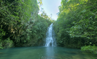
The flora of Belize is highly diverse by regional standards, given the country's small geographical extent. Situated on the Caribbean coast of northern Central America the flora and vegetation have been intimately intertwined with Belize's history. The nation itself grew out of British timber extraction activities from the 17th century onwards, at first for logwood and later for mahogany, fondly called "red gold" because of its high cost and was much sought after by European aristocracy. Central America generally is thought to have gained much of it characteristic flora during the "Great American interchange" during which time South American elements migrated north after the geological closure of the isthmus of Panama. Few Amazonian elements penetrate as far north as Belize and in species composition the forests of Belize are most similar to the forests of the Petén (Guatemala) and the Yucatán (Mexico).
The Cockscomb Basin Wildlife Sanctuary is a nature reserve in the Stann Creek District of south-central Belize. It was established to protect the forests, fauna and watersheds of an approximately 400 square kilometres (150 sq mi) area of the eastern slopes of the Maya Mountains.

Since declaring independence in 1981, Belize has enacted many environmental protection laws aimed at the preservation of the country's natural and cultural heritage, as well as its wealth of natural resources. These acts have established a number of different types of protected areas, with each category having its own set of regulations dictating public access, resource extraction, land use and ownership.

The porcupine ray is a rare species of stingray in the family Dasyatidae. This bottom-dweller is found throughout the tropical Indo-Pacific, as well as off West Africa. It favors sand, coral rubble, and seagrass habitats in inshore waters to a depth of 30 m (100 ft). A large and heavy-bodied species reaching 1.2–1.5 m (3.9–4.9 ft) in width, the porcupine ray has a nearly circular, plain-colored pectoral fin disc and a thin tail without any fin folds. Uniquely within its family, it lacks a venomous stinging spine. However, an adult ray can still defend itself ably with the many large, sharp thorns found over its disc and tail.

Teatown Lake Reservation is a nonprofit nature preserve and environmental education center in Westchester County, New York, in the United States. The reservation includes an 1,000-acre (4.0 km2) nature preserve and education center located in the Westchester towns of Ossining, Yorktown, Cortlandt, and New Castle. About 25,000 people come each year to hike the preserve's 15 miles (24 km) of trails, attend an education program, visit the Nature Center, or tour "Wildflower Island". Teatown's educators offer adult, family and children's programs to 20,000 participants annually, including nearly 6,000 schoolchildren and 700 summer camp students.
Janet Gibson is a biologist and zoologist from Belize. She was awarded the Goldman Environmental Prize in 1990 for her efforts on conservation of the marine ecosystems along the Belizean coast, in particular the barrier reef system. The Belize Barrier Reef was granted UNESCO World Heritage status in 1996, through efforts of Gibson and others. She is the current director of the Belize Wildlife Conservation Society.

Bacalar Chico National Park and Marine Reserve (BCNPMR) is a protected area and UNESCO World Heritage Site on the northern part of Ambergris Caye in Belize.

Gladden Spit and Silk Cayes Marine Reserve (GSSCMR) is a protected marine reserve in the central part of Belize's Barrier Reef. It covers approximately 25,980 acres (10,510 ha) lying 36 kilometres (22 mi) off the coast of Placencia. Established in 2003, The reserve comes under the authority of the government's Fisheries Department, but is managed by the Southern Environmental Association, a community-based organisation.
Manatee River is a coastal watercourse in the Belize District of Belize. It consists of two parts, one on the western side of the Southern Lagoon, and the other connecting the eastern side of the Southern Lagoon with the Caribbean Sea. The beach on either side of the mouth of the river is a nesting site for Loggerhead and Hawksbill sea turtles. The river was originally known by the Maya as the Texach.
Community Baboon Sanctuary is a protected area in Belize. It was established in 1985 to help address the threats of agriculture, logging and hunting of the black howler monkey (‘baboon”) and to educate locals and visitors about the importance of biodiversity, sustainability, and to promote the economic development of the Bermudian Landing community.
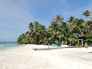
Ranguana Caye is a two-acre private island located roughly 20 miles west of Placencia. According to Peter Eltringham, author of The Rough Guide to Belize, Ranguana Caye has sand softer in comparison to Placencia with taller palm trees. Those exploring the caye are required to set up transportation through private boat charters. The island includes a dock and moorings for visiting boats, located just off the Belize Barrier Reef. A day tour to the island is through Belize Ocean Club, a resort located in Maya Beach Village near Placencia and managed by Muy'Ono Properties. Ranguana Caye also features three rustic cabanas for overnight guests, with Bully's Beach Bar, a BBQ grill and composting restroom systems for guests. The resort has no pay phones, but features wifi and radio communication. Snorkeling the Belize Barrier Reef and reef fishing are also some activities on the island.
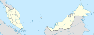
The Kudat Peninsula is a peninsula in northern of Sabah, Malaysia. It consists of high coastal with windy shorelines and swamp areas. The peninsula become the area where the South China Sea meets the Sulu Sea.
References
- ↑ Environmental Conservation Organization (1997). Eco: journal of environmental information. Environmental Conservation Organization Limited.
- ↑ Meb Cutlack (2000). Belize: Ecotourism in Action. Macmillan Education, Limited. ISBN 978-0-333-77329-1.
- ↑ Anne Sutherland (1998). The Making of Belize: Globalization in the Margins. Greenwood Publishing Group. pp. 139–. ISBN 978-0-89789-579-8.
- ↑ Peter Eltringham (2001). The Rough Guide to Belize . Rough Guides. pp. 73–. ISBN 978-1-85828-710-2.