The name Caribbean derives from the Caribs, one of the region's dominant native people at the time of Europe and contact during the late 15th century. After Christopher Columbus landed in The Bahamas in 1492 and later discovered some of the islands in the Caribbean, the Spanish term Antillas applied to the lands; stemming from this, the Sea of the Antilles became a common alternative name for the "Caribbean Sea" in various European languages. Spanish dominance in the region remained undisputed during the first century of European colonization.[citation needed]
From the 16th century, Europeans visiting the Caribbean region distinguished the "South Sea" (the Pacific Ocean south of the isthmus of Panama) from the "North Sea" (the Caribbean Sea north of the same isthmus).[5]
The Caribbean Sea was unknown to the populations of Eurasia until after 1492, when Christopher Columbus sailed into Caribbean waters in search of a sea route to Asia. At that time, the Americas were generally unknown to most Europeans, although they had been visited in the 10th century by the Vikings. After Columbus discovered the islands, the area was quickly colonized by several Western cultures (initially Spain, then later England, the Dutch Republic, France, Courland and Denmark). After the colonization of the Caribbean islands, the Caribbean Sea became a busy area for European-based maritime trade and transport. The commerce eventually attracted pirates such as Samuel Bellamy and Blackbeard.[citation needed]
Eastern limits. From Point San Diego (Puerto Rico) northward along the meridian thereof (65°39′W) to the 100-fathom line, thence eastward and southward, in such a manner that all islands, shoals, and narrow waters of the Lesser Antilles are included in the Caribbean Sea as far as but not including Trinidad. From before Trinidad to Baja Point (9°32′N61°0′W / 9.533°N 61.000°W / 9.533; -61.000) in Venezuela.
Although Trinidad and Tobago and Barbados are on the same continental shelf, they are considered to be in the Atlantic Ocean rather than in the Caribbean Sea.[7]
The Caribbean Sea is estimated to be 160 million to 180million years old and formed when a horizontal fracture in Pangaea split the supercontinent during the Mesozoic Era.[10] It is assumed the proto-Caribbean basin existed in the Devonian period and, in the early Carboniferous movement of Gondwana to the north and its convergence with the Euramerica basin, decreased in size. The next stage in the formation of the Caribbean Sea began in the Triassic. Powerful rifting led to the formation of narrow troughs stretching from modern Newfoundland to the Gulf of Mexico's west coast, which deposited siliciclasticsedimentary rocks.
During the Cretaceous, the Caribbean acquired a shape close to today's. In the early Paleogene, due to marine regression, the Caribbean became separated from the Gulf of Mexico and the Atlantic Ocean by the lands of Cuba and Haiti. The Caribbean remained like this for most of the Cenozoic until the Holocene, when rising ocean levels restored communication with the Atlantic Ocean.
The Caribbean's floor is composed of suboceanic sediments of deep red clay in the deep basins and troughs. On continental slopes and ridges, calcareoussilts are found. Clay minerals have likely been deposited by the mainland river Orinoco and the Magdalena River. Deposits on the bottom of the Caribbean Sea and the Gulf of Mexico have thicknesses of about 1km (0.62mi). Upper sedimentary layers date to the Mesozoic to Cenozoic (250 million years ago), and the lower layers to the Paleozoic to Mesozoic.
Caribbean plate tectonics
The Caribbean seafloor is divided into five basins (the Yucatan, Cayman, Colombian, Venezuelan, and Grenada Basins) separated from one another by underwater ridges and mountain ranges (the Cayman Ridge, the Nicaraguan Rise, the Beata Ridge, and the Aves Ridge). Atlantic Ocean water enters the Caribbean through the Anegada Passage between the Lesser Antilles and the Virgin Islands and the Windward Passage between Cuba and Haiti.
The Yucatán Channel between Mexico and Cuba links the Gulf of Mexico with the Caribbean. The deepest points of the sea lie in Cayman Trough, with depths reaching approximately 7,686m (25,220ft). Despite that, the Caribbean Sea is considered relatively shallow compared to other bodies of water. The pressure of the South American Plate to the east of the Caribbean causes the Lesser Antilles to have high volcanic activity, and a severe eruption of Mount Pelée in 1902 resulted in many casualties.
The Caribbean seafloor is also the home of two oceanic trenches: the Cayman Trench and the Puerto Rico Trench, which put the area at a high risk of earthquakes. Underwater earthquakes pose a threat of generating tsunamis, which could have devastating effects on the Caribbean islands. Scientific data reveal that over the past 500 years, the area has experienced a dozen earthquakes of magnitude 7.5 or higher.[11] Most recently, a 7.1-magnitude earthquake struck Haiti, on January 12, 2010.
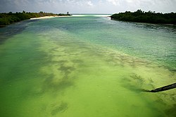
The hydrology of the sea is highly homogeneous. Annual variations in monthly average water temperatures at the surface do not exceed 3°C (5.4°F). In the past 50 years, the Caribbean has gone through three stages: cooling until 1974, a cold phase with peaks during 1974–1976 and 1984–1986, and, finally, a warming phase with an increase in temperature of 0.6°C (1.1°F) per year. Virtually all temperature extremes were associated with the phenomena of El Niño and La Niña. The salinity of the seawater is about 3.6%, and its density is 1,023.5–1,024.0kg/m3 (63.90–63.93lb/cuft). The surface water color is blue-green to green.
The Caribbean's depth in its wider basins and deepwater temperatures are similar to those of the Atlantic Ocean. Atlantic deepwater is thought to spill into the Caribbean and contribute to the general deepwater of the Caribbean Sea.[12] The surface water (30m; 100ft) acts as an extension of the northern Atlantic as the Guiana Current and part of the North Equatorial Current enter the sea on the east. On the western side of the sea, the trade winds influence a northerly current, which causes an upwelling and a rich fishery near Yucatán.[13]
Ecology
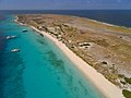
The Caribbean is the home of about 9% of the world's coral reefs, covering about 50,000km2 (19,000sqmi), most of which are located off the Caribbean islands and the Central American coast.[14] Among them, the Belize Barrier Reef stands out, with an area of 963km2 (372sqmi), which was declared a World Heritage Site in 1996. It forms part of the Great Mayan Reef (also known as the MBRS) and, being more than 1,000km (600mi) in length, is the world's second longest. It runs along the Caribbean coasts of Mexico, Belize, Guatemala and Honduras.
Since 2005, unusually warm Caribbean waters have been increasingly threatening the coral reefs. Coral reefs support some of the most diverse marine habitats in the world, but they are fragile ecosystems. When tropical waters become unusually warm for extended periods of time, microscopic plants called zooxanthellae, which are symbiotic partners living within the coral polyp tissues, die off. These plants provide food for the corals and give them their color. The death and dispersal of these tiny plants is called coral bleaching and can devastate large areas of reef. More than 42% of corals are completely bleached, and 95% are experiencing some whitening.[15] Historically, the Caribbean is thought to contain 14% of the world's coral reefs.[16]
The habitats supported by the reefs are critical to activities such as fishing and scuba diving, and they provide an annual economic value to Caribbean nations of US$3.1–4.6billion. Continued reef destruction could severely damage the region's economy.[17] The Convention for the Protection and Development of the Marine Environment of the Wider Caribbean Region came into effect in 1986 to protect the various endangered marine life of the Caribbean by forbidding human activities that would advance the continued destruction of such marine life in various areas. Currently, the convention has been ratified by 15 countries.[18] Several charitable organizations have formed to preserve Caribbean marine life, such as Sea Turtle Conservancy, which seeks to study and protect sea turtles while educating about them.[19]
In 2012, the Institute of Marine Sciences and Limnology of the National Autonomous University of Mexico conducted a regional study funded by the Department of Technical Cooperation of the International Atomic Energy Agency, in which specialists from 11 Latin American countries (Colombia, Costa Rica, Cuba, the Dominican Republic, Guatemala, Haiti, Honduras, Mexico, Nicaragua, Panama, and Venezuela) plus Jamaica participated. The study's findings indicate that heavy metals, including mercury, arsenic, and lead, have been detected in the coastal zone of the Caribbean Sea. Analysis of toxic metals and hydrocarbons is based on the investigation of coastal sediments that have accumulated to depths of less than 50 meters over the past 150 years. Project results were presented in Vienna at the forum "Water Matters" and the 2011 General Conference of that multilateral organization.[20]
After the Mediterranean Sea, the Caribbean Sea is the second-most-polluted sea. Pollution in the form of up to 300,000 tonnes of solid garbage dumped into the Caribbean Sea each year is progressively endangering marine ecosystems, wiping out species, and harming the livelihoods of local people, who rely primarily on tourism and fishing.[21][22][23][24]
Climate
The average sea surface temperatures for the Caribbean Atlantic Ocean, 25–27 August 2005. Hurricane Katrina is seen just above Cuba.
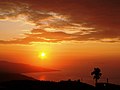
The Caribbean's climate is driven by its low latitude and tropical ocean currents. The principal ocean current is the North Equatorial Current, which enters the region from the tropical Atlantic. The climate of the area is tropical, varying from tropical rainforest in some regions to tropical savanna in others. There are also some locations with arid climates and considerable drought in some years.
Rainfall varies with elevation, size, and water currents. Cool upwelling keeps the ABC islands arid. Warm, moist trade winds blow consistently from the east, creating both rainforest and semi-arid climates across the region. Tropical rainforest climates include lowland areas near the Caribbean Sea from Costa Rica north to Belize, as well as the Dominican Republic and Puerto Rico.[26]
More seasonal dry tropical savanna climates are found in Cuba, northern Venezuela and Colombia, and southern Yucatán, Mexico. Arid climates are found along the extreme northern coast of Venezuela (e.g., Paraguaná Peninsula) and Colombia (e.g., Guajira Peninsula), extending to the islands, including Aruba and Curaçao, and to the northern tip of Yucatán.[27]
Tropical cyclones are a threat to the nations that rim the Caribbean Sea. While landfalls are infrequent, the resulting loss of life and property damage makes them a significant hazard to life in the Caribbean. Tropical cyclones that impact the Caribbean often develop off the West coast of Africa and make their way west across the Atlantic Ocean toward the Caribbean, while other storms develop in the Caribbean itself. The Caribbean hurricane season runs from June to November, with most hurricanes occurring in August and September. On average, about nine tropical storms form each year, with five reaching hurricane strength. According to the National Hurricane Center, 385 hurricanes occurred in the Caribbean between 1494 and 1900.
Flora and fauna
The region has a high level of biodiversity, and many species are endemic to the Caribbean.
In shallow water, flora and fauna are concentrated around coral reefs where there is little variation in water temperature, purity, and salinity. Leeward sides of lagoons provide areas of growth for sea grasses. Turtle grass (Thalassia testudinum) is common in the Caribbean, as is manatee grass (Syringodium filiforme), which can grow together as well as in fields of single species at depths up to 20m (66ft). Another type of shoal grass (Halodule wrightii) grows on sand and mud surfaces at depths of up to 5m (16ft).
The Caribbean region has seen a significant increase in human activity since colonization. The sea is one of the largest oil production areas in the world, producing approximately 170million tons[clarification needed] per year.[34] The area also generates a large fishing industry for the surrounding countries, accounting for 500,000 tonnes (490,000 long tons; 550,000 short tons) of fish a year.[35]
Human activity in the area contributes significantly to pollution. In 1993, it was estimated that only about 10% of the sewage from the Central American and Caribbean Island countries was properly treated before being released into the sea.[34]
The region has been famous for its rum production - the drink is first mentioned in records from Barbados in around 1650, although it was likely to have been produced beforehand across the other islands.[36]
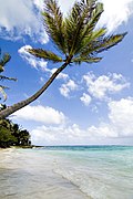
The Caribbean region supports a large tourism industry. The Caribbean Tourism Organization calculates that about 12million people a year visit the area, including (in 1991–1992) about 8million cruise ship tourists. Tourism based upon scuba diving and snorkeling on coral reefs of many Caribbean islands makes a major contribution to their economies.[37]
↑National Geophysical Data Center, 1999. Global Land One-kilometer Base Elevation (GLOBE) v.1. Hastings, D. and P.K. Dunbar. National Geophysical Data Center, NOAAArchived 2011-02-10 at the Wayback Machine . doi:10.7289/V52R3PMS [access date: 2015-03-16]
↑Amante, C. and B.W. Eakins, 2009. ETOPO1 1 Arc-Minute Global Relief Model: Procedures, Data Sources and Analysis. NOAA Technical Memorandum NESDIS NGDC-24. National Geophysical Data Center, NOAA. doi:10.7289/V5C8276M [access date: 2015-03-18].
↑Iturralde-Vinent, Manuel (2004), The first inhabitants of the Caribbean, Cuban Science Network. URL accessed on 28/07/2007
Donovan, Stephen K., and Trevor A. Jackson, eds. Caribbean Geology: An Introduction (1994) online
Gallegos, Artemio. "Descriptive physical oceanography of the Caribbean Sea". Small Islands Marine Science and Sustainable Development 51 (1996): 36–55.
Wood, Robert E. "Caribbean cruise tourism: Globalization at sea." Annals of tourism research 27.2 (2000): 345–370.
Woodring, Wendell Phillips. "Caribbean land and sea through the ages." Geological Society of America Bulletin 65.8 (1954): 719–732. GSA Bulletin (1954) 65 (8): 719–732. doi:10.1130/0016-7606(1954)65[719:CLASTT]2.0.CO
Reefs at Risk in the Caribbean: Economic Valuation Methodology, World Resources Institute, 2007.
External links
Wikimedia Commons has media related to Caribbean Sea .
†Physiographically, these continental islands are not part of the volcanic Windward Islands arc, although sometimes grouped with them culturally and politically.
#Bermuda is an isolated North Atlanticoceanic island, physiographically not part of the Lucayan Archipelago, Antilles, Caribbean Sea nor North American continental nor South American continental islands. It is grouped with the Northern American region, but occasionally also with the Caribbean region culturally.
This page is based on this Wikipedia article Text is available under the CC BY-SA 4.0 license; additional terms may apply. Images, videos and audio are available under their respective licenses.