Gulf

Last updated
Gulf of Tunis in Tunisia Gulf of Tunis NASA.jpg
Gulf of Tunis in Tunisia
Map of the Gulf of Bothnia between Sweden and Finland 486 of 'The Illustrated History of the War against Russia. Plates' (11045635933).jpg
Map of the Gulf of Bothnia between Sweden and Finland

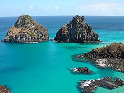
A gulf is a large inlet from the ocean into the landmass, typically with a narrower opening than a bay, but that is not observable in all geographic areas so named. The term gulf was traditionally used for large highly indented navigable bodies of salt water that are enclosed by the coastline. [1] Many gulfs are major shipping areas, such as the Persian Gulf, Gulf of Mexico, Gulf of Finland, and Gulf of Aden. [2]

Contents

See also

Related Research Articles

<span class="mw-page-title-main">Gulf Coast of the United States</span> Coastline in the United States

The Gulf Coast of the United States, also known as the Gulf South or the South Coast, is the coastline along the Southern United States where they meet the Gulf of Mexico. The coastal states that have a shoreline on the Gulf of Mexico are Texas, Louisiana, Mississippi, Alabama, and Florida, and these are known as the Gulf States.

<span class="mw-page-title-main">Geography of the Philippines</span>

The Philippines is an archipelago that comprises 7,641 islands, and with a total land area of 300,000 square kilometers (115,831 sq mi), it is the world's fifth largest island country. The eleven largest islands contain 95% of the total land area. The largest of these islands is Luzon at about 105,000 square kilometers (40,541 sq mi). The next largest island is Mindanao at about 95,000 square kilometers (36,680 sq mi). The archipelago is around 800 kilometers (500 mi) from the Asian mainland and is located between Taiwan and Borneo.

<span class="mw-page-title-main">Fjord</span> Long, narrow inlet with steep sides or cliffs, created by glacial activity

In physical geography, a fjord or fiord is a long, narrow sea inlet with steep sides or cliffs, created by a glacier. Fjords exist on the coasts of Antarctica, the Arctic, and surrounded landmasses of the northern and southern hemispheres. Norway's coastline is estimated to be 29,000 km (18,000 mi) long with its nearly 1,200 fjords, but only 2,500 km (1,600 mi) long excluding the fjords.

<span class="mw-page-title-main">Estuary</span> Partially enclosed coastal body of brackish water

An estuary is a partially enclosed coastal body of brackish water with one or more rivers or streams flowing into it, and with a free connection to the open sea. Estuaries form a transition zone between river environments and maritime environments and are an example of an ecotone. Estuaries are subject both to marine influences such as tides, waves, and the influx of saline water, and to fluvial influences such as flows of freshwater and sediment. The mixing of seawater and freshwater provides high levels of nutrients both in the water column and in sediment, making estuaries among the most productive natural habitats in the world.

<span class="mw-page-title-main">Gulf of Thailand</span> Shallow inlet in the western part of the South China Sea

The Gulf of Thailand, also known as the Gulf of Siam, is a shallow inlet in the southwestern South China Sea, bounded between the southwestern shores of the Indochinese Peninsula and the northern half of the Malay Peninsula. It is around 800 km (500 mi) in length and up to 560 km (350 mi) in width, and has a surface area of 320,000 km2 (120,000 sq mi). The gulf is surrounded on the north, west and southwest by the coastlines of Thailand, on the northeast by Cambodia and the Mekong Delta region of Vietnam, and opens to the South China Sea in the southeast.

Landforms are categorized by characteristic physical attributes such as their creating process, shape, elevation, slope, orientation, rock exposure, and soil type.

<span class="mw-page-title-main">Barrier island</span> Coastal dune landform that forms by wave and tidal action parallel to the mainland coast

Barrier islands are a coastal landform, a type of dune system and sand island, where an area of sand has been formed by wave and tidal action parallel to the mainland coast. They usually occur in chains, consisting of anything from a few islands to more than a dozen. They are subject to change during storms and other action, but absorb energy and protect the coastlines and create areas of protected waters where wetlands may flourish. A barrier chain may extend for hundreds of kilometers, with islands periodically separated by tidal inlets. The largest barrier island in the world is Padre Island of Texas, United States, at 113 miles (182 km) long. Sometimes an important inlet may close permanently, transforming an island into a peninsula, thus creating a barrier peninsula, often including a beach, barrier beach. Though many are long and narrow, the length and width of barriers and overall morphology of barrier coasts are related to parameters including tidal range, wave energy, sediment supply, sea-level trends, and basement controls. The amount of vegetation on the barrier has a large impact on the height and evolution of the island.

<span class="mw-page-title-main">Rip tide</span> Current caused by the tide pulling water through an inlet

A rip tide, or riptide, is a strong offshore current that is caused by the tide pulling water through an inlet along a barrier beach, at a lagoon or inland marina where tide water flows steadily out to sea during ebb tide. It is a strong tidal flow of water within estuaries and other enclosed tidal areas. The riptides become the strongest where the flow is constricted. When there is a falling or ebbing tide, the outflow water is strongly flowing through an inlet toward the sea, especially once stabilised by jetties.

<span class="mw-page-title-main">Sound (geography)</span> A long, relatively wide body of water, connecting two larger bodies of water

In geography, a sound is a smaller body of water usually connected to a sea or an ocean. A sound may be an inlet that is deeper than a bight and wider than a fjord; or a narrow sea channel or an ocean channel between two land masses, such as a strait; or also a lagoon between a barrier island and the mainland.

<span class="mw-page-title-main">Inlet</span> Indentation of a shoreline

An inlet is a indentation of a shoreline, such as a small arm, cove, bay, sound, fjord, lagoon or marsh, that leads to an enclosed larger body of water such as a lake, estuary, gulf or marginal sea.

<span class="mw-page-title-main">Gulf of Alaska</span> Arm of the Pacific Ocean

The Gulf of Alaska is an arm of the Pacific Ocean defined by the curve of the southern coast of Alaska, stretching from the Alaska Peninsula and Kodiak Island in the west to the Alexander Archipelago in the east, where Glacier Bay and the Inside Passage are found.

<span class="mw-page-title-main">Garabogazköl</span> Shallow water-filled depression in the northwestern corner of Turkmenistan

Garabogazköl, or Garabogazköl Aylagy, is a shallow, highly saline lagoon off the Caspian Sea in northwestern Turkmenistan. The lagoon has a variable surface area typically about 18,000 km2 (6,900 sq mi). It is separated from the Caspian Sea by a narrow, rocky ridge having a very narrow opening through which the Caspian Sea waters flow into it. There is likely a subterranean highly saline water flow when there is less evaporation in winter. The lagoon's volume fluctuates seasonally, accentuated by its salt evaporation ponds and seasonally dry salt pans.

An inland sea is a continental body of water which is very large in area and is either completely surrounded by dry land or connected to an ocean by a river, strait or "arm of the sea". An inland sea will generally be brackish, with higher salinity than a freshwater lake but usually lower salinity than seawater. As with other seas, inland seas experience tides governed by the orbits of the Moon and Sun.

<span class="mw-page-title-main">Bay</span> Recessed, coastal body of water connected to an ocean or lake

A bay is a recessed, coastal body of water that directly connects to a larger main body of water, such as an ocean, a lake, or another bay. A large bay is usually called a gulf, sea, sound, or bight. A cove is a small, circular bay with a narrow entrance. A fjord is an elongated bay formed by glacial action. The term embayment is also used for related features, such as extinct bays or freshwater environments.

<span class="mw-page-title-main">Zona Austral</span> Southernmost natural region of continental Chile

The Zona Austral is one of the five natural regions into which CORFO divided continental Chile in 1950 corresponding to the Chilean portion of Patagonia. It is surrounded by the Zona Sur and the Chacao Channel to the north, the Pacific Ocean and Drake's Passage to the south and west, and the Andean mountains and Argentina to the east. If excluding Chiloé Archipelago, Zona Austral covers all of Chilean Patagonia.

<span class="mw-page-title-main">Gulf of Mexico</span> Marginal sea of the Atlantic Ocean

The Gulf of Mexico is an ocean basin and a marginal sea of the Atlantic Ocean, mostly surrounded by the North American continent. It is bounded on the northeast, north and northwest by the Gulf Coast of the United States; on the southwest and south by the Mexican states of Tamaulipas, Veracruz, Tabasco, Campeche, Yucatán, and Quintana Roo; and on the southeast by Cuba. The Southern U.S. states of Texas, Louisiana, Mississippi, Alabama, and Florida, which border the gulf on the north, are often referred to as the "Third Coast" of the United States.

<span class="mw-page-title-main">Atlantic Biogeographic Region</span>

The Atlantic Biogeographic Region is the biogeographic region of Europe bordering the Atlantic Ocean and North Sea.

<span class="mw-page-title-main">Mississippi–Alabama barrier islands</span> Islands in the Gulf of Mexico

The Mississippi–Alabama barrier islands are a chain of barrier islands in the Gulf of Mexico along the coasts of Mississippi and Alabama enclosing the Mississippi Sound. The major islands are Cat Island, Ship Island, Horn Island, Petit Bois Island, and Dauphin Island; in the early 20th century the chain also included the Isle of Caprice, which has since been submerged. The islands are separated by wide inlets, several of which have been channelized to form the shipping channels for Gulf coast ports. The shapes and sizes of the islands have changed significantly since the 1800s, with the islands generally shrinking and shifting westward, especially after major tropical cyclones. Most of the islands are uninhabited. Much of the Mississippi portion of the chain is included in the Gulf Islands National Seashore.

References

  1. Gregory, George (1816). A Dictionary of Arts and Sciences. Vol. 2 (First American ed.). Philadelphia: Isaac Peirce. p.  269 . Retrieved 25 June 2020. A sea is a smaller collection of waters; as the Black Sea. A gulf is a part of the sea which is nearly surrounded with land; as the gulf of Venice. A bay has a wider entrance than a gulf; as the Bay of Biscay. A strait is a narrow passage that joins.
  2. Duggal, Gita. Chowdhury, Baruna Ray (ed.). Madhubun ICSE Geography 6. New Delhi: Vikas Publishing House. p.  32. ISBN   9789325994645 . Retrieved 25 June 2020. A gulf is an inlet of an ocean or a sea deep into the land with a narrow mouth. It is more highly indented, more enclosed by the coast and larger than a bay. Some examples of gulfs are Persian Gulf, Gulf of Mexico, Gulf of Eden and Gulf of...