
A harbor or harbour is a sheltered body of water where ships, boats, and barges can be docked. The term harbor is often used interchangeably with port, which is a man-made facility built for loading and unloading vessels and dropping off and picking up passengers. Ports usually include one or more harbors. Alexandria Port in Egypt is an example of a port with two harbors.

Coastal erosion is the loss or displacement of land, or the long-term removal of sediment and rocks along the coastline due to the action of waves, currents, tides, wind-driven water, waterborne ice, or other impacts of storms. The landward retreat of the shoreline can measured and described over a temporal scale of tides, seasons, and other short-term cyclic processes. Coastal erosion may be caused by hydraulic action, abrasion, impact and corrosion by wind and water, and other forces, natural or unnatural.

Port Phillip , is a horsehead-shaped bay in the central coastline of southern Victoria, Australia. The bay is surrounded mostly by metropolitan Greater Melbourne in its main eastern portion, and the city of Greater Geelong in the much smaller western portion north of the Bellarine Peninsula. Geographically, the bay covers 1,930 square kilometres and the shore stretches roughly 264 km (164 mi). Although it is extremely shallow for its size, most of the bay is navigable. The deepest portion is only 24 metres (79 ft), and half the region is shallower than 8 m (26 ft). The volume of the water in the port is around 25 cubic kilometres (6.0 cu mi).
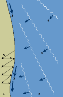
Longshore drift from longshore current is a geological process that consists of the transportation of sediments along a coast parallel to the shoreline, which is dependent on oblique incoming wave direction. Oblique incoming wind squeezes water along the coast, and so generates a water current which moves parallel to the coast. Longshore drift is simply the sediment moved by the longshore current. This current and sediment movement occur within the surf zone.

An artificial island or man-made island is an island that has been constructed by people rather than formed by natural means. Artificial islands may vary in size from small islets reclaimed solely to support a single pillar of a building or structure, to those that support entire communities and cities. Early artificial islands included floating structures in still waters, or wooden or megalithic structures erected in shallow waters.

Land reclamation, usually known as reclamation, and also known as land fill, is the process of creating new land from oceans, seas, riverbeds or lake beds. The land reclaimed is known as reclamation ground or land fill.

Dredging is the operation of excavating material from a water environment. Possible purposes of dredging include: improving existing water features; reshaping land and water features to alter drainage, navigability, and commercial use; construct dams, dikes, and other controls for streams and shorelines; and to recover valuable mineral deposits or marine life having commercial value. In all but a few situations the excavation is undertaken by a specialist floating plant, known as a dredger. Dredging is carried out in many different locations and for many different purposes, but the main objectives are usually to recover material of value or use, or to create a greater depth of water. Dredges have been classified as suction or mechanical.

Beach nourishment describes a process by which sediment, usually sand, lost through longshore drift or erosion is replaced from other sources. A wider beach can reduce storm damage to coastal structures by dissipating energy across the surf zone, protecting upland structures and infrastructure from storm surges, tsunamis and unusually high tides. Beach nourishment is typically part of a larger Integrated coastal zone management aimed at coastal defense. Nourishment is typically a repetitive process since it does not remove the physical forces that cause erosion but simply mitigates their effects.

Breakwaters are structures constructed near the coasts as part of coastal management or to protect an anchorage from the effects of both weather and longshore drift.

Coastal geography is the study of the constantly changing region between the ocean and the land, incorporating both the physical geography and the human geography of the coast. It includes understanding coastal weathering processes, particularly wave action, sediment movement and weather, and the ways in which humans interact with the coast

Coastal management is defence against flooding and erosion, and techniques that stop erosion to claim lands.
Beach evolution occurs at the shoreline where sea, lake or river water is eroding the land. Beaches exist where sand accumulated from centuries-old, recurrent processes that erode rocky and sedimentary material into sand deposits. River deltas deposit silt from upriver, accreting at the river's outlet to extend lake or ocean shorelines. Catastrophic events such as tsunamis, hurricanes, and storm surges accelerate beach erosion.

Fishing techniques are methods for catching fish. The term may also be applied to methods for catching other aquatic animals such as molluscs and edible marine invertebrates.
The Gold Coast Shoreline Management Plan (GCSMP) is an ICZM plan to manage the coastal resources of City of Gold Coast. The EPA encourages the City Council's to produce shoreline management plans for coastlines and tidal waterways within the local authority area.

The Agua Hedionda Lagoon is a lagoon in Carlsbad, California, that is fed by the Agua Hedionda Creek. Stewardship of much of the lagoon is held by the Encina Power Station and its owner NRG Energy. In November 2000 the Agua Hedionda Lagoon was designated as a critical habitat for the tidewater goby.

Sand is a granular material composed of finely divided rock and mineral particles. It is defined by size, being finer than gravel and coarser than silt. Sand can also refer to a textural class of soil or soil type; i.e., a soil containing more than 85 percent sand-sized particles by mass.

A surf break is a permanent obstruction such as a coral reef, rock, shoal, or headland that causes a wave to break, forming a barreling wave or other wave that can be surfed, before it eventually collapses. The topography of the seabed determines the shape of the wave and type of break. Since shoals can change size and location, affecting the break, it takes commitment and skill to find good breaks. Some surf breaks are quite dangerous, since the surfer can collide with a reef or rocks below the water.
A multi-purpose reef, also commonly known as an artificial surfing reef or surf reef, is a structure located offshore designed to induce wave breaking in a manner that creates a wave suitable for surfing or body boarding. Artificial surfing reefs can exist in many different configurations and be built from a variety of different materials. To date there have been fewer than ten attempts to build such a structure worldwide.

Living shorelines are a relatively new approach for addressing shoreline erosion and protecting marsh areas. Unlike traditional structures such as bulkheads or seawalls that worsen erosion, living shorelines incorporate as many natural elements as possible which create more effective buffers in absorbing wave energy and protecting against shoreline erosion. The process of creating a living shoreline is referred to as soft engineering, which utilizes techniques that incorporate ecological principles in shoreline stabilization. The natural materials used in the construction of living shorelines create and maintain valuable habitats. Structural and organic materials commonly used in the construction of living shorelines include sand, wetland plants, sand fill, oyster reefs, submerged aquatic vegetation, stones and coir fiber logs.

Dynamic revetment, also known as a "cobble berm", uses gravel or cobble-sized rocks to mimic a natural cobble storm beach for the purpose of reducing wave energy and stopping or slowing coastal erosion. Unlike seawalls, dynamic revetment is designed to allow wave action to rearrange the stones into an equilibrium profile, disrupting wave action and dissipating wave energy as the cobbles move. This can reduce the wave reflection which often contributes to beach scouring.


