Sound (geography)

Last updated

The Aldersund in Helgeland, Norway, separates the island of Aldra (left side) from the continent. Aldersund.jpg
The Aldersund in Helgeland, Norway, separates the island of Aldra (left side) from the continent.

In geography, a sound is a smaller body of water usually connected to a sea or an ocean. A sound may be an inlet that is deeper than a bight and wider than a fjord; or a narrow sea channel or an ocean channel between two land masses, such as a strait; or also a lagoon between a barrier island and the mainland. [1] [2]

Contents

Overview

View over the Oresund (English: The Sound
), from Helsingborg, Sweden Oresund from helsingborg.jpg
View over the Øresund (English: The Sound), from Helsingborg, Sweden

A sound is often formed by the seas flooding a river valley. This produces a long inlet where the sloping valley hillsides descend to sea-level and continue beneath the water to form a sloping sea floor. These sounds are more appropriately called rias. The Marlborough Sounds in New Zealand are good examples of this type of formation.

Sometimes a sound is produced by a glacier carving out a valley on a coast then receding, or the sea invading a glacier valley. The glacier produces a sound that often has steep, near vertical sides that extend deep underwater. The sea floor is often flat and deeper at the landward end than the seaward end, due to glacial moraine deposits. This type of sound is more properly termed a fjord (or fiord). The sounds in Fiordland, New Zealand, have been formed this way.

A sound generally connotes a protected anchorage. It can be part of most large islands.

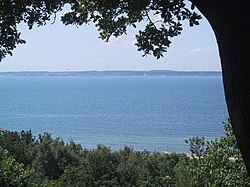
In the more general northern European usage, a sound is a strait or the narrowest part of a strait. In Scandinavia and around the Baltic Sea, there are more than a hundred straits named Sund, mostly named for the island they separate from the continent or a larger island.

In contrast, the Sound is the common international [3] short name for Øresund, the narrow stretch of water that separates Denmark and Sweden, and is the main waterway between the Baltic Sea and the North Sea. It is also a colloquial short name, among others, for Plymouth Sound, England.

In areas explored by the British in the late 18th century, particularly the northwest coast of North America, the term "sound" was applied to inlets containing large islands, such as Howe Sound in British Columbia and Puget Sound in the U.S. state of Washington. It was also applied to bodies of open water not fully open to the ocean, such as Caamaño Sound or Queen Charlotte Sound in Canada, or broadenings or mergings at the openings of inlets, like Cross Sound in Alaska and Fitz Hugh Sound in British Columbia.

Long Island Sound in the New York metropolitan area, seen from space at night New York City, Southern RI and CT, illuminated at night.jpg
Long Island Sound in the New York metropolitan area, seen from space at night

Along the east coast and Gulf Coast of the United States, a number of bodies of water that separate islands from the mainland are called "sounds". Long Island Sound separates Long Island from the eastern shores of the Bronx, Westchester County, and southern Connecticut. Similarly, in North Carolina, a number of large lagoons lie between the mainland and its barrier beaches, the Outer Banks. These include Pamlico Sound, Albemarle Sound, Bogue Sound, and several others. The Mississippi Sound separates the Gulf of Mexico from the mainland, along much of the gulf coasts of Alabama and Mississippi.

Etymology

The term sound is derived from the Anglo-Saxon or Old Norse word sund, which also means "swimming". [2]

The word sund is also documented in Old Norse and Old English as meaning "gap" (or "narrow access"). This suggests a relation to verbs meaning "to separate", such as absondern and aussondern (German), söndra (Swedish), sondre (Norwegian), as well as the English noun sin, German Sünde ("apart from God's law"), and Swedish synd. English has also the adjective "asunder" and the noun "sundry', and Swedish has the adjective sönder ("broken").

In Swedish and in both Norwegian languages, "sund" is the general term for any strait. In Swedish and Nynorsk, it is even part of names worldwide, such as in Swedish "Berings sund" and "Gibraltar sund", and in Nynorsk "Beringsundet" and "Gibraltarsundet". In German "Sund" is mainly used for place names at the Baltic Sea like Fehmarnsund, Strelasund, and Stralsund.

Bodies of water called sounds

Related Research Articles

<span class="mw-page-title-main">Fjord</span> Long, narrow inlet with steep sides or cliffs, created by glacial activity

In physical geography, a fjord or fiord is a long, narrow sea inlet with steep sides or cliffs, created by a glacier. Fjords exist on the coasts of Antarctica, the Arctic, and surrounded landmasses of the northern and southern hemispheres. Norway's coastline is estimated to be 29,000 km (18,000 mi) long with its nearly 1,200 fjords, but only 2,500 km (1,600 mi) long excluding the fjords.

<span class="mw-page-title-main">Øresund</span> Strait between Denmark and Sweden

Øresund or Öresund, commonly known in English as the Sound, is a strait which forms the Danish–Swedish border, separating Zealand (Denmark) from Scania (Sweden). The strait has a length of 118 kilometres (73 mi); its width varies from 4 kilometres (2.5 mi) to 28 kilometres (17 mi). The narrowest point is between Helsingør in Denmark and Helsingborg in Sweden.

<span class="mw-page-title-main">Lagoon</span> Shallow body of water separated from a larger one by a narrow landform

A lagoon is a shallow body of water separated from a larger body of water by a narrow landform, such as reefs, barrier islands, barrier peninsulas, or isthmuses. Lagoons are commonly divided into coastal lagoons and atoll lagoons. They have also been identified as occurring on mixed-sand and gravel coastlines. There is an overlap between bodies of water classified as coastal lagoons and bodies of water classified as estuaries. Lagoons are common coastal features around many parts of the world.

Firth is a word in the English and Scots languages used to denote various coastal waters in the United Kingdom, predominantly within Scotland. In the Northern Isles, it more often refers to a smaller inlet. It is linguistically cognate to Scandinavian fjord and fjard, with the original meaning of "sailable waterway". The word has a more constrained sense in English. Bodies of water named "firths" tend to be more common on the Scottish east coast, or in the southwest of the country, although the Firth of Clyde is an exception to this. The Highland coast contains numerous estuaries, straits, and inlets of a similar kind, but not called "firth" ; instead, these are often called sea lochs. Before about 1850, the spelling "Frith" was more common.

Landforms are categorized by characteristic physical attributes such as their creating process, shape, elevation, slope, orientation, rock exposure, and soil type.

<span class="mw-page-title-main">Ria</span> Coastal inlet formed by the partial submergence of an unglaciated river valley

A ria is a coastal inlet formed by the partial submergence of an unglaciated river valley. It is a drowned river valley that remains open to the sea.

<span class="mw-page-title-main">Barrier island</span> Coastal dune landform that forms by wave and tidal action parallel to the mainland coast

Barrier islands are a coastal landform, a type of dune system and sand island, where an area of sand has been formed by wave and tidal action parallel to the mainland coast. They usually occur in chains, consisting of anything from a few islands to more than a dozen. They are subject to change during storms and other action, but absorb energy and protect the coastlines and create areas of protected waters where wetlands may flourish. A barrier chain may extend for hundreds of kilometers, with islands periodically separated by tidal inlets. The largest barrier island in the world is Padre Island of Texas, United States, at 113 miles (182 km) long. Sometimes an important inlet may close permanently, transforming an island into a peninsula, thus creating a barrier peninsula, often including a beach, barrier beach. Though many are long and narrow, the length and width of barriers and overall morphology of barrier coasts are related to parameters including tidal range, wave energy, sediment supply, sea-level trends, and basement controls. The amount of vegetation on the barrier has a large impact on the height and evolution of the island.

<span class="mw-page-title-main">Inlet</span> Indentation of a shoreline

An inlet is a indentation of a shoreline, such as a small arm, cove, bay, sound, fjord, lagoon or marsh, that leads to an enclosed larger body of water such as a lake, estuary, gulf or marginal sea.

<span class="mw-page-title-main">Strait of Georgia</span> Waterway between Vancouver Island and mainland North America

The Strait of Georgia or the Georgia Strait is an arm of the Salish Sea between Vancouver Island and the extreme southwestern mainland coast of British Columbia, Canada, and the extreme northwestern mainland coast of Washington, United States. It is approximately 240 kilometres (150 mi) long and varies in width from 20 to 58 kilometres. Along with the Strait of Juan de Fuca and Puget Sound, it is a constituent part of the Salish Sea.

<span class="mw-page-title-main">British Columbia Coast</span> Coastal region of British Columbia, Canada

The British Columbia Coast, popularly referred to as the BC Coast or simply the Coast, is a geographic region of the Canadian province of British Columbia. As the entire western continental coastline of Canada along the Pacific Ocean is in the province, it is synonymous with being the West Coast of Canada.

<span class="mw-page-title-main">Danish straits</span> Three channels in Denmark connecting the Baltic Sea to the North Sea

The Danish straits are the straits connecting the Baltic Sea to the North Sea through the Kattegat and Skagerrak. Historically, the Danish straits were internal waterways of Denmark; however, following territorial losses, Øresund and Fehmarn Belt are now shared with Sweden and Germany, while the Great Belt and the Little Belt have remained Danish territorial waters. The Copenhagen Convention of 1857 made all the Danish straits open to commercial shipping. The straits have generally been regarded as an international waterway.

<span class="mw-page-title-main">Baltic Ice Lake</span> Prehistoric freshwater lake in the Baltic Sea basin formed from receding glaciers

The Baltic Ice Lake is a name given by geologists to a freshwater lake that evolved in the Baltic Sea basin as glaciers retreated from that region at the end of the last ice age. The lake existed between 12,600 and 10,300 years Before Present (BP).

<span class="mw-page-title-main">Zona Austral</span> Southernmost natural region of continental Chile

The Zona Austral is one of the five natural regions into which CORFO divided continental Chile in 1950 corresponding to the Chilean portion of Patagonia. It is surrounded by the Zona Sur and the Chacao Channel to the north, the Pacific Ocean and Drake's Passage to the south and west, and the Andean mountains and Argentina to the east. If excluding Chiloé Archipelago, Zona Austral covers all of Chilean Patagonia.

<span class="mw-page-title-main">Förden and East Jutland Fjorde</span>

The eastern coast of the Jutland Peninsula, consisting of Danish Jutland and German Schleswig-Holstein features a type of narrow bay called Förde in German and fjord in Danish. These bays are of glacial origin, but the glacial mechanics were different from those of Norwegian Fjords and also from those of Swedish and Finnish Fjards. Inlets more similar to these are also found on the peninsulas of the Green bay and Georgian bay, and on Manitoulin island, and eastern Long island.

<span class="mw-page-title-main">Gat (landform)</span> Relatively narrow but deep strait that is constantly eroded by currents

A gat is an inshore channel or strait connecting coastal waters with the open sea or dividing two landmasses, such as two islands or an island and a peninsula. Gats are usually relatively narrow but deep and are in many instances constantly eroded by currents flowing back and forth, such as tidal currents. The term is mostly used for features on the North Sea and Baltic Sea coasts.

A gut is a narrow coastal body of water, a channel or strait, usually one that is subject to strong tidal currents flowing back and forth.

<span class="mw-page-title-main">Fjords in the Faroe Islands</span> List of fjords in the Faroe Islands

The Faroe Islands consist of 18 islands, several of which are deeply incised by fjords.

References

  1. "sound-3". TheFreeDictionary.com. Retrieved 3 March 2013.
  2. 1 2 "sound-4". Oxford English Dictionary. Archived from the original on 19 August 2012. Retrieved 3 March 2013.
  3. "Baltic Straits". Legal provision for integrated coastal zone management, Chapter 2.3: International straits and canals. UNESCO . Retrieved 3 March 2013., archived version