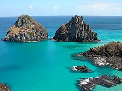
Emergent coastline

Last updated

An emergent coastline is a stretch along the coast that has been exposed by the sea by a relative fall in sea levels by either isostasy or eustasy.[ not verified in body ]

Emergent coastline are the opposite of submergent coastlines, which have experienced a relative rise in sea levels. [1]

The emergent coastline may have several specific landforms:

The Scottish Gaelic word machair or machar refers to a fertile low-lying raised beach found on some of the coastlines of Ireland and Scotland (especially the Outer Hebrides).

Hudson Bay, in Canada's north, is an example of an emergent coastline. It is still emerging by as much as 1 cm per year.[ citation needed ] Another example of emergent coastline is the Eastern Coastal Plains of the Indian Subcontinent.

Related Research Articles

<span class="mw-page-title-main">Coast</span> Area where land meets the sea or ocean

The coast, also known as the coastline or seashore, is defined as the area where land meets the ocean, or as a line that forms the boundary between the land and the coastline. The Earth has around 620,000 kilometres (390,000 mi) of coastline. Coasts are important zones in natural ecosystems, often home to a wide range of biodiversity. On land, they harbor important ecosystems such as freshwater or estuarine wetlands, which are important for bird populations and other terrestrial animals. In wave-protected areas they harbor saltmarshes, mangroves or seagrasses, all of which can provide nursery habitat for finfish, shellfish, and other aquatic species. Rocky shores are usually found along exposed coasts and provide habitat for a wide range of sessile animals and various kinds of seaweeds. Along tropical coasts with clear, nutrient-poor water, coral reefs can often be found between depths of 1–50 meters.

<span class="mw-page-title-main">Coastal erosion</span> Displacement of land along the coastline

Coastal erosion is the loss or displacement of land, or the long-term removal of sediment and rocks along the coastline due to the action of waves, currents, tides, wind-driven water, waterborne ice, or other impacts of storms. The landward retreat of the shoreline can be measured and described over a temporal scale of tides, seasons, and other short-term cyclic processes. Coastal erosion may be caused by hydraulic action, abrasion, impact and corrosion by wind and water, and other forces, natural or unnatural.

Landforms are categorized by characteristic physical attributes such as their creating process, shape, elevation, slope, orientation, rock exposure, and soil type.

<span class="mw-page-title-main">Submergent coastline</span> Stretches of coast that have been inundated by the sea by a relative rise in sea levels

Submergent coastlines or drowned coastlines are stretches along the coast that have been inundated by the sea by a relative rise in sea levels from either isostacy or eustacy.

<span class="mw-page-title-main">Wave-cut platform</span> Narrow flat area created by erosion

A wave-cut platform, shore platform, coastal bench, or wave-cut cliff is the narrow flat area often found at the base of a sea cliff or along the shoreline of a lake, bay, or sea that was created by erosion. Wave-cut platforms are often most obvious at low tide when they become visible as huge areas of flat rock. Sometimes the landward side of the platform is covered by sand, forming the beach, and then the platform can only be identified at low tides or when storms move the sand.

<span class="mw-page-title-main">Raised beach</span> Emergent coastal landform

A raised beach, coastal terrace, or perched coastline is a relatively flat, horizontal or gently inclined surface of marine origin, mostly an old abrasion platform which has been lifted out of the sphere of wave activity. Thus, it lies above or under the current sea level, depending on the time of its formation. It is bounded by a steeper ascending slope on the landward side and a steeper descending slope on the seaward side. Due to its generally flat shape, it is often used for anthropogenic structures such as settlements and infrastructure.

<span class="mw-page-title-main">Machair</span> Fertile low-lying grassy plain

A machair is a fertile low-lying grassy plain found on part of the northwest coastlines of Ireland and Scotland, in particular the Outer Hebrides. The best examples are found on North and South Uist, Harris and Lewis.

<span class="mw-page-title-main">Coastal geography</span> Study of the region between the ocean and the land

Coastal geography is the study of the constantly changing region between the ocean and the land, incorporating both the physical geography and the human geography of the coast. It includes understanding coastal weathering processes, particularly wave action, sediment movement and weather, and the ways in which humans interact with the coast.

Marine transgression Geologic event in which sea level rises relative to the land

A marine transgression is a geologic event during which sea level rises relative to the land and the shoreline moves toward higher ground, which results in flooding. Transgressions can be caused by the land sinking or by the ocean basins filling with water or decreasing in capacity. Transgressions and regressions may be caused by tectonic events such as orogenies, severe climate change such as ice ages or isostatic adjustments following removal of ice or sediment load.

<span class="mw-page-title-main">Machars</span>

The Machars is a peninsula in the historical county of Wigtownshire in Galloway in the south-west of Scotland. Its name is derived from the Gaelic word Machair meaning low-lying or level land, known as "links" on the east coast of Scotland. Although there are no high peaks in The Machars, it is not flat and would best be described as undulating or rolling. The North Atlantic Drift or Gulf Stream creates a mild climate, and dolphins and basking sharks are frequently seen in the seas.

<span class="mw-page-title-main">Terrace (geology)</span> A step-like landform

In geology, a terrace is a step-like landform. A terrace consists of a flat or gently sloping geomorphic surface, called a tread, that is typically bounded on one side by a steeper ascending slope, which is called a "riser" or "scarp". The tread and the steeper descending slope together constitute the terrace. Terraces can also consist of a tread bounded on all sides by a descending riser or scarp. A narrow terrace is often called a bench.

<span class="mw-page-title-main">Gurteen Beach</span>

Gurteen Beach, located in Roundstone, County Galway, in the Connemara region of the west of Ireland, lies back-to-back with Dog's Bay. The two beaches were formed by a sand spit and tombolo which now separates the two bays known as Gurteen Bay and Dog's Bay. The name Gurteen derives from the Irish Goirtín meaning small plot or small field.

<span class="mw-page-title-main">Sea cave</span> Cave formed by the wave action of the sea and located along present or former coastlines

A sea cave, also known as a littoral cave, is a type of cave formed primarily by the wave action of the sea. The primary process involved is erosion. Sea caves are found throughout the world, actively forming along present coastlines and as relict sea caves on former coastlines. Some of the largest wave-cut caves in the world are found on the coast of Norway, but are now 100 feet or more above present sea level. These would still be classified as littoral caves. By contrast, in places like Thailand's Phang Nga Bay, solutionally formed caves in limestone have been flooded by the rising sea and are now subject to littoral erosion, representing a new phase of their enlargement.

Beach evolution occurs at the shoreline where sea, lake or river water is eroding the land. Beaches exist where sand accumulated from centuries-old, recurrent processes that erode rocky and sedimentary material into sand deposits. River deltas deposit silt from upriver, accreting at the river's outlet to extend lake or ocean shorelines. Catastrophic events such as tsunamis, hurricanes, and storm surges accelerate beach erosion.

<span class="mw-page-title-main">Shingle beach</span> Beach which is armoured with pebbles or small- to medium-sized cobbles

A shingle beach is a beach which is armoured with pebbles or small- to medium-sized cobbles. Typically, the stone composition may grade from characteristic sizes ranging from 2 to 200 millimetres diameter.

<span class="mw-page-title-main">South Lewis, Harris and North Uist National Scenic Area</span>

South Lewis, Harris and North Uist is a large national scenic area (NSA) in the Western Isles of Scotland. It is one of 40 such areas in Scotland, which are defined so as to identify areas of exceptional scenery and to ensure its protection from inappropriate development. The designated area covers 202,388 ha in total, of which 112,301 ha is on land, with a further 90,087 ha being marine, making it the largest of the NSAs in both total and marine area. The designated area includes the mountainous south west of Lewis, all of Harris, the Sound of Harris and the northern part of North Uist.

A raised shoreline is an ancient shoreline exposed above current water level. These landforms are formed by a relative change in sea level due to global sea level rise, isostatic rebound, and/or tectonic uplift. These surfaces are usually exposed above modern sea level when a heavily glaciated area experiences a glacial retreat, causing water levels to rise. This area will then experience post-glacial rebound, effectively raising the shoreline surface.

<span class="mw-page-title-main">Environment of Scotland</span>

Scotland occupies the northern part of the United Kingdom. The landscape is diverse; ranging from rugged mountain terrain to arable flat land with many rivers and lochs.

<span class="mw-page-title-main">Bideford Bay</span> Body of water

Bideford Bay, also known as Barnstaple Bay and often shown on maps as Barnstaple or Bideford Bay, is a large area of water on the northwest coast of Devon in South West England, at the southwestern end of the Bristol Channel where it joins the Celtic Sea. The bay extends from Hartland Point in the southwest to Baggy point the northeast, and is partly sheltered by the island of Lundy, 12 miles (19 km) offshore. It takes its alternative names from the towns of Bideford and Barnstaple, located respectively on the rivers Torridge and Taw which flow into the bay. The alternative spelling Barnstable Bay, in use long after that spelling became obsolete for the town, is also sometimes seen.

<span class="mw-page-title-main">Cliffed coast</span> Coast where waves have formed steep cliffs

A cliffed coast, also called an abrasion coast, is a form of coast where the action of marine waves has formed steep cliffs that may or may not be precipitous. It contrasts with a flat or alluvial coast.

References

  1. "Emergent and Submergent Coasts". Pennsylvania State University . InTeGrate. Retrieved 31 May 2020.