Continental shelf

Last updated

A continental shelf is a portion of a continent that is submerged under an area of relatively shallow water, known as a shelf sea. Much of these shelves were exposed by drops in sea level during glacial periods. The shelf surrounding an island is known as an insular shelf.

Contents

The continental margin, between the continental shelf and the abyssal plain, comprises a steep continental slope, surrounded by the flatter continental rise, in which sediment from the continent above cascades down the slope and accumulates as a pile of sediment at the base of the slope. Extending as far as 500 km (310 mi) from the slope, it consists of thick sediments deposited by turbidity currents from the shelf and slope. [1] [2] The continental rise's gradient is intermediate between the gradients of the slope and the shelf.

Under the United Nations Convention on the Law of the Sea, the name continental shelf was given a legal definition as the stretch of the seabed adjacent to the shores of a particular country to which it belongs.

Topography

The shelf usually ends at a point of increasing slope [3] (called the shelf break). The sea floor below the break is the continental slope. [4] Below the slope is the continental rise, which finally merges into the deep ocean floor, the abyssal plain. [5] The continental shelf and the slope are part of the continental margin. [6]

Continental shelf.png

The shelf area is commonly subdivided into the inner continental shelf, mid continental shelf, and outer continental shelf, [7] each with their specific geomorphology [8] [9] and marine biology. [10]

The character of the shelf changes dramatically at the shelf break, where the continental slope begins. With a few exceptions, the shelf break is located at a remarkably uniform depth of roughly 140 m (460 ft); this is likely a hallmark of past ice ages, when sea level was lower than it is now. [11]

The continental slope is much steeper than the shelf; the average angle is 3°, but it can be as low as 1° or as high as 10°. [12] [11] The slope is often cut with submarine canyons. The physical mechanisms involved in forming these canyons were not well understood until the 1960s. [13] [14]

Geographical distribution

Bathymetry of the ocean floor showing the continental shelves and oceanic plateaus (red), the mid-ocean ridges (yellow-green) and the abyssal plains (blue to purple) Mid-ocean ridge system.gif
Bathymetry of the ocean floor showing the continental shelves and oceanic plateaus (red), the mid-ocean ridges (yellow-green) and the abyssal plains (blue to purple)

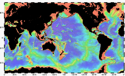
Continental shelves cover an area of about 27 million km2 (10 million sq mi), equal to about 7% of the surface area of the oceans. [15] The width of the continental shelf varies considerably – it is not uncommon for an area to have virtually no shelf at all, particularly where the forward edge of an advancing oceanic plate dives beneath continental crust in an offshore subduction zone such as off the coast of Chile or the west coast of Sumatra. The largest shelf – the Siberian Shelf in the Arctic Ocean – stretches to 1,500 kilometers (930 mi) in width. The South China Sea lies over another extensive area of continental shelf, the Sunda Shelf, which joins Borneo, Sumatra, and Java to the Asian mainland. Other familiar bodies of water that overlie continental shelves are the North Sea and the Persian Gulf. The average width of continental shelves is about 80 km (50 mi). The depth of the shelf also varies, but is generally limited to water shallower than 100 m (330 ft). [16] The slope of the shelf is usually quite low, on the order of 0.5°; vertical relief is also minimal, at less than 20 m (66 ft). [17]

Though the continental shelf is treated as a physiographic province of the ocean, it is not part of the deep ocean basin proper, but the flooded margins of the continent. [18] Passive continental margins such as most of the Atlantic coasts have wide and shallow shelves, made of thick sedimentary wedges derived from long erosion of a neighboring continent. Active continental margins have narrow, relatively steep shelves, due to frequent earthquakes that move sediment to the deep sea. [19]

Continental shelf widths [20] (in km)
OceanActive MarginPassive MarginTotal Margin
MeanMaximumMeanMaximumMeanMaximum
Arctic Ocean00104.1 ± 1.7389104.1 ± 1.7389
Indian Ocean19 ± 0.6117547.6 ± 0.823837 ± 0.58238
Mediterranean Sea and Black Sea11 ± 0.297938.7 ± 1.516617 ± 0.44166
North Atlantic Ocean28 ± 1.08259115.7 ± 1.643485 ± 1.14434
North Pacific Ocean39 ± 0.7141234.9 ± 1.211439 ± 0.68412
South Atlantic Ocean24 ± 2.655123.0 ± 2.5453104 ± 2.4453
South Pacific Ocean214 ± 2.8635796.1 ± 2.0778110 ± 1.92778
All Oceans31 ± 0.441288.2 ± 0.777857 ± 0.41778

Sediments

The continental shelves are covered by terrigenous sediments; that is, those derived from erosion of the continents. However, little of the sediment is from current rivers; some 60–70% of the sediment on the world's shelves is relict sediment, deposited during the last ice age, when sea level was 100–120 m lower than it is now. [21] [11]

Sediments usually become increasingly fine with distance from the coast; sand is limited to shallow, wave-agitated waters, while silt and clays are deposited in quieter, deep water far offshore. [22] These accumulate 15–40 centimetres (5.9–15.7 in) every millennium, much faster than deep-sea pelagic sediments. [23]

Shelf seas

"Shelf seas" are the ocean waters on the continental shelf. Their motion is controlled by the combined influences of the tides, wind-forcing and brackish water formed from river inflows (Regions of Freshwater Influence). These regions can often be biologically highly productive due to mixing caused by the shallower waters and the enhanced current speeds. Despite covering only about 8% of Earth's ocean surface area, [20] shelf seas support 15–20% of global primary productivity. [24]

In temperate continental shelf seas, three distinctive oceanographic regimes are found, as a consequence of the interplay between surface heating, lateral buoyancy gradients (due to river inflow), and turbulent mixing by the tides and to a lesser extent the wind. [25]

(The well mixed and seasonally stratifying regimes are separated by persistent features called tidal mixing fronts.) [27]

Indian Ocean shelf seas are dominated by major river systems, including the Ganges and Indus rivers. [30] The shelf seas around New Zealand are complicated because the submerged continent of Zealandia creates wide plateaus. [31] Shelf seas around Antarctica and the shores of the Arctic Ocean are influenced by sea ice production and polynya. [32]

There is evidence that changing wind, rainfall, and regional ocean currents in a warming ocean are having an effect on some shelf seas. [33] Improved data collection via Integrated Ocean Observing Systems in shelf sea regions is making identification of these changes possible. [34]

Biota

Continental shelves teem with life because of the sunlight available in shallow waters, in contrast to the biotic desert of the oceans' abyssal plain. The pelagic (water column) environment of the continental shelf constitutes the neritic zone, and the benthic (sea floor) province of the shelf is the sublittoral zone. [35] The shelves make up less than 10% of the ocean, and a rough estimate suggests that only about 30% of the continental shelf sea floor receives enough sunlight to allow benthic photosynthesis. [36]

Though the shelves are usually fertile, if anoxic conditions prevail during sedimentation, the deposits may over geologic time become sources for fossil fuels. [37] [38]

Economic significance

The continental shelf is the best understood part of the ocean floor, as it is relatively accessible. Most commercial exploitation of the sea, such as extraction of metallic ore, non-metallic ore, and hydrocarbons, takes place on the continental shelf.

Sovereign rights over their continental shelves down to a depth of 100 m (330 ft) or to a distance where the depth of waters admitted of resource exploitation were claimed by the marine nations that signed the Convention on the Continental Shelf drawn up by the UN's International Law Commission in 1958. This was partly superseded by the 1982 United Nations Convention on the Law of the Sea (UNCLOS). [39] The 1982 convention created the 200 nautical miles (370 km; 230 mi) exclusive economic zone, plus continental shelf rights for states with physical continental shelves that extend beyond that distance.

The legal definition of a continental shelf differs significantly from the geological definition. UNCLOS states that the shelf extends to the limit of the continental margin, but no less than 200 nmi (370 km; 230 mi) and no more than 350 nmi (650 km; 400 mi) from the baseline. Thus inhabited volcanic islands such as the Canaries, which have no actual continental shelf, nonetheless have a legal continental shelf, whereas uninhabitable islands have no shelf.

See also

Notes

  1. Pinet 2003, p. 39.
  2. Gross 1972, p. 45.
  3. Encyclopædia Britannica.
  4. Jackson 1997, "Continental slope".
  5. Jackson 1997, "Continental rise".
  6. Jackson 1997, "Continental margin".
  7. Atkinson et al. 1983.
  8. Wellner, Heroy & Anderson 2006.
  9. Figueiredo et al. 2016.
  10. Muelbert et al. 2008.
  11. 1 2 3 Gross 1972, p. 43.
  12. Pinet 2003, p. 36.
  13. Pinet 2003, p. 98.
  14. Gross 1972, p. 44.
  15. Continental shelf – Blue Habitats
  16. Pinet 2003, p. 37.
  17. Pinet 2003, pp. 36–37.
  18. Pinet 2003, pp. 35–36.
  19. Pinet 2003, pp. 90–93.
  20. 1 2 Harris et al. 2014.
  21. Pinet 2003, pp. 84–85.
  22. Gross 1972, pp. 121–122.
  23. Gross 1972, p. 127.
  24. de Haas, van Weering & de Stigter 2002.
  25. Simpson, John H.; Sharples, Jonathan (2012). Introduction to the Physical and Biological Oceanography of Shelf Seas. doi:10.1017/CBO9781139034098. ISBN   9780521877626.
  26. Rippeth, Tom P. (2005). "Mixing in seasonally stratified shelf seas: A shifting paradigm". Philosophical Transactions of the Royal Society A: Mathematical, Physical and Engineering Sciences . 363 (1837): 2837–2854. Bibcode:2005RSPTA.363.2837R. doi:10.1098/rsta.2005.1662. PMID   16286293. S2CID   45053190.
  27. Simpson, John H.; Sharples, Jonathan (2012). Introduction to the Physical and Biological Oceanography of Shelf Seas. doi:10.1017/CBO9781139034098. ISBN   9780521877626.
  28. Verspecht, F.; Rippeth, T. P.; Howarth, M. J.; Souza, A. J.; Simpson, J. H.; Burchard, H. (2009). "Processes impacting on stratification in a region of freshwater influence: Application to Liverpool Bay". Journal of Geophysical Research . 114 (C11). Bibcode:2009JGRC..11411022V. doi:10.1029/2009jc005475.
  29. Guihou et al. 2018.
  30. Han & McCreary 2001.
  31. Stevens et al. 2021.
  32. Morley, Barnes & Dunn 2019.
  33. Montero-Serra, Edwards & Genner 2015.
  34. O’Callaghan et al. 2019.
  35. Pinet 2003, pp. 316–317, 418–419.
  36. Gattuso et al. 2006.
  37. Tyson & Pearson 1991.
  38. Ferriday, Tim; Montenari, Michael (2016). "Chemostratigraphy and Chemofacies of Source Rock Analogues: A High-Resolution Analysis of Black Shale Successions from the Lower Silurian Formigoso Formation (Cantabrian Mountains, NW Spain)". Stratigraphy & Timescales. 1: 123–255. doi:10.1016/bs.sats.2016.10.004 via Elsevier Science Direct.
  39. United Nations 1958, 499:311.

Related Research Articles

<span class="mw-page-title-main">Coast</span> Area where land meets the sea or ocean

The coast, also known as the coastline, shoreline or seashore, is defined as the area where land meets the ocean, or as a line that forms the boundary between the land and the coastline. Shores are influenced by the topography of the surrounding landscape, as well as by water induced erosion, such as waves. The geological composition of rock and soil dictates the type of shore which is created. The Earth has around 620,000 kilometres (390,000 mi) of coastline. Coasts are important zones in natural ecosystems, often home to a wide range of biodiversity. On land, they harbor important ecosystems such as freshwater or estuarine wetlands, which are important for bird populations and other terrestrial animals. In wave-protected areas they harbor saltmarshes, mangroves or seagrasses, all of which can provide nursery habitat for finfish, shellfish, and other aquatic species. Rocky shores are usually found along exposed coasts and provide habitat for a wide range of sessile animals and various kinds of seaweeds. In physical oceanography, a shore is the wider fringe that is geologically modified by the action of the body of water past and present, while the beach is at the edge of the shore, representing the intertidal zone where there is one. Along tropical coasts with clear, nutrient-poor water, coral reefs can often be found between depths of 1–50 meters.

<span class="mw-page-title-main">Estuary</span> Partially enclosed coastal body of brackish water

An estuary is a partially enclosed coastal body of brackish water with one or more rivers or streams flowing into it, and with a free connection to the open sea. Estuaries form a transition zone between river environments and maritime environments and are an example of an ecotone. Estuaries are subject both to marine influences such as tides, waves, and the influx of saline water, and to fluvial influences such as flows of freshwater and sediment. The mixing of seawater and freshwater provides high levels of nutrients both in the water column and in sediment, making estuaries among the most productive natural habitats in the world.

<span class="mw-page-title-main">Oceanic trench</span> Long and narrow depressions of the sea floor

Oceanic trenches are prominent, long, narrow topographic depressions of the ocean floor. They are typically 50 to 100 kilometers wide and 3 to 4 km below the level of the surrounding oceanic floor, but can be thousands of kilometers in length. There are about 50,000 km (31,000 mi) of oceanic trenches worldwide, mostly around the Pacific Ocean, but also in the eastern Indian Ocean and a few other locations. The greatest ocean depth measured is in the Challenger Deep of the Mariana Trench, at a depth of 10,920 m (35,830 ft) below sea level.

<span class="mw-page-title-main">River delta</span> Silt deposition landform at the mouth of a river

A river delta is a landform shaped like a triangle, created by the deposition of sediment that is carried by a river and enters slower-moving or stagnant water. This occurs at a river mouth, when it enters an ocean, sea, estuary, lake, reservoir, or another river that cannot carry away the supplied sediment. It is so named because its triangle shape resembles the uppercase Greek letter delta, Δ. The size and shape of a delta are controlled by the balance between watershed processes that supply sediment, and receiving basin processes that redistribute, sequester, and export that sediment. The size, geometry, and location of the receiving basin also plays an important role in delta evolution.

<span class="mw-page-title-main">Tidal resonance</span> Enhanced tide due to ocean resonance

In oceanography, a tidal resonance occurs when the tide excites one of the resonant modes of the ocean. The effect is most striking when a continental shelf is about a quarter wavelength wide. Then an incident tidal wave can be reinforced by reflections between the coast and the shelf edge, the result producing a much higher tidal range at the coast.

<span class="mw-page-title-main">Benthic zone</span> Ecological region at the lowest level of a body of water

The benthic zone is the ecological region at the lowest level of a body of water such as an ocean, lake, or stream, including the sediment surface and some sub-surface layers. The name comes from ancient Greek, βένθος (bénthos), meaning "the depths." Organisms living in this zone are called benthos and include microorganisms as well as larger invertebrates, such as crustaceans and polychaetes. Organisms here generally live in close relationship with the substrate and many are permanently attached to the bottom. The benthic boundary layer, which includes the bottom layer of water and the uppermost layer of sediment directly influenced by the overlying water, is an integral part of the benthic zone, as it greatly influences the biological activity that takes place there. Examples of contact soil layers include sand bottoms, rocky outcrops, coral, and bay mud.

<span class="mw-page-title-main">Seabed</span> The bottom of the ocean

The seabed is the bottom of the ocean. All floors of the ocean are known as 'seabeds'.

<span class="mw-page-title-main">Submarine canyon</span> Steep-sided valley cut into the seabed of the continental slope

A submarine canyon is a steep-sided valley cut into the seabed of the continental slope, sometimes extending well onto the continental shelf, having nearly vertical walls, and occasionally having canyon wall heights of up to 5 km (3 mi), from canyon floor to canyon rim, as with the Great Bahama Canyon. Just as above-sea-level canyons serve as channels for the flow of water across land, submarine canyons serve as channels for the flow of turbidity currents across the seafloor. Turbidity currents are flows of dense, sediment laden waters that are supplied by rivers, or generated on the seabed by storms, submarine landslides, earthquakes, and other soil disturbances. Turbidity currents travel down slope at great speed, eroding the continental slope and finally depositing sediment onto the abyssal plain, where the particles settle out.

An inland sea is a continental body of water which is very large in area and is either completely surrounded by dry land or connected to an ocean by a river, strait or "arm of the sea". An inland sea will generally have higher salinity than a freshwater lake, but usually lower salinity than seawater. As with other seas, inland seas experience tides governed by the orbits of the Moon and Sun.

<span class="mw-page-title-main">Antarctic bottom water</span> Cold, dense, water mass originating in the Southern Ocean surrounding Antarctica

The Antarctic bottom water (AABW) is a type of water mass in the Southern Ocean surrounding Antarctica with temperatures ranging from −0.8 to 2 °C (35 °F) and absolute salinities from 34.6 to 35.0 g/kg. As the densest water mass of the oceans, AABW is found to occupy the depth range below 4000 m of all ocean basins that have a connection to the Southern Ocean at that level. AABW forms the lower branch of the large-scale movement in the world's oceans through thermohaline circulation.

<span class="mw-page-title-main">Passive margin</span> Transition between oceanic and continental lithosphere that is not an active plate margin

A passive margin is the transition between oceanic and continental lithosphere that is not an active plate margin. A passive margin forms by sedimentation above an ancient rift, now marked by transitional lithosphere. Continental rifting forms new ocean basins. Eventually the continental rift forms a mid-ocean ridge and the locus of extension moves away from the continent-ocean boundary. The transition between the continental and oceanic lithosphere that was originally formed by rifting is known as a passive margin.

<span class="mw-page-title-main">Continental margin</span> Zone of the ocean floor that separates the thin oceanic crust from thick continental crust

A continental margin is the outer edge of continental crust abutting oceanic crust under coastal waters. It is one of the three major zones of the ocean floor, the other two being deep-ocean basins and mid-ocean ridges. The continental margin consists of three different features: the continental rise, the continental slope, and the continental shelf. The continental shelf is the relatively shallow water area found in proximity to continents. Continental margins constitute about 28% of the oceanic area.

<span class="mw-page-title-main">Marine sediment</span>

Marine sediment, or ocean sediment, or seafloor sediment, are deposits of insoluble particles that have accumulated on the seafloor. These particles either have their origins in soil and rocks and have been transported from the land to the sea, mainly by rivers but also by dust carried by wind and by the flow of glaciers into the sea, or they are biogenic deposits from marine organisms or from chemical precipitation in seawater, as well as from underwater volcanoes and meteorite debris.

<span class="mw-page-title-main">Submarine landslide</span> Landslides that transport sediment across the continental shelf and into the deep ocean

Submarine landslides are marine landslides that transport sediment across the continental shelf and into the deep ocean. A submarine landslide is initiated when the downwards driving stress exceeds the resisting stress of the seafloor slope material, causing movements along one or more concave to planar rupture surfaces. Submarine landslides take place in a variety of different settings, including planes as low as 1°, and can cause significant damage to both life and property. Recent advances have been made in understanding the nature and processes of submarine landslides through the use of sidescan sonar and other seafloor mapping technology.

Internal tides are generated as the surface tides move stratified water up and down sloping topography, which produces a wave in the ocean interior. So internal tides are internal waves at a tidal frequency. The other major source of internal waves is the wind which produces internal waves near the inertial frequency. When a small water parcel is displaced from its equilibrium position, it will return either downwards due to gravity or upwards due to buoyancy. The water parcel will overshoot its original equilibrium position and this disturbance will set off an internal gravity wave. Munk (1981) notes, "Gravity waves in the ocean's interior are as common as waves at the sea surface-perhaps even more so, for no one has ever reported an interior calm."

<span class="mw-page-title-main">West Spitsbergen Current</span> Warm, salty current that runs poleward just west of Spitsbergen

The West Spitsbergen Current (WSC) is a warm, salty current that runs poleward just west of Spitsbergen,, in the Arctic Ocean. The WSC branches off the Norwegian Atlantic Current in the Norwegian Sea. The WSC is of importance because it drives warm and salty Atlantic Water into the interior Arctic. The warm and salty WSC flows north through the eastern side of Fram Strait, while the East Greenland Current (EGC) flows south through the western side of Fram Strait. The EGC is characterized by being very cold and low in salinity, but above all else it is a major exporter of Arctic sea ice. Thus, the EGC combined with the warm WSC makes the Fram Strait the northernmost ocean area having ice-free conditions throughout the year in all of the global ocean.

In oceanography, a front is a boundary between two distinct water masses. The formation of fronts depends on multiple physical processes and small differences in these lead to a wide range of front types. They can be as narrow as a few hundreds of metres and as wide as several tens of kilometres. While most fronts form and dissipate relatively quickly, some can persist for long periods of time.

<span class="mw-page-title-main">Heceta Bank</span> Rocky bank off the coast of Oregon, United States

Heceta Bank is a rocky bank located 55 kilometers (km) off the Oregon coast near Florence, centered on approximately 44°N, 125°W, and is roughly 29 km long and upwards of 13 km wide. Heceta Bank is an area of ecological and oceanographic importance. The unique bathymetric features and seasonal circulation within the bank provides habitat for a diversity of economically-important fish species.

Tides in marginal seas are tides affected by their location in semi-enclosed areas along the margins of continents and differ from tides in the open oceans. Tides are water level variations caused by the gravitational interaction between the Moon, the Sun and the Earth. The resulting tidal force is a secondary effect of gravity: it is the difference between the actual gravitational force and the centrifugal force. While the centrifugal force is constant across the Earth, the gravitational force is dependent on the distance between the two bodies and is therefore not constant across the Earth. The tidal force is thus the difference between these two forces on each location on the Earth.

<span class="mw-page-title-main">Internal wave breaking</span> Fluid dynamics process driving mixing in the oceans

Internal wave breaking is a process during which internal gravity waves attain a large amplitude compared to their length scale, become nonlinearly unstable and finally break. This process is accompanied by turbulent dissipation and mixing. As internal gravity waves carry energy and momentum from the environment of their inception, breaking and subsequent turbulent mixing affects the fluid characteristics in locations of breaking. Consequently, internal wave breaking influences even the large scale flows and composition in both the ocean and the atmosphere. In the atmosphere, momentum deposition by internal wave breaking plays a key role in atmospheric phenomena such as the Quasi-Biennial Oscillation and the Brewer-Dobson Circulation. In the deep ocean, mixing induced by internal wave breaking is an important driver of the meridional overturning circulation. On smaller scales, breaking-induced mixing is important for sediment transport and for nutrient supply to the photic zone. Most breaking of oceanic internal waves occurs in continental shelves, well below the ocean surface, which makes it a difficult phenomenon to observe.

References