Ocean exploration

Last updated
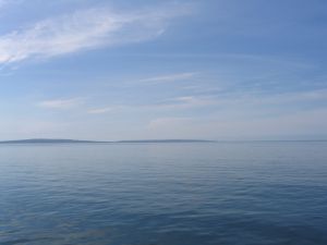
Atlantic Ocean Ireland-AtlanticOceanwithAranIsland.jpg
Atlantic Ocean

Ocean exploration is a part of oceanography describing the exploration of ocean surfaces. Notable explorations were undertaken by the Greeks, the Phoenicians, the Romans, the Polynesians, Phytheas, the Vikings, Arabs and the Portuguese. Scientific investigations began with early scientists such as James Cook, Charles Darwin, and Edmund Halley. Ocean exploration itself coincided with the developments in shipbuilding, diving, navigation, depth, measurement, exploration, and cartography.

Contents

Timeline

Early exploration

From Age of Exploration to present

Human-powered

  • The renaissance of ocean exploration occurred in the 20th century, when human-powered exploration became increasingly popular. Via this new medium, pioneering has once again become the goal of ocean explorers. [3]

See also

Related Research Articles

<span class="mw-page-title-main">Mariana Trench</span> Deepest oceanic trench on Earth

The Mariana Trench is an oceanic trench located in the western Pacific Ocean, about 200 kilometres (124 mi) east of the Mariana Islands; it is the deepest oceanic trench on Earth. It is crescent-shaped and measures about 2,550 km (1,580 mi) in length and 69 km (43 mi) in width. The maximum known depth is 10,984 ± 25 metres at the southern end of a small slot-shaped valley in its floor known as the Challenger Deep. The deepest point of the trench is more than 2 km (1.2 mi) farther from sea level than the peak of Mount Everest.

<span class="mw-page-title-main">Pacific Ocean</span> Ocean between Asia, Australia, and the Americas

The Pacific Ocean is the largest and deepest of Earth's five oceanic divisions. It extends from the Arctic Ocean in the north to the Southern Ocean in the south, and is bounded by the continents of Asia and Australia in the west and the Americas in the east.

<span class="mw-page-title-main">Oceanography</span> Study of physical, chemical, and biological processes in the ocean

Oceanography, also known as oceanology, sea science, ocean science, and marine science, is the scientific study of the ocean, including its physics, chemistry, biology, and geology.

<i>Challenger</i> expedition Oceanographic research expedition (1872–1876)

The Challenger expedition of 1872–1876 was a scientific programme that made many discoveries to lay the foundation of oceanography. The expedition was named after the naval vessel that undertook the trip, HMS Challenger.

<span class="mw-page-title-main">Hydrography</span> Measurement of bodies of water

Hydrography is the branch of applied sciences which deals with the measurement and description of the physical features of oceans, seas, coastal areas, lakes and rivers, as well as with the prediction of their change over time, for the primary purpose of safety of navigation and in support of all other marine activities, including economic development, security and defense, scientific research, and environmental protection.

<span class="mw-page-title-main">Geographical exploration</span> Act of searching for unknown space

Geographical exploration, sometimes considered the default meaning for the more general term exploration, refers to the practice of discovering remote lands and regions of the planet Earth. It is studied by geographers and historians.

<span class="mw-page-title-main">Physical oceanography</span> Study of physical conditions and processes within the ocean

Physical oceanography is the study of physical conditions and physical processes within the ocean, especially the motions and physical properties of ocean waters.

<span class="mw-page-title-main">Argo (oceanography)</span> International oceanographic observation program

Argo is an international programme for researching the ocean. It uses profiling floats to observe temperature, salinity and currents. Recently it has observed bio-optical properties in the Earth's oceans. It has been operating since the early 2000s. The real-time data it provides support climate and oceanographic research. A special research interest is to quantify the ocean heat content (OHC). The Argo fleet consists of almost 4000 drifting "Argo floats" deployed worldwide. Each float weighs 20–30 kg. In most cases probes drift at a depth of 1000 metres. Experts call this the parking depth. Every 10 days, by changing their buoyancy, they dive to a depth of 2000 metres and then move to the sea-surface. As they move they measure conductivity and temperature profiles as well as pressure. Scientists calculate salinity and density from these measurements. Seawater density is important in determining large-scale motions in the ocean.

<span class="mw-page-title-main">Puerto Rico Trench</span> Oceanic trench on a transform boundary between the Caribbean and North American plates

The Puerto Rico Trench is located on the boundary between the North Atlantic Ocean and Caribbean Sea, parallel to and north of Puerto Rico, where the oceanic trench reaches the deepest points in the Atlantic Ocean. The trench is associated with a complex transition from the Lesser Antilles frontal subduction zone between the South American plate and Caribbean plate to the oblique subduction zone and the strike-slip transform fault zone between the North American plate and Caribbean plate, which extends from the Puerto Rico Trench at the Puerto Rico–Virgin Islands microplate through the Cayman Trough at the Gonâve microplate to the Middle America Trench at the Cocos plate.

<span class="mw-page-title-main">Cordell Bank National Marine Sanctuary</span> Marine protected area off of California, USA

Cordell Bank National Marine Sanctuary is a marine sanctuary located off the coast of California. It protects an area of 1,286 sq mi (3,331 km2) of marine wildlife. The administrative center of the sanctuary is on an offshore granite outcrop 4.5 sq mi (12 km2) by 9.5 sq mi (25 km2), located on the continental shelf off of California. The outcrop is, at its closest, 6 mi (10 km) from the sanctuary itself.

The (oceanic) water column is a concept used in oceanography to describe the physical and chemical characteristics of seawater at different depths for a defined geographical point. Generally, vertical profiles are made of temperature, salinity, chemical parameters at a defined point along the water column. The water column is the largest, yet one of the most under-explored, habitats on the planet; it is explored to better understand the ocean as a whole, including the huge biomass that lives there and its importance to the global carbon and other biogeochemical cycles. Studying the water column also provides understanding on the links between living organisms and environmental parameters, large-scale water circulation and the transfer of matter between water masses.

<span class="mw-page-title-main">History of navigation</span> Intersection of history and navigation

The history of navigation, or the history of seafaring, is the art of directing vessels upon the open sea through the establishment of its position and course by means of traditional practice, geometry, astronomy, or special instruments. Many peoples have excelled as seafarers, prominent among them the Austronesians, the Harappans, the Phoenicians, the Iranians, the ancient Greeks, the Romans, the Arabs, the ancient Indians, the Norse, the Chinese, the Venetians, the Genoese, the Hanseatic Germans, the Portuguese, the Spanish, the English, the French, the Dutch, and the Danes.

<span class="mw-page-title-main">Deep-sea exploration</span> Investigation of ocean conditions beyond the continental shelf

Deep-sea exploration is the investigation of physical, chemical, and biological conditions on the ocean waters and sea bed beyond the continental shelf, for scientific or commercial purposes. Deep-sea exploration is an aspect of underwater exploration and is considered a relatively recent human activity compared to the other areas of geophysical research, as the deeper depths of the sea have been investigated only during comparatively recent years. The ocean depths still remain a largely unexplored part of the Earth, and form a relatively undiscovered domain.

<i>Nereus</i> (underwater vehicle) Hybrid remotely operated or autonomous underwater vehicle

Nereus was a hybrid uncrewed autonomous underwater vehicle built by the Woods Hole Oceanographic Institution (WHOI). Constructed as a research vehicle to operate at depths of up to 11,000 metres (36,000 ft), it was designed to explore Challenger Deep, the deepest surveyed point in the global ocean. Nereus, named for Greek sea titan Nereus through a nationwide contest of high school and college students, began its deep sea voyage to Challenger Deep in May 2009 and reached the bottom on May 31, 2009.

<span class="mw-page-title-main">Marine navigation</span> Process of steering a ship from a starting point to a destination

Marine navigation is the art and science of steering a ship from a starting point (sailing) to a destination, efficiently and responsibly. It is an art because of the skill that the navigator must have to avoid the dangers of navigation, and it is a science because it is based on physical, mathematical, oceanographic, cartographic, astronomical, and other knowledge.

Maritime history dates back thousands of years. In ancient maritime history, evidence of maritime trade between civilizations dates back at least two millennia. The first prehistoric boats are presumed to have been dugout canoes which were developed independently by various Stone Age populations. In ancient history, various vessels were used for coastal fishing and travel. A mesolithic boatyard has been found from the Isle of Wight in Britain

NOAAS <i>Okeanos Explorer</i> Exploratory vessel for the National Oceanic and Atmospheric Administration

NOAAS Okeanos Explorer is a converted United States Navy ship, now an exploratory vessel for the National Oceanic and Atmospheric Administration (NOAA), officially launched in 2010. Starting in 2010, NOAA entered into a five-year partnership with the San Francisco Exploratorium. The focus is on gathering scientific information about oceans for the public as well as for scientific uses. As much as 95% of the ocean remains unexplored, NOAA officials said. The ship is equipped with cameras and will provide real-time viewing of the ocean floor for scientists and for the public.

<span class="mw-page-title-main">History of marine biology</span>

Marine biology is a hybrid subject that combines aspects of organismal function, ecological interaction and the study of marine biodiversity. The earliest studies of marine biology trace back to the Phoenicians and the Greeks who are known as the initial explorers of the oceans and their composition. The first recorded observations on the distribution and habits of marine life were made by Aristotle.

<span class="mw-page-title-main">NOAAS Okeanos Explorer Gulf of Mexico 2018 Expedition</span> Oceanographic expedition

This expedition was the final of three expeditions on the NOAAS Okeanos Explorer intended to increase the understanding of the deep-sea environment in the Gulf of Mexico. Gulf of Mexico 2018 was a 23-day telepresence-enabled expedition to collect critical information and acquire data on priority exploration areas identified by the ocean management and scientific communities. The goal of the expedition was to use remotely operated vehicle (ROV) dives in combination with seafloor mapping operations to increase the understanding of deep-sea ecosystems and collect scientific information to support future management decisions. The expedition lasted from 11 April 2018 to 3 May 2018.

<span class="mw-page-title-main">Underwater exploration</span> Investigating or traveling around underwater for the purpose of discovery

Underwater exploration is the exploration of any underwater environment, either by direct observation by the explorer, or by remote observation and measurement under the direction of the investigators. Systematic, targeted exploration is the most effective method to increase understanding of the ocean and other underwater regions, so they can be effectively managed, conserved, regulated, and their resources discovered, accessed, and used. Less than 10% of the ocean has been mapped in any detail, less has been visually observed, and the total diversity of life and distribution of populations is similarly obscure.

References

  1. Russo, Lucio (2004). The Forgotten Revolution. Berlin: Springer. pp. 273–277.
  2. Sverdrup, Keith A.; Alyn C. Duxbury; Alison B. Duxbury (2005). An Introduction to the World's Oceans. New York: McGraw-Hill. p. 4. ISBN   0-07-252807-9.
  3. "Ocean Rowing Society International launches the first real adventure database". Guinness World Records. 2021-04-07. Retrieved 2021-08-12.

Sources