Piloting references
Charts
Depending on whether one is navigating on a water course, in the air or on land, a different chart applies for the navigator:
- Nautical charts – show coastal regions and depict depths of water and land features, natural features of the seabed, details of the coastline, navigational hazards, locations of natural and human-made aids to navigation, and human-made structures such as harbours, buildings and bridges.
- Aeronautical charts – for visual meteorological conditions depict terrain, geographic features, navigational aids and other aids to navigation. They vary in scale from 1:1,000,000 for world aeronautical charts to 1:250,000.
- Topographic maps – show landforms and terrain, lakes and rivers, forest cover, administrative areas, populated areas, roads and railways, and other man-made features. [8]
- Cartography showing man-made and natural features that can be used as points of reference appropriate to the type of navigation.
 Nautical chart – includes water depth.
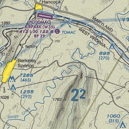 Aeronautical chart – includes elevation.
 Topographic map – emphasizes contours – suitable for land navigation.


Maritime piloting
Coastal mariners often use reference manuals, called "pilots" for navigating coastal waters. In addition to providing descriptions of shipping channels and coastal profiles, they discuss weather, currents and other topics of interest to mariners. Notable guides include a worldwide series of "Sailing Directions" by the United Kingdom Hydrographic Office (formerly by the British Admiralty) that includes, most notably, the English Channel, the Mediterranean Sea, the Red Sea and the Persian Gulf. [9] Another series worldwide series of Sailing Directions is by the US National Geospatial-Intelligence Agency, [10] which has planning guide and enroute portions. The "United States Coast Pilot", by the National Oceanic and Atmospheric Administration (NOAA) Office of Coast Survey, covers the coastal and intracoastal waters and the Great Lakes of the United States. [11]
Remote pilotage
In 2024, Denmark became the first country in the world to launch a test program for remote pilotage, allowing qualified marine pilots to guide ships without being physically onboard. The initiative is led by the Danish pilotage authority DanPilot in cooperation with technology provider Danelec, and is approved by the Danish Emergency Management Agency. The program involves using real-time sensor data, including navigational data and radar feeds transmitted from the ship to a remote operations center.
The project is being trialed in the Western Baltic Sea and aims to demonstrate that remote pilotage can meet the same safety and operational standards as traditional onboard pilotage. If successful, remote pilotage could provide greater flexibility and efficiency in vessel handling, particularly for short transits and in adverse boarding conditions. [12] [13]


