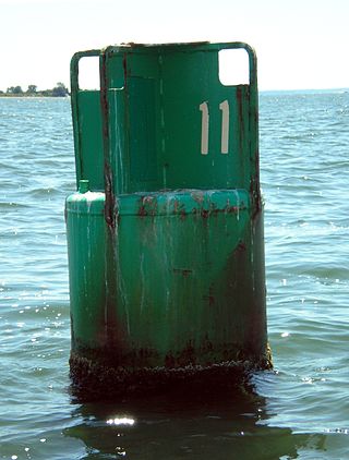
A buoy is a floating device that can have many purposes. It can be anchored (stationary) or allowed to drift with ocean currents.

Hydrography is the branch of applied sciences which deals with the measurement and description of the physical features of oceans, seas, coastal areas, lakes and rivers, as well as with the prediction of their change over time, for the primary purpose of safety of navigation and in support of all other marine activities, including economic development, security and defense, scientific research, and environmental protection.

A non-directional beacon (NDB) or non-directional radio beacon is a radio beacon which does not include inherent directional information. Radio beacons are radio transmitters at a known location, used as an aviation or marine navigational aid. NDB are in contrast to directional radio beacons and other navigational aids, such as low-frequency radio range, VHF omnidirectional range (VOR) and tactical air navigation system (TACAN).
Piloting or pilotage is the process of navigating on water or in the air using fixed points of reference on the sea or on land, usually with reference to a nautical chart or aeronautical chart to obtain a fix of the position of the vessel or aircraft with respect to a desired course or location. Horizontal fixes of position from known reference points may be obtained by sight or by radar. Vertical position may be obtained by depth sounder to determine depth of the water body below a vessel or by altimeter to determine an aircraft's altitude, from which its distance above the ground can be deduced. Piloting a vessel is usually practiced close to shore or on inland waterways. Pilotage of an aircraft is practiced under visual meteorological conditions for flight.
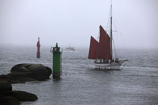
A sea mark, also seamark and navigation mark, is a form of aid to navigation and pilotage that identifies the approximate position of a maritime channel, hazard, or administrative area to allow boats, ships, and seaplanes to navigate safely.
Leading lights, also known as range lights in the United States, are a pair of light beacons used in navigation to indicate a safe passage for vessels entering a shallow or dangerous channel; they may also be used for position fixing. At night, the lights are a form of leading line that can be used for safe navigation. The beacons consist of two lights that are separated in distance and elevation, so that when they are aligned, with one above the other, they provide a bearing. Range lights are often illuminated day and night.

Cape Hatteras Light is a lighthouse located on Hatteras Island in the Outer Banks in the town of Buxton, North Carolina and is part of the Cape Hatteras National Seashore. It is the tallest lighthouse in the U.S. from base to tip at 210 feet. The lighthouse's semi-unique pattern makes it easy to recognize and famous. It is often ranked high on lists of most beautiful, and famous lighthouses in the US.

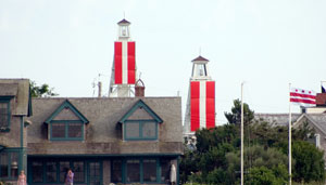
The Navesink Twin Lights is a non-operational lighthouse and museum located in Highlands, Monmouth County, New Jersey, United States, overlooking Sandy Hook Bay, the entrance to New York Harbor, and the Atlantic Ocean. The Twin Lights, as the name implies, are a pair of beacons located 246 feet (75 m) above sea level on the headlands of the Navesink Highlands.

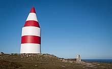
A day beacon is an unlighted nautical sea mark. A signboard identifying it is called a day mark. Day beacons typically mark channels whose key points are marked by lighted buoys. They may also mark smaller navigable routes in their entirety. They are the most common navigation aid in shallow water, as they are relatively inexpensive to install and maintain. Navigation around them is similar to that around other navigation aids.

A navigational aid (NAVAID), also known as aid to navigation (ATON), is any sort of signal, markers or guidance equipment which aids the traveler in navigation, usually nautical or aviation travel. Common types of such aids include lighthouses, buoys, fog signals, and day beacons.

In aeronautics, the final approach is the last leg in an aircraft's approach to landing, when the aircraft is lined up with the runway and descending for landing. In aviation radio terminology, it is often shortened to "final".

The Keskiniemi beacon tower, often referred to as the Karvo beacon tower, is a historic daymark located on a promontory of Keskiniemi in the northwestern part of Hailuoto island in the Gulf of Bothnia in Finland. The tower was built in 1858 to alert the vessels about sandbars reaching northwest from the site. It is the oldest surviving navigational aid on Hailuoto island. The tower has structural similarities with the Härkmeri beacon tower built in 1857.

Laitakari beacon tower is a daymark located on the island of Laitakari in the Gulf of Bothnia in Finland. The island is located east-northeast of Hailuoto and is within the municipal boundaries of the City of Oulu. There has been a navigational aid on the island since the 1750s, and a beacon tower has been marked on a chart dated in 1785.
Tasku beacon tower is a daymark tower located on the island of Tasku in the Raahe archipelago in the Gulf of Bothnia in Finland. The structure was built in 1853 from the plans drawn by Albin Stjerncreutz. In 1983 the Finnish Maritime Administration handed it over to the City of Raahe. Currently the city is responsible of the upkeep of this historical aid to navigation. The Tasku beacon tower is one of three historical beacon towers in Raahe archipelago, however only two beacon towers remain: the second one is the Iso-Kraaseli beacon tower.
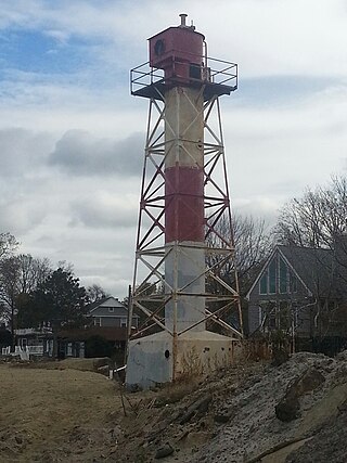
The Conover Beacon is a lighthouse in Leonardo section of Middletown Township, Monmouth County, New Jersey, United States, that functioned as the front light of the now-discontinued Chapel Hill Range.
Depth sounding, often simply called sounding, is measuring the depth of a body of water. Data taken from soundings are used in bathymetry to make maps of the floor of a body of water, such as the seabed topography.

A landmark is a recognizable natural or artificial feature used for navigation, a feature that stands out from its near environment and is often visible from long distances.

Port and starboard are nautical terms for watercraft, aircraft and spacecraft, referring respectively to the left and right sides of the vessel, when aboard and facing the bow (front).
Chester Rock Light was a light in Chester, Connecticut on the Connecticut River. It was built in 1889 as part of a $15,000 appropriation by the United States Congress. The 21-foot tall wooden hexagonal pyramidal tower had a black lantern with a 6th order Fresnel lens. The light was first lit on July 1, 1889. The tower was replaced in 1912 by a skeleton tower that was subsequently modified in 1927. Records do not show the deactivation or destruction of the light, but it was believed to have been removed in the 1930s. In the 1990s, the Deep River Historical Society of Deep River, Connecticut wanted to build a replica of the structure for use as a daymark.