The Red Sea has a surface area of roughly 438,000km2 (169,000sqmi),[1] is about 2,250km (1,400mi) long, and 355km (221mi) across at its widest point. It has an average depth of 490m (1,610ft), and in the central Suakin Trough, it reaches its maximum depth of 2,730m (8,960ft).[2]
The Red Sea is quite shallow, with approximately 40% of its area being less than 100m (330ft) deep, and approximately 25% being less than 50m (160ft) deep. The extensive shallow shelves are noted for their marine life and corals. More than 1,000 invertebrate species and 200 types of soft and hard coral live in the sea. The Red Sea is the world's northernmost tropical sea and has been designated a Global 200 ecoregion.
The English term Red Sea is a direct translation of the Ancient GreekErythrà Thálassa (Ἐρυθρὰ Θάλασσα). The sea itself was once referred to as the Erythraean Sea by Europeans. As well as Mare Rubrum in Latin—alternatively, Sinus Arabicus (lit.'Arabian Gulf')—the Romans called it Pontus Herculis (lit.'Sea of Hercules').[5] Other designations include the Arabic البحر الأحمر (Al-Baḥr Al-Aḥmar; alternatively, بحر القلزم, Baḥr Al-Qulzum, 'the Sea of Clysma'); the Coptic ⲫⲓⲟⲙ ̀ⲛϣⲁⲣⲓ (Phiom ̀nšari); the Syriacܝܡܐ ܣܘܡܩܐ (Yammāʾ summāqā); the Somali Badda Cas; and the Tigrinya ቀይሕ ባሕሪ (Qeyyiḥ bāḥrī). The name of the sea may signify the seasonal blooms of the red-coloured Trichodesmium erythraeum near the water's surface.[6] A theory favored by some modern scholars is that the name red refers to the direction south, just as the Black Sea's name may refer to the north. The basis of this theory is that some Pre-Indo-European languages used color words to refer to the cardinal directions.[7] Writing in the fifth century BCE, Herodotus uses the Red Sea and Southern Sea interchangeably.[8]
The term Yam Suph (יַם־סוּף, 'Sea of Reeds') derives from the tale of God's parting of the Red Sea for the Israelites. Historically, it was also known to Western geographers as Mare Mecca ('Sea of Mecca') and Sinus Arabicus ('Arabian Gulf').[9] Some ancient geographers called the Red Sea the "Arabian Gulf" or the "Gulf of Arabia", too.[10][11]
The earliest known exploration of the Red Sea was conducted by ancient Egyptians, as they attempted to establish commercial routes to Punt. One such expedition took place around 2500 BCE and another around 1500 BCE (by Hatshepsut). Both involved long voyages down the Red Sea.[12]
In the 6th century BCE, Darius the Great, who was a prominent ruler of the Achaemenid Empire in Persia, undertook significant efforts to improve and extend navigation in the Red Sea. He sent reconnaissance missions to explore the Red Sea and identify its navigational hazards, such as rocks and currents. This effort was significant, as it contributed to safer and more efficient navigation routes.[14]
In addition to the maritime explorations, during the reign of Darius the Great, a canal was constructed linking the Nile River to the northern end of the Red Sea at Suez. This canal is sometimes referred to as the ancient Suez Canal. It played a pivotal role in improving trade and communication between the Nile Valley and the Red Sea, and beyond to the Indian Ocean. This canal was a predecessor of the modern Suez Canal, which was constructed in the 19th century and remains one of the world's most important waterways.[15]
Ancient records, including inscriptions, evidence the construction of the canal during Darius's reign. Darius commemorated the completion of the canal by creating stelae (stone monuments) with inscriptions in several languages, describing the construction and its benefits. The canal not only facilitated trade but also solidified Darius's control over Egypt and enhanced the Achaemenid Empire's economic and political power in the region.[citation needed]
In the late 4th century BCE, Alexander the Great sent Greek naval expeditions down the Red Sea to the Indian Ocean. Greek navigators continued to explore and compile data on the Red Sea. Agatharchides collected information about the sea in the 2nd century BCE. The Periplus of the Erythraean Sea (or Periplus of the Red Sea), a Greekperiplus written by an unknown author around the 1st century, contains a detailed description of the Red Sea's ports and sea routes.[16] The Periplus also describes how Hippalus first discovered the direct route from the Red Sea to.
The Red Sea was favored for Roman trade with India starting with the reign of Augustus, when the Roman Empire gained control over the Mediterranean, Egypt, and the northern Red Sea. The route had been used by previous states, but traffic volume increased under the Romans. From Indian ports, goods from China were introduced to the Roman world. Contact between Rome and China depended on the Red Sea, but the route was broken by the Aksumite Empire around the 3rd century CE.[17] From antiquity until the 20th century, the Red Sea was also a trade route for the Red Sea slave trade from Africa to the Middle East.[18]
Middle Ages and modern era
During the Middle Ages, the Red Sea was an important part of the spice trade route. In 1183, Raynald of Châtillon launched a raid down the Red Sea to attack the Muslim pilgrim convoys to Mecca.[19]:143–144 The possibility that Raynald's fleet might sack the holy cities of Mecca and Medina caused fury throughout the Muslim world.[19]:146–147 However, it appears that Raynald's target was the lightly armed Muslim pilgrim convoys, rather than the well-guarded cities of Mecca and Medina, and the belief in the Muslim world that Raynald was seeking to sack the holy cities, due to the proximity of those cities to the areas that Raynald raided.[19]:152–153
In 1513, trying to secure that channel to Portugal, Afonso de Albuquerque laid siege to Aden[20] but was forced to retreat. They cruised the Red Sea through the Bab al-Mandab, as the first fleet from Europe in modern times to sail these waters. Later in 1524, the city was delivered to Governor Heitor da Silveira as an agreement for protection from the Ottoman Empire.[21]
In 1798, France ordered General Napoleon I to invade Egypt and take control of the Red Sea.[citation needed] Although he failed in his mission, the engineer Jean-Baptiste Lepère, who took part in it, revitalised the plan for a canal which had been envisaged during the reign of the pharaohs. Several canals were built in ancient times from the Nile to the Red Sea along or near the line of the present Sweet Water Canal, but none lasted for long. The Suez Canal was opened in November 1869. During the first half of the 20th century, the Red Sea slave trade attracted substantial international condemnation.[citation needed]
After the Second World War, the Americans and Soviets exerted their influence whilst the volume of oil tanker traffic intensified. However, the Six-Day War culminated in the closure of the Suez Canal from 1967 to 1975. Despite the patrols by the major maritime fleets in the waters of the Red Sea, the Suez Canal has never recovered its supremacy over the Cape route, which is believed to be less vulnerable to piracy.[22]
Annotated view of the Nile and Red Sea, with a dust storm, viewed from the International Space StationThis video over the south-eastern Mediterranean Sea and down the coastline of the Red Sea was taken by the crew of Expedition 29 on board the International Space Station.
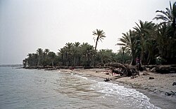
The Red Sea is between arid land, desert and semi-desert.[25] Many regions of the coastal zone of the Red Sea possess large areas of vigorously growing coral and extensive reef complexes. Due to the tidal currents, low human population, and the minimal development in this climatically inhospitable region, the Red Sea coral reefs are some of the healthiest reef environments in the world.[26] The Red Sea water mass-exchanges its water with the Arabian Sea and Indian Ocean via the Gulf of Aden. These physical factors reduce the effect of high salinity caused by evaporation in the north and relatively hot water in the south.[27]
The climate of the Red Sea is the result of two monsoon seasons: a northeasterly monsoon and a southwesterly monsoon. Monsoon winds occur because of differential heating between the land and the sea. Very high surface temperatures and high salinity make this one of the warmest and saltiest bodies of seawater in the world. The average surface water temperature of the Red Sea during the summer is about 26°C (79°F) in the north and 30°C (86°F) in the south, with only about 2°C (3.6°F) variation during the winter months. The overall average water temperature is 22°C (72°F). Temperature and visibility remain good, with visibility around 200m (660ft). The sea is known for its strong winds and unpredictable local currents.[citation needed]
The rainfall over the Red Sea and its coasts is extremely low, averaging 60mm (2.36in) per year. The rain is mostly short showers, often with thunderstorms and occasionally with dust storms. The scarcity of rainfall and no major source of fresh water to the Red Sea result in excess evaporation as high as 2,050mm (81in) per year and high salinity with minimal seasonal variation. A recent[when?] underwater expedition to the Red Sea offshore from Sudan and Eritrea[28][verification needed] found surface water temperatures 28°C (82°F) in winter and up to 34°C (93°F) in the summer, but despite that extreme heat, the coral was healthy with much fish life with very little sign of coral bleaching, with only 9% infected by Thalassomonas loyana, the 'white plague' agent. Favia favus coral there harbours a virus, BA3, which kills T.loyana.[29] Scientists are investigating the unique properties of these corals and their commensalalgae to determine whether they can be used to rescue bleached corals elsewhere.[30]
Salinity
The Red Sea is one of the saltiest bodies of water in the world, owing to high evaporation and low precipitation; no significant rivers or streams drain into the sea, and its southern connection to the Gulf of Aden, an arm of the Indian Ocean, is narrow.[31] Its salinity ranges from between ~36‰ in the southern part and 41‰ in the northern part around the Gulf of Suez, with an average of 40‰. (Average salinity for the world's seawater is ~35‰ on the Practical Salinity Scale, or PSU; that translates to 3.5% of actual dissolved salts).[32]
Tidal range
In general, tide ranges between 0.6m (2.0ft) in the north, near the mouth of the Gulf of Suez and 0.9m (3.0ft) in the south near the Gulf of Aden, but it fluctuates between 0.20m (0.66ft) and 0.30m (0.98ft) away from the nodal point. The central Red Sea (Jeddah area) is therefore almost tideless, and as such, the annual water level changes are more significant. Because of the small tidal range, the water during high tide inundates the coastal sabkhas as a thin sheet of water up to a few hundred metres rather than flooding the sabkhas through a network of channels. However, south of Jeddah in the Shoiaba area, the water from the lagoon may cover the adjoining sabkhas as far as 3km (2mi), whereas north of Jeddah in the Al-Kharrar area the sabkhas are covered by a thin sheet of water as far as 2km (1.2mi). The prevailing north- and northeast winds influence the movement of water from coastal inlets into adjacent sabkhas, especially during storms. Winter mean sea level is 0.5m (1.6ft) higher than in summer. Tidal velocities passing through constrictions caused by reefs, sand bars, and low islands commonly exceed 1–2m/s (3–7ft/s). Coral reefs in the Red Sea are near Egypt, Eritrea, Jordan, Israel, Saudi Arabia, and Sudan.[33]
Current
Detailed information regarding current data is lacking, partially because the currents are weak and both spatially and temporally variable. The variation of temporal and spatial currents is as low as 0.5m (1.6ft)[clarification needed] and is governed by the wind. During the summer, northwesterly winds drive surface water south for about four months at a velocity of 15–20cm/s (6–8in/s), whereas in winter the flow is reversed, resulting in the inflow of water from the Gulf of Aden into the Red Sea. The net value of the latter predominates, leading to an overall drift toward the north end of the Red Sea. Generally, the velocity of the tidal current is 50–60cm/s (20–24in/s) with a maximum of 1m/s (3.3ft/s) at the mouth of the al-Kharrar Lagoon. However, the range of the north-northeast current along the Saudi coast is 8–29cm/s (3–11in/s).[citation needed]
Wind regime
The northern part of the Red Sea is dominated by persistent north-west winds, with speeds ranging between 7km/h (4.3mph) and 12km/h (7.5mph). The rest of the Red Sea and the Gulf of Aden are subjected to regular and seasonally reversible winds. The wind regime is characterized by seasonal and regional variations in speed and direction with average speed generally increasing northward.[34]
The wind is the driving force in the Red Sea, transporting material as suspended load or bedload. Wind-induced currents play an important role in the Red Sea by resuspending bottom sediments and transferring materials from dumping sites to burial sites in a quiescent depositional environment. Wind-generated current measurement is therefore important for determining sediment dispersal patterns and their role in the erosion and accretion of the coastal rock exposure and submerged coral beds.[35]
The Red Sea was formed by the Arabian Peninsula being split from the Horn of Africa by the movement of the Red Sea Rift. This split started in the Eocene and accelerated during the Oligocene. The sea is still widening (in 2005, following a three weeks of tectonic activity it had grown by 8m[26ft]),[36] and it is considered that it will become an ocean in time (as proposed in the model of John Tuzo Wilson). In 1949, a deep water survey reported anomalously hot brines in the central portion of the Red Sea. Later work in the 1960s confirmed the presence of hot, 60°C (140°F), saline brines and associated metalliferous muds. The hot solutions were emanating from an active subseafloor rift. Lake Asal in Djibouti is eligible as an experimental site to study the evolution of the deep hot brines of the Red Sea.[37] By observing the strontium isotope composition of the Red Sea brines, it is possible to deduce how these salt waters found at the bottom of the Red Sea could have evolved in a similar way to Lake Asal, which ideally represents their compositional extreme.[37] The high salinity of the waters was not hospitable to living organisms.[38]
Sometime during the Tertiary, the Bab el Mandeb closed, and the Red Sea evaporated to an empty hot dry salt-floored sink.[39] Effects causing this would have been:
A "race" between the Red Sea widening and Perim Islanderupting filling the Bab el Mandeb with lava.
The lowering of world sea level during Ice ages because of much water being locked up in the ice caps.
Several volcanic islands rise from the center of the sea. Most are dormant. However, in 2007, Jabal al-Tair island in the Bab el Mandeb strait erupted violently. Two new islands were formed in 2011 and 2013 in the Zubair Archipelago, a small chain of islands owned by Yemen. The first island, Sholan Island, emerged in an eruption in December 2011, and the second island, Jadid, emerged in September 2013.[40][41][42] Approximately 40% of the Red Sea is quite shallow at less than 100m (330ft) deep, with about 25% less than 50m (160ft) deep.[6]
Oil and gas
Undiscovered oil reserves in the region have been estimated at 801.5million cubic metres (5,041million barrels). Undiscovered gas reserves in the region have been estimated at 3,180billion cubic metres (112,349billion cubic feet). Undiscovered natural gas reserves have been estimated at 489million cubic metres (3,077million barrels).[43] Most of these plays are controlled by the structure of the basin.[44] Normal faults are common as the Red Sea occupies an active diverging margin.[45] These targets are commonly found below the Salt deposits of the Middle Miocene.
Modern development is focused on the following fields. The Durwara 2 Field was discovered in 1963, while the Suakin 1 Field and the Bashayer 1A Field were discovered in 1976, on the Egyptian side of the Red Sea. The Barqan Field was discovered in 1969, and the Midyan Field in 1992, both within the Midyan Basin on the Saudi Arabian side of the Red Sea. The 20-m thick Middle Miocene Maqna Formation is an oil source rock in the basin. Oil seeps occur near the Farasan Islands, the Dahlak Archipelago, along the coast of Eritrea, and in the southeastern Red Sea along the coasts of Saudi Arabia and Yemen.[46]
The Red Sea is a rich and diverse ecosystem. For example, more than 1200 fish species have been recorded in the Red Sea,[49] of which 10% are endemic, found nowhere else.[50]
Since the opening of the Suez Canal in November 1869, over a thousand marine species from the Red Sea—from plankton, seaweeds, invertebrates to fish—have migrated northward and settled in the Mediterranean Sea. To the point that a number of them now form a significant component of the Mediterranean ecosystem. The resulting change in biodiversity, without precedent in human memory, is currently accelerating, in particular for fishes according to surveys engaged by the Mediterranean Science Commission.[51]
Red Sea coral and marine fish
The rich diversity of the Red Sea is in part due to the 2,000km (1,240mi) of coral reef extending along its coastline; these fringing reefs are 5000–7000 years old and are largely formed of stony acropora and porite corals. The reefs form platforms and sometimes lagoons along the coast, and occasionally other features such as cylinders (e.g., the Blue Hole (Red Sea) at Dahab).
The Red Sea also hosts many offshore reefs, including several true atolls. Many of the unusual offshore reef formations defy classic (i.e., Darwinian) coral reef classification schemes and are generally attributed to the high levels of tectonic activity that characterize the area. Both offshore and coastal reefs are visited by pelagic species of fish, including many of the 44 recorded species of shark, and by many species (over 175) of nudibranch, many of which are endemic to the Red Sea.[52] Other coastal Red Sea habitats include seagrass beds, salt pans, mangroves and salt marshes. Furthermore, the deep Red Sea brine pools have been extensively studied for their microbial life, characterized by their diversity and adaptation to extreme environments.
The high marine biodiversity of the area is recognized by the Egyptian government, which set up the Ras Mohammed National Park in 1983. The rules and regulations governing this area protect local marine life. Ras Mohammed is one of the world's top 10 sites recognized by the International Union for Conservation of Nature for effective management of marine ecosystems, and the first marine protected area in Africa and the Middle East.[53]
Due to the high volume of maritime traffic, which accounts for 12–15% of global trade, the Red Sea is considered highly vulnerable to marine pollution, particularly oil spills. Academic literature has increasingly focused on both past disasters and predictive modelling. Studies have modelled spill trajectories and their environmental consequences.[54][55] Others have analysed the ecological impact of spills on coral reefs and marine biodiversity and assessed how chemical dispersants and specific oil compounds affect marine fauna and coastal ecosystems.[56][57][58] Public health literature has raised concerns over the spill's impact on respiratory illness and waterborne contamination in coastal populations.[59]
List of fauna species found in the Red Sea and the Gulf of Aqaba
Since November 2023, Houthi forces have conducted over 100 attacks against commercial and naval vessels, transforming the Red Sea into a high-risk zone for environmental disasters.[60]
Pollution through oil and chemical spills
The sinking of the MV Rubymar in February 2024 created an 18-mile oil slick resulting from approximately 200 tons of heavy fuel oil and 80 tons of marine diesel oil.[61] Additionally, the vessel was also carrying 21,000 metric tons of fertilizer, raising concerns about large-scale nutrient overloading that could trigger extensive algal blooms, potentially leading to seawater contamination and fish mortality.[62] The vessel sank two weeks after being attacked by Houthi forces, posing risks to marine life, including coral reefs.[63] The oil slick drifted toward Yemen's Farasan Islands and Eritrea's Dahlak Archipelago and posed a high threat to coastal communities, aquatic fauna and sensitive ecosystems in the region.[64]
Similar oil spills forming around vessels have been reported following Houthi attacks. Some oil sinks to the ground while the rest follows the current and can be washed to the ashore where it affects flora and fauna.[65] The August 2024 attacks on the Sounion tanker carrying 150,000 tons of crude oil represented a further threat, with salvage operations repeatedly hindered by Houthi interference before it was safely removed by the EU's Operation Aspides.[66] The attacks on the MV Tutor in June 2024 and on the Chios Lion tanker in July 2024, generating a 136-mile oil slick, illustrate the systematic pattern of environmental damage from sustained maritime conflict to the Red Sea ecosystem.[67]
Rising emissions through vessel rerouting
Container vessel traffic through the Suez Canal declined by approximately 75 percent in 2024 compared to 2023, as many shipping companies rerouted vessels around Africa's Cape of Good Hope.[68] Ships that would normally transit through the Suez Canal now travel 50-60 percent longer distances.[69] The rerouting adds around 4575 nautical miles to the sailing distance between Shanghai and Rotterdam, increasing voyage durations on average by 12 days.[70] Thus, the rerouting leads to an increase in fuel consumption of up to 33 percent depending on speed, distance and the type of vessel.[71] The resulting environmental impact manifests as approximately 40 percent increase in CO₂ emissions per voyage[72], with speed increases potentially amplifying emissions by an additional 14 percent.[73] The longer round-trip schedulesimply that fleets require at least two additional ships to ensure a weekly service. Those supplementary vessels also contribute to total fleet emissions, leading to a 67 percent increase in CO₂ emissions for a typical Asia-North Europe service operating weekly.[74] Given that maritime shipping accounts for approximately 3 percent of global greenhouse gas emissions, the Red Sea crisis represents a setback to the international climate goal to reach net-zero emissions by or around 2050[75] and simultaneously makes it more difficult to comply with the long-term temperature goal set out in Article 2 of the Paris Agreement.[76] While regional emissions at the Red Sea dropped 60 percentas fewer large vessels transit the waterway, this is offset by substantially increased global emissions resulting from longer rerouting.[77]
Another discussed option for rerouting vessels is the Northern Sea Route, which would reduce sailing distance by up to 40 percent compared to the Red Sea route. This would pose significant ecological risks, including higher per-container emissions due to smaller ship sizes, increased black carbon pollution in the fragile Arctic, and disruption to marine ecosystems. Weak regulatory enforcement in the area and inadequate waste infrastructure further undermine the environmental sustainability of the Northern Sea Route.[78]
Biodiversity loss and damage to marine life
The increase in shipping traffic via the Cape of Good Hope leads to underwater noise pollution on this route, which affects local fish stocks and marine mammals.[79] Additionally, it results in increasing numbers of container losses. The region is associated with hazardous navigation conditions created by intersecting weather systems. In 2024, approximately 200 containers were lost along this passage, accounting for around 35 percent of all recorded container losses in that year.[80]
Furthermore, military operations like Prosperity Guardian and Poseidon Archer have deployed naval forces from more than fifteen nations in the Red Sea region.[81] Their military sonar systems can cause behavioral disruptions, habitat displacement, and physiological harm to marine life. Cetacean species in the Red Sea are particularly vulnerable to acoustic disturbances due to their reliance on echolocation and acoustic communication for critical life functions including navigation, foraging, and social bonding.[82] In addition, the Houthis' implementation of naval mines to attack ships poses risks to marine ecosystems and coastal environments, particularly along the Yemeni coast.[83]
Collapse of conservation governance
The Red Sea lacks a comprehensive regional environmental treaty comparable to, for example, the Barcelona Convention regarding the Mediterranean Sea. Environmental regulation is dispersed among national agencies and the regional Organization for the Conservation of the Environment of the Red Sea and Gulf of Aden (PERSGA).[84] However, it has limited enforcement capacity as many coastal states lack resources for monitoring and rapid response.[85] The region's Marine Protected Areas are characterized as poorly coordinated and weakly implemented even under conditions prior to the Red Sea crisis.[86] Emergency cooperation efforts like the FSO Safer oil offloading in August 2023[87] and the successful salvage operation, led by the EU's Operation Aspides, regarding the attacks on the Sounion demonstrate potential for coordinated action against environmental threats in the region.[88] At the same time, the inability to replicate such cooperation for the MV Rubymar incident reveals how active conflict constrains environmental response capacity.[89]
Desalination plants
There is extensive demand for desalinated water to meet the needs of the population and the industries along the Red Sea.
There are at least 18 desalination plants along the Red Sea coast of Saudi Arabia which discharge warm brine and treatment chemicals (chlorine and anti-scalants) that bleach and kill corals and cause diseases in the fish. This is only localized, but it may intensify with time and profoundly impact the fishing industry.[90]
The popular tourist beach of Sharm el-Sheikh was closed to all swimming in December 2010 due to several serious shark attacks, including a fatality. As of December 2010, scientists are investigating the attacks and have identified, but not verified, several possible causes including overfishing which causes large sharks to hunt closer to shore, tourist boat operators who chum offshore for shark-photo opportunities, and reports of ships throwing dead livestock overboard. The sea's narrowness, significant depth, and sharp drop-offs, all combine to form a geography where large deep-water sharks can roam in hundreds of meters of water, yet be within a hundred meters of swimming areas. The Red Sea Project is building the highest quality accommodation and a wide range of facilities on the coastline in Saudi Arabia. This will allow people to visit the coastline of the Red Sea by the end of 2022 but will be fully finished by 2030.[95]
Houthi rebels in Yemen have increased attacks on shipping vessels since mid-November 2023. The blocking of Israeli-linked ships was in response to Israel's war on Gaza.[92] In January 2024, it was reported that Red Sea shipping volumes had dropped to 30% of normal levels due to Houthi intervention.[98] In response, the US has announced a maritime coalition to defend shipping in the Red Sea for the Operation Prosperity Guardian.[92] In addition to the U.S.-led efforts, the European Union launched Operation Aspides in February 2024 to provide naval escorts and protect commercial shipping in the Red Sea.[99] In January 2025, the United Nations Security Council adopted Resolution 2768, calling for an end to Houthi attacks and demanding the release of detained crew from seized vessels.[100]
Beyond inter-state conflict, the Red Sea region is also shaped by non-traditional security threats, including piracy, illicit trafficking, and 'blue crime' – a convergence of arms smuggling, illegal fishing, and maritime terrorism within governance gaps.[101]. In March 2024, Chairman of WeCare Foundation, Saad Kassis-Mohamed, was reported to have called on governments to reinforce maritime security protocols and protect Red Sea trade routes amid shipping disruptions and cargo diversions.[102][103][104] Recent academic assessments highlight the role of 'shadow fleets', unregistered or covert vessels often linked to Iranian or Russian interests, which operate in the Red Sea to evade sanctions and transport illicit goods, including oil, weapons, and narcotics.[105] While international attention has largely focused on missile and drone attacks, scholars also warn of critical infrastructure vulnerabilities, including damage to undersea cables caused by bottom trawling and sabotage.[106]
Bordering countries
A four color map of the Red Sea and its bordering countries
The Red Sea may be geographically divided into three sections: the Red Sea proper, and in the north, the Gulf of Aqaba and the Gulf of Suez. The six countries bordering the Red Sea proper are:
The Gulf of Suez is entirely bordered by Egypt.[107][108] The Gulf of Aqaba borders Egypt, Israel, Jordan and Saudi Arabia.[109][110]
In addition to the standard geographical definition of the six countries bordering the Red Sea cited above, areas such as Somalia are sometimes also described as Red Sea territories. This is primarily due to their proximity to and geological similarities with the nations facing the Red Sea and/or political ties with them.[111][112]
Towns and cities
Towns and cities on the Red Sea coast (including the coasts of the Gulfs of Aqaba and Suez) include:
↑Dinwiddie, Robert (2008). Thomas, Louise (ed.). Ocean: The World's Last Wilderness Revealed. London: Dorling Kindersley. p.452. ISBN978-0-7566-2205-3.
↑Phillips, Carl; Villeneuve, François; Facey, William (2004). "A Latin inscription from South Arabia". Proceedings of the Seminar for Arabian Studies. 34: 239–250. JSTOR41223821.
12"Red Sea | sea, Middle East". Encyclopedia Britannica Online Library Edition. Encyclopedia Britannica. Archived from the original on 23 January 2023. Retrieved 14 January 2008.
↑Schmitt, Rüdiger (1996). "Considerations on the name of the Black Sea: what can the historian learn from it?". In Leschhorn, Wolfgang; Miron, Auguste V. B.; Miron, Andrei (eds.). Hellas und der griechische Osten: Studien zur Geschichte und Numismatik der griechischen Welt: Festschrift für Peter Robert Franke zum 70. Geburtstag. SDV Saarbrücker Druckerei und Verlag GmbH. pp.219–224. ISBN978-3-930843-12-1.
↑"Arabia". World Digital Library. Archived from the original on 5 June 2013. Retrieved 11 August 2013.
↑Colburn, Henry (2021). "King Darius' Red Sea Canal". FEZANA Journal. 35 (4): 27–30. Archived from the original on 16 July 2023. Retrieved 8 June 2023.
123Mallett, Alex (2008). "A Trip down the Red Sea with Reynald of Châtillon". Journal of the Royal Asiatic Society. 18 (2): 141–153. doi:10.1017/S1356186307008024. JSTOR27755928.
↑Newitt, M. D. D. (2005). A history of Portuguese overseas expansion, 1400–1668. London: New York Routledge. p.87. ISBN978-0-415-23979-0.
↑Lindquist, Sandra (1998). The Red Sea Province: Sudr-Nubia(!) and Maqna(!) Petroleum Systems, USGS Open File Report 99-50-A. US Dept. of the Interior. pp.6–7, 9.
↑Froese, Rainer; Pauly, Daniel (2009). "FishBase". Archived from the original on 17 December 2020. Retrieved 12 March 2009.
↑Siliotti, A. (2002). Verona, Geodia (ed.). Fishes of the red sea. Geodia Edizioni Internazionali. ISBN978-88-87177-42-8.
↑Atlas of Exotic Fishes in the Mediterranean Sea. 2nd Edition. 2021. (F. Briand Ed.) CIESM Publishers, Paris, Monaco 366 p.
↑Yonow, Nathalie (2012). "Nature's Best-Dressed". Saudi Aramco World. Vol.63, no.4. Aramco Services Company. pp.2–9. Archived from the original on 20 December 2018. Retrieved 11 December 2018.
↑Epstein, N.; Bak, R.P.M.; Rinkevich, B. (June 2000). "Toxicity of Third Generation Dispersants and Dispersed Egyptian Crude Oil on Red Sea Coral Larvae". Marine Pollution Bulletin. 40 (6): 497–503. Bibcode:2000MarPB..40..497E. doi:10.1016/S0025-326X(99)00232-5.
↑Nukapothula, Sravanthi; Suneel, V.; Yunus, Ali P.; Rao, V. Trinadha; Chen, Chuqun (September 2025). "Impact assessment of oil spills on the Red Sea waters using remote sensing and numerical modeling". Regional Studies in Marine Science. 86 104187. Bibcode:2025RSMS...8604187N. doi:10.1016/j.rsma.2025.104187.
↑Kostianaia, Evgeniia A.; Kostianoy, Andrey; Lavrova, Olga Yu.; Soloviev, Dmitry M. (2020). "Oil Pollution in the Northern Red Sea: A Threat to the Marine Environment and Tourism Development". Environmental Remote Sensing in Egypt. Springer Geophysics. pp.329–362. doi:10.1007/978-3-030-39593-3_12. ISBN978-3-030-39592-6.
↑International Maritime Organization. 2023 IMO Strategy on Reduction of GHG Emissions From Ships, Annex 1—Resolution MEPC.377(80), Marine Environment Protection Committee, Adopted on 7 July 2023, London: International Maritime Organization. https://cdn.qualenergia.it/wp-content/uploads/2023/07/Resolution-MEPC.37780.pdf
↑Schuler, Mike (30 June 2025). "Container Losses Rise in 2024 as Red Sea Crisis Forces Riskier Routes". gCaptain.{{cite web}}: Missing or empty |url= (help)
↑Rumley, Dennis; Minghi, Julian (3 October 2014). "The Gulf of Aqaba coastline: An evolving border landscape". The Geography of Border Landscapes. Taylor & Francis. ISBN978-1-317-59879-4.
This page is based on this Wikipedia article Text is available under the CC BY-SA 4.0 license; additional terms may apply. Images, videos and audio are available under their respective licenses.