Background
The WWF has identified 867 terrestrial ecoregions across the Earth's land surface, as well as freshwater and marine ecoregions. The goal of this classification system is to ensure that the full range of ecosystems will be represented in regional conservation and development strategies. Of these ecoregions, the WWF selected the Global 200 as the ecoregions most crucial to the conservation of global biodiversity. The Global 200 list actually contains 238 ecoregions, made up of 142 terrestrial, 53 freshwater, and 43 marine ecoregions.
Conservationists interested in preserving biodiversity have generally focused on the preservation of tropical moist broadleaf forests (commonly known as tropical rainforests) because it is estimated that they harbor one half of Earth's species. On the other hand, the WWF determined that a more comprehensive strategy for conserving global biodiversity should also consider the other half of species, as well as the ecosystems that support them.
Several habitats, such as Mediterranean forests, woodlands, and scrub biome, were determined to be more threatened than tropical rain forests, and therefore require concerted conservation action. WWF maintains that "although conservation action typically takes place at the country level, patterns of biodiversity and ecological processes (e.g., migration) do not conform to political boundaries", which is why ecoregion-based conservation strategies are deemed essential.
Classification
Historically, zoologists and botanists have developed various classification systems that take into account the world's plant and animal communities. Two of the worldwide classification systems most commonly used today were summarized by Miklos Udvardy in 1975.
The Earth's land surface can be divided into eight biogeographic realms (formerly called kingdoms, and which the BBC calls ecozones) that represent the major terrestrial communities of animals and plants, and are a synthesis of previous systems of floristic provinces and faunal regions. The biome system classifies the world into ecosystem types (i.e. forests, grasslands, etc.) based on climate and vegetation. Each biogeographical realm contains multiple biomes, and biomes occur across several biogeographical realms. A system of biogeographical provinces was developed to identify specific geographic areas in each biogeographical realm that were of a consistent biome type, and shared distinct plant and animal communities. The WWF system represents a further refinement of the system of biomes (which the WWF calls "major habitat types"), biogeographical realms, and biogeographical provinces (the WWF scheme divides most biogeographical provinces into multiple smaller ecoregions).
Selection process
Based on a comprehensive list of ecoregions, The Global 200 includes all major habitat types (biomes), all ecosystem types, and species from every major habitat type. It focuses on each major habitat type of every continent (such as tropical forests or coral reefs). It uses ecoregions as the unit of scale for comparison. WWF say ecoregions could be considered as conservation units at regional scale because they meet similar biological communities.
Some ecoregions were selected over other ecoregions of the same major habitat type (biome) or realm. Selection of the Global 200 relied on extensive studies of 19 terrestrial, freshwater, and marine major habitat types. Selection of the ecoregions was based on analyses of species richness, species endemism, unique higher taxa, unusual ecological or evolutionary phenomena, and global rarity of major habitat type.
Global 200 ecoregion list is most helpful to conservation efforts at a regional scale: local deforestation, destruction of swamp habitats, degradation of soils, etc. However, certain phenomena, such as bird or whale migration, depend on more complex parameters not used to define the current database, such as atmospheric currents and dynamic pelagic ecosystems. These would require gathering more information, and co-ordination of efforts between multiple ecoregions. However, the Global 200 ecoregions can help these efforts by identifying habitat sites and resting sites for migratory animals. It may also help identify the origin of invasive species, and offer insights for slowing down or stopping their intrusion.
This page is based on this
Wikipedia article Text is available under the
CC BY-SA 4.0 license; additional terms may apply.
Images, videos and audio are available under their respective licenses.
 WWF Global 200 ecoregions.
 WWF terrestrial ecoregions.
 Map of the Amazon Basin. Urubamba - Ucayali River.
 Lijiang City, Yunnan, China.
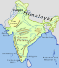 Hills of India.
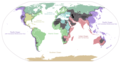 Major endorheic basins of the world. Basins are shown in dark gray; major endorheic lakes are shown in black.
 Terrestrial biomes classified by vegetation.


