Guianan moist forests

Last updated
Guyana moist forests (NT0125)
Waterfall near Paramakatoi.jpg
Waterfall near Paramakatoi, Guyana
Ecoregion NT0125.svg
Location in South America
Ecology
Realm Neotropical
Biome Tropical and subtropical moist broadleaf forests
Geography
Area512,817 km2 (198,000 sq mi)
Countries Guyana, Suriname, French Guiana, Venezuela, Brazil
Coordinates 3°59′24″N57°10′48″W / 3.990°N 57.180°W / 3.990; -57.180 Coordinates: 3°59′24″N57°10′48″W / 3.990°N 57.180°W / 3.990; -57.180
Climate typeAf: equatorial, fully humid
Conservation
Global 200 Guianan moist forests

The Guianan moist forests (NT0125) is an ecoregion in the east of Venezuela, north of Brazil and the Guyanas (Guyana, Suriname and French Guiana). It is in the Amazon biome. The climate is hot and humid, with two rainy seasons each year. As of 1996 the tropical rainforest habitat was relatively intact, although there were mounting threats from illegal logging and gold mining.

Contents

Location

The Guianan moist forests ecoregion covers most of Guyana, Suriname, and French Guiana. It covers part of eastern Venezuela and parts of the north of the Brazilian states of Pará and Amapá. It has a total area of 51,281,764 hectares (126,720,000 acres). [1]

Along the Atlantic coast to the east and northeast the ecoregion adjoins strips of Guianan freshwater swamp forests, Amazon-Orinoco-Southern Caribbean mangroves and Orinoco Delta swamp forests. To the northwest it adjoins the Llanos ecoregion, the Guianan piedmont and lowland moist forests and Guianan Highlands moist forest. Scattered patches of this last ecoregion are found on higher ground within the Guianan moist forests ecoregion. To the southwest and in places along its southern border it adjoins large areas of Guianan savanna. Most of the southern border adjoins the Uatuma-Trombetas moist forests. [2]

Physical

The ecoregion lies to the east of the lower Orinoco basin and covers about 65% of the northeast part of the ancient Guiana Shield. It is bounded to the south by the line of the Acarai and Tumuk Humak mountains, which defines the rim of the Amazon basin and the northern border of Brazil. A small part of the ecoregion in the east is in the lower Amazon basin. The Essequibo, Courantyne, Maroni and Oyapock rivers run through the region to the Atlantic Ocean. [3]

The terrain is mostly plains or low hills, with some steep slopes in river valleys and the bases of tepuis. In the west-central area the ecoregion surrounds the Pacaraima Mountains, a sandstone plateau with an average elevation of 1,000 metres (3,300 ft). It also surrounds tepuis, or tabletop mountains, the highest being Mount Roraima with an elevation of 2,810 metres (9,220 ft). The highlands and tepuis have a distinct tepui ecosystem. [3]

Ecology

The Guianan moist forests ecoregion is in the Neotropical realm and the tropical and subtropical moist broadleaf forests biome. [1] The ecoregion is part of the Guianan Moist Forests Global Ecoregion, which also includes the Paramaribo swamp forests and the Orinoco Delta swamp forests. [4]

Climate

The Köppen climate classification is "Af": equatorial, fully humid. [5] The northeastern trade winds carry humidity from the Atlantic Ocean, fluctuating annually due to the effects of the Intertropical Convergence Zone (doldrums). Annual rainfall ranges from 2,000 to 4,000 millimetres (79 to 157 in), with two rainy seasons in December–January and May–August. [3] At a sample location ( 4°15′N56°15′W / 4.25°N 56.25°W / 4.25; -56.25 ) in the Central Suriname Nature Reserve temperatures vary little throughout the year, slightly warmer in October and slightly cooler in January. Yearly average temperatures are minimum 21.5 °C (70.7 °F) and maximum 30.5 °C (86.9 °F) with a mean of 26 °C (79 °F). Annual rainfall is 2,700 millimetres (110 in). Monthly rainfall varies from 54.3 millimetres (2.14 in) in October to 406.3 millimetres (16.00 in) in May. [5]

Flora

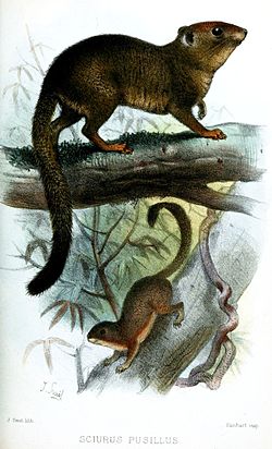
The ecoregion is mainly covered by lowland or submontane rainforest, including marsh forest along the rivers. There are an estimated 8,000 vascular plant species, of which half may be endemic. The plant species in the forests change from east to west, with species dominant in one area completely missing from another. There are also patches of savanna, and the coastal lowlands have patches of herbaceous swamp. The flora is diverse. The upper tiers of the forest may reach a height of 40 metres (130 ft). The trees are mainly evergreen, but may shed leaves in the dry season. The trees hold many epiphytes and parasites, and shrubs and herbaceous plants cover the forest floor. [3]

The main plant families are Bignoniaceae, Bombacaceae, Euphorbiaceae, Moraceae, Sterculiaceae, Lauraceae, Vochysiaceae, Sapotaceae, Lecythidaceae, Fabaceae, Combretaceae, Anacardiaceae, Rubiaceae, Meliaceae, Sapindaceae, Annonaceae and Arecaceae. Common species include Calophyllum brasiliense , Carapa guianensis , Ceiba pentandra , Couroupita guianensis , Eschweilera species, Guarea trichiloides , Luehea species, Parkia pendula , Pentaclethra macroloba , Protium species, Schwartzia species and Trichilia species. Cedrela fissilis , Coumourana punctata , Coumourana punctata and Warszewiczia coccinea are common in some areas but are not found in Suriname. [3]

There are centers of plant diversity in the south and in the Saül region of central French Guiana. The Saul region is a dry belt of semi-open forest and patches of savanna that are more characteristic of the Guayana Lowland province. This region has more than 150 endemic vascular plants, with plants adapted to moderate temperatures in the higher areas and along watercourses. There are many palm species including Astrocaryum mumbaca , Astrocaryum munbaca , Maximiliana maripa , Iriartea excrrhiza and Bactris sphaerocarpa , which is not found in Suriname. [3]

The forests contain patches of savanna, particularly in Suriname, which may be remnants of the savanna that covered all of Suriname in the Pleistocene epoch apart from the river valleys and the high-altitude refugia of rainforest. In the early Holocene epoch the climate changed to favor the present rainforest, and remnants of savanna now cover just 1% of Suriname. There are more than 800 species of savanna plants. [3]

The Neotropical pygmy squirrel (Sciurillus pusillus) is endemic. SciurusPusillusSmit.jpg
The Neotropical pygmy squirrel (Sciurillus pusillus) is endemic.

Fauna

More than 220 species of mammals have been identified in Guyana alone, of which more than 100 are bats. Endemic species include rufous mouse opossum (Marmosa lepida), six-banded armadillo (Euphractus sexcinctus), red-handed tamarin (Saguinus midas), white-faced saki (Pithecia pithecia), red-faced spider monkey (Ateles paniscus), Neotropical pygmy squirrel (Sciurillus pusillus), delicate pygmy rice rat (Oligoryzomys delicatus), Guiana bristly mouse ( Neacomys guianae ), Bahia porcupine (Coendou insidiosus), white-faced spiny tree-rat (Echimys chrysurus), Schultz's round-eared bat (Lophostoma schulzi), and rufous dog-faced bat (Molossops neglectus). [3] Endangered mammals include the black bearded saki (Chiropotes satanas) and giant otter (Pteronura brasiliensis). [6]

There are many birds species, often the same as in the Guyana Highlands and northern Andes, such as Guianan cock-of-the-rock (Rupicola rupicola), or the Amazon lowlands, such as hoatzin (Opisthocomus hoazin). Raptors include harpy eagle (Harpia harpyja) and crested eagle (Morphnus guianensis). [3] Endangered birds include the sun parakeet (Aratinga solstitialis) and yellow-bellied seedeater (Sporophila nigricollis). [6]

Reptiles include the threatened black caiman (Melanosuchus niger) and yellow-spotted river turtle (Podocnemis unifilis). There are diverse amphibians in the families Hylidae, Dendrobatidae and Leptodactylidae. [3]

Status

The World Wildlife Fund classes the ecoregion as "Relatively Stable/Intact". [3] As of 1996 relatively little deforestation had occurred, and conservation efforts were being made, but apart from Suriname there were few conservation areas and rising human pressure on the environment. Guyana is a major exporter of wild birds. The main threats come from illegal gold mining and logging along the unpoliced borders between the Guyanas and Venezuela and Brazil. A mounting drive to promote tourism might motivate the people to preserve the environment as a source of revenue. [3]

IUCN protected area category II (National Park) conservation units include the Kaieteur National Park in Guyana and the Brownsberg Nature Park in Suriname. [3] Other protected areas include the Imataca Forest Reserve, Iwokrama Forest Reserve and Raleigh Falls - Voltzberg Nature Reserve. [1]

Notes

    1. 1 2 3 Guianan moist forests – Myers, WWF Abstract.
    2. WildFinder – WWF.
    3. 1 2 3 4 5 6 7 8 9 10 11 12 13 Schipper, Teunissen & Lim.
    4. Guianan Moist Forests – WWF Global.
    5. 1 2 Guianan moist forests – Myers, Climate Data.
    6. 1 2 Guianan moist forests – Myers, All Endangered.

    Sources

    Related Research Articles

    The Global 200 is the list of ecoregions identified by WWF, the global conservation organization, as priorities for conservation. According to WWF, an ecoregion is defined as a "relatively large unit of land or water containing a characteristic set of natural communities that share a large majority of their species dynamics, and environmental conditions". So, for example, based on their levels of endemism, Madagascar gets multiple listings, ancient Lake Baikal gets one, and the North American Great Lakes get none.

    Orinoco Delta Delta region of the Orinoco River

    The Orinoco Delta is a vast river delta of the Orinoco River, located in eastern Venezuela.

    Amazon biome Ecological region of South America

    The Amazon biome contains the Amazon rainforest, an area of tropical rainforest, and other ecoregions that cover most of the Amazon basin and some adjacent areas to the north and east. The biome contains blackwater and whitewater flooded forest, lowland and montane terra firme forest, bamboo and palm forest, savanna, sandy heath and alpine tundra. Some areas are threatened by deforestation for timber and to make way for pasture or soybean plantations.

    Guianan savanna

    The Guianan savanna (NT0707) is an ecoregion in the south of Venezuela, Guyana and Suriname and the north of Brazil. It is in the Amazon biome. The savanna covers an area of rolling upland plains on the Guiana Shield between the Amazon and Orinoco basins. It includes forested areas, but these are shrinking steadily due to the effect of frequent fires, either accidental or deliberate. The ecoregion includes the Gran Sabana region of Venezuela.

    Negro–Branco moist forests Tropical broadleaf forest covering portions of Venezuela, Colombia, and Brazil

    The Negro–Branco moist forests (NT0143) is an ecoregion of tropical moist broadleaf forest to the east of the Andes in southern Venezuela, eastern Colombia and northern Brazil, in the Amazon biome. It lies on the watershed between the Orinoco and Rio Negro basins. It includes both blackwater and whitewater rivers, creating different types of seasonally flooded forest. The vegetation is more typical of the Guiana region than the Amazon.

    Marajó várzea

    The Marajó várzea (NT0138) is an ecoregion of seasonally and tidally flooded várzea forest in the Amazon biome. It covers a region of sedimentary islands and floodplains at the mouth of the Amazon that is flooded twice daily as the ocean tides push the river waters onto the land. The flooded forests provide food for a wide variety of fruit-eating fish, aquatic mammals, birds and other fauna. It has no protected areas and is threatened by cattle and water-buffalo ranching, logging and fruit plantations.

    Solimões–Japurá moist forests

    The Solimões-Japurá moist forests (NT0163) is an ecoregion in northwest Brazil and eastern Peru and Colombia in the Amazon biome. It has a hot climate with high rainforest throughout the year, and holds one of the most diverse collections of fauna and flora in the world. The ecoregion is relatively intact.

    Juruá–Purus moist forests

    The Juruá–Purus moist forests (NT0133) is an ecoregion in northwest Brazil in the Amazon biome. The terrain is very flat and soils are poor. The rivers flood annually. There are no roads in the region, and the dense rainforest is relatively intact, although plans to extend the Trans-Amazonian Highway through the region would presumably cause widespread damage to the habitat.

    Uatuma–Trombetas moist forests

    The Uatuma–Trombetas moist forests (NT0173) is an ecoregion in northwest Brazil in the Amazon biome. It covers the Amazon basin north of the Amazon River from close to the Atlantic Ocean to the Rio Negro west of Manaus. The ecoregion is relatively intact, although it has been damaged along the main rivers and around population centers.

    Guianan Highlands moist forests

    The Guayanan Highlands moist forests (NT0124) is an ecoregion in the south of Venezuela and the north of Brazil and in Guyana, Suriname, French Guiana. It is in the Amazon biome. It encompasses an upland region with diverse fauna and flora, which contains dramatic tepuis, or sandstone table mountains. The region has been inaccessible in the past and is generally fairly intact, apart from the north and northeast where large scale agriculture, ranching and mining operations are steadily encroaching on the ecosystem. New roads are opening the interior to logging, and planned dams will have a drastic impact on the riparian zones.

    The Alto Orinoco-Casiquiare Biosphere Reserve is a UNESCO biosphere reserve in the Venezuelan Amazon biome.

    Guianan piedmont and lowland moist forests

    The Guianan piedmont and lowland moist forests (NT0182) is an ecoregion in the south of Venezuela and the north of Brazil. It is in the Amazon biome. The ecoregion is relatively intact, largely protected by conservation units or indigenous territories, and less threatened by global warming than flatter and more deforested regions.

    Amazon–Orinoco–Southern Caribbean mangroves

    The Amazon–Orinoco–Southern Caribbean mangroves (NT1401) is an ecoregion along the coasts of Colombia, Venezuela, Guyana, Suriname, French Guiana and Brazil.

    Guianan mangroves Coastal ecoregion of southeastern Venezuela, Guyana, Suriname and French Guiana

    The Guianan mangroves (NT1411) is a coastal ecoregion of southeastern Venezuela, Guyana, Suriname and French Guiana. The mangroves provide an important habitat for migrating birds that winter in the area. Large areas are intact, although they are threatened by destruction of the trees for timber and to make way for agriculture, and from upstream agricultural and industrial pollution.

    Orinoco Delta swamp forests Wetland region of Venezuela and Guyana

    The Orinoco Delta swamp forests (NT0147) is an ecoregion of eastern Venezuela and northern Guyana covering the large and shifting Orinoco Delta. The vegetation is mostly permanently flooded rainforest. The ecoregion is relatively intact apart from a large area that was damaged by a failed flood control program in the 1960s. It is inaccessible, so logging is difficult, and the soil is unsuitable for farming. The main threat comes from oil exploration, which would bring an influx of settlers into the delta.

    Orinoco wetlands

    The Orinoco wetlands (NT0906) is an ecoregion of northeast Venezuela within the northern Orinoco Delta. It holds areas of tall grasses in flooded land, surrounded by mangroves and swamp forest, giving way to the drier Llanos savanna in the west.

    Catatumbo moist forests

    The Catatumbo moist forests (NT0108) is an ecoregion in Venezuela and Colombia to the west and east of Lake Maracaibo. It includes four regions of moist forest on slightly higher ground than the dry forest and mangroves that surround the lake. The forest has unique flora related to the flora of the Amazon basin. It is badly degraded due to farming, livestock grazing and oil exploration.

    Paramaribo swamp forests

    The Paramaribo swamp forests (NT0149) is an ecoregion in the coastal plain of Suriname covering a strip of land that is almost always flooded by fresh waters. It transitions into saline mangrove swamps towards the coast, and into submontane forests towards the interior.