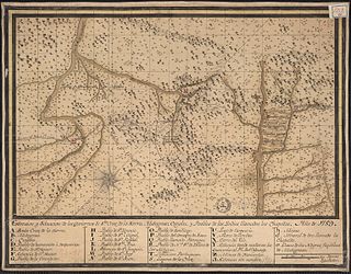
Chiquitano dry forests | |
---|---|
Ecology | |
Realm | Neotropical |
Biome | tropical and subtropical dry broadleaf forests – Amazon |
Borders | |
Geography | |
Area | 229,766 km2 (88,713 sq mi) |
Countries | Brazil and Bolivia |
Coordinates | 15°S62°W / 15°S 62°W Coordinates: 15°S62°W / 15°S 62°W |
Conservation | |
Protected | 55,861 km² (24%) [1] |
The Chiquitano dry forests is a tropical dry broadleaf forest ecoregion in Bolivia and Brazil. The ecoregion is named for the Chiquitano people who live in the region. [2]
The Chiquitano dry forests cover an area of 230,600 square kilometers (89,000 sq mi). The ecoregion lies east of the Andes in the lowlands of eastern Bolivia and the Brazilian states of Mato Grosso and Rondônia.
The World Wildlife Fund includes the Chiquitano dry forests in the Amazon biome. [3] The ecoregion adjoins the Dry Chaco ecoregion to the south and the Pantanal ecoregion to the southeast. To the northeast it blends into the Cerrado ecoregion. To the northwest it adjoins the Madeira-Tapajós moist forests and Southwest Amazon moist forests ecoregions. [4]
The climate of the Chiquitano dry forests is tropical, with a strong dry season during the southern hemisphere winter. Average precipitation ranges between 1,000mm in the south and 2,000mm in the northwest, varying with orography.
There are several common plant communities, or associations, which vary in structure and characteristic species. The forests of the region are adapted to the strong seasonal variation in rainfall, including wet-season flooding and dry-season fires. [2] Many trees are deciduous, losing their leaves during the winter dry season, Deciduousness is more common in the semi-arid south. [5]
The soto/curupaú association includes the trees soto ( Schinopsis brasiliensis ), curupaú ( Anadenanthera macrocarpa ), momoqui ( Caesalpinia pluviosa ), morado ( Machaerium scleroxylon ), roble ( Amburana cearensis ), and cedro ( Cedrela fissilis ). This association is found on well-drained soils. Trees form a canopy averaging 20 meters in height with emergent trees up to 30 meters. The canopy is 80% closed, and there is an understory of shrubs and herbs. [2] Emergent soto trees are some of the largest in the forest, reaching up to 35 meters in height and living up to 500 years. [6]
In the cuchi/curupaú association, either curupaú ( Anadenanthera macrocarpa ) or cuchi ( Astronium urundeuva ) predominates. It grows on well-drained but nutrient-poor soils, including rocky mountain slopes and sandy lowland soils. The canopy varies from 10 to 15 meters in height and is 65% closed, with emergent trees up to 25 meters high. [2]
The cuta/ajo-ajo association is predominantly cuta ( Phyllostylon rhamnoides ) and ajo-ajo ( Gallesia integrifolia ). This association is found on seasonally-flooded soils near streams.
The tajibo/tusequi association is of Tajibo ( Tabebuia heptaphylla ) and tusequi ( Machaerium hirtum ). It forms patches of forest on low rises (half a meter to a meter) surrounded by open savanna. [2]
The ecoregion also has areas of grassy savanna similar to the Cerrado savannas further east.
The ecoregion has 42 species of mammals, including marsh deer (Blastocerus dichotomus), white-lipped peccary (Tayassu pecari), giant armadillo (Priodontes maximus), jaguar (Panthera onca), maned wolf (Chrysocyon brachyurus), giant otter (Pteronura brasiliensis), and the rodent Goodfellow's tuco-tuco (Ctenomys goodfellowi). [2]
Native birds include the black-and-tawny seedeater (Sporophila nigrorufa). Native reptiles include the broad-snouted caiman (Caiman latirostris). [2]
During the period from 2004 to 2011 the ecoregion experienced an annual rate of habitat loss of 0.62%. [7]
In response to indigenous demands for control over their home territories, the Bolivian government issued a decree in 1990 designating indigenous territories in the lowlands, and acknowledging the rights of indigenous peoples to collectively govern those territories. A 1993 agrarian reform law acknowledged indigenous communities' collective land ownership and formalized Native Community Lands (called Tierras Comunitarias de Origen , or TCOs) as the vehicle for ownership, and the 1995 constitutional reform further guaranteed the rights of indigenous peoples to Native Community Lands. Portions of the dry forests are within TCOs. A 1996 reform of Bolivia's forestry law required forest management plans and forest inventories, established harvest limits, and guaranteed the rights of indigenous communities to manage timber harvesting on forest lands within TCOs, and to engage in customary forms of forest product harvesting without central government approval. [8]
From August to November 2019, fires burned 1.4 million hectares of the dry forests, an estimated 12% of the Chiquitano forest area before the fires. Earlier in 2019 the Bolivian government issued a decree supporting clearance of forest lands in the Chiquitano and Amazon regions for cattle and soya production. Civil society organizations concluded the fires were mostly deliberately set by people seeking to clear land, and linked the increase in fires to the change in government policy. Those organizations and indigenous leaders petitioned the government to repeal the pro-clearance policies, better protect the forests, and uphold indigenous land rights. [9] [10]
A 2017 assessment found that 55,861 km², or 24%, of the ecoregion is in protected areas. [1] Protected areas include Noel Kempff Mercado National Park and Ríos Blanco y Negro Wildlife Reserve in Bolivia.
Wikimedia Commons has media related to Chiquitano dry forests . |
The Global 200 is the list of ecoregions identified by WWF, the global conservation organization, as priorities for conservation. According to WWF, an ecoregion is defined as a "relatively large unit of land or water containing a characteristic set of natural communities that share a large majority of their species dynamics, and environmental conditions". So, for example, based on their levels of endemism, Madagascar gets multiple listings, ancient Lake Baikal gets one, and the North American Great Lakes get none.
The Gran Chaco or Dry Chaco is a sparsely populated, hot and semiarid lowland natural region of the Río de la Plata basin, divided among eastern Bolivia, western Paraguay, northern Argentina, and a portion of the Brazilian states of Mato Grosso and Mato Grosso do Sul, where it is connected with the Pantanal region. This land is sometimes called the Chaco Plain.
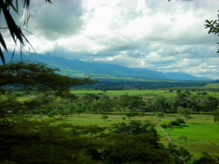
The Llanos is a vast tropical grassland plain situated to the east of the Andes in Colombia and Venezuela, in northwestern South America. It is an ecoregion of the tropical and subtropical grasslands, savannas, and shrublands biome.
The Sri Lanka dry-zone dry evergreen forests are a tropical dry broadleaf forest ecoregion of the island of Sri Lanka.
The Beni savanna, also known as the Llanos de Moxos or Moxos plains, is a tropical savanna ecoregion of the Beni Department of northern Bolivia.
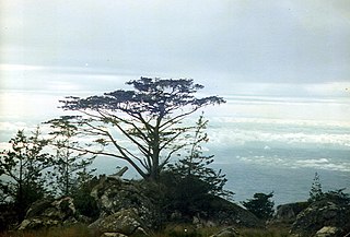
The South Malawi montane forest-grassland mosaic is an ecoregion of Malawi.
Kaa-Iya del Gran Chaco National Park and Integrated Management Natural Area is the biggest national park in Bolivia and one of the largest in South America. It is a protected area in the region of the Gran Chaco and has a larger surface area than Belgium. It is situated in the south of Santa Cruz Department on the border with Paraguay in the Cordillera Province and Chiquitos Province.
The Sri Lanka lowland rain forests represents Sri Lanka's Tropical rainforests below 1,000 m (3,281 ft) in elevation in the southwestern part of the island. The year-around warm, wet climate together with thousands years of isolation from mainland India have resulted in the evolution of numerous plants and animal species that can only be found in rain forests in Sri Lanka. The thick forest canopy is made up of over 150 species of trees, some of the emergent layer reaching as high as 45 m (148 ft). The lowland rain forests accounts for 2.14 percent of Sri Lanka's land area. This ecoregion is the home of the jungle shrew, a small endemic mammal of Sri Lanka. Sri Lanka has the highest density of amphibian species worldwide. Many of these, including 250 species of tree frogs, live in these rain forests.
The Arnhem Land tropical savanna is a tropical and subtropical grasslands, savannas, and shrublands ecoregion in Australia's Northern Territory.
The Kimberley tropical savanna is a tropical and subtropical grasslands, savannas, and shrublands ecoregion in northwestern Australia, covering portions of Western Australia and the Northern Territory south of the Timor Sea.
The Amazon biome contains the Amazon rainforest, an area of tropical rainforest, and other ecoregions that cover most of the Amazon basin and some adjacent areas to the north and east. The biome contains blackwater and whitewater flooded forest, lowland and montane terra firme forest, bamboo and palm forest, savanna, sandy heath and alpine tundra. Some areas are threatened by deforestation for timber and to make way for pasture or soybean plantations.
The Guianan savanna (NT0707) is an ecoregion in the south of Venezuela, Guyana and Suriname and the north of Brazil. It is in the Amazon biome. The savanna covers an area of rolling upland plains on the Guiana Shield between the Amazon and Orinoco basins. It includes forested areas, but these are shrinking steadily due to the effect of frequent fires, either accidental or deliberate. The ecoregion includes the Gran Sabana region of Venezuela.
The Negro–Branco moist forests (NT0143) is an ecoregion of tropical moist broadleaf forest to the east of the Andes in southern Venezuela, eastern Colombia and northern Brazil, in the Amazon biome. It lies on the watershed between the Orinoco and Rio Negro basins. It includes both blackwater and whitewater rivers, creating different types of seasonally flooded forest. The vegetation is more typical of the Guiana region than the Amazon.
The Madeira-Tapajós moist forests (NT0135) is an ecoregion in the Amazon basin. It is part of the Amazon biome. The ecoregion extends southwest from the Amazon River between its large Madeira and Tapajós tributaries, and crosses the border into Bolivia. In the south it transitions into the cerrado biome of Mato Grosso. In the state of Rondônia it contains some of the most degraded land of the Amazon basin.
The Mato Grosso tropical dry forests (NT0140), also called the Mato Grosso seasonal forests, is an ecoregion in central Brazil to the south of the Amazon region. It contains vegetation in the transition between the Amazon rainforest to the north and the cerrado savanna to the south. The opening of highways through the region has caused rapid population growth, deforestation and pollution.
The Uatuma–Trombetas moist forests (NT0173) is an ecoregion in northwest Brazil in the Amazon biome. It covers the Amazon basin north of the Amazon River from close to the Atlantic Ocean to the Rio Negro west of Manaus. The ecoregion is relatively intact, although it has been damaged along the main rivers and around population centers.
The Guianan piedmont and lowland moist forests (NT0182) is an ecoregion in the south of Venezuela and the north of Brazil. It is in the Amazon biome. The ecoregion is relatively intact, largely protected by conservation units or indigenous territories, and less threatened by global warming than flatter and more deforested regions.
The Northern New Guinea montane rain forests is a tropical moist forest ecoregion in northern New Guinea. The ecoregion covers several separate mountain ranges lying north of New Guinea's Central Range and south of the Pacific Ocean.
The Carolines tropical moist forests is a tropical and subtropical moist broadleaf forests ecoregion in Micronesia. It includes the central and eastern Caroline Islands in the Federated States of Micronesia.