Sundarbans is a mangrove area in the delta formed by the confluence of the Ganges, Brahmaputra and Meghna Rivers in the Bay of Bengal. Spread across parts of India and Bangladesh, this forest is the largest Mangrove forest in the world. It spans the area from the Baleswar River in Bangladesh's division of Khulna to the Hooghly River in India's state of West Bengal. It comprises closed and open mangrove forests, land used for agricultural purpose, mudflats and barren land, and is intersected by multiple tidal streams and channels. Sundarbans is home to the world's largest area of mangrove forests. Four protected areas in the Sundarbans are enlisted as UNESCO World Heritage Sites, viz. Sundarbans West (Bangladesh), Sundarbans South (Bangladesh), Sundarbans East (Bangladesh) and Sundarbans National Park (India).

The Nansei Islands subtropical evergreen forests is a terrestrial ecoregion of the Ryukyu Islands, also known as the Nansei Islands, in Japan. The Nansei Islands are an island arc that stretches southwest from Kyushu towards Taiwan. The larger islands are mostly volcanic islands and the smaller ones mostly coral. The largest is Okinawa Island. The highest point is Mount Miyanoura on Yakushima Island at 1,936 metres.

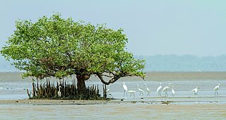
Coringa Wildlife Sanctuary is an estuary situated near Kakinada in Andhra Pradesh, India. It is the third largest stretch of mangrove forests in India with 24 mangrove tree species and more than 120 bird species. It is home to the critically endangered white-backed vulture and the long billed vulture. Mangroves are a group of trees and shrubs that live in the coastal intertidal zone, with a dense tangle of prop roots that make the trees appear to be standing on stilts above the water. This tangle of roots allows the trees to handle the daily rise and fall of tides; hence, the mangrove forest gets flooded at least twice per day. The roots also slow the movement of tidal waters, causing sediments to settle out of the water and build up the muddy bottom.

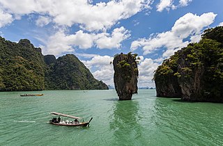
Ao Phang Nga National Park, located in the Phang Nga Province of the Southern Thailand, encompasses parts of Mueang Phang Nga District and Takua Thung District. The park is predominantly maritime, featuring a section of the Strait of Malacca dotted with numerous limestone tower karst islands. Among these islands, Khao Phing Kan stands out as particularly well-known, having gained the nickname 'James Bond Island' due to its use as a filming location for the James Bond film The Man with the Golden Gun.

The New Guinea mangroves is a mangrove ecoregion that covers extensive areas of the coastline New Guinea, the large island in the western Pacific Ocean north of Australia.

The Borneo lowland rain forests is an ecoregion, within the tropical and subtropical moist broadleaf forests biome, of the large island of Borneo in Southeast Asia. It supports approximately 15,000 plant species, 380 bird species and several mammal species. The Borneo lowland rain forests is diminishing due to logging, hunting and conversion to commercial land use.

The Central African mangroves ecoregion consists of the largest area of mangrove swamp in Africa, located on the coasts of West Africa, mainly in Nigeria.

Madagascar mangroves are a coastal ecoregion in the mangrove forest biome found on the west coast of Madagascar. They are included in the WWF's Global 200 list of most outstanding ecoregions.

The Southern Africa mangroves are mangrove ecoregion on the Mozambique's southernmost coast and the eastern coast of South Africa.

Teluk Cenderawasih National Park is the largest marine national park of Indonesia, located in Cenderawasih Bay, south-east of Bird's Head Peninsula. It includes the islands of Mioswaar, Nusrowi Island, Roon, Rumberpon, Anggrameos and Yoop. The park protects a rich marine ecosystem, with over 150 recorded coral species, for which it is considered a potential World Heritage Site.

The Borneo montane rain forests is an ecoregion on the island of Borneo in Southeast Asia. It includes montane tropical and subtropical moist broadleaf forests, also known as a cloud forests. The ecoregion is partly in East Malaysia and Indonesia (Kalimantan).

The Ord River floodplain is the floodplain of the lower Ord River in the Shire of Wyndham-East Kimberley, in the Kimberley region of northern Western Australia. It lies within the Victoria Bonaparte IBRA bioregion and contains river, seasonal creek, tidal mudflat and floodplain wetlands, with extensive stands of mangroves, that support saltwater crocodiles and many waterbirds. It is recognised as an internationally important wetland area, with 1,384 square kilometres (534 sq mi) of it designated on 7 June 1990 as Ramsar Site 477 under the Ramsar Convention on Wetlands.

The Ngezi Forest Reserve is a forest reserve located in the Micheweni District of the North Pemba Region on Pemba Island, Tanzania. It covers an area of 1,440 hectares, mostly comprising primary forest. The reserve was established in 1959.

Muara Angke mangrove forest and wildlife sanctuary is a protected nature conservation area at Kapuk Muara, Penjaringan along the north coast of Jakarta, Indonesia. Muara Angke Wildlife Sanctuary is located at the end of Muara Karang Raya street, near Mediterranean Gallery shopping complex.

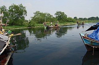
The Abatan River is a river in western Bohol, Philippines. The river winds through the towns of Catigbian, Antequera, Balilihan, and Maribojoc to its mouth at Cortes.

The Sulu Archipelago rain forests ecoregion covers the Sulu Archipelago, excepting Basilan Island at the northern end, in the southwest of the Philippines. The islands are separated enough from Borneo to the south and Mindanao to the north that they have developed their own distinctive floral and faunal communities. Most of the original rainforest has been removed or disturbed for agriculture, and political instability in the islands has hampered conservation efforts.

The Southern Dry Pacific Coast mangroves ecoregion covers a series of mangrove forests along the Pacific Ocean coast of Nicaragua and Costa Rica, from the southern margin of the Gulf of Fonseca to the Gulf of Nicoya near the border with Panama. Because the area is drier than the mangroves further south, evapotranspiration leaves some areas with higher salinity and even salt pans in the internal areas.

The Red Sea mangroves ecoregion is defined by One Earth to span mangrove forests along the coast of the Red Sea. The ecoregion has no source of fresh water and the temperatures get high in the summer which causes the salinity of the mangrove forest to be high. The soils of the ecoregion are carbonates, which are poor in iron. The unusual soil stunts the growth of the mangroves, limiting their height to approximately 2 m (7 ft).


