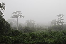
 Western Guinean lowland forests, a humid forest
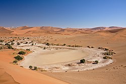 The Namib, a warm desert
 Ethiopian Highlands montane forest
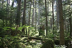
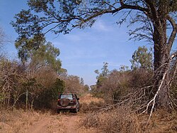
 Wilderness National Park, an evergreen sclerophyllous woodland

This page features a list of biogeographic provinces that were developed by Miklos Udvardy in 1975, [1] [2] later modified by other authors.[ according to whom? ] Biogeographic Province is a biotic subdivision of biogeographic realms subdivided into ecoregions, which are classified based on their biomes or habitat types and, on this page, correspond to the floristic kingdoms of botany.
Contents
- Afrotropical Realm
- Antarctic Realm
- Australasian Realm
- Indomalayan Realm
- Nearctic Realm
- Neotropical Realm
- Oceanian Realm
- Palearctic Realm
- Region coding
- See also
- References
- Bibliography
The provinces represent the large areas of Earth's surface within which organisms have been evolving in relative isolation over long periods of time, separated from one another by geographic features, such as oceans, broad deserts, or high mountain ranges, that constitute barriers to migration.
Biomes are characterized by similar climax vegetation, though each realm may include a number of different biomes. A tropical moist broadleaf forest in Brazil, for example, may be similar to one in New Guinea in its vegetation type and structure, climate, soils, etc., but these forests are inhabited by plants with very different evolutionary histories.