Western Guinean lowland forests

Last updated
Western Guinean lowland forests
Tai National Park (24148248710).jpg
Taï National Park, Ivory Coast
AT0130 map.png
Map of the Western Guinean lowland forests
Ecology
Realm Afrotropical
Biome tropical and subtropical moist broadleaf forests
Borders
Geography
Area203,842 km2 (78,704 sq mi)
Countries
Coordinates 6°54′N6°33′W / 6.9°N 6.55°W / 6.9; -6.55
Conservation
Conservation status Vulnerable
Global 200 yes
Protected24,028 km2% [1]

The Western Guinean lowland forests ecoregion (WWF #AT0130) is a tropical moist broadleaf forest ecoregion of West Africa. It is centered on Liberia, with portions in surrounding countries. It is the westernmost tropical rainforest in Africa, and has high levels of species endemism, with over 200 species of endemic plants. [2] [3] [4] [5]

Contents

Geography

The ecoregion includes the lowland forests extending from the Atlantic Ocean a few hundred kilometres inland, and from western Côte d'Ivoire across Liberia, southeastern Guinea, most of Sierra Leone, and into southwest Guinea.

The terrain is relatively flat, with a mean elevation of 2,225 meters and a few isolated mountains that reach a high point of 1,290 metres (4,230 ft). [4] Major rivers include the Sewa River, Mano River, Saint Paul River, Cavalla River and Sassandra River. The soils are poor, heavily leached lateritic. [2]

The Sassandra River of Côte d'Ivoire separates the Western Guinean forests from the Eastern Guinean forests which lie to the east. Inland and to the west, the Western Guinean forests transition to the Guinean forest-savanna mosaic, and to the Guinean montane forests at higher elevations.

The Western Guinean forests, together with the other tropical moist forests of West Africa, is included within Conservation International's Guinean Forests of West Africa biodiversity hotspot.

Climate

The climate of the ecoregion is Tropical savanna climate - dry winter (Köppen climate classification (Aw)). Temperatures can average from 30 to 33 degrees (C) in the hot months, 12 to 12 (C) in the colder months. The rainy season is May to October, with precipitation reaching 3,300 mm/year or more in the higher regions. [6] [7]

Flora and fauna

Closed forest covers two thirds of the ecoregion, mostly broadleaf evergreen trees, but much of this is second-growth or otherwise disturbed by human activities. Another 22% of the terrain is open forest or shrub. [4] The term ‘farmbush’ has been applied to the degraded secondary growth that follows slash-and-burn agriculture. [2] Common trees include Dacroydes klaineana, Strombosia glaucescens, Allanblackia floribunda, Coula edulis and Diospyros sanza-minika. [2] Semi-deciduous forests occur at lower altitudes into Guinea. [2]

Because the wet areas expanded and contracted during the Ice Age, 'islands' of specialized species developed. Some of these areas of diversified floral and faunal communities are in protected areas.

Protected areas

A 2017 assessment found that 24,028 km2, or 12%, of the ecoregion is in protected areas. Only 2% of the unprotected area is covered by relatively-intact forest. [8] Protected areas include:

See also

Related Research Articles

<span class="mw-page-title-main">Geography of Ivory Coast</span>

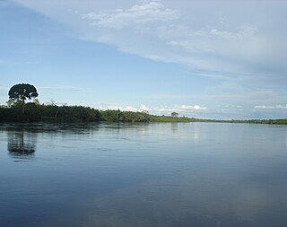
Ivory Coast is a sub-Saharan nation in southern West Africa located at 8° N, 5° W. The country is approximately square in shape.

<span class="mw-page-title-main">Eastern Guinean forests</span> Tropical moist broadleaf forest ecoregion

The Eastern Guinean forests are a tropical moist broadleaf forest ecoregion of West Africa.

<span class="mw-page-title-main">Cross–Sanaga–Bioko coastal forests</span> Tropical forest ecoregion of west-central Africa

The Cross–Sanaga–Bioko coastal forests are a tropical moist broadleaf forest ecoregion of west-central Africa. This is a lush forest, rich in flora and birdlife.

<span class="mw-page-title-main">Upper Guinean forests</span> Tropical moist forest region of West Africa

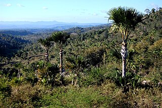
The Upper Guinean forests is a tropical seasonal forest region of West Africa. The Upper Guinean forests extend from Guinea and Sierra Leone in the west through Liberia, Côte d'Ivoire and Ghana to Togo in the east, and a few hundred kilometers inland from the Atlantic coast. A few enclaves of montane forest lie further inland in the mountains of central Guinea and central Togo and Benin.

<span class="mw-page-title-main">Western Congolian swamp forests</span>

The Western Congolian swamp forests are an ecoregion of the Republic of the Congo, Democratic Republic of the Congo and adjoining Central African Republic. Together with the adjacent Eastern Congolian swamp forests, it forms one of the largest continuous areas of freshwater swamp forest in the world. It is a flooded forest with a high canopy, dense undergrowth and has a muddy floor. It has not been disturbed very much by outside influences and so remains largely pristine as getting through this forest is called "almost impossible".

<span class="mw-page-title-main">Northern New Guinea lowland rain and freshwater swamp forests</span> Ecoregion in New Guinea

The Northern New Guinea lowland rain and freshwater swamp forests is a tropical moist broadleaf forest ecoregion of northern New Guinea.

<span class="mw-page-title-main">Atlantic Equatorial coastal forests</span>

The Atlantic Equatorial coastal forests, also known as the Congolian coastal forests, are a tropical moist broadleaf forest ecoregion of Central Africa, covering hills, plains, and mountains of the Atlantic coast of Cameroon, Equatorial Guinea, Gabon, Republic of the Congo, Angola, and Democratic Republic of the Congo.

<span class="mw-page-title-main">Timor and Wetar deciduous forests</span> Ecoregion in Indonesia and East Timor

The Timor and Wetar deciduous forests is a tropical dry forest ecoregion in Indonesia and East Timor. The ecoregion includes the islands of Timor, Wetar, Rote, Savu, and adjacent smaller islands.

<span class="mw-page-title-main">Tenasserim–South Thailand semi-evergreen rain forests</span> Ecoregion on Mainland Southeast Asia

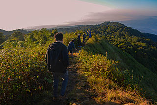
The Tenasserim–South Thailand semi-evergreen rain forests is a tropical moist broadleaf forest ecoregion on Mainland Southeast Asia. The ecoregion extends north–south along the Kra Isthmus. It includes lowland forests along the coasts, and montane forests on the Tenasserim Hills and Bilauktaung range, which form the mountainous spine of the isthmus.

<span class="mw-page-title-main">Guinean montane forests</span>

The Guinean montane forests are a tropical moist broadleaf forest ecoregion of West Africa.

<span class="mw-page-title-main">Belizean pine forests</span>

The Belizean pine forests is an ecoregion that represents an example of lowland and premontane pine forests in the Neotropical realm, where the dominant tree species is Caribbean pine. The vegetation here is generally adapted to the xeric, acidic and nutrient-poor conditions along the Belizean near coastal zone of the Caribbean versant.

<span class="mw-page-title-main">Southern Congolian forest–savanna mosaic</span>

The southern Congolian forest–savanna mosaic is an ecoregion that covers a large area of the southern Democratic Republic of the Congo and northeastern Angola. Its rich blend of habitats provides key insights into the biogeography of central Africa with the extensive climatic variation that it has been experiencing for the last 10 million years. The human population is not high.

<span class="mw-page-title-main">Northeastern Congolian lowland forests</span>

The Northeastern Congolian lowland forests is a tropical moist broadleaf forest ecoregion that spans the Democratic Republic of the Congo and the Central African Republic.

<span class="mw-page-title-main">Northwestern Congolian lowland forests</span> Tropical forest ecoregion in Central Africa

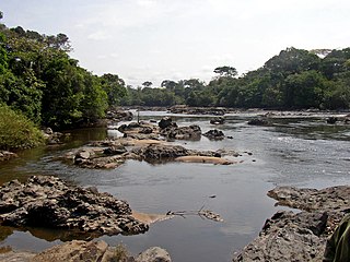
The Northwestern Congolian lowland forests is a tropical moist broadleaf forest ecoregion that spans Cameroon, Gabon, the Republic of Congo, the Central African Republic and a minuscule part of the Democratic Republic of the Congo. It forms part of the larger Congolian rainforests region in Central Africa. The region is noteworthy for very high levels of species richness and endemism. It is home to a core population of the critically endangered Western lowland gorilla. There are also large populations of forest elephants.

<span class="mw-page-title-main">Irrawaddy moist deciduous forests</span> Ecoregion in Myanmar

The Irrawaddy moist deciduous forests is a tropical moist broadleaf forest ecoregion in central Myanmar. The ecoregion occupies the central basin of the Irrawaddy River and the lower basin of the Salween River. The ecoregion is characterized by forests of tall trees which drop their leaves in the dry season. Most of the ecoregion's forests have been converted to agriculture.

<span class="mw-page-title-main">Kayah–Karen montane rain forests</span> Ecoregion on Mainland Southeast Asia

The Kayah–Karen montane rain forests is a tropical moist broadleaf forest ecoregion on Mainland Southeast Asia. The montane rain forests cover several connected mountain ranges, including the Daen Lao Range, the Dawna Range, the Karen Hills, the Khun Tan Range, and the Thanon Thong Chai Range.

<span class="mw-page-title-main">Chao Phraya lowland moist deciduous forests</span> Ecoregion in Central Thailand

The Chao Phraya lowland moist deciduous forests is a tropical moist broadleaf forest ecoregion in Thailand. The ecoregion occupies the coastal lowlands along the Gulf of Thailand lying east and west of the Chao Phraya River.

<span class="mw-page-title-main">Northern New Guinea montane rain forests</span> Ecoregion in New Guinea

The Northern New Guinea montane rain forests is a tropical moist forest ecoregion in northern New Guinea. The ecoregion covers several separate mountain ranges lying north of New Guinea's Central Range and south of the Pacific Ocean.

<span class="mw-page-title-main">Southern New Guinea lowland rain forests</span> Ecoregion in New Guinea

The Southern New Guinea lowland rain forests is a tropical moist forest ecoregion in southeastern New Guinea. The ecoregion covers portions of New Guinea's southern lowlands.

<span class="mw-page-title-main">Southern New Guinea freshwater swamp forests</span> Ecoregion in New Guinea

The Southern New Guinea freshwater swamp forests is a tropical moist forest ecoregion in southern New Guinea. The ecoregion includes the extensive swamp forests of southern and western New Guinea.

References

  1. Eric Dinerstein, David Olson, et al. (2017). An Ecoregion-Based Approach to Protecting Half the Terrestrial Realm, BioScience, Volume 67, Issue 6, June 2017, Pages 534–545; Supplemental material 2 table S1b.
  2. 1 2 3 4 5 "Western Guinean lowland forests". World Wildlife Federation. Retrieved June 20, 2020.
  3. "Map of Ecoregions 2017". Resolve. Retrieved August 20, 2021.
  4. 1 2 3 "Western Guinean lowland forests". Digital Observatory for Protected Areas. Retrieved August 20, 2021.
  5. "Western Guinean lowland forests". The Encyclopedia of Earth. Retrieved August 20, 2021.
  6. Kottek, M.; Grieser, J.; Beck, C.; Rudolf, B.; Rubel, F. (2006). "World Map of Koppen-Geiger Climate Classification Updated" (PDF). Gebrüder Borntraeger 2006. Retrieved September 14, 2019.
  7. "Dataset - Koppen climate classifications". World Bank. Retrieved September 14, 2019.
  8. Eric Dinerstein, David Olson, et al. (2017). An Ecoregion-Based Approach to Protecting Half the Terrestrial Realm, BioScience, Volume 67, Issue 6, June 2017, Pages 534–545; Supplemental material 2 table S1b.