Al Lith

Last updated • 1 min readFrom Wikipedia, The Free Encyclopedia
Al Lith
Arabic: ٱللِّيْث, romanized: Al-Līth
Nickname: 
The Pearl of the Red Sea
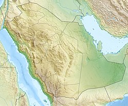
Saudi Arabia relief location map.jpg
Red pog.svg
Al Lith
Location in Saudi Arabia
Middle East location map.svg
Red pog.svg
Al Lith
Al Lith (Middle East)
West Asia non political with water system.jpg
Red pog.svg
Al Lith
Al Lith (West and Central Asia)
Coordinates: 20°9′0″N40°16′0″E / 20.15000°N 40.26667°E / 20.15000; 40.26667
Country Flag of Saudi Arabia.svg  Saudi Arabia
Province Makkah (Mecca)
Governorate Al-Lith [1] [2]
Joined Saudi Arabia 1925;100 years ago (1925)
Government
  City GovernorMohammad Al Qabbaa [1]
Population
 (2022)
   City
20,811
   Metro
73,753 (Al Lith Governorate)
Time zone UTC+3 (EAT)
  Summer (DST) UTC+3 (EAT)
Postal Code
(5 digits)
Area code +966-12

Al Lith (Arabic : ٱللِّيْث, romanized: Al-Līth) is a city in the region of the Tihamah on the coast of the Red Sea, southwest of the Islamic holy city of Mecca, and south of the Miqat of Yalamlam. [3] [4] It is the fifth largest city in population in Mecca Province, and it is one of the large sea ports of the Kingdom of Saudi Arabia on the Red Sea. The population of Al Lith is over 20,800 people (2022 census). [1] [2]

Contents

Geography and climate

It is located 90 kilometres (56 mi) south of the Miqat of Yalamlam, [3] [4] 180 kilometres (110 miles) to the southwest of Mecca, and 190 km (120 miles) south of Jeddah. Its northern villages are just 90 km (56 miles) away from Mecca. It extends to Hejaz mountains, and the cities of Adham and Taif to the east, and as far south as the city of Al Qunfudhah. The international coastal road Jeddah - Jizan passes by it. Al Lith has a hot desert climate (Köppen climate classification BWh).

Climate data for Al Lith
MonthJanFebMarAprMayJunJulAugSepOctNovDecYear
Mean daily maximum °C (°F)30.7
(87.3)
31.6
(88.9)
34.2
(93.6)
35.0
(95.0)
39.3
(102.7)
41.3
(106.3)
41.9
(107.4)
41.2
(106.2)
39.8
(103.6)
37.1
(98.8)
34.0
(93.2)
32.1
(89.8)
36.5
(97.7)
Mean daily minimum °C (°F)20.0
(68.0)
20.3
(68.5)
22.3
(72.1)
24.2
(75.6)
27.0
(80.6)
28.6
(83.5)
30.2
(86.4)
30.3
(86.5)
28.3
(82.9)
25.5
(77.9)
23.3
(73.9)
20.9
(69.6)
25.1
(77.1)
Average precipitation mm (inches)20
(0.8)
6
(0.2)
7
(0.3)
11
(0.4)
8
(0.3)
2
(0.1)
2
(0.1)
4
(0.2)
3
(0.1)
8
(0.3)
20
(0.8)
21
(0.8)
111
(4.4)
Source: Climate-data.org

History

Al Lith got its name from the Valley of Leith, which is located at the east, near the village of Ghumayqah (Arabic : غُمَيْقَة). [5] Al Lith today is a commercial port that receives pilgrims and goods from all corners of the world. In the past, it used to be a large commercial port that receives ships from Jizan, Yemen and the coast of Africa, and exporting those goods after that to Mecca and Jeddah.

Infrastructure

The area of Al Lith boasts prominent underwater diving sites. [6]

See also

References

  1. 1 2 3 Al-Basrawi, Abdullah (21 April 2013). "Khalid bin Faisal Al Saud visits Al Lith". Al-Riyadh (in Arabic). Retrieved 21 April 2013.
  2. 1 2 "Places in Al-Līth (Mecca Region, Saudi Arabia) - Population Statistics, Charts, Map, Location, Weather and Web Information". City Populaton. Retrieved 2024-03-03.
  3. 1 2 "مِيقَاتُ يَلَمْلَم (دراسة تاريخية وتحقيق ميداني)". Mighatul-Hajj (in Arabic). Retrieved 2025-03-11.
  4. 1 2 Ibrahim H. Elsebaie; Atef Q. Kawara; Ali O. Alnahit (2013-03-15). "17: Delineation of Groundwater Recharge Potential Zones Using GIS: A Case Study for Yalamlam Watershed in Saudi Arabia". In Ahmed Sefelnasr; Mohsen Abrar; M. Abrar; Vijay P. Singh (eds.). Water Resources Management and Sustainability. Springer. pp. 305–316. doi:10.1007/978-3-031-80520-2. ISBN   978-3-031-80519-6.
  5. Hassan Faqih, 1413
  6. Eric Bjurstrom (May 1997). "Beneath the Waters of the Red Sea". The Middle East (267). Archived from the original on 19 February 2014. Retrieved 20 January 2014.{{cite journal}}: CS1 maint: year (link)