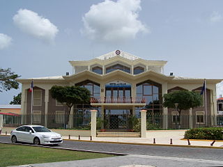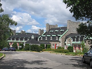
Baie-Mahault is a commune in the overseas department and region of Guadeloupe, France. It is the second most populated commune of Guadeloupe, after Les Abymes. The extensive industrial zone of Jarry in Baie-Mahault is by far the most industrialized commune in the islands and the largest industrial park in the Lesser Antilles. It is part of the urban area of Pointe-à-Pitre, the largest metropolitan area in Guadeloupe, located in the northwest.

Baie-Saint-Paul is a city in the Province of Quebec, Canada, on the northern shore of the Saint Lawrence River. Baie-Saint-Paul is the seat of Charlevoix Regional County Municipality. The city is situated at the mouth of the Gouffre River. It is known for its art galleries, shops and restaurants.

Baie-Comeau is a city in the Côte-Nord region of the province of Quebec, Canada. It is located on the shores of the St. Lawrence River, and is the seat of Manicouagan Regional County Municipality. It is near the mouth of the Manicouagan River, named after the adjacent Comeau Bay. It has a population of 20,687 in the 2021 Canadian census, and the census agglomeration population is 26,643.

La Baie is one of three boroughs in the city of Saguenay, Quebec, Canada. It was created during Quebec's municipal reorganization in 2002. From 1976 to 2001, it was known as the Town of La Baie, a municipality composed of the Grande-Baie, Bagotville and Port-Alfred sectors.

Le Crotoy is a commune in the Somme department in Hauts-de-France in northern France. The inhabitants are known as Crotellois.
Bay d'Espoir is an arm of Hermitage Bay in the Gulf of Saint Lawrence, located on the south coast of Newfoundland. Communities in Bay d'Espoir include: Milltown-Head of Bay d'Espoir, Morrisville, St. Alban's, St. Joseph's Cove, St. Veronica's and Miawpukek. The Miawpukek First Nation reserve of Samiajij Miawpukek is located in Bay d'Espoir.

Baie-Sainte-Catherine is a town in Quebec, Canada. The municipal's territory extends along the Saguenay and Saint Lawrence rivers, whereas the town itself is on the small St. Catherine Bay, which is located at the confluence of these two rivers. Its elevation is 260 feet.
Articles related to Madagascar include:

Saint-Valery-sur-Somme, commune in the Somme department, is a seaport and resort on the south bank of the River Somme estuary. The town's medieval character and ramparts, its Gothic church and long waterside boardwalk, make it a popular tourist destination.
Marolinta is a town and commune in Madagascar. It belongs to the district of Beloha, which is a part of Androy Region.

Baie de Baly National Park is a National Park in Madagascar.

Tsingy de Namoroka National Park, formerly known as Tsingy de Namoroka Strict Nature Reserve, is a national park located in the northwestern part of Madagascar in the Mahajanga Province, specifically, the Soalala District.

Caraquet Bay is situated in the northeast of the Canadian province of New Brunswick. It is bordered on the south by the town of Caraquet and the village of Bertrand, to the south by the parish of New Bandon, to the north by the village of Maisonnette and to the northwest by the Baie des Chaleurs. Caraquet Island is located between the two bays. There are a number of beaches on the bay, as well as oyster farms and the port of Caraquet. Caraquet Bay flows into the Caraquet River and the Du Nord River

Baie-Johan-Beetz is a municipality located near the mouth of the Piashti River on the north shore of the Gulf of St. Lawrence, in the Côte-Nord region, Minganie RCM, Quebec, Canada.
The Hatokaliotsy Site of Biological Interest is a site of biological interest in Madagascar located near Marolinta, the Menarandra River and the Bay of Langarano.

The Baie de Bouéni is a large bay in the south-west of the French island territory of Mayotte, in the Comoro Islands lying at the northern end of the Mozambique Channel between the East African country of Mozambique and Madagascar. It is about 5 kilometres (3.1 mi) wide at its mouth, and 10 kilometres (6.2 mi) in length. It was made a protected area in 2007.
The ZEC Trinity is a "zone d'exploitation contrôlée" (ZEC) in the municipality of the town of Baie-Trinité, in the Manicouagan Regional County Municipality (RCM), in the administrative region of Côte-Nord, in Quebec, in Canada.
Rupert Bay is a large bay located on the south-east shore of James Bay, in Canada. Although the coast is part of the province of Quebec, the waters of the bay are under jurisdiction of the territory of Nunavut.

Missisquoi Bay is a large extension in the northern part of Lake Champlain, at the East of the output of the latter in Richelieu River. It takes the form of a violin head, with the neck extending from the head of the lake and is about 5 kilometres (3.1 mi) in diameter. The bay is divided between Quebec in Canada and Vermont in the United States. The main town on its banks is Venise-en-Québec, a major summer resort. The river of the same name flows into the bay and the Missisquoi National Wildlife Refuge is located on the American side.

Baie de Somme is a large estuary in the Hauts-de-France region of France. The bay drains six rivers into the English Channel, principally the River Somme, and covers a total area of 72 km2 (28 sq mi). The bay is noted for its ornithological richness, as well as being a major tourist attraction.


