This article relies largely or entirely on a single source .(November 2025) |
| Menarandra River | |
|---|---|
 | |
 | |
| Location | |
| Country | Madagascar |
| Region | Atsimo-Andrefana, Anosy |
| Cities | Tranoroa, Riambe, Vohitovoa, Morafeno Bekily |
| Physical characteristics | |
| Source | |
| • location | west of Isoanala, Tsikoriky massif |
| • elevation | 600 m (2,000 ft) |
| Mouth | Indian Ocean |
• location | near Bevoalavo Est, Anosy |
• coordinates | 25°16′40″S44°29′40″E / 25.27778°S 44.49444°E |
• elevation | 0 m (0 ft) |
| Length | 235 km (146 mi) |
| Basin size | 8,350 km2 (3,220 sq mi) |
| Basin features | |
| Tributaries | |
| • left | Manantanana River at Bekily, Menakompy River, 30 km south of Bekily, Ivovoky |
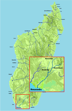
Menarandra is a river in the regions of Androy and Atsimo-Andrefana in southern Madagascar. It flows into the Indian Ocean near Bevoalavo Est.
Its annual discharge is low, approx. 2–3 L/s/km2 at Tranoroa where it also crossed the National road 10. Between Tranoroa and its mouth in the Indian Ocean it forms the border between the regions of Androy and Atsimo-Andrefana.
The Mahafaly ethnic group inhabits the area between the Menaranda River and the Onilahy River. [1]