
The Mangoky River is a 564-kilometer-long (350 mi) river in Madagascar in the regions of Atsimo-Andrefana and Anosy. It is formed by the Mananantanana and the Matsiatra. Another important affluent is the Zomandao River.

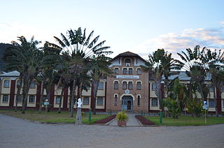
Fianarantsoa is a city in south central Madagascar, and is the capital of Haute Matsiatra Region.
Ikalamavony is a small town in Haute Matsiatra region, in the hills of southern central Madagascar with a population of 35,114 in 2018. It is the capital of the district.
Solila is a town in Haute Matsiatra Region in central Madagascar. It is some 30 kilometres west of Fianarantsoa.
Articles related to Madagascar include:

Menabe is a region in western Madagascar, with its capital at Morondava. It covers an area of 46,121 square kilometres, and its population was 700,577 in 2018. The population mostly belongs to the Sakalava ethnic group. The region is named after the 18th-century Sakalava Kingdom of Menabe. The name "Menabe", in turn, means "big red", after the color of laterite rock that dominates the landscape.
Haute Matsiatra is a region in Madagascar. It borders Amoron'i Mania region in north, Vatovavy-Fitovinany in east, Ihorombe in south and Atsimo-Andrefana in west. The capital of the region is Fianarantsoa, and the population was 1,447,296 in 2018. The area is 21,080 km2 (8,139 sq mi).

Atsimo-Andrefana is a region of Madagascar. It borders Menabe in north, Amoron'i Mania and Haute Matsiatra in northeast, Ihorombe and Anosy in east and Androy in southeast. The capital is Toliara and the population was 1,799,088 in 2018. Atsimo Andrefana is geographically the largest of all Malagasy regions with an area of 66,236 km2 (25,574 sq mi).

Districts are second-level administrative divisions of Madagascar below the regions. There are 114 districts in Madagascar. Districts are in their turn divided into communes; while some of the districts in urban areas and offshore islands each consist of only one commune, most of the districts are divided typically into 5–20 communes.
Tanandava Station is a rural municipality in Madagascar. It belongs to the district of Morombe, which is a part of Atsimo-Andrefana Region. It has a population of 18,235.
Isorana is a rural municipality in Madagascar. It belongs to the Isandra district, which is a part of Haute Matsiatra Region. The population of the commune was 15,472 in 2018.
Fitampito is a town and commune in Madagascar. It belongs to the district of Ikalamavony, which is a part of Haute Matsiatra Region. The population of the commune was estimated to be approximately 9,546 in 2018.

The Zomandao River is a 283-km-long river in the regions of Haute Matsiatra and Ihorombe in central-southern Madagascar. It begins in the Andringitra Massif at Boby Peak, the second highest peak of Madagascar, and flows across the Zomandao Plain. It is one of the main tributaries of the Mangoky River. It has some waterfalls, including the Riandahy Falls and Rianbavy Falls.
Betroka is a district of Anosy in Madagascar.
Ikalamavony is a small town in Haute Matsiatra region, in the hills of southern central Madagascar with a population of 35,114 in 2018. The district has a total population of 151,056 inhabitants. With 10,163 km2 it occupies almost half of the surface of Haute Matsiatra. The capital of the district is Ikalamavony.
Isandra is a district of Haute Matsiatra in Madagascar.

Route nationale 9 is a secondary highway in Madagascar of382 km, running from Toliara to Mandabe. It crosses the regions of Menabe and Atsimo-Andrefana.
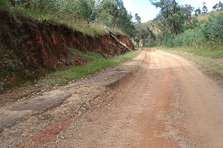
Route nationale 42 is a secondary highway in Madagascar, running from Fianarantsoa to Ambatomainty. It crosses the region of Haute Matsiatra.

The Mananantanana is a river in Haute Matsiatra region, is located in eastern Madagascar. It flows into the Mangoky River.
The Mikea National Park covers a forested region of southwestern Madagascar, between Manombo and Morombe. It stretches over 120km from North to South between the Mangoky River and the Manombo river. It is situated west along the coast of National Road 9.

