Madagascar, officially the Republic of Madagascar, is an island country comprising the island of Madagascar and numerous smaller peripheral islands. Lying off the southeastern coast of Africa, it is the world's fourth largest island, the second-largest island country and the 46th largest country in the world. Its capital and largest city is Antananarivo.

Madagascar is a large island in the Indian Ocean off the eastern coast of Southern Africa, east of Mozambique. It has a total area of 587,040 square kilometres (226,660 sq mi) with 581,540 square kilometres (224,530 sq mi) of land and 6,900 square kilometres (2,700 sq mi) of water. Madagascar is the fourth-largest island and the second-largest island country in the world. The highest point is Maromokotro, in the Tsaratanana Massif region in the north of the island, at 2,876 metres (9,436 ft). The capital Antananarivo is in the Central Highlands near the centre of the island. It has the 25th largest exclusive economic zone of 1,225,259 km2 (473,075 sq mi). Madagascar is 400 kilometres east of mainland Africa.

Antananarivo, also known by its colonial shorthand form Tana, is the capital and largest city of Madagascar. The administrative area of the city, known as Antananarivo-Renivohitra, is the capital of Analamanga region. The city sits at 1,280 m (4,199 ft) above sea level in the center of the island, the highest national capital by elevation among the island countries. It has been the country's largest population center since at least the 18th century. The presidency, National Assembly, Senate, and Supreme Court are located there, as are 21 diplomatic missions and the headquarters of many national and international businesses and NGOs. It has more universities, nightclubs, art venues, and medical services than any city on the island. Several national and local sports teams, including the championship-winning national rugby team, the Makis, are based here.

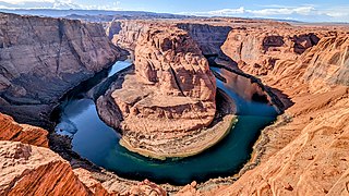
The Colorado River is one of the principal rivers in the Southwestern United States and in northern Mexico. The 1,450-mile-long (2,330 km) river, the 5th longest in the United States, drains an expansive, arid watershed that encompasses parts of seven U.S. states and two Mexican states. The name Colorado derives from the Spanish language for "colored reddish" due to its heavy silt load. Starting in the central Rocky Mountains of Colorado, it flows generally southwest across the Colorado Plateau and through the Grand Canyon before reaching Lake Mead on the Arizona–Nevada border, where it turns south toward the international border. After entering Mexico, the Colorado approaches the mostly dry Colorado River Delta at the tip of the Gulf of California between Baja California and Sonora.
The Culgoa River is a river that is part of the Darling catchment within the Murray–Darling basin and is located in South West Queensland.

Rajasaurus is a genus of carnivorous abelisaurid theropod dinosaur from the Late Cretaceous of India, containing one species: Rajasaurus narmadensis. The bones were excavated from the Lameta Formation in the Gujarat state of Western India, probably inhabiting what is now the Narmada River Valley. It was formally described by palaeontologist Jeffrey A. Wilson and colleagues in 2003 based on a partial skeleton comprising the braincase, spine, hip bone, legs, and tail–a first for an Indian theropod. The dinosaur likely measured 6.6 metres (22 ft), and had a single horn on the forehead which was probably used for display and head-butting. Like other abelisaurids, Rajasaurus was probably an ambush predator.

The Battle of Madagascar was an Allied campaign to capture the Vichy French-controlled island Madagascar during World War II. The seizure of the island by the British was to deny Madagascar's ports to the Imperial Japanese Navy and to prevent the loss or impairment of the Allied shipping routes to India, Australia and Southeast Asia. It began with Operation Ironclad, the seizure of the port of Diego-Suarez near the northern tip of the island, on 5 May 1942.

Androy is the most southerly region of Madagascar. It covers an area of 19,540 km2, and had a population of 903,376 inhabitants in 2018. The administrative capital is Ambovombe-Androy.

Atsimo-Atsinanana is a region in Madagascar. Its capital is Farafangana. The region used to be part of the Fianarantsoa Province.

Anosy is one of the 22 regions of Madagascar. It is located in the southeast of the country, on the eastern side of what was once the Toliara Province. The name Anosy means "island(s)" in Malagasy.

Zahamena National Park is a national park of Madagascar. Established in 1997, it covers an area of 423 square kilometres (163.32 sq mi) out of a total protected area of 643 square kilometres (248.26 sq mi). It is part of a UNESCO World Heritage Site, Rainforests of the Atsinanana, inscribed in 2007 and consisting of 13 specific areas located within eight national parks in the eastern part of Madagascar. In 2001, Bird Life International assessed avifauna of 112 species of which 67 species are exclusively endemic to Madagascar.

The 1983–84 South-West Indian Ocean cyclone season featured above normal activity and several deadly storms. There was steady storm activity from December through April due to favorable conditions, such as warm sea surface temperatures and an active monsoon. The first named storm – Andry – was tied for the strongest with Bakoly, Jaminy, and Kamisy. Cyclone Andry passed near Agaléga island within Mauritius, damaging or destroying every building there and killing one person. It later struck Madagascar, the first of three storms to strike the nation within two months, which collectively caused $25 million in damage and 42 deaths. The third of these storms, Tropical Storm Domoina, caused deadly flooding in southeastern Africa that killed 242 people and caused $199 million in damage. The storm destroyed more than 50 small dams in Madagascar and caused the worst flooding in Swaziland in 20 years. In addition three of the first storms affecting Madagascar, Cyclone Bakoly in December left $21 million in damage on Mauritius.

Severe Tropical Storm Domoina in 1984 caused 100-year floods in South Africa and record rainfall in Swaziland. The fourth named storm of the season, Domoina developed on January 16 off the northeast coast of Madagascar. With a ridge to the north, the storm tracked generally westward and later southwestward. On January 21, Domoina struck eastern Madagascar, the third storm in six weeks to affect the nation; collectively, the storms caused 242 deaths and $25 million in damage (1984 USD). After crossing the country, Domoina strengthened in the Mozambique Channel to peak 10-minute sustained winds of 95 km/h (60 mph). On January 28, the storm made landfall in southern Mozambique, and slowly weakened over land. Domoina crossed into Swaziland and later eastern South Africa before dissipating on February 2.

The Tsiribihina is a river of western Madagascar.

The Mangoro River is the largest river on the east coast of Madagascar by basin size and water volume, and is 300 km in length.

Intense Tropical Cyclone Kamisy was considered the worst tropical cyclone to affect northern Madagascar since 1911. A tropical disturbance formed near Diego Garcia on 3 April 1984 and subsequently moved westward, intensifying into a moderate tropical storm two days later. Given the name Kamisy, the storm gradually intensified into an intense tropical cyclone by 9 April. Kamisy reached winds of 170 km/h (105 mph) before making landfall in extreme northern Madagascar near Diego Suarez. It weakened upon entering the Mozambique Channel, but briefly re-intensified on 10 April. That day while passing near Mayotte, the cyclone turned to the southeast, striking Madagascar again near Majunga. Kamisy quickly crossed the country. After emerging into the Indian Ocean off the east coast of Madagascar, the system reintensified into a moderate tropical storm before dissipating on 16 April.
Mandraka Dam is a gravity dam on the Mandraka River near Mandraka in the Analamanga Region of Madagascar. The dam was constructed by a French firm by 1956 and creates Lake Mandraka.
The Andekaleka Dam is a gravity dam on the Vohitra river near Andekaleka in eastern Madagascar. The primary purpose of the dam is hydroelectric power generation and it diverts water from the Vohitra east into a 4 kilometres (2.5 mi) headrace tunnel where it reaches a 91 megawatts (122,000 hp) underground power station. After water charges the turbine-generators, it travels down a 500 metres (1,600 ft) tailrace tunnel before it reenters the Vohitra River. The drop in elevation between the dam and power station affords a hydraulic head of 235 metres (771 ft). The dam and power station were funded by the World Bank at a cost of US$142.1 million. It was constructed between 1978 and 1982. The power station can house up to four generators. The first two were operational in 1982 and a third in 2012. Generator one and two host Vevey and Jeumont turbines while the third is made by HEC. They all use Francis reaction turbines which typically range from 10 to 700MW and with water head operating from 10 to 600 meters

Intense Tropical Cyclone Herold was a powerful tropical cyclone that affected Madagascar and the Mascarene Islands in March 2020. Herold was the tenth zone of disturbed weather, ninth depression, eighth moderate tropical storm, sixth severe tropical storm, fifth tropical cyclone, and second intense tropical cyclone of the slightly above-average 2019–20 South-West Indian Ocean cyclone season. Herold formed on 13 March from a disorganized area of low pressure near Tromelin Island.


