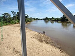
Manajeba River | |
---|---|
Location | |
Country | Madagascar |
Region | Diana |
City | Marivorahona |
Physical characteristics | |
Source | Tsaratanana Massif |
• location | Diana |
• elevation | 1,785 m (5,856 ft) |
Mouth | |
• location | Indian Ocean |
• coordinates | 12°53′00″S48°56′30″E / 12.88333°S 48.94167°E |
• elevation | 0 m (0 ft) |
Length | 248 km (154 mi) |
Basin size | 2,198.6 km2 (848.9 sq mi) [1] |
Discharge | |
• location | Near mouth |
• average | (Period: 1971–2000)59.3 m3/s (2,090 cu ft/s) [1] |
Discharge | |
• location | Marivorahona (1980–1983) |
• average | 24.2 m3/s (850 cu ft/s)- (1980–1983) |
• minimum | 0.497 m3/s (17.6 cu ft/s) |
• maximum | 220 m3/s (7,800 cu ft/s) |
The Manajeba River is located in northern Madagascar. Its sources are situated near in the Tsaratanana Massif, it crosses the Route nationale 6 near Tanambao Marivorahona and flows into the Indian Ocean.
In January 2012 the bridge of 32 meters of the Route nationale 6 collapsed between Tanambao Marivorahona and the village of Marivorahona. [2]
Ihosy is a city with 39,556 inhabitants (2018) in Ihorombe Region in central south Madagascar.
Antsohihy is a city in northern Madagascar. It is the administrative capital of the Sofia Region.
Boriziny is a city in western Madagascar in Sofia Region. The population of the commune urbaine was 22,573 in 2018.
Ambovombe-Androy, or just Ambovombe, is a city in the far south of Madagascar, and the capital of the Androy region. Ambovombe has now acquired city status with an officially estimated population in 2018 of 114,230.
Tanambao Daoud or Tanambao is a rural municipality in northern Madagascar. It belongs to the district of Sambava, which is a part of Sava Region. The population of the commune was estimated to be approximately 10,000 in 2001 commune census.
Tanambao may mean several communes in Madagascar:
Tanambao Besakay is a town and commune in Madagascar. It belongs to the district of Ambatondrazaka, which is a part of Alaotra-Mangoro Region. The population of the commune was estimated to be approximately 10,000 in 2001 commune census.
Tanambao Ambony is a town and commune in southwest Madagascar. It belongs to the district of Betioky Sud, which is a part of Atsimo-Andrefana Region. The population of the commune was estimated to be approximately 3,000 in 2001 commune census.
Ambatondrazaka District is a district in the Alaotra-Mangoro Region of Madagascar. Its capital is the town of Ambatondrazaka. The district has an area of 6,967 km2 (2,690 sq mi), and the estimated population in 2020 was 375,183.
Route nationale 2 (RN2) is a primary highway in Madagascar. The route runs from the capital city of Antananarivo to Toamasina, a city on the eastern coast of the Madagascar.
Maintinandry is a small village and commune in the Vatomandry District, Atsinanana Region, Madagascar.
The Besokatra River is located in northern Madagascar. Its sources are situated near Joffreville in the Amber Mountain National Park, in the Ambohitra Massif, it crosses the Route nationale 6 near Mahavanona and flows into the Indian Ocean.
The Saharenana River is located in northern Madagascar and crosses the Route Nationale 6 near Antananandrenitelo. Its sources are situated near Joffreville in the Ambohitra Massif and flows into the Indian Ocean.
The Fanambana River is located in northern Madagascar and crosses the Route Nationale 5a near Fanambana. Its sources are situated in the Marojejy Massif and flows into the Indian Ocean south of Vohemar.
Antsohihy is a district of Sofia in Madagascar. The district has an area of 4,774 km2 (1,843 sq mi), and the estimated population in 2020 was 186,283.
Betioky is a town in Atsimo-Andrefana Region, Madagascar and is crossed by the Route nationale 10. An airport serves the town.
Vatomandry is a district located in Atsinanana Region, Madagascar.
Route nationale 9 is a secondary highway in Madagascar of 382 km, running from Toliara to Mandabe. It crosses the regions of Menabe and Atsimo-Andrefana.
The Ankavanana is a river located in northern Madagascar in the Sava Region. Its sources are south of Andapa, crosses the Route Nationale 5a near Antalaha and flows into the Indian Ocean.
RIP 202D is a secondary road in Sava Region, Madagascar. It has a length of 31.4 kilometres (19.5 mi) and links Nosiarina, Bemanevika and Tanambao Daoud.