Madagascar has diplomatic relations with many countries, both individual bilateral relations and by virtue of its membership of African and other regional blocs. International aid has been received from the IMF and the World Bank, and a national environmental plan supported by the World Bank and USAID began in 1990.
The Mozambique Channel is an arm of the Indian Ocean located between the Southeast African countries of Madagascar and Mozambique. The channel is about 1,600 km (1,000 mi) long and 419 km (260 mi) across at its narrowest point, and reaches a depth of 3,292 m (10,800 ft) about 230 km (143 mi) off the coast of Mozambique. A warm current, the Mozambique Current, flows in a southward direction in the channel, leading into the Agulhas Current off the east coast of South Africa.

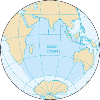
Madagascar is a large island in the Indian Ocean off the eastern coast of southern Africa, east of Mozambique. It is the fourth largest island in the world. The highest point is Maromokotro, in the Tsaratanana Massif region in the north of the island, at 2,876 metres (9,436 ft). The capital Antananarivo is in the Central Highlands near the centre of the island. Madagascar has a total area of 587,040 square kilometres (226,660 sq mi) with 581,540 square kilometres (224,530 sq mi) of land and 5,500 square kilometres (2,100 sq mi) of water. Madagascar is 400 kilometres east of mainland Africa.

The Pottawatomi, also spelled Pottawatomie and Potawatomi, are a Native American people of the Great Plains, upper Mississippi River, and western Great Lakes region. They traditionally speak the Potawatomi language, a member of the Algonquian family. The Potawatomi called themselves Neshnabé, a cognate of the word Anishinaabe. The Potawatomi were part of a long-term alliance, called the Council of Three Fires, with the Ojibwe and Odawa (Ottawa). In the Council of Three Fires, the Potawatomi were considered the "youngest brother" and were referred to in this context as Bodéwadmi, a name that means "keepers of the fire" and refers to the council fire of three peoples.

Ethnobotany is the study of a region's plants and their practical uses through the traditional knowledge of a local culture and people. An ethnobotanist thus strives to document the local customs involving the practical uses of local flora for many aspects of life, such as plants as medicines, foods, and clothing. Richard Evans Schultes, often referred to as the "father of ethnobotany", explained the discipline in this way:
Ethnobotany simply means ... investigating plants used by societies in various parts of the world.

Teeth blackening or teeth lacquering is a custom of dyeing one's teeth black. It was most predominantly practiced in Southeast Asian and Oceanic cultures, particularly among Austronesian, Austroasiatic, and Kra-Dai-speaking peoples. It was also practiced in Japan prior the Meiji era, and among minorities in southern China. It was also performed among some groups in the Americas, most notably among the Shuar people of northern Peru and Ecuador.

Elaeocarpus is a genus of tropical and subtropical evergreen trees and shrubs. The approximately 350 species are distributed from Madagascar in the west through India, Southeast Asia, southern China, and Japan, through Australia to New Zealand, Fiji, and Hawaii in the east. The islands of Borneo and New Guinea have the greatest concentration of species. These trees are well-known for their attractive, pearl-like fruit which are often colorful. A notable feature of the family is the drooping, often frilly, small clusters of flowers.
The Meskwaki are a Native American people often known by Western society as the Fox tribe. They have been closely linked to the Sauk people of the same language family. In the Meskwaki language, the Meskwaki call themselves Meshkwahkihaki, which means "the Red-Earths", related to their creation story. Historically their homelands were in the Great Lakes region. The tribe coalesced in the St. Lawrence River Valley in present-day Ontario, Canada. Under French colonial pressures, it migrated to the southern side of the Great Lakes to territory that much later was organized by European Americans as the states of Michigan, Wisconsin, Illinois, and Iowa.
Ethnobiology is the scientific study of the way living things are treated or used by different human cultures. It studies the dynamic relationships between people, biota, and environments, from the distant past to the immediate present.
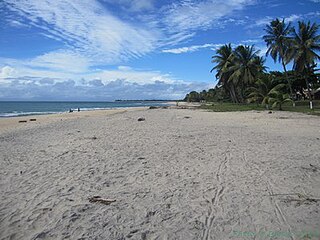
Sava is a region of northern Madagascar. Its capital is Sambava. Until 2009 Sava belonged to Antsiranana Province. The region is situated at the northern part of the east coast of Madagascar. It is bordered by Diana to the north, Sofia to the west, and Analanjirofo to the south. The population was estimated to be 980,807 in 2013 and the total area is 25,518 km2 (9,853 sq mi). The region contains wild areas such as Marojejy National Park.

The Madagascan big-headed turtle is a turtle native to the waters of permanent slow moving rivers and lakes in western Madagascar. These turtles are critically endangered and have been evaluated to be the most endangered turtle in the world by a 2018 review. Despite their vulnerability to extinction, they are commonly eaten for food and they are still commonly shipped from Madagascar to Asia to help meet the demand of Asia's traditional medicine market. A captive breeding program has also been started to prevent the species from becoming extinct. The Turtle Conservation Fund (TCF) intends to raise US$5.6 million to cover a five-year 'Global Action Plan' which includes captive breeding and reintroduction projects, trade monitoring, new rescue centers, local conservation plans, and educational programs.
The Aïna River is a tributary of the Ivindo River that rises in Cameroon. Along the way it forms the border between Cameroon and Gabon and then the border between Gabon and Republic of the Congo (Map.).
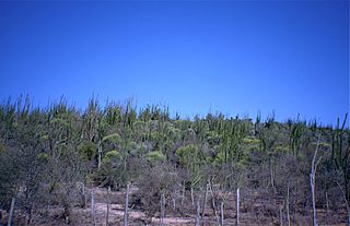
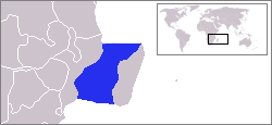
Androy is the most southerly region of Madagascar. It covers an area of 19,540 km2, and had an estimated population of 733,933 inhabitants in 2013. The administrative capital is Ambovombe-Androy, and the chief administrator is Michael Andrianirina.

Madagascar – United States relations are bilateral relations between Madagascar and the United States.

William Balée is a professor of anthropology at Tulane University in New Orleans, Louisiana.

Moringa hildebrandtii, or Hildebrandt's moringa, is a tree species with a massive, water-storing trunk in the family Moringaceae. It is endemic to Madagascar, where it is extinct in the wild, but preserved by indigenous horticulture practices.
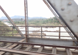
The Mangoro River is the largest river on the east coast of Madagascar by basin size and water volume, and is 300 km in length.