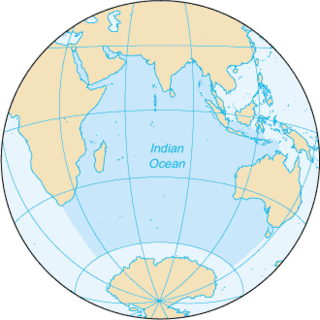
The Indian Ocean is the third-largest of the world's five oceanic divisions, covering 70,560,000 km2 (27,240,000 sq mi) or ~20% of the water on Earth's surface. It is bounded by Asia to the north, Africa to the west and Australia to the east. To the south it is bounded by the Southern Ocean, or Antarctica, depending on the definition in use. Along its core, the Indian Ocean has large marginal, or regional seas, such as the Arabian Sea, Laccadive Sea, Bay of Bengal and Andaman Sea.
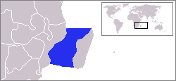
The Mozambique Channel is an arm of the Indian Ocean located between the Southeast African countries of Madagascar and Mozambique. The channel is about 1,700 km long and 419 km across at its narrowest point, and reaches a depth of 3,292 m (10,801 ft) about 230 km off the coast of Mozambique. A warm current, the Mozambique Current, flows in a southward direction in the channel, leading into the Agulhas Current off the east coast of Southern Africa.

Madagascar is a large island in the Indian Ocean off the eastern coast of Southern Africa, east of Mozambique. It has a total area of 587,040 square kilometres (226,660 sq mi) with 581,540 square kilometres (224,530 sq mi) of land and 5,500 square kilometres (2,100 sq mi) of water. Madagascar is the fourth-largest island and the second-largest island country in the world. The highest point is Maromokotro, in the Tsaratanana Massif region in the north of the island, at 2,876 metres (9,436 ft). The capital Antananarivo is in the Central Highlands near the centre of the island. It has the 25th largest exclusive economic zone of 1,225,259 km2 (473,075 sq mi). Madagascar is 400 kilometres east of mainland Africa.

An ocean current is a continuous, directed movement of seawater generated by a number of forces acting upon the water, including wind, the Coriolis effect, breaking waves, cabbeling, and temperature and salinity differences. Depth contours, shoreline configurations, and interactions with other currents influence a current's direction and strength. Ocean currents are primarily horizontal water movements.
The East Madagascar Current is an oceanic flow feature near Madagascar. It flows southward from 20°S on the east side of Madagascar to the southern limit at Cape Saint Marie and subsequently feeds the Agulhas Current. Its flow is complicated by large cyclonic and anticyclonic eddies.
The Madagascar current is an oceanic current in the west Indian Ocean.

Namorona is a river in Vatovavy, eastern Madagascar. It flows down from the central highlands, runs along the Ranomafana National Park, forms the Andriamamovoka Falls, to flow into the Indian Ocean. It empties near Namorona and has a length of 103 km (64 mi).

Rianila is a river in the Atsinanana region in eastern Madagascar. It flows down from the central highlands to flow into the Indian Ocean south of Brickaville at Andevoranto. Its largest tributary is the Rongaronga, which joins it near Brickaville as well as the Iaroka and Vohitra Rivers.

Antainambalana is a river in the region of Analanjirofo in north-eastern Madagascar. It flows down from the highlands to flow into the Bay of Antongil and the Indian Ocean near Maroantsetra. Its basin has the size of 5,902 km2 (2,279 sq mi).

Menarandra is a river in the regions of Androy and Atsimo-Andrefana in southern Madagascar. It flows into the Indian Ocean near Bevoalavo Est.
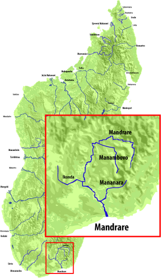
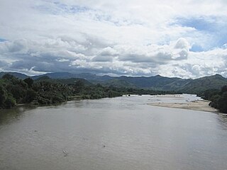
Mandrare is a river in the region of Anosy in southern Madagascar. It flows into the Indian Ocean near Amboasary Sud. It becomes dry in certain months of the year.

Maningory is a river in the region of Analanjirofo in north-eastern Madagascar. It takes it source in Lake Alaotra and flows into the Indian Ocean near Antakobola.

Manampatrana is a river in the region of Atsimo-Atsinanana in south-eastern Madagascar. It has its springs in the Andringitra Massif and flows into the Indian Ocean north of Farafangana.
Fiherenana is a river in the region Atsimo-Andrefana in southern Madagascar. It flows into the Indian Ocean at Tulear.
The Fanambana River is located in northern Madagascar and crosses the Route Nationale 5a near Fanambana. Its sources are situated in the Marojejy Massif and flows into the Indian Ocean south of Vohemar.
Ambalona is a river in eastern Madagascar. It flows into the Indian Ocean south of Toamasina.

The Ivondro River in Alaotra-Mangoro and Atsinanana regions, is located in central-eastern Madagascar. It drains to the eastern coast. It flows into the Canal des Pangalanes and the Indian Ocean south of Toamasina.
The Ankavanana is a river located in northern Madagascar in the Sava Region. Its sources are south of Andapa, crosses the Route Nationale 5a near Antalaha and flows into the Indian Ocean.

The Matitanana river in Fitovinany region, is located in eastern Madagascar. It flows into the Indian Ocean near Vohipeno.
The Morondava is a river in the Menabe region, located in western Madagascar. It originates on the Makay Massif and flows northwestwards into the Indian Ocean near a town with the same name.