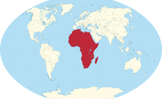
Africa is a continent comprising 63 political territories, representing the largest of the great southward projections from the main mass of Earth's surface. Within its regular outline, it comprises an area of 30,368,609 km2 (11,725,385 sq mi), excluding adjacent islands. Its highest mountain is Kilimanjaro; its largest lake is Lake Victoria.

Madagascar is a large island in the Indian Ocean off the eastern coast of Southern Africa, east of Mozambique. It has a total area of 587,040 square kilometres (226,660 sq mi) with 581,540 square kilometres (224,530 sq mi) of land and 5,500 square kilometres (2,100 sq mi) of water. Madagascar is the fourth-largest island and the second-largest island country in the world. The highest point is Maromokotro, in the Tsaratanana Massif region in the north of the island, at 2,876 metres (9,436 ft). The capital Antananarivo is in the Central Highlands near the centre of the island. It has the 25th largest exclusive economic zone of 1,225,259 km2 (473,075 sq mi). Madagascar is 400 kilometres east of mainland Africa.

Maroantsetra, formerly Louisbourg, is a market town and domestic seaport in Analanjirofo Region, Madagascar, at the northern end of the Bay of Antongil. In 2018, Maroantsetra counted 42,529 people. Even though it is a small city, Maroantsetra played an important role in the betsimisaraka history as the unification of this tribe by Ratsimilaho started there. Throughout the eighteenth century, Maroantsetra also actively participated in the piracy and the attack led collectively by the betsimisarakas against the islands of comoros and some east african countries.

Anjozorobe is a large town in the Analamanga Region, Madagascar, approximately 90 kilometers north-east of the capital Antananarivo. It has a population of 24,117 inhabitants in 2018.

Farafangana is a city on the south-east coast of Madagascar and capital of the Atsimo-Atsinanana region.

Atsimo-Atsinanana is a region in Madagascar. Its capital is Farafangana. The region used to be part of the Fianarantsoa Province.

Analanjirofo is a region in northeastern Madagascar. Until 2009 it was a part of Toamasina Province. It borders Sava Region to the north, Sofia Region to the west, Alaotra-Mangoro Region to the southwest and Atsinanana Region to the south.
Antanambaobe is a rural municipality in Madagascar. It belongs to the district of Mananara Nord, which is a part of Analanjirofo Region. The population of the commune was estimated to be approximately 14,000 in 2001.
Mananara Nord or Mananara Avaratra is a municipality in Madagascar. It belongs to the district of Mananara Nord, which is a part of Analanjirofo Region. The population of the commune was 35,148 in 2018.

Saint Augustin is a rural municipality in Madagascar. It belongs to the district of Toliara II, which is a part of Atsimo-Andrefana Region. The population of the commune was estimated to be approximately 15,000 in 2001 commune census. The mouth of the Onilahy River is near the town.
Behara is a town and commune in Madagascar. It belongs to the district of Amboasary Sud, which is a part of Anosy Region. The population of the commune was estimated to be approximately 27,285 in 2018.
Mahatalaky is a rural commune in Madagascar. It belongs to the district of Taolanaro, which is a part of Anosy Region. It is situated at 35 km from Fort Dauphin. The population of the commune was estimated to be approximately 25,000 in 2001 commune census.

Madagascar mangroves are a coastal ecoregion in the mangrove forest biome found on the west coast of Madagascar. They are included in the WWF's Global 200 list of most outstanding ecoregions.

The Mananara River is one of the main rivers in north-eastern Madagascar. Its mouth is located in the Bay of Antongil, near the city of Mananara Nord in the Analanjirofo region.
Imorona is a town and commune in Madagascar. It belongs to the district of Mananara Nord, which is a part of Analanjirofo Region. The population of the commune was estimated to be approximately 7,413 in 2018.
Analampotsy is a town and commune in Madagascar. It belongs to the district of Mananara Nord, which is a part of Analanjirofo Region. The population of the commune was estimated to be approximately 16,987 in 2018.
Antanananivo is a town and commune in Madagascar. It belongs to the district of Mananara Nord, which is a part of Analanjirofo Region. The population of the commune was estimated to be approximately 10,066 in 2018.
Mananara Nord National Park is a national park near Mananara Nord in the Analanjirofo Region of Madagascar.


