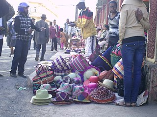
Antananarivo, also known by its colonial shorthand form Tana, is the capital and largest city of Madagascar. The administrative area of the city, known as Antananarivo-Renivohitra, is the capital of Analamanga region. The city sits at 1,280 m (4,199 ft) above sea level in the center of the island, the highest national capital by elevation among the island countries. It has been the country's largest population center since at least the 18th century. The presidency, National Assembly, Senate and Supreme Court are located there, as are 21 diplomatic missions and the headquarters of many national and international businesses and NGOs. It has more universities, nightclubs, art venues, and medical services than any city on the island. Several national and local sports teams, including the championship-winning national rugby team, the Makis are based here.
Antananarivo Province is a former province of Madagascar with an area of 58,283 square kilometres (22,503 sq mi). It had a population of 5,370,900 in 2004. Its capital was Antananarivo, which is also the capital of the country. Established in 1965, it was the most important province of Madagascar in terms of industrial production. It was one of the most literate provinces and was dominated by the Merina people. Along with the other five provinces, it was abolished in 2007 after a referendum in favour of creation of smaller regions to help in development was approved. It was badly affected by plagues in the 20th century. In 2002 a state of emergency was proclaimed by the then president Didier Ratsiraka. The events that followed led to the other five provinces announcing the creation of a new republic that would have excluded Antananarivo Province. Peace was restored only when Marc Ravalomanana was installed as the country's president.

The Madagascar subhumid forests are a tropical moist broadleaf forest ecoregion that covers most of the Central Highlands of the island of Madagascar. They are included in the WWF's Global 200 list of outstanding ecoregions. Most of the original habitats have been lost due to human pressure.

Antanifotsy is an urban municipality and a district located in Vakinankaratra Region in Madagascar. It has a population of 54,448 in 2018. The city is at 112 km from Antananarivo and at 60 km to Antsirabe. The municipality is 3 km off the RN7 that passes at Ilempona Gara, at the entrance of Antanifotsy. This is also a railway station on the Antananarivo - Antsirabe line.

Morondava is a city located in Menabe Region, of which it is the capital, in Madagascar. It is located in the delta of the Morandava River at 20°17′5″S44°19′3″E. Its population as of the 2018 census, was 53,510.

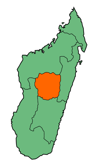
Analamanga is a region in central Madagascar, containing the capital Antananarivo and its surrounding metropolitan area. The region has an area of 17,488 square kilometres, and had a population of 4,325.226 in 2018.

Ankazobe is a municipality in Analamanga Region, in the Central Highlands of Madagascar. It is the administrative capital of Ankazobe District and is situated at 75 km north of the capital Antananarivo.

Moramanga is a city in Madagascar. It is located in the region Alaotra-Mangoro and the Moramanga District. It has a population of 57084 inhabitants (2018).
Melanophylla alnifolia is a species of plant in the Torricelliaceae family. It is endemic to eastern Madagascar. Its natural habitat is tropical moist lowland and montane forests. It is threatened by habitat loss.

Tsimanampetsotsa National Park also spelt Tsimanampetsotse, and known as Tsimanampetsotsa Nature Reserve is a 432 km2 national park on the south-west coast of Madagascar in the region Atsimo-Andrefana. The park is 90 kilometres (56 mi) south of Toliara and 950 kilometres (590 mi) south of the capital, Antananarivo. Route Nationales (RN) 10 to Faux Cap passes the park and the nearest airport is at Toliara. The national park contains and is named after Lake Tsimanampetsotsa.

The eastern voalavo is a rodent in the family Nesomyidae which occurs in the Anjozorobe forest of eastern Madagascar. Although surveys before 2002 failed to record the species, it is common in some places. However, it is threatened by habitat loss because of slash-and-burn agriculture. The species was formally described in 2005 and is most closely related to the only other species of Voalavo, the northern voalavo from northern Madagascar.

Brookesia thieli, commonly also known as Domergue's leaf chameleon or Thiel's pygmy chameleon, is a species of lizard in the family Chamaeleonidae. The species is endemic to eastern Madagascar, with a type locality of Ambodimanga, Andapa. It was first described in 1969 by Édouard-Raoul Brygoo and Charles Antoine Domergue, and it was ranked by the International Union for Conservation of Nature as "least concern". B. thieli is thought to be found over an area of 43,865 km2 (16,936 sq mi) at 875–1,200 m (2,871–3,937 ft) above sea level.
The following is a timeline of the history of the city of Antananarivo, Madagascar.
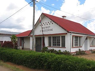
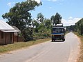
Anjozorobe is a district of Analamanga in Madagascar.
Ankazobe is a district of Analamanga in Madagascar.
Ambatomanoina is a rural municipality in Analamanga Region, in the Central Highlands of Madagascar. It belongs to the district of Anjozorobe and its populations numbers to 21,779 in 2018.
Talata Volonondry is a rural commune in Analamanga Region, in the Central Highlands of Madagascar. It belongs to the district of Antananarivo Avaradrano and its population numbers to 18,314 in 2018.
Analaroa is a large town in the Analamanga Region, Madagascar, 80 km north-east of the capital Antananarivo, in the district of Anjozorobe.
Mangamila is a municipality in the Analamanga Region, Madagascar, 69 km north-east of the capital Antananarivo, in the district of Anjozorobe.
The Antananarivo–Toamasina toll highway is a toll highway under construction in Madagascar that will connect the Malagasy capital of Antananarivo with the port city of Toamasina. Construction, overseen by Egyptian firm Samcrete, began in December 2022 with a projected cost of $1 billion over four years to build. It will be the first toll highway in Madagascar, and will reduce the distance required to travel from Antananarivo to Madagascar's largest port by 110 kilometers (68 mi) and is expected to reduce typical travel time by between five-and-a-half and seven-and-a-half hours. Upon the toll highway's completion, drivers in Madagascar will be permitted to drive the 260-kilometer (160 mi) road at a pace of 120 km/h (75 mph). Tolls for passenger cars will be 15,000 Malagasy ariary (3.08 euros), while tolls for heavy trucks will be 20,000 ariary (€4.11).