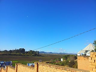
Antananarivo, also known by its colonial shorthand form Tana, is the capital and largest city of Madagascar. The administrative area of the city, known as Antananarivo-Renivohitra, is the capital of Analamanga region. The city sits at 1,280 m (4,199 ft) above sea level in the center of the island, the highest national capital by elevation among the island countries. It has been the country's largest population center since at least the 18th century. The presidency, National Assembly, Senate and Supreme Court are located there, as are 21 diplomatic missions and the headquarters of many national and international businesses and NGOs. It has more universities, nightclubs, art venues, and medical services than any city on the island. Several national and local sports teams, including the championship-winning national rugby team, the Makis are based here.

Fianarantsoa is a city in south central Madagascar, and is the capital of Haute Matsiatra Region.

Analamanga is a region in central Madagascar, containing the capital Antananarivo and its surrounding metropolitan area. The region has an area of 17,488 square kilometres, and had a population of 3,618,128 in 2018.

Maevatanana is an urban municipality in Madagascar. The city is in the central-north part of the island, at the Ikopa River, and is connected by the national road RN 4 to Antananarivo and Mahajanga. The altitude is low and as it is located far from the coast, temperatures tend to be high. The city belongs to the district of Maevatanana, which is a part of Betsiboka Region. Maevatanana is the capital of the Betsiboka region, and the population of the commune was estimated to be approximately 24,000 in 2001 commune census.

Ambatolampy is a city in the Vakinankaratra Region, situated in the Central Highlands of Madagascar. It had a population of about 28,500 in 2013.

Manjakandriana is a town and commune in Manjakandriana District, Analamanga Region, in the Central Highlands of Madagascar. It is located 47 km east of Antananarivo on the Route Nationale RN2 and the railway line from Antananarivo - Toamasina.

Districts are second-level administrative divisions of Madagascar below the regions. There are 114 districts in Madagascar. Districts are in their turn divided into communes; while some of the districts in urban areas and offshore islands each consist of only one commune, most of the districts are divided typically into 5–20 communes.

Andasibe is a rural municipality in Madagascar. It belongs to the district of Moramanga, which is a part of Alaotra-Mangoro Region. The population of the commune was estimated to be approximately 13493 in 2006.
Sabotsy Anjiro is a rural municipality that is composed by two towns in Madagascar. It belongs to the district of Moramanga, which is a part of Alaotra-Mangoro Region. The population of the commune was estimated to be 17,418 in 2018 and lies approximately 80 km west of Antananarivo, along the National Road 2 to Toamasina.

Ambohijanahary is a rural municipality in Madagascar. It belongs to the district of Amparafaravola, which is a part of the Alaotra-Mangoro Region, and lies on the RN3a, approximately 320km from Antananarivo. The population of the commune was estimated to be 28,000 in the 2001 commune census.

Behenjy is a rural municipality in Madagascar. It belongs to the district of Ambatolampy, which is a part of Vakinankaratra Region. The population of the commune was estimated to be approximately 18,000 in 2001 commune census.
Ivato or Ivato Centre is a town and commune in Madagascar. It belongs to the district of Ambositra, which is a part of Amoron'i Mania Region.

Route nationale 4 (RN4) is a primary highway in Madagascar. The route runs from the capital city of Antananarivo to Mahajanga, a city on the north-east coast of the Madagascar. It covers a distance of 570 km.
Andekaleka is a town and commune in Madagascar. It belongs to the district of Vohibinany (district), which is a part of Atsinanana Region.

Miantso is a town in Analamanga Region, in the Central Highlands of Madagascar, located north-west from the capital of Antananarivo.
Masindray is a rural commune in Analamanga Region, in the Central Highlands of Madagascar. It belongs to the district of Antananarivo Avaradrano and its populations numbers to 13,505 in 2018. It is situated at 20 km West from Antananarivo.
Ambohimanjaka is a town and commune in Madagascar. It belongs to the district of Ambohidratrimo (district), which is a part of Analamanga Region. It lies North West from the capital Antananarivo. The population of the commune was estimated to be approximately 5,284 in 2018.

Ivato is a town and commune in Madagascar. It belongs to the district of Ambohidratrimo (district), which is a part of Analamanga Region.

Ambohimanga Rova is a rural commune in Analamanga Region, in the Central Highlands of Madagascar. It belongs to the district of Antananarivo Avaradrano and its populations numbers to 20,872 in 2018.


