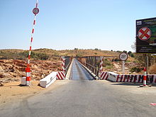
Paved and unpaved roadways, as well as railways, provide the main forms of transport in Madagascar. Madagascar has approximately 31,640 km (19,660 mi) of paved roads and 836 km of rail lines. In 2010, Madagascar had 432 km (270 mi) of navigable waterways.

Mahajanga was a former province of Madagascar that had an area of 150,023 km². It had a population of 1,896,000 (2004). Its capital was Mahajanga, the second largest city in Madagascar.

Sofia is a region in northern Madagascar. It is named for the Sofia River. The region covers 50,100 km² and had a population of 1,500,227 in 2018. The administrative capital is Antsohihy.

The Pro League Championnat de Football National Division 1 is the premier football league in Madagascar. Prior to 2019, it was known as the Three Horses Beer-sponsored THB Champions League.
Articles related to Madagascar include:

Maevatanana is an urban municipality in Madagascar. The city is in the central-north part of the island, at the Ikopa River, and is connected by the national road RN 4 to Antananarivo and Mahajanga. The altitude is low and as it is located far from the coast, temperatures tend to be high. The city belongs to the district of Maevatanana, which is a part of Betsiboka Region. Maevatanana is the capital of the Betsiboka region, and the population of the commune was estimated to be approximately 24,000 in 2001 commune census.

Ankazobe is a municipality in Analamanga Region, in the Central Highlands of Madagascar. It is the administrative capital of Ankazobe District and is situated at 75 km north of the capital Antananarivo.

Moramanga is a city in Madagascar. It is located in the region Alaotra-Mangoro and the Moramanga District. It has a population of 57084 inhabitants (2018).
Ambondromamy is a town and commune in Madagascar. It belongs to the district of Ambato-Boeni, which is a part of Boeny Region. The population of the commune was estimated to be approximately 8,000 in 2001 commune census.

Andasibe is a rural municipality in Madagascar. It belongs to the district of Moramanga, which is a part of Alaotra-Mangoro Region. The population of the commune was estimated to be approximately 13493 in 2006.
Moramanga District is a district in the Alaotra-Mangoro region in Madagascar. Its capital is Moramanga.

Route nationale 2 (RN2) is a primary highway in Madagascar. The route runs from the capital city of Antananarivo to Toamasina, a city on the eastern coast of the Madagascar.

Route nationale 7 (RN7) is a primary highway in Madagascar running 980km from the capital Antananarivo to Tulear at the south-west coast of the country. It crosses the regions of Analamanga, Vakinankaratra, Amoron'i Mania, Haute Matsiatra, Ihorombe, and Atsimo-Andrefana.

Route nationale 6 (RN6) is a primary highway in Madagascar of 706 km, running from Antsiranana to Ambondromamy. It crosses the regions of Diana and Sofia. It was paved in 1992.

Route nationale 10 is an unpaved, secondary highway in Madagascar of 512 km, running from Andranovory to Ambovombe. It crosses the regions of Atsimo-Andrefana and Androy.
Ankazobe is a district of Analamanga in Madagascar.

Brickaville District is an administrative district in Atsinanana Region, Madagascar; also known as Ampasimanolotra and Vohibinany. Brickaville is located along Route nationale 2, 105 km south of Toamasina and 220 km east of Antananarivo. It is also situated alongside the Rianila river. It is a railway station on the Antananarivo - East Coast line. Its main industries revolve around sugar.

Antehiroka is a town and commune in Madagascar. It belongs to the district of Ambohidratrimo (district), which is a part of Analamanga Region.
Ampanotokana is a town and commune in Madagascar. It belongs to the district of Ambohidratrimo (district), which is a part of Analamanga Region. The population of the commune was estimated to be approximately 21,969 in 2019.
Beanana is an rural municipality in Madagascar. The city is in the central-north part of the island and is connected by the national road RN 4 to Antananarivo and Mahajanga. This municipality belongs to the district of Maevatanana, which is a part of Betsiboka Region.