
Fianarantsoa Province is a former province of Madagascar. It has an area of 103,272 km2 and population of 3,366,291. Its capital was Fianarantsoa. The province along with the 5 other was abolished in 2007 in favour of creation of smaller regions to facilitate administration.

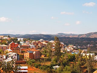
Fianarantsoa is a city in south central Madagascar, and is the capital of Haute Matsiatra Region.

Antanifotsy is an urban municipality and a district located in Vakinankaratra Region in Madagascar. It has a population of 54,448 in 2018. The city is at 112 km from Antananarivo and at 60 km to Antsirabe. The municipality is 3 km off the RN7 that passes at Ilempona Gara, at the entrance of Antanifotsy. This is also a railway station on the Antananarivo - Antsirabe line.

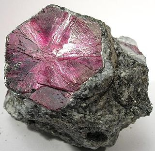
Ilakaka is a small town in Ihorombe Region in the south western part of Madagascar. In the early 1990s there were only about 40 residents in the area. After the discovery of one of Earth's largest known alluvial sapphire deposits in the valley of the Ilakaka river in 1998, the population had boomed to nearly 60,000 in 2005. Since high profits are at stake, violence is common in the town.

Ihosy is a city with 39,556 inhabitants (2018) in Ihorombe Region in central south Madagascar.
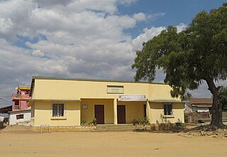
Zazafotsy is a town and commune in Madagascar. It belongs to the district of Ihosy, which is a part of Ihorombe Region. The population of the commune was 14,062 in 2018.
Ambositra is a city in central Madagascar.

Vakinankaratra is a region in central Madagascar. The capital of the region is Antsirabe. Vakinankaratra covers an area of 16,599 kilometres, and had a population of 2,074,358 in 2018.

Ambatolampy is a city in the Vakinankaratra Region, situated in the Central Highlands of Madagascar. It had a population of about 28,500 in 2013.
Ambalavao is a city in Madagascar, in the Haute Matsiatra region. The city is in the most southern part of the Central Highlands, near the city of Fianarantsoa.
Haute Matsiatra is a region in Madagascar. It borders Amoron'i Mania region in north, Vatovavy-Fitovinany in east, Ihorombe in south and Atsimo-Andrefana in west. The capital of the region is Fianarantsoa, and the population was 1,447,296 in 2018. The area is 21,080 km2 (8,139 sq mi).
Ranohira is a town and commune in Madagascar. It belongs to the district of Ihosy, which is a part of Ihorombe Region. The population of the commune was 16,041 in 2018. The nearest towns are Ilakaka at 26 km and Ihosy 93 km distance.

Despite a high potential for tourism, tourism in Madagascar is underdeveloped. Madagascar's tourist attractions include its beaches and biodiversity. The island's endemic wildlife and forests are unique tourist attractions. However, historical sites, craftsmen communities, and relaxed cities make it a favorite with return travellers.

Ambalavao District is a district in central Madagascar. It covers an area of 4,798.47 km2, and had a population estimated at 209,417 in 2013. It is part of Haute Matsiatra Region. Its capital is Ambalavao.

Route nationale 35 is a primary highway in Madagascar of 456 km, running from Ivato, Ambositra to Morondava. It crosses the regions of Menabe and Amoron'i Mania.

Route nationale 10 is an unpaved, secondary highway in Madagascar of 512 km, running from Andranovory to Ambovombe. It crosses the regions of Atsimo-Andrefana and Androy.

Sakaraha is a district located in Atsimo-Andrefana Region, south-western Madagascar.

Route nationale 34 is a primary highway in Madagascar of 456 km, running from Antsirabe to Malaimbandy. It crosses the regions of Amoron'i Mania and Menabe.
The Ambatolampy Solar Power Station is a 40 MW solar power plant in Madagascar. As of April 2022, it was the first grid-connected, privately-funded solar power plant in the country. The power plant, which was first commissioned in 2018, underwent expansion from 20 MW to 40 MW, between 2021 and 2022. The off-taker of the power generated at this renewable energy power plant is Jirama, the national electricity utility company.


