Paved and unpaved roadways, as well as railways, provide the main forms of transport in Madagascar. Madagascar has approximately 31,640 km (19,660 mi) of paved roads and 836 km of rail lines. In 2010, Madagascar had 432 km (270 mi) of navigable waterways.

The Toamasina Province is a former province of Madagascar with an area of 71,911 km2. It had a population of 2,855,600 (2004). Its capital was Toamasina, the most important seaport of the country. The province was also known as Tamatave Province.

Brickaville is a town and commune in Atsinanana Region, Madagascar.

Moramanga is a city in Madagascar. It is located in the region Alaotra-Mangoro and the Moramanga District. It has a population of 57084 inhabitants (2018).

Alaotra-Mangoro is a region in eastern Madagascar. It borders Sofia Region in north, Analanjirofo in northeast, Atsinanana in east, Vakinankaratra in southwest, Analamanga in west and Betsiboka in northwest. The capital of the region is Ambatondrazaka, and the population was 1,255,514 in 2018. The area of the region is 31,948 km2 (12,335 sq mi).

Atsinanana is a coastal region in eastern Madagascar. It borders Analanjirofo region in the north, Alaotra-Mangoro in the west, Vakinankaratra and Amoron'i Mania in the southwest, and Vatovavy in the south. The region contains over 285km of coastline, which includes many beaches and cultural heritage sites.

Andasibe is a rural municipality in Madagascar. It belongs to the district of Moramanga, which is a part of Alaotra-Mangoro Region. The population of the commune was estimated to be approximately 13,493 in 2006.

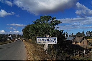
Beforona is a town and commune in Madagascar. It belongs to the district of Moramanga, which is a part of Alaotra-Mangoro Region. The population of the commune was estimated to be approximately 20,380 in 2018.
List of Railway stations in Madagascar include:
Moramanga District is a district in the Alaotra-Mangoro region in Madagascar. Its capital is Moramanga.

The history of rail transport in Madagascar began at the end on the nineteenth century, with the construction of industrial and military Decauville lines in the north of the country, centred on the port of Diego-Suarez.

Intense Tropical Cyclone Geralda was a powerful tropical cyclone that caused catastrophic damage in Madagascar in late January 1994, among the strongest to hit the country. It was also the most intense tropical cyclone worldwide in 1994. Cyclone Geralda originated from an area of low pressure over the Indian Ocean on 25 January. Over the following few days, the depression underwent gradual intensification, reaching its peak intensity with ten-minute sustained winds of 205 km/h (127 mph) on 31 January. It eventually made landfall near Toamasina, Madagascar after weakening from its peak intensity, and substantially weakened within hours of moving onshore. By 5 February, Geralda had degenerated into a land depression, and became extratropical three days later. Geralda's remnants dissipated on 12 February.

Andevoranto is a rural municipality in the Brickaville District, Atsinanana Region, Madagascar.

Route nationale 6 (RN6) is a primary highway in Madagascar of 706 km, running from Antsiranana to Ambondromamy. It crosses the regions of Diana and Sofia. It was paved in 1992.
Route nationale 44 (RN44) is a secondary highway in Madagascar, running from Moramanga to Amboavory along the eastern banks of Lake Alaotra until its junction with the RN 3a.

Brickaville District is an administrative district in Atsinanana Region, Madagascar; also known as Ampasimanolotra and Vohibinany. Brickaville is located along Route nationale 2, 105 km south of Toamasina and 220 km east of Antananarivo. It is also situated alongside the Rianila river. It is a railway station on the Antananarivo - East Coast line. Its main industries revolve around sugar. The district has an estimated population in 2020 was 218,727.

Route nationale 4 (RN4) is a primary highway in Madagascar. The route runs from the capital city of Antananarivo to Mahajanga, a city on the northeast coast of Madagascar. It covers a distance of 570 km (350 mi).
Route nationale 43 is a secondary highway in Madagascar of 133 km, running from Analavory to the intersection with RN 7. It crosses the region of Vakinankaratra and Itasy.


