
Dakar is the capital and largest city of Senegal. The department of Dakar has a population of 1,278,469, and the population of the Dakar metropolitan area was at 4.0 million in 2023.

The Paris Commune was a French revolutionary government that seized power in Paris from 18 March to 28 May 1871. During the Franco-Prussian War of 1870–71, the French National Guard had defended Paris, and working-class radicalism grew among its soldiers. Following the establishment of the Third Republic in September 1870 and the complete defeat of the French Army by the Germans by March 1871, soldiers of the National Guard seized control of the city on March 18. They killed two French army generals and refused to accept the authority of the Third Republic, instead attempting to establish an independent government.
The commune is a level of administrative division in the French Republic. French communes are analogous to civil townships and incorporated municipalities in the United States and Canada, Gemeinden in Germany, comuni in Italy, or municipios in Spain. The UK equivalent are civil parishes. Communes are based on historical geographic communities or villages and are vested with significant powers to manage the populations and land of the geographic area covered. The communes are the fourth-level administrative divisions of France.

An intentional community is a voluntary residential community which is designed to have a high degree of social cohesion and teamwork. The members of an intentional community typically hold a common social, political, religious, or spiritual vision, and typically share responsibilities and property. This way of life is sometimes characterized as an "alternative lifestyle". Intentional communities can be seen as social experiments or communal experiments. The multitude of intentional communities includes collective households, cohousing communities, coliving, ecovillages, monasteries, survivalist retreats, kibbutzim, Hutterites, ashrams, and housing cooperatives.

Saint-Manvieu-Norrey is a commune in the Calvados department in the Normandy region in northwestern France.
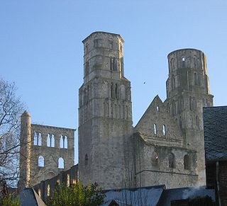
Jumièges is a commune in the Seine-Maritime department in the Normandy region in north-western France.
Taverny is a commune in the northwestern suburbs of Paris, France. It is located 21.2 km (13.2 mi) from the center of Paris.

Viry-Châtillon is a commune in the southern suburbs of Paris, France. It is located 20.9 km (13.0 mi) from the center of Paris.

Camiers is a commune in the Pas-de-Calais department in Hauts-de-France in France.

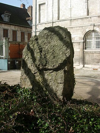
Castagnac is a commune in the Haute-Garonne department in southwestern France.

Arrosès is a commune in the Pyrénées-Atlantiques department in the Nouvelle-Aquitaine region of south-western France.
Guisy is a commune in the Pas-de-Calais département in the Hauts-de-France region of France.

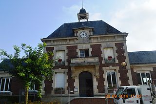
Saint-Léonard is a commune in the Pas-de-Calais department in the Hauts-de-France region of France.
Anguilcourt-le-Sart is a commune in the department of Aisne in the Hauts-de-France region of northern France.
Barbuise is a commune in the Aube department in the Grand Est region of north-central France.

Togny-aux-Bœufs is a commune in the Marne department in Grand Est, in the north-east of France.

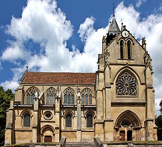
Perrecy-les-Forges is a commune in the Saône-et-Loire department in the region of Bourgogne-Franche-Comté in eastern France. It played a significant regional influence in the 14th-16th centuries.

Yzengremer is a commune in the Somme département in Hauts-de-France in northern France.

A commune is the third-level administrative unit in Mali. Mali is divided into eight regions and one capital district (Bamako). These subdivisions bear the name of their principal city. The regions are divided into 49 cercles. The cercles and the district are divided into 703 communes, with 36 urban communes and 667 rural communes, while some larger cercles still contain arrondissements above the commune level, these are organisational areas with no independent power or office. Rural communes are subdivided into villages, while urban communes are subdivided into quartier. Communes usually bear the name of their principal town. The capital, Bamako, consists of six urban communes. There were initially 701 communes until Law No. 01-043 of 7 June 2001 created two new rural communes in the desert region in the north east of the country: Alata, Ménaka Cercle in the Gao Region and Intadjedite, Tin-Essako Cercle in the Kidal Region.

