
A village is a clustered human settlement or community, larger than a hamlet but smaller than a town, with a population typically ranging from a few hundred to a few thousand. Alhough villages are often located in rural areas, the term urban village is also applied to certain urban neighborhoods. Villages are normally permanent, with fixed dwellings; however, transient villages can occur. Further, the dwellings of a village are fairly close to one another, not scattered broadly over the landscape, as a dispersed settlement.

Urbanization refers to the population shift from rural to urban areas, the corresponding decrease in the proportion of people living in rural areas, and the ways in which societies adapt to this change. It is predominantly the process by which towns and cities are formed and become larger as more people begin living and working in central areas.

In general, a rural area or a countryside is a geographic area that is located outside towns and cities. Typical rural areas have a low population density and small settlements. Agricultural areas and areas with forestry typically are described as rural. Different countries have varying definitions of rural for statistical and administrative purposes.
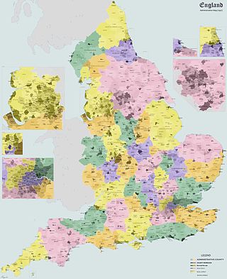
Rural districts were a type of local government area – now superseded – established at the end of the 19th century in England, Wales, and Ireland for the administration of predominantly rural areas at a level lower than that of the administrative counties.

In 13 German states, the primary administrative subdivision higher than a Gemeinde (municipality) is the Landkreis or Kreis. Most major cities in Germany are not part of any Kreis, but instead combine the functions of a municipality and a Kreis; such a city is referred to as a kreisfreie Stadt or Stadtkreis.
Selsoviet is a shortened name for a rural council and for the area governed by such a council (soviet). The full names for the term are, in Belarusian: се́льскi саве́т, Russian: се́льский сове́т, Ukrainian: сільська́ ра́да. Selsoviets were the lowest level of administrative division in rural areas in the Soviet Union. After the dissolution of the Soviet Union, they were preserved as a third tier of administrative-territorial division throughout Ukraine, Belarus, and some of the federal subjects of Russia.

The gmina is the principal unit of the administrative division of Poland, similar to a municipality. As of 1 January 2019, there were 2,477 gminas throughout the country, encompassing over 43,000 villages. 940 gminas include cities and towns, with 302 among them constituting an independent urban gmina consisting solely of a standalone town or one of the 107 cities, the latter governed by a city mayor.
The classification system of inhabited localities in Russia and some other post-Soviet states has certain peculiarities compared with those in other countries.
A bakhsh is a third-level administrative division of Iran. While sometimes translated as "county," it is more accurately translated as "district," similar to a township in the United States or a district of England.

National Bank for Agriculture and Rural Development (NABARD) is an apex regulatory body for overall regulation of regional rural banks and apex cooperative banks in India. It is under the jurisdiction of Ministry of Finance, Government of India. The bank has been entrusted with "matters concerning policy, planning, and operations in the field of credit for agriculture and other economic activities in rural areas in India". NABARD is active in developing and implementing financial inclusion.
Ambohimanambola is a town and commune in Madagascar. It belongs to the district of Betafo, which is a part of Vakinankaratra Region. The population of the commune was estimated to be approximately 21,000 in 2001 commune census.

Regional Rural Banks (RRBs) are government owned scheduled commercial banks of India that operate at regional level in different states of India. These banks are under the ownership of Ministry of Finance, Government of India. They were created to serve rural areas with basic banking and financial services. However, RRBs also have urban branches.

In India, a Community development block or simply Block is a sub-division of Tehsil, administratively earmarked for planning and development. The area is administered by a Block Development Officer (BDO), supported by several technical specialists and village-level workers. A community development block covers several gram panchayats, the local administrative units at the village level.

A sampy is an amulet or idol of spiritual and political importance among numerous ethnic groups in Madagascar. Amulets and idols fashioned from assorted natural materials have occupied an important place among many Malagasy communities for centuries. Sampy can be classified into two categories. Those that are meant to bless and protect an entire community by serving as a deity figure, and individual amulets that people wear on their person as protection. The latter are called Ody. The Sampy are sometimes considered autonomous beings; having their own name, their own characteristics, their own purposes, their own conditions and even their own home. Among the most famous are Ikelimaza, Rafantaka and Ramahavaly.
The Antelomita Hydroelectric Power Station is located in the rural commune Anjeva Gara of the Analamanga Region, Madagascar. The hydroelectric power station comprises two parts, Antelomita I and II. Both are adjacent to one another on separate water falls along the Ikopa River. Each water fall is dammed and water is diverted to the power station; each of which contains three 1.4 megawatts (1,900 hp) generators. The first two were commissioned in 1930, the second two in 1952 and the final two in 1953. Both stages have an installed capacity of 8.4 megawatts (11,300 hp). They were built by a French firm but are now owned and operated by Jirama. The Tsiazompaniry and Mantasoa Dams upstream regulate water to the power station.

A gaunpalika is an administrative division in Nepal. The Ministry of Federal Affairs and Local Development dissolved the existing village development committees and announced the establishment of this new local body. It is a sub-unit of a district. There are currently 460 rural municipalities.
Antananarivo-Avaradrano is a district of Analamanga in Madagascar.


