Tanambao Marivorahona Marivorahona | |
---|---|
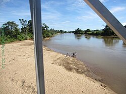
Manajeba River at Marivorahona | |
Coordinates: 13°5′S49°5′E / 13.083°S 49.083°E | |
Country | |
Region | Diana |
District | Ambilobe |
Elevation [1] | 24 m (79 ft) |
Population (2001) [2] | |
• Total | 9,462 |
Time zone | EAT (UTC3) |
Marivorahona or Tanambao Marivorahona is a municipality (French : commune, Malagasy : kaominina) in northern Madagascar. It belongs to the district of Ambilobe, which is a part of Diana Region.
French is a Romance language of the Indo-European family. It descended from the Vulgar Latin of the Roman Empire, as did all Romance languages. French evolved from Gallo-Romance, the spoken Latin in Gaul, and more specifically in Northern Gaul. Its closest relatives are the other langues d'oïl—languages historically spoken in northern France and in southern Belgium, which French (Francien) has largely supplanted. French was also influenced by native Celtic languages of Northern Roman Gaul like Gallia Belgica and by the (Germanic) Frankish language of the post-Roman Frankish invaders. Today, owing to France's past overseas expansion, there are numerous French-based creole languages, most notably Haitian Creole. A French-speaking person or nation may be referred to as Francophone in both English and French.
Malagasy is an Austronesian language and the national language of Madagascar. Most people in Madagascar speak it as a first language as do some people of Malagasy descent elsewhere.
Madagascar, officially the Republic of Madagascar, and previously known as the Malagasy Republic, is an island country in the Indian Ocean, approximately 400 kilometres off the coast of East Africa. The nation comprises the island of Madagascar and numerous smaller peripheral islands. Following the prehistoric breakup of the supercontinent Gondwana, Madagascar split from the Indian subcontinent around 88 million years ago, allowing native plants and animals to evolve in relative isolation. Consequently, Madagascar is a biodiversity hotspot; over 90% of its wildlife is found nowhere else on Earth. The island's diverse ecosystems and unique wildlife are threatened by the encroachment of the rapidly growing human population and other environmental threats.
It is situated some 15 km north of Ambilobe at the Route nationale 6 in the fertile plains of the Manajeba River.
Ambilobe[amˌbilʷˈbe] is a city in Madagascar. It belongs to the district of Ambilobe, which is a part of Diana Region. The town is the capital of Ambilobe district, and according to 2001 census the population was approximately 56,000.
The Manajeba River is located in northern Madagascar. Its sources are situated near in the Tsaratanana Massif, it crosses the Route nationale 6 near Tanambao Marivorahona and flows into the Indian Ocean.
According to 2001 census the population of Tanambao Marivorahona was 9462. [2]
A census is the procedure of systematically acquiring and recording information about the members of a given population. The term is used mostly in connection with national population and housing censuses; other common censuses include agriculture, business, and traffic censuses. The United Nations defines the essential features of population and housing censuses as "individual enumeration, universality within a defined territory, simultaneity and defined periodicity", and recommends that population censuses be taken at least every 10 years. United Nations recommendations also cover census topics to be collected, official definitions, classifications and other useful information to co-ordinate international practice.
Only primary schooling is available in town. The majority (94%) of the population are farmers. The most important crops are sugarcane and tomato, while other important agricultural products are cotton, sweet potato and rice. Industry and services both provide employment for 3% of the population. [2]
Sugarcane, or sugar cane, are several species of tall perennial true grasses of the genus Saccharum, tribe Andropogoneae, native to the warm temperate to tropical regions of South, Southeast Asia, and New Guinea, and used for sugar production. It has stout, jointed, fibrous stalks that are rich in the sugar sucrose, which accumulates in the stalk internodes. The plant is two to six metres tall. All sugar cane species can interbreed and the major commercial cultivars are complex hybrids. Sugarcane belongs to the grass family Poaceae, an economically important seed plant family that includes maize, wheat, rice, and sorghum, and many forage crops.
The tomato is the edible, often red, berry of the nightshade Solanum lycopersicum, commonly known as a tomato plant. The species originated in western South America. The Nahuatl word tomatl gave rise to the Spanish word tomate, from which the English word tomato derived. Its use as a cultivated food may have originated with the indigenous peoples of Mexico. The Spanish encountered the tomato from their contact with the Aztec during the Spanish colonization of the Americas and brought it to Europe. From there, the tomato was introduced to other parts of the European-colonized world during the 16th century.
Cotton is a soft, fluffy staple fiber that grows in a boll, or protective case, around the seeds of the cotton plants of the genus Gossypium in the mallow family Malvaceae. The fiber is almost pure cellulose. Under natural conditions, the cotton bolls will increase the dispersal of the seeds.
Coordinates: 13°5′S49°5′E / 13.083°S 49.083°E
A geographic coordinate system is a coordinate system that enables every location on Earth to be specified by a set of numbers, letters or symbols. The coordinates are often chosen such that one of the numbers represents a vertical position and two or three of the numbers represent a horizontal position; alternatively, a geographic position may be expressed in a combined three-dimensional Cartesian vector. A common choice of coordinates is latitude, longitude and elevation. To specify a location on a plane requires a map projection.
This Diana Region of Madagascar location article is a stub. You can help Wikipedia by expanding it. |
Antsohimbondrona is a municipality in Madagascar. It belongs to the district of Ambilobe, which is a part of Diana Region. According to 2001 census the population of Antsohimbondrona was 32080.
Mantaly is a town and commune in Madagascar. It belongs to the district of Ambilobe, which is a part of Diana Region. According to 2001 commune census the population of Mantaly was 14,420.
Manambato is a municipality in Madagascar. It belongs to the district of Ambilobe, which is a part of Diana Region. It is situated at the Mahavavy River.
Betsihaka or Betsiaka is a town and commune in Madagascar. It belongs to the district of Ambilobe, which is a part of Diana Region. According to 2001 commune census the population of Betsihaka was 10,661.
Beramanja is a town and commune in Madagascar. It belongs to the district of Ambilobe, which is a part of Diana Region. According to 2001 commune census the population of Beramanja was 26,273.
Antsaravibe is a municipality in Madagascar. It belongs to the district of Ambilobe, which is a part of Diana Region. According to 2001 census the population of Antsaravibe was 10648.
Anjiabe Ambony is a town and commune in Madagascar. It belongs to the district of Ambilobe, which is a part of Diana Region. According to 2001 commune census the population of Anjiabe Ambony was 5,285.
Anaborano Ifasy is a municipality in Madagascar. It belongs to the district of Ambilobe, which is a part of Diana Region. According to 2001 census the population of Anaborano Ifasy was 24852.
Ampondralava is a municipality in Madagascar. It belongs to the district of Ambilobe, which is a part of Diana Region. According to 2001 census the population of Ampondralava was 6381.
Ambodibonara is a municipality in Madagascar. It belongs to the district of Ambilobe, which is a part of Diana Region. According to 2001 census the population of Ambodibonara was 6418.
Ambarakaraka is a town and commune in Madagascar. It belongs to the district of Ambilobe, which is a part of Diana Region. According to 2001 commune census the population of Ambarakaraka was 16114.
Ambalan'anjavy is a town and commune in Madagascar. It belongs to the district of Ambilobe, which is a part of Diana Region. According to 2001 commune census the population of Ambalan'anjavy was 3,743.
Ambakirano is a town and commune in Madagascar. It belongs to the district of Ambilobe, which is a part of Diana Region. According to 2001 commune census the population of Ambakirano was 16,000.
Anivorano Nord or Anivorano Avaratra is a municipality in Madagascar. It belongs to the district of Antsiranana II, which is a part of Diana Region. According to 2001 census the population of Anivorano Nord was 15,000.
Tanambao Daoud or Tanambao is a town and commune in northern Madagascar. It belongs to the district of Sambava, which is a part of Sava Region. The population of the commune was estimated to be approximately 10,000 in 2001 commune census.
Daraina is a town and commune in northern Madagascar. It belongs to the district of Vohemar, which is a part of Sava Region. The city is located at the unpaved part of the Route Nationale 5a between Vohemar and Ambilobe.
Maromokotra is a town and commune in northern Madagascar. It is situated at the unpaved Route Nationale 5a halfway between Ambilobe and Daraina, near the Saharenana River. It belongs to the district of Vohemar, which is a part of the Sava Region. The population of the commune was estimated to be approximately 4,000 in the 2001 commune census.
Tanambao Besakay is a town and commune in Madagascar. It belongs to the district of Ambatondrazaka, which is a part of Alaotra-Mangoro Region. The population of the commune was estimated to be approximately 10,000 in 2001 commune census.
Naninora is a town and commune in Madagascar. It belongs to the district of Betroka, which is a part of Anosy Region. The population of the commune was estimated to be approximately 2,000 in 2001 commune census.