According to 2001 census the population of Manambato was 7000.[2]
Only primary schooling is available in town. The majority (99%) of the population are farmers. The most important crop is rice, while other important products are maize, seeds of catechu and vanilla. Services provide employment for 1% of the population.[2]
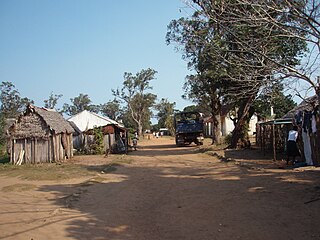
Mangaoka is a rural municipality in Madagascar. It belongs to the district of Antsiranana II, which is a part of Diana Region. It is situated at the Indian Ocean, in northern Madagascar.
Antsatsaka is a municipality in Madagascar. It belongs to the district of Ambanja, which is a part of Diana Region. According to 2001 census the population of Antsatsaka was 10,214.
Ambatoafo is a town and commune in northern Madagascar. It belongs to the district of Sambava, which is a part of Sava Region. The population of the commune was estimated to be approximately 6,000 in 2001 commune census.
Ambalasatrana is a town and commune in northern Madagascar. It belongs to the district of Vohemar, which is a part of Sava Region. The population of the commune was estimated to be approximately 5,000 in 2001 commune census.
Andravory is a town and commune in northern Madagascar. It belongs to the district of Vohemar, which is a part of Sava Region. The population of the commune was estimated to be approximately 5,000 in 2001 commune census.
Daraina is a town and commune in northern Madagascar. It belongs to the district of Vohemar, which is a part of Sava Region. The city is located at the unpaved part of the Route Nationale 5a between Vohemar and Ambilobe.
Belambo is a town and commune in northern Madagascar. It belongs to Vohemar District, which is a part of Sava Region. The population of the commune was estimated to be approximately 6,000 in 2001 commune census.
Antanambaon'amberina is a town and commune in Madagascar. It belongs to the district of Mandritsara, which is a part of Sofia Region. The population of the commune was estimated to be approximately 6,000 in 2001 commune census.
For other places called Ambatoharanana, please see: Ambatoharanana (disambiguation)
Ambohibe is a rural municipality in Madagascar. It belongs to the district of Vavatenina, which is a part of Analanjirofo Region. The population of the commune was estimated to be approximately 16,000 in 2001 commune census.
For the river with the same name, see Manambolo (disambiguation)
Rantabe is a rural municipality in Madagascar. It belongs to the district of Maroantsetra, which is a part of Analanjirofo Region. The population of the commune was estimated to be approximately 20,000 in 2001 commune census.
Maromiandra is a rural municipality in Madagascar. It belongs to the district of Toliara II, which is a part of Atsimo-Andrefana Region. The population of the commune was estimated to be approximately 8,000 in 2001.
Anjeky Ankilikira is a town and commune in Madagascar. It belongs to the district of Ambovombe, which is a part of Androy Region. The population of the commune was estimated to be approximately 10,000 in 2001 commune census.
Vohimanitra is a town and commune in Madagascar. It belongs to the district of Manakara, which is a part of Vatovavy-Fitovinany Region. The population of the commune was estimated to be approximately 6,000 in 2001 commune census.
Manantenina is a rural municipality in Madagascar. It belongs to the district of Taolanaro, which is a part of Anosy Region.
Mahavelo is a town and commune in Madagascar. It belongs to the district of Farafangana, which is a part of Atsimo-Atsinanana Region. The population of the commune was estimated to be approximately 8,000 in 2001 commune census.
Ambohimilanja is a town and commune within the district of Manandriana, in the region of Amoron'i Mania, Madagascar. The population of the commune was estimated to be approximately 6,000 in the 2001 commune census.
Sadabe is a town and commune in Madagascar. It belongs to the district of Manjakandriana, which is a part of Analamanga Region. The population of the commune was estimated to be approximately 17,000 in 2001 commune census.
Soavinandriana is a town and commune in Madagascar. It belongs to the district of Manjakandriana, which is a part of Analamanga Region. The population of the commune was estimated to be approximately 3,000 in 2001 commune census.
This page is based on this Wikipedia article Text is available under the CC BY-SA 4.0 license; additional terms may apply. Images, videos and audio are available under their respective licenses.