
The International Hydrographic Organization (IHO) is an intergovernmental organisation representing hydrography. As of May 2022 the IHO comprised 98 Member States.

The Taiwan Strait is a 180-kilometer -wide strait separating the island of Taiwan and continental Asia. The strait is part of the South China Sea and connects to the East China Sea to the north. The narrowest part is 130 km wide.

The Java Sea is an extensive shallow sea on the Sunda Shelf, between the Indonesian islands of Borneo to the north, Java to the south, Sumatra to the west, and Sulawesi to the east. Karimata Strait to its northwest links it to the South China Sea. It is a part of the western Pacific Ocean.

Davis Sea is an area of the sea along the coast of East Antarctica between West Ice Shelf in the west and the Shackleton Ice Shelf in the east, or between 82° and 96°E. The name "Davis Sea" appears in most leading geographically authoritative publications such as the 2014 10th edition World Atlas from the National Geographic Society and the 2014 12th edition of the Times Atlas of the World, unlike neighboring proposed water body names such as the Russian-proposed Cooperation Sea to the west.

Shackleton Ice Shelf is an extensive ice shelf fronting the coast of East Antarctica from 95° E to 105° E. It extends for an along-shore distance of about 384 kilometres (239 mi), projecting seaward about 145 kilometres (90 mi) in the western portion and 64 kilometres (40 mi) in the east. It occupies an area of 33,820 square kilometres (13,058 sq mi). It is part of Mawson Sea and separates the Queen Mary Coast to the west from the Knox Coast of Wilkes Land to the east.

Denman Glacier is a glacier 11 to 16 km wide, descending north some 110 km (70 mi), which debouches into the Shackleton Ice Shelf east of David Island, Queen Mary Land. It was discovered in November 1912 by the Western Base party of the Australasian Antarctic Expedition under Sir Douglas Mawson. Mawson named the glacier for Lord Denman, Governor-General of Australia in 1911, a patron of the expedition.

The Australasian Antarctic Expedition was a 1911–1914 expedition headed by Douglas Mawson that explored the largely uncharted Antarctic coast due south of Australia. Mawson had been inspired to lead his own venture by his experiences on Ernest Shackleton's Nimrod expedition in 1907–1909. During its time in Antarctica, the expedition's sledging parties covered around 4,180 kilometres (2,600 mi) of unexplored territory, while its ship, SY Aurora, navigated 2,900 kilometres (1,800 mi) of unmapped coastline. Scientific activities included meteorological measurements, magnetic observations, an expansive oceanographic program, and the collection of many biological and geological samples, including the discovery of the first meteorite found in Antarctica. The expedition was the first to establish and maintain wireless contact between Antarctica and Australia. Another planned innovation – the use of an aircraft – was thwarted by an accident before the expedition sailed. The plane's fuselage was adapted to form a motorised sledge or "air-tractor", but it proved to be of very limited use.
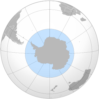
Pobeda Ice Island, original Russian name остров Победы, is an ice island in the Mawson Sea. It is located 160 km (99 mi) off the coast of Queen Mary Land, East Antarctica. This island, which exists periodically, is formed by the running aground of a tabular iceberg.

The Western Base Party was a successful exploration party of the Australasian Antarctic Expedition. The eight-man Western Party was deposited by the SY Aurora on the Shackleton Ice Shelf at Queen Mary Land. The leader of the team was Frank Wild and the party included the geologist Charles Hoadley.
The Southern Ocean, also known as the Antarctic Ocean, comprises the southernmost waters of the World Ocean, generally taken to be south of 60° S latitude and encircling Antarctica. As such, it is regarded as the second-smallest of the five principal oceanic divisions: smaller than the Pacific, Atlantic, and Indian oceans but larger than the Arctic Ocean. Over the past 30 years, the Southern Ocean has been subject to rapid climate change, which has led to changes in the marine ecosystem.

The borders of the oceans are the limits of Earth's oceanic waters. The definition and number of oceans can vary depending on the adopted criteria. The principal divisions of the five oceans are the Pacific Ocean, Atlantic Ocean, Indian Ocean, Southern (Antarctic) Ocean, and Arctic Ocean. Smaller regions of the oceans are called seas, gulfs, bays, straits, and other terms. Geologically, an ocean is an area of oceanic crust covered by water.

King Haakon VII Sea is a proposed name for part of the Southern Ocean on the coast of East Antarctica.
Cooperation Sea, also called Commonwealth Sea (erratum) or Sodruzhestvo Sea, is a proposed sea name for part of the Southern Ocean, between Enderby Land and West Ice Shelf (85°E), off the coast of MacRobertson Land and Princess Elizabeth Land. It would stretch over an area of 258,000 km². It would be bordered by the Davis Sea on the east, and by another Russian proposal to the 2002 International Hydrographic Organization (IHO) draft, a Cosmonauts Sea to the west.
The Cosmonauts Sea was a proposed sea name as part of the Southern Ocean, off the Prince Olav Coast and Enderby Land, Antarctica, between about 30°E and 50°E. It would have an area of 699,000 square kilometres (270,000 sq mi). It would be bordered by two other proposals from a 2002 International Hydrographic Organization (IHO) draft, a Cooperation Sea to the east, and to the west a Riiser-Larsen Sea.
Somov Sea was a proposed name for part of the Southern Ocean. It would be located north of the easternmost part of the Antarctic subcontinent East Antarctica, north of Oates Coast, Victoria Land, and of George V Coast, between 150° and 170° East. West of it would be the D'Urville Sea. East of Cape Adare, at 170°14' East, is the Ross Sea.

The Lazarev Sea is a proposed name for a marginal sea of the Southern Ocean. It would be bordered by two proposals from a 2002 International Hydrographic Organization (IHO) draft, a King Haakon VII Sea to the west and a Riiser-Larsen Sea to the east, or between the Prime Meridian of 0° and 14°E. It would stretch over an area of 929,000 km2 (359,000 sq mi).
The Riiser-Larsen Sea is one of the marginal seas located in the Southern Ocean off East Antarctica and south of the Indian Ocean. It is delimited Astrid Ridge in the west and the Gunnerus Ridge and the Kainanmaru Bank in the east. It is bordered by the Lazarev Sea to the west and the Cosmonauts Sea to the east, or between 14°E and 30°E. Its northern border is defined to be the 65th parallel south. The name, proposed by the Soviet Union, was never officially approved by the International Hydrographic Organization (IHO).

The Natuna Sea is an extensive shallow sea located around the Natuna Regency, extended from south of the Riau Islands, east of the Lingga Regency and west of Borneo, to the Bangka Belitung Islands. The islands of the Badas and Tambelan Archipelago are located at its center. Mostly located within Indonesian territorial waters, this sea is the southernmost portion of the South China Sea, and geologically is the part of Sunda Shelf. It communicates with the Java Sea to its southeast via the Karimata and Gaspar Strait east and west of Belitung, and with the Strait of Malacca to the west via the Berhala and Singapore Strait.

The Iceland Sea is a small body of water delimited by the Jan Mayen fracture zone to the north, Greenland to the west, the Denmark Strait to the south, and the Jan Mayen Ridge to the east. Depths usually range from 500 to 2,000 meters but can be shallower on the Continental shelf of East Greenland. The Kolbeinsey Ridge crosses the Iceland Sea, dividing it into eastern and western parts.

