Bay of Fundy

Last updated
Bay of Fundy
Baie de Fundy
Wpdms nasa topo bay of fundy - en.jpg
The Bay of Fundy
Nova Scotia topographic map.png
Red pog.svg
Bay of Fundy
Location New Brunswick, Nova Scotia, Maine
Coordinates 45°00′N65°45′W / 45.000°N 65.750°W / 45.000; -65.750
Type Estuary
EtymologyLikely from the French Fendu, meaning "split".
Primary inflows Canada and USA
River sources Big Salmon, Magaguadavic, Memramcook, Petitcodiac, Quiddy, Saint John, St. Croix, Upper Salmon, Annapolis, Avon, Cornwallis, Farrells, Salmon, Shubenacadie, Kennetcook
Primary outflows Gulf of Maine
Ocean/sea sourcesAtlantic Ocean
References

The Bay of Fundy (French : Baie de Fundy) is a bay between the Canadian provinces of New Brunswick and Nova Scotia, with a small portion touching the U.S. state of Maine. It is an arm of the Gulf of Maine. Its tidal range is the highest in the world. [1] The name is probably a corruption of the French word fendu, meaning 'split'. [2]

Contents

Hydrology

Bay of Fundy High Tide.jpg
Bay of Fundy Low Tide.jpg
Alma, New Brunswick, at high and low tide

Tides

The tidal range in the Bay of Fundy is about 16 metres (52 ft); the average tidal range worldwide is only one metre (3.3 ft). Some tides are higher than others, depending on the position of the moon, the sun, and atmospheric conditions. [3] Tides are semidiurnal, meaning they have two highs and two lows each day, [3] with about six hours and 13 minutes between each high and low tide. [3]

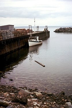
Because of tidal resonance in the funnel-shaped bay, the tides that flow through the channel are very powerful. In one 12-hour tidal cycle, about 100 billion tonnes (110 billion short tons) of water flows in and out of the bay, which is twice as much as the combined total flow of all the rivers of the world over the same period. [4] The Annapolis Royal Generating Station, a 20  MW tidal power station on the Annapolis River upstream of Annapolis Royal, was, until its shutdown in 2019, [5] one of the few tidal generating stations in the world, and the only one in North America. [6]

Most of the rivers that drain into the Bay of Fundy have a tidal bore, a wave front of the incoming tide that "bores" its way up a river against its normal flow. Notable tidal bores include those on the Petticodiac, Maccan, St. Croix, and Kennetcook rivers. [7] Before the construction of a causeway in 1968 and subsequent siltation of the river, the Petitcodiac River had one of the world's largest tidal bores, up to two metres (6.6 ft) high. Since the opening of the causeway gates in 2010, the bore has been coming back, and in 2013 surfers rode it a record-breaking 29 kilometres (18 mi). [8]

Other tidal phenomena include the Reversing Falls near the mouth of the Saint John River, a rip tide at Cape Enrage, and the Old Sow whirlpool at Passamaquoddy Bay. [7]

Geology

The story of the Fundy Basin begins about 200 million years ago in the early Jurassic, when all land on earth was part of a supercontinent called Pangaea. At that time what is now the Maritimes was situated near the equator and had a warm tropical climate and lush vegetation. [9] As continental drift reshaped the world, rift valleys formed, including the CobequidChedabucto fault system.

During the continental breakup, magma erupted as basaltic lavas and left igneous rock formations such as the columnar jointing which can be seen on Brier and Grand Manan islands, among other places around the bay. These flows often are the sites of rarer mineral deposits including agate, amethyst, and stilbite, the latter being the provincial mineral of Nova Scotia. [9]

These rifts filled with sediment which became sedimentary rock. Many fossils have been found along the Fundy shoreline. The oldest dinosaur fossil in Canada was found at Burntcoat Head. Very early reptiles have been discovered in Carboniferous tree trunks at Joggins. Wasson Bluff has a rich trove of Jurassic fossils.

The bay is a member of the Global Geoparks Network, [10] a UNESCO initiative to promote and conserve the planet's geological heritage.

Flora and fauna

Although some land areas are protected, there is no formal marine protection zone in the bay. [11] The Conservation Council of New Brunswick works to protect the ecosystem of the bay. [12] [13] A result of shipping traffic has been the potential for increased collisions between ships and the critically endangered North Atlantic right whale. In 2003, the Canadian Coast Guard adjusted shipping lanes crossing prime whale feeding areas at the entrance to the Bay of Fundy to lessen the risk of collision. Many other marine mammals are found in the bay including fin whales, humpback whales, minke whales, Atlantic white-sided dolphin and the harbour porpoise.

The Bay of Fundy mudflats are a rare and unique intertidal habitat. Major mudflats are found on around the Maringouin Peninsula which lies between Shepody Bay and the Cumberland Basin and at the northern end of Chignecto Bay. On the Nova Scotia side, mudflats are found on the southern side of the Minas Basin and in Cobequid Bay. In the Minas Basin, the size of the mudflats from low to high water marks is as much as 4 km (2.5 mi). [14] Due to tidal turbulence, the water in these area contains very high amounts of fine sediment, source from tidal erosion of Carboniferous and Triassic sedimentary rock. Primary producers include hollow green weed, phytoplankton, algae, and sea lettuce.

Protected areas include:

Human geography and history

History

Fort Edward (built 1750), Windsor, Nova Scotia--the oldest blockhouse in North America FortEdwardWindsorNovaScotiaCanada.JPG
Fort Edward (built 1750), Windsor, Nova Scotia—the oldest blockhouse in North America

The Miꞌkmaq fished in the Bay of Fundy and lived in communities around the bay for centuries before the first Europeans arrived. According to Miꞌkmaq legend, the tide was created when Glooscap wanted to take a bath. [23]

The first European to visit the bay may have been Portuguese explorer João Álvares Fagundes in about 1520, although the bay does not appear on Portuguese maps until 1558. [24] The first European settlement was French, founded at Saint Croix Island in Maine, and then Port Royal, founded by Pierre Dugua and Samuel de Champlain in 1605. Champlain named it Labaye Francoise [25] [26] (The French Bay). Champlain describes finding an old rotted cross in the bay which may have been left by the Portuguese. [24]

The village was the first permanent European settlement north of the Spanish St. Augustine, Florida, and predated by two years the first permanent British settlement in Jamestown, Virginia. About 75 years later, Acadians spread out along the bay, founding Grand-Pré, Beaubassin, Cobequid, and Pisiguit. [27]

There was much military action and many attacks on the settlements around the bay, first as the French and British fought for control of the area, leading to the expulsion of the Acadians, and later by Americans during the American Revolution and the War of 1812. [28]

In the 19th century, the bay was the site of much shipping, and shipbuilders flourished, including James Moran of St. Martins, New Brunswick, Joseph Salter, of Moncton, and William D. Lawrence of Maitland, Nova Scotia. Fundy ports produced the fastest ship in the world, Marco Polo; the largest wooden ship ever built in Canada, William D. Lawrence; and the first female sea captain in the western world, Molly Kool. The mystery ship Mary Celeste was also built there.

The highest water level ever recorded, 21.6 metres (71 feet), occurred in October 1869. It caused extensive destruction to ports and communities, much of which was attributed to a two-metre storm surge created by the Saxby Gale, a tropical cyclone, which coincided with a perigean spring tide. Waves breached dykes protecting low-lying farmland in the Minas Basin and the Tantramar Marshes, sending ocean waters surging far inland.

Settlements

The largest population centre on the bay is Saint John, New Brunswick, a major port and the first incorporated city in what is now Canada. [29] [30] Other settlements include, in New Brunswick, St. Andrews, Blacks Harbour, Grand Manan, Campobello, Fundy-St. Martins, Alma, Riverside-Albert, Hopewell Cape, and Sackville, and in Nova Scotia, Amherst, Advocate Harbour, Parrsboro, Truro, Maitland, Cheverie, Windsor, Wolfville, Canning, Annapolis Royal, and Digby.

Saint John, NB, is the only major city on the Bay of Fundy. Saint John, NB, skyline at dusk8.jpg
Saint John, NB, is the only major city on the Bay of Fundy.

Ports and shipping

Grand Manan V ferry at North Head, Grand Manan Island GMV 11June2008.jpg
Grand Manan V ferry at North Head, Grand Manan Island

The port of Saint John gives access to the pulp and paper industry and the Irving oil refinery. Hantsport, Nova Scotia, also has a pulp and paper mill and ships gypsum to the United States.

The bay is also traversed by ferries:

Related Research Articles

<span class="mw-page-title-main">Passamaquoddy Bay</span> International inlet of the Bay of Fundy

Passamaquoddy Bay is an inlet of the Bay of Fundy, between the U.S. state of Maine and the Canadian province of New Brunswick, at the mouth of the St. Croix River. Most of the bay lies within Canada, with its western shore bounded by Washington County, Maine. The southernmost point is formed by West Quoddy Head on the U.S. mainland in Lubec, Maine; and runs northeasterly through Campobello Island, New Brunswick, engulfing Deer Island, New Brunswick, to the New Brunswick mainland head at L'Etete, New Brunswick in Charlotte County, New Brunswick.

<span class="mw-page-title-main">Minas Basin</span>

The Minas Basin is an inlet of the Bay of Fundy and a sub-basin of the Fundy Basin located in Nova Scotia, Canada. It is known for its extremely high tides.

<span class="mw-page-title-main">Cobequid Bay</span> Inlet in Nova Scotia, Canada

Cobequid Bay is an inlet of the Bay of Fundy and the easternmost part of the Minas Basin, located in the Canadian province of Nova Scotia. The bay was carved by rivers flowing into the eastern end of the Bay of Fundy.

<span class="mw-page-title-main">Chignecto Bay</span>

Chignecto Bay is an inlet of the Bay of Fundy located between the Canadian provinces of New Brunswick and Nova Scotia and separated from the waters of the Northumberland Strait by the Isthmus of Chignecto. It is a unit within the greater Gulf of Maine Watershed. Chignecto Bay forms the northeastern part of the Bay of Fundy which splits at Cape Chignecto and is delineated on the New Brunswick side by Martin Head. Chignecto Bay is a Ramsar site.

<span class="mw-page-title-main">Grand-Pré, Nova Scotia</span> Community in Nova Scotia, Canada

Grand-Pré is a Canadian rural community in Kings County, Nova Scotia. Its French name translates to "Great/Large Meadow" and the community lies at the eastern edge of the Annapolis Valley several kilometres east of the town of Wolfville on a peninsula jutting into the Minas Basin surrounded by extensive dyked farm fields, framed by the Gaspereau and Cornwallis Rivers. The community was made famous by Henry Wadsworth Longfellow's poem Evangeline and is today home to the Grand-Pré National Historic Site. On June 30, 2012, the Landscape of Grand-Pré was named a World Heritage Site by UNESCO.

The Glooscap Trail is a scenic roadway in the Canadian province of Nova Scotia.

The Fundy Shore Ecotour is a former scenic drive and network of tourist destinations in the Canadian province of Nova Scotia and encircles several sub-basins of the Bay of Fundy, which contains the highest tidal range on the planet.

<span class="mw-page-title-main">Cumberland Basin (Canada)</span>

Cumberland Basin is an inlet and northeasternmost part of the Bay of Fundy, located on the border between the Canadian provinces of Nova Scotia and New Brunswick.

<span class="mw-page-title-main">Geography of New Brunswick</span>

New Brunswick is one of Canada's three Maritime provinces. While New Brunswick is one of Canada's Maritime Provinces, it differs from its neighbours both ethnoculturally and physiographically. Both Nova Scotia and Prince Edward Island are either wholly or nearly surrounded by water and the ocean, therefore, tends to define their climate, economy and culture. New Brunswick, on the other hand, although having a significant seacoast, is sheltered from the Atlantic Ocean proper and has a large interior that is removed from oceanic effects. New Brunswick, therefore, tends to be defined by its rivers rather than its seacoast.

<span class="mw-page-title-main">Geography of Nova Scotia</span>

Nova Scotia is a province located in Eastern Canada fronting the Atlantic Ocean. One of the Maritime Provinces, Nova Scotia's geography is complex, despite its relatively small size in comparison to other Canadian provinces.

<span class="mw-page-title-main">Nova Scotia peninsula</span> Peninsula in Nova Scotia

The Nova Scotia peninsula is a peninsula on the Atlantic coast of North America. It is called Enmigtaqamu'g in the Mi'kmaw language.

<span class="mw-page-title-main">Cape Chignecto Provincial Park</span> Provincial park in Nova Scotia, Canada

Cape Chignecto Provincial Park is a Canadian provincial park located in Nova Scotia. A wilderness park, it derives its name from Cape Chignecto, a prominent headland which divides the Bay of Fundy with Chignecto Bay to the north and the Minas Channel leading to the Minas Basin to the east. The park, which opened in 1998, is the largest provincial park in Nova Scotia. It also anchors one end of the UNESCO Cliffs of Fundy Global Geopark.

<span class="mw-page-title-main">Partridge Island (Nova Scotia)</span>

Partridge Island is a significant historical, cultural and geological site located near the mouth of Parrsboro Harbour and the town of Parrsboro on the Minas Basin, in Cumberland County, Nova Scotia, Canada. It attracts many visitors including sightseers, swimmers, photographers, hikers and amateur geologists. Partridge Island is actually a peninsula that is connected to the mainland by a sandbar isthmus. According to local legend, the isthmus was created during the Saxby Gale of 1869. The hiking trail to the top of the island affords scenic views of key landforms on the Minas Basin including Cape Blomidon, Cape Split and Cape Sharp. The nearby Ottawa House By-the-Sea Museum contains artifacts and exhibits illustrating the history of the former village at Partridge Island, which dates from the 1770s. Partridge Island is a favourite hunting ground for rockhounds because its ancient sandstone and basalt cliffs are steadily eroded by the fast-moving currents of the world's highest tides. Rocks and debris worn away from its cliffs are dragged down the beach making it possible to find gemstones, exotic-looking zeolite minerals and fossils. Fossil hunters are warned, however, that although one or two loose specimens may be collected, Nova Scotia law requires that they be sent or taken to a museum for further study, and no fossils may be excavated from bedrock without a permit.

<span class="mw-page-title-main">Mary's Point</span> Wetland in Albert County, New Brunswick, Canada

Mary's Point is a 12 square kilometres (4.6 sq mi) wetland in Albert County, New Brunswick, Canada. It is at the head of the Bay of Fundy, just outside the small community of Harvey and approximately 40 km (25 mi) south of Moncton. Designated a Ramsar wetland of international importance on May 24, 1982, it is also part of the Fundy biosphere reserve established in 2007, which also contains the Shepody Bay wetland. It was also the first Canadian site in the Western Hemisphere Shorebird Reserve, as part of the Bay of Fundy Hemisphere Shorebird Reserve. It is within the Shepody Bay National Wildlife Area, which is administered by the Canadian Wildlife Service.

<span class="mw-page-title-main">Eatonville, Nova Scotia</span> Ghost town in Nova Scotia, Canada

Eatonville is a former lumber and shipbuilding village in Cumberland County, Nova Scotia. It includes a large tidal harbour at the mouth of the Eatonville Brook beside several dramatic sea stacks known as the "Three Sisters". It was founded in 1826 and abandoned in the 1940s. The site of the village is now part of Cape Chignecto Provincial Park.

<span class="mw-page-title-main">Fundy Basin</span> Sediment-filled rift basin on the Atlantic coast of southeastern Canada

The Fundy Basin is a sediment-filled rift basin on the Atlantic coast of southeastern Canada. It contains three sub-basins; the Fundy sub-basin, the Minas Basin and the Chignecto Basin. These arms meet at the Bay of Fundy, which is contained within the rift valley. From the Bay of Fundy, the Minas Basin trends northeast to Nova Scotia. Chignecto Bay runs from the Bay of Fundy northwest between New Brunswick and Nova Scotia which is separated from the waters of the Northumberland Strait by the Isthmus of Chignecto. The Fundy Basin is best known for the bay it contains. The Bay of Fundy is home to huge tidal changes and tidal bores. It is part of the system of Eastern North America Rift Basins.

<span class="mw-page-title-main">Isle Haute</span>

Isle Haute is an island in the upper regions of Bay of Fundy in Nova Scotia, near the entrance to the Minas Basin. It is 16 kilometers from Harbourville and eight kilometers south-southwest of Cape Chignecto. The island is part of Cumberland County, Nova Scotia and is three kilometres (1.9 mi) long and 400 metres (1,300 ft) wide. The Mi'kmaq used the island to make stone tools before Europeans arrived and called the island "Maskusetik", meaning place of wild beans, hidden oats. In 1604, Samuel de Champlain gave the present name to the island, which means "High Island" in French, when he observed the towering bluffs, timber and fresh-water springs. The steep 100 m (328 ft) basalt cliffs of the island are the result from volcanic eruptions in the Jurassic period and may have been connected to the North Mountain volcanic ridge on the mainland 200 million years ago, before the Bay of Fundy was formed.

<span class="mw-page-title-main">Cape d'Or</span> Lighthouse

Cape d'Or is a headland located near Advocate, Cumberland County, on the Bay of Fundy coast of the Canadian province of Nova Scotia.

The Fundy Shore Scenic Drive is a scenic drive in the Canadian province of Nova Scotia. It located along the northeastern portion of the Bay of Fundy, following the Chignecto Peninsula which separates Chignecto Bay and Minas Basin, an area which contains the highest tidal range on the planet.

References

  1. National Ocean Service,
  2. Garrett, Chris; Koslow, Tony; Singh, Rabindra (March 25, 2015) [July 8, 2010]. "Fundy, Bay of and Gulf of Maine". The Canadian Encyclopedia (online ed.). Historica Canada.
  3. 1 2 3 "The Bay of Fundy is a 160 billion tonne wonder. Here's why". Tourism New Brunswick. Government of New Brunswick. 2018-05-02. Retrieved 7 June 2019.
  4. "Why are the Bay of Fundy Hides so High?". www.bayfundy.net. Retrieved 15 June 2019.
  5. Paul Withers. "Nova Scotia Power to pull plug on tidal station, seeks $25M from ratepayers". CBC News. Retrieved 26 June 2023.
  6. "Annapolis Tidal Station". Nova Scotia Power. Archived from the original on 1 July 2019. Retrieved 1 July 2019.
  7. 1 2 "The tidal bore". Bay of Fundy. Retrieved 15 June 2019.
  8. "Surfers set record after 29 km ride on Moncton tidal bore". CBC. Retrieved 18 June 2019.
  9. 1 2 Atlantic Geoscience Society (2001). The Last Billion Years: a Geological History of the Maritime Provinces of Canada. Nimbus Pub. pp.  126–134. ISBN   1-55109-351-0.
  10. "UNESCO Global Geoparks – Cliffs of Fundy Aspiring Global Geopark – Tidal Landscapes on an Ancient Shoreline". Cliffs of Fundy aspiring Geopark. Retrieved 15 June 2019.
  11. "FAQ". Canadian Parks and Wilderness Society. Retrieved 19 June 2019.
  12. "Marine Conservation". Conservation Council of New Brunswick. 2013-02-17. Archived from the original on 2019-06-21. Retrieved 21 June 2019.
  13. 1 2 "South Wolf Island Nature Preserve". Nature Trust of New Brunswick. Archived from the original on 16 June 2020. Retrieved 19 June 2019.
  14. "Bay of Funday Mudflats". Fundy Biosphere. Archived from the original on 29 September 2022. Retrieved 20 June 2019.
  15. "Boot Island National Wildlife Area". Government of Canada. 2011-12-21. Retrieved 20 June 2019.
  16. "Chignecto National Wildlife Area". Government of Canada. 2011-12-21. Retrieved 20 June 2019.
  17. "Grindstone Island Conservation Easement". Nature Trust of New Brunswick. Archived from the original on 16 June 2020. Retrieved 19 June 2019.
  18. "Isle Haute National Wildlife Area". Government of Canada. 23 April 2019. Retrieved 19 June 2019.
  19. "John Lusby Marsh National Wildlife Area". Government of Canada. 2011-12-21. Retrieved 20 June 2019.
  20. "Raven Head Wilderness Area". Government of Nova Scotia. 1 April 2009. Retrieved 19 June 2019.
  21. "Shepody National Wildlife Area". Government of Canada. 2011-12-21. Retrieved 20 June 2019.
  22. "Tintamarre National Wildlife Area". Government of Canada. 2011-12-21. Retrieved 20 June 2019.
  23. "Mi'kmaq Heritage". Bay of Fundy. 1 February 2011. Retrieved 15 June 2019.
  24. 1 2 "European Contact and Mapping". Mount Allison University. Archived from the original on 24 June 2019. Retrieved 23 July 2019.
  25. Map of the northeast coast of North America, 1607, drawn by Samuel de Champlain, umaine.edu
  26. Champlain's 1607 Map of New England, old-maps.com
  27. Faragher, John Mack (2005). A Great and Noble Scheme: The Tragic Story of the Expulsion of the French Acadians from Their American Homeland . W.W Norton & Company. pp.  110–112. ISBN   978-0-393-05135-3.
  28. Smith, Joshua (2011). Battle for the Bay: The Naval War of 1812. Fredericton, NB: Goose Lane Editions. pp. passim. ISBN   978-0-86492-644-9.
  29. "Port Saint John reports 2016 tonnage". Archived from the original on July 28, 2017. Retrieved July 23, 2017.
  30. "Saint John". Canadian Encyclopedia. Retrieved June 12, 2017.

See also

  1. "Welcome to Campobello Island". VisitCampobello.com. Retrieved 21 June 2019.