Related Research Articles

Phillips is a town in Franklin County, Maine, United States. The population was 898 at the 2020 census. It is home to the Sandy River and Rangeley Lakes Railroad, a heritage railroad.

Roxbury is a town in Oxford County, Maine, United States. The population was 361 at the 2020 census. Ellis Pond is popular with recreational fishermen.

The Sandy River and Rangeley Lakes Railroad (SR&RL) was a 2 ft narrow gauge common carrier railroad that operated approximately 112 miles (180 km) of track in Franklin County, Maine. The former equipment from the SR&RL continues to operate in the present day on a revived, short segment of the railway in Phillips, Maine.
The Western Lakes and Mountains region spans most of Maine's western border with New Hampshire. A small part of the scenic White Mountain National Forest is located in this area. The region consists of Oxford County, Androscoggin County, Franklin County, as well as northern York and interior Cumberland counties. The largest cities in the region are Lewiston and Auburn. Notable towns include Bethel, Bridgton, Oxford, Rangeley, and Rumford. Many of the state's highest peaks are located in the region, although the highest, Mount Katahdin, is not.
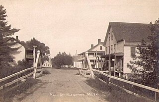
Flagstaff is a ghost town and former town in Somerset County, Maine, United States, near the existing town of Eustis and approximately 20 miles north of Rangeley.
The Northern Forest Canoe Trail (NFCT) is a 740-mile (1,190 km) marked canoeing trail in the northeastern United States and Canada, extending from Old Forge in the Adirondacks of New York to Fort Kent, Maine. Along the way, the trail also passes through the states and provinces of Vermont, Quebec, and New Hampshire. The trail was opened on June 3, 2006.

The Carrabassett River, a tributary of the Kennebec River, is located in Franklin County and Somerset County, Maine, in the United States. It rises near Sugarloaf Mountain, east of Rangeley Lake, and runs for 33.8 miles (54.4 km), flowing southeast past Kingfield and joining the Kennebec River in the town of Anson.
Rapid River is a 6.0-mile-long (9.7 km) river in the northwestern portion of the US state of Maine flowing from Lower Richardson Lake to Umbagog Lake. Despite its short length, it forms the end of a major portion of the Umbagog Lake and Androscoggin River watersheds. Much of this watershed is covered by Lower and Upper Richardson Lakes, Mooselookmeguntic Lake, Cupsuptic Lake and Rangeley Lake. The major tributaries of this system are the Cupsuptic, Kennebago and Rangeley rivers, all of which flow into Cupsuptic Lake.

Orgonon was the 175-acre (71 ha) home, laboratory and research center of the Austrian-born psychiatrist Wilhelm Reich (1897–1957). Located in Rangeley, Maine, it is Reich's burial place, and is open to the public as the Wilhelm Reich Museum. Its main building, designed by James B. Bell and built for Reich in 1948, is listed on the National Register of Historic Places, and is a significant example of International Style architecture in the state. The name is derived from the hypostatized term "orgone", Reich's principal area of study in his later years.

The Maine Central Railroad Rumford Branch is a railroad line in Maine now operated as part of the Pan Am Railways system. The Rumford Branch leaves the mainline at Leeds Junction and continues northwest up the Androscoggin River valley, passing through Livermore Falls and terminating at Rumford. The branch comprises the remaining trackage of three earlier branches:
The Dead River is a tributary of the Androscoggin River in western Maine in the United States. The river flows from Androscoggin Lake, northwest through the town of Leeds 7 miles (11 km) to the Androscoggin.
The Bear River is a 2.7-mile-long (4.3 km) tributary of Long Lake in the U.S. state of Maine. It originates at the outlet of Bear Pond in the town of Waterford in Oxford County, then flows southeast into the town of Bridgton in Cumberland County and finally the town of Harrison, where it reaches Long Lake. Via Long Lake, the Songo River, and Sebago Lake, the Bear River is part of the Presumpscot River watershed, flowing to Casco Bay on the Atlantic Ocean.
The Little Androscoggin River is a 51.4-mile-long (82.7 km) river in Maine. It flows from Bryant Pond in Woodstock to its confluence with the Androscoggin River in Auburn. The Androscoggin flows into Merrymeeting Bay in the Kennebec River estuary.
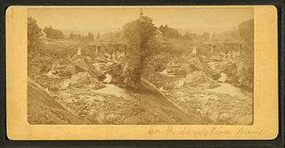
The Sandy River is a 73.3-mile-long (118.0 km) tributary of the Kennebec River in the U.S. state of Maine.
The South Branch Dead River is a 26.3-mile-long (42.3 km) tributary of the Dead River in Franklin County, Maine.
The Swift Cambridge River is a 15.3-mile-long (24.6 km) river in northwestern Maine. It rises near the New Hampshire border, north of Grafton Notch, and flows north to the Dead Cambridge River, a tributary of Umbagog Lake. The Androscoggin River flows from Umbagog to the tidal Kennebec River in Maine.
The Swift River is a 26.7-mile-long (43.0 km) river in western Maine. It is a tributary of the Androscoggin River, which flows to the Kennebec River near its mouth at the Atlantic Ocean.

Rangeley is a town in Franklin County, Maine, United States. The population was 1,222 at the 2020 census. Rangeley is the center of the Rangeley Lakes Region, a resort area. The town includes the villages of Rangeley and Oquossoc, as well as the communities of Mooselookmeguntic, Bald Mountain, Mountainview, and South Rangeley.
Stephen A. Bean Municipal Airport is a town owned, public use airport located two nautical miles (4 km) northwest of the central business district of Rangeley, a town in Franklin County, Maine, United States. It is included in the National Plan of Integrated Airport Systems for 2011–2015, which categorized it as a general aviation facility.
Rangeley Lake Seaplane Base is a privately owned, public use seaplane base on Rangeley Lake, located two nautical miles (4 km) north of the central business district of Rangeley, a town in Franklin County, Maine, United States.
References
- ↑ U.S. Geological Survey. National Hydrography Dataset high-resolution flowline data. The National Map, accessed June 30, 2011
44°58′13.6″N70°46′33.5″W / 44.970444°N 70.775972°W