West Branch Pleasant River (Pleasant River tributary)

Last updated
West Branch Pleasant River
Location
Country United States
Physical characteristics
Source 
 - location Maine

The West Branch Pleasant River is a 7.5-mile-long (12.1 km) [1] tributary of the Pleasant River in the U.S. state of Maine. It is part of the Androscoggin River watershed, which flows to the tidal Kennebec River near its mouth at the Atlantic Ocean.

Tributary stream or river that flows into a main stem river or lake

A tributary or affluent is a stream or river that flows into a larger stream or main stem river or a lake. A tributary does not flow directly into a sea or ocean. Tributaries and the main stem river drain the surrounding drainage basin of its surface water and groundwater, leading the water out into an ocean.

U.S. state constituent political entity of the United States

In the United States, a state is a constituent political entity, of which there are currently 50. Bound together in a political union, each state holds governmental jurisdiction over a separate and defined geographic territory and shares its sovereignty with the federal government. Due to this shared sovereignty, Americans are citizens both of the federal republic and of the state in which they reside. State citizenship and residency are flexible, and no government approval is required to move between states, except for persons restricted by certain types of court orders. Four states use the term commonwealth rather than state in their full official names.
Maine State of the United States of America

Maine is a state in the New England region of the northeastern United States. Maine is the 12th smallest by area, the 9th least populous, and the 38th most densely populated of the 50 U.S. states. It is bordered by New Hampshire to the west, the Atlantic Ocean to the southeast, and the Canadian provinces of New Brunswick and Quebec to the northeast and northwest respectively. Maine is the easternmost state in the contiguous United States, and the northernmost state east of the Great Lakes. It is known for its jagged, rocky coastline; low, rolling mountains; heavily forested interior; and picturesque waterways, as well as its seafood cuisine, especially lobster and clams. There is a humid continental climate throughout most of the state, including in coastal areas such as its most populous city of Portland. The capital is Augusta.

The river rises at Haystack Notch in the unorganized territory of South Oxford within the White Mountain National Forest and flows northeast, joining the East Branch at the South Oxford-Bethel town line to form the Pleasant River.

South Oxford, Maine

South Oxford is an unorganized territory located in Oxford County, Maine, United States. The population was 515 at the 2000 census. The unorganized territory encompasses the areas designated under state law as Albany Township, Mason Township, and Batchelder's Grant. Albany and Mason were formerly incorporated as towns. Albany disincorporated in 1937 while Mason disincorporated in 1935.

White Mountain National Forest

The White Mountain National Forest (WMNF) is a federally managed forest contained within the White Mountains in the northeastern United States. It was established in 1918 as a result of the Weeks Act of 1911; federal acquisition of land had already begun in 1914. It has a total area of 750,852 acres (303,859 ha). Most of the WMNF is in New Hampshire; a small part is in the neighboring state of Maine. While often casually referred to as a park, this is a National Forest, used not only for hiking, camping, and skiing, but for logging and other limited commercial purposes. The WMNF is the only National Forest located in either New Hampshire or Maine. Most of the major peaks over 4,000 feet high for peak-bagging in New Hampshire are located in the National Forest. Over 100 miles (160 km) of the Appalachian Trail traverses the White Mountain National Forest. In descending order of land area the forest lies in parts of Grafton, Coos, and Carroll counties in New Hampshire, and Oxford County in Maine.
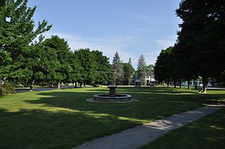
Bethel, Maine Town in Maine, United States

Bethel is a town in Oxford County, Maine, United States. The population was 2,607 at the 2010 census. It includes the villages of West Bethel and South Bethel. The town is home to Gould Academy, a private preparatory school, and is near the Sunday River ski resort.

See also

Related Research Articles

Pleasant River is a 4.7-mile-long (7.6 km) river in Oxford County, Maine in the United States. It is a tributary of the Androscoggin River, which flows east and south to join the Kennebec River in Merrymeeting Bay near the Atlantic Ocean.

The Bear River is a 2.7-mile-long (4.3 km) tributary of Long Lake in the U.S. state of Maine. It originates at the outlet of Bear Pond in the town of Waterford in Oxford County, then flows southeast into the town of Bridgton in Cumberland County and finally the town of Harrison, where it reaches Long Lake. Via Long Lake, the Songo River, and Sebago Lake, the Bear River is part of the Presumpscot River watershed, flowing to Casco Bay on the Atlantic Ocean.

The East Branch Eastern River is a 6.5-mile-long (10.5 km) river in Maine. It is part of the Kennebec River watershed. It rises in the town of Whitefield and flows southwest to its confluence with the West Branch Eastern River at East Pittston to form the Eastern River.

The East Branch Nezinscot River is a 19.4-mile-long (31.2 km) river in Maine. It flows from its source on Black Mountain in Peru to its confluence with the West Branch in Buckfield. The resulting river, the Nezinscot, continues east to the Androscoggin River, which flows to the Kennebec River near its mouth at the Atlantic Ocean.

The East Branch Pleasant River is a 6.2-mile-long (10.0 km) tributary of the Pleasant River in the U.S. state of Maine. The Pleasant River is a tributary of the Androscoggin River, which flows southeast to the tidal Kennebec River and the Atlantic Ocean.

The East Branch Swift River is a 10.2-mile-long (16.4 km) tributary of the Swift River in western Maine. Via the Swift River, it is part of the Androscoggin River watershed, which flows to the Kennebec River and ultimately the Atlantic Ocean.

The Little Androscoggin River is a 51.4-mile-long (82.7 km) river in Maine. It flows from Bryant Pond in Woodstock to its confluence with the Androscoggin River in Auburn. The Androscoggin flows into Merrymeeting Bay in the Kennebec River estuary.

The Sanborn River is a 5.8-mile-long (9.3 km) river in Maine. It flows from its source on Round Mountain in the unorganized territory of South Oxford to Hicks Pond in the town of Greenwood. Hicks Pond drains via Niles Brook into the Little Androscoggin River, the Androscoggin River, and thence into Merrymeeting Bay in the Kennebec River estuary.

The South Branch Marsh River is a 3.0-mile-long (4.8 km) tidal river in the towns of Prospect and Frankfort in Waldo County, Maine. It joins the North Branch Marsh River to form Marsh Bay, a short arm of the tidal Penobscot River.

The South Branch Sunday River is a 2.5-mile-long (4.0 km) mountain stream in western Maine. It is a tributary of the Sunday River, which flows to the Androscoggin River and ultimately to the Kennebec River and the Atlantic Ocean.

The Swift River is a 26.7-mile-long (43.0 km) river in western Maine. It is a tributary of the Androscoggin River, which flows to the Kennebec River near its mouth at the Atlantic Ocean.

Webb River river in the United States of America

The Webb River is a 16.8-mile-long (27.0 km) river in western Maine. It is a tributary of the Androscoggin River, which flows to the Kennebec River and ultimately the Atlantic Ocean.

The West Branch Carrabassett River is a short tributary of the Carrabassett River in Franklin County, Maine. From the confluence of Quick Stream with a small stream in Salem, the river runs 11.1 miles (17.9 km) northeast to its mouth in Kingfield.

The West Branch Eastern River is a 10.4-mile-long (16.7 km) tributary of the Eastern River in Maine. It is part of the Kennebec River watershed. The West Branch begins near South Windsor and flows southwest through the town of Whitefield, joining the East Branch at East Pittston to form the Eastern River.

The West Branch Ellis River is a 13.5-mile-long (21.7 km) river in western Maine. It is a tributary of the Ellis River, which flows to the Androscoggin River and ultimately to the Kennebec River near its mouth at the Atlantic Ocean.

The West Branch Nezinscot River is an 18.7-mile-long (30.1 km) river in Maine. It flows from Shagg Pond in Woodstock to its confluence with the East Branch in Buckfield. The resulting river, the Nezinscot, flows east to the Androscoggin River, which in turn flows southeast to the Kennebec River near its mouth at the Atlantic Ocean.

The West Branch Pleasant River is a tributary of the Pleasant River in Washington County, Maine. From the confluence of Branch Brook and Bells Brook in southeast Columbia, the river meanders 2.3 miles (3.7 km) south to the estuary of the Pleasant River at Addison.

The West Branch Swift River is a 6.4-mile-long (10.3 km) tributary of the Swift River in western Maine. Via the Swift River, it is part of the Androscoggin River watershed, flowing to the Kennebec River and ultimately the Atlantic Ocean.

The West Branch Tenmile River is a 5.0-mile-long (8.0 km) tributary of the Tenmile River in western Maine. It is part of the Saco River watershed, flowing to the Atlantic Ocean.

The Western Little River, or the Northwest Branch, is a tributary of the Pleasant River in Washington County, Maine. From its source in Maine Township 18, MD, BPP, the river runs 11.2 miles (18.0 km) southeast and south to its confluence with the Pleasant River, at Little River Corner in Columbia.

References

  1. U.S. Geological Survey. National Hydrography Dataset high-resolution flowline data. The National Map, accessed June 30, 2011

Coordinates: 44°21′59″N70°50′55″W / 44.36645°N 70.84868°W / 44.36645; -70.84868

Geographic coordinate system Coordinate system

A geographic coordinate system is a coordinate system that enables every location on Earth to be specified by a set of numbers, letters or symbols. The coordinates are often chosen such that one of the numbers represents a vertical position and two or three of the numbers represent a horizontal position; alternatively, a geographic position may be expressed in a combined three-dimensional Cartesian vector. A common choice of coordinates is latitude, longitude and elevation. To specify a location on a plane requires a map projection.