Webb River

Last updated
Webb River
Webb River, Dixfield, ME.jpg
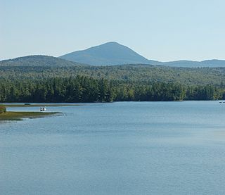
Scene at Dixfield in 1910
Location
Country United States
Physical characteristics
Source 
 - location Maine

The Webb River is a 16.8-mile-long (27.0 km) [1] river in western Maine. It is a tributary of the Androscoggin River, which flows to the Kennebec River and ultimately the Atlantic Ocean.

Maine State of the United States of America

Maine is a state in the New England region of the northeastern United States. Maine is the 12th smallest by area, the 9th least populous, and the 38th most densely populated of the 50 U.S. states. It is bordered by New Hampshire to the west, the Atlantic Ocean to the southeast, and the Canadian provinces of New Brunswick and Quebec to the northeast and northwest respectively. Maine is the easternmost state in the contiguous United States, and the northernmost state east of the Great Lakes. It is known for its jagged, rocky coastline; low, rolling mountains; heavily forested interior; and picturesque waterways, as well as its seafood cuisine, especially lobster and clams. There is a humid continental climate throughout most of the state, including in coastal areas such as its most populous city of Portland. The capital is Augusta.

Androscoggin River river in New Hampshire and Maine, United States

The Androscoggin River is a river in the U.S. states of Maine and New Hampshire, in northern New England. It is 178 miles (286 km) long and joins the Kennebec River at Merrymeeting Bay in Maine before its water empties into the Gulf of Maine on the Atlantic Ocean. Its drainage basin is 3,530 square miles (9,100 km2) in area. The name "Androscoggin" comes from the Eastern Abenaki term /aləssíkɑntəkw/ or /alsíkɑntəkw/, meaning "river of cliff rock shelters" ; or perhaps from Penobscot /aləsstkɑtəkʷ/, meaning "river of rock shelters". The Anglicization of the Abenaki term is likely an analogical contamination with the colonial governor Edmund Andros.

Kennebec River river in Maine, United States

The Kennebec River is a 170-mile-long (270 km) river within the U.S. state of Maine.

The Webb River begins at the outlet of Webb Lake near the southern border of the town of Weld and flows south, quickly entering the town of Carthage, where it turns southwest, then south again. The southernmost 6 miles (10 km) of the river forms the boundary between the towns of Mexico and Dixfield. The river enters the Androscoggin just west of the village of Dixfield. The entire course of the river is paralleled by Maine Route 142.

Webb Lake (Maine) lake of the United States of America

Webb Lake is a lake in the town of Weld in Franklin County, Maine.

Weld, Maine Town in Maine, United States

Weld is a town in Franklin County, Maine, United States. The population was 419 at the 2010 census. Set beside Webb Lake and almost surrounded by mountains, Weld is noted for its scenic beauty. It is home to Mount Blue State Park, Camp Kawanhee for Boys, and Camp Lawroweld.

Carthage, Maine Town in Maine, United States

Carthage is a town in Franklin County, Maine, United States. The population was 560 at the 2010 census.

See also

Related Research Articles

Pleasant River is a 4.7-mile-long (7.6 km) river in Oxford County, Maine in the United States. It is a tributary of the Androscoggin River, which flows east and south to join the Kennebec River in Merrymeeting Bay near the Atlantic Ocean.

Sunday River (Androscoggin River tributary) river in Maine, United States of America

Sunday River is a 14.1-mile-long (22.7 km) river in Oxford County, Maine in the United States. It is a tributary of the Androscoggin River, which flows east and south to join the Kennebec River in Merrymeeting Bay near the Atlantic Ocean.

The Dead River is a tributary of the Androscoggin River in western Maine in the United States. The river flows from Androscoggin Lake, northwest through the town of Leeds 7 miles (11 km) to the Androscoggin. This sluggish river is the outlet of a chain of ponds, of which Androscoggin Pond is the largest and last. The river has the rare power of running either way at different times. Upon a sudden rise of the Androscoggin River, the flow sets back the current of Dead River into the pond. It sometimes flows into the pond for three or four days.

The Ellis River is a 23-mile-long (37 km) river in Oxford County in western Maine. It is a tributary of the Androscoggin River.

The Bear River is a 14.6-mile-long (23.5 km) tributary of the Androscoggin River in the U.S. state of Maine. It rises in Grafton Notch at the northeastern end of the Mahoosuc Range and flows southeast, joining the Androscoggin in the town of Newry. Maine Route 26 follows the entire course of the river.

The Concord River is a 7.8-mile-long (12.6 km) tributary of the Androscoggin River in western Maine. The Androscoggin flows east and southeast to the Kennebec River near its mouth at the Atlantic Ocean.

The East Branch Nezinscot River is a 19.4-mile-long (31.2 km) river in Maine. It flows from its source on Black Mountain in Peru to its confluence with the West Branch in Buckfield. The resulting river, the Nezinscot, continues east to the Androscoggin River, which flows to the Kennebec River near its mouth at the Atlantic Ocean.

The East Branch Pleasant River is a 6.2-mile-long (10.0 km) tributary of the Pleasant River in the U.S. state of Maine. The Pleasant River is a tributary of the Androscoggin River, which flows southeast to the tidal Kennebec River and the Atlantic Ocean.

The East Branch Swift River is a 10.2-mile-long (16.4 km) tributary of the Swift River in western Maine. Via the Swift River, it is part of the Androscoggin River watershed, which flows to the Kennebec River and ultimately the Atlantic Ocean.

The Little Androscoggin River is a 51.4-mile-long (82.7 km) river in Maine. It flows from Bryant Pond in Woodstock to its confluence with the Androscoggin River in Auburn. The Androscoggin flows into Merrymeeting Bay in the Kennebec River estuary.

The Sabattus River is an 11.4-mile-long (18.3 km) tributary of the Androscoggin River in Maine. It rises at the outlet of Sabattus Pond in the town of Sabattus and flows south into the town of Lisbon, reaching the Androscoggin just southeast of Lisbon Center and about 1.5 miles (2.4 km) upstream (northwest) of Lisbon Falls. Via the Androscoggin River, water from the Sabattus River flows to the Kennebec River at Merrymeeting Bay and ultimately to the Atlantic Ocean.

The Sanborn River is a 5.8-mile-long (9.3 km) river in Maine. It flows from its source on Round Mountain in the unorganized territory of South Oxford to Hicks Pond in the town of Greenwood. Hicks Pond drains via Niles Brook into the Little Androscoggin River, the Androscoggin River, and thence into Merrymeeting Bay in the Kennebec River estuary.

The South Branch Sunday River is a 2.5-mile-long (4.0 km) mountain stream in western Maine. It is a tributary of the Sunday River, which flows to the Androscoggin River and ultimately to the Kennebec River and the Atlantic Ocean.

The Swift Cambridge River is a 15.3-mile-long (24.6 km) river in northwestern Maine. It rises near the New Hampshire border, north of Grafton Notch, and flows north to the Dead Cambridge River, a tributary of Umbagog Lake. The Androscoggin River flows from Umbagog to the tidal Kennebec River in Maine.

The Swift River is a 26.7-mile-long (43.0 km) river in western Maine. It is a tributary of the Androscoggin River, which flows to the Kennebec River near its mouth at the Atlantic Ocean.

The West Branch Ellis River is a 13.5-mile-long (21.7 km) river in western Maine. It is a tributary of the Ellis River, which flows to the Androscoggin River and ultimately to the Kennebec River near its mouth at the Atlantic Ocean.

The West Branch Nezinscot River is an 18.7-mile-long (30.1 km) river in Maine. It flows from Shagg Pond in Woodstock to its confluence with the East Branch in Buckfield. The resulting river, the Nezinscot, flows east to the Androscoggin River, which in turn flows southeast to the Kennebec River near its mouth at the Atlantic Ocean.

The West Branch Pleasant River is a 7.5-mile-long (12.1 km) tributary of the Pleasant River in the U.S. state of Maine. It is part of the Androscoggin River watershed, which flows to the tidal Kennebec River near its mouth at the Atlantic Ocean.

The West Branch Swift River is a 6.4-mile-long (10.3 km) tributary of the Swift River in western Maine. Via the Swift River, it is part of the Androscoggin River watershed, flowing to the Kennebec River and ultimately the Atlantic Ocean.

References

  1. U.S. Geological Survey. National Hydrography Dataset high-resolution flowline data. The National Map, accessed June 30, 2011

Coordinates: 44°31′52″N70°27′34″W / 44.53117°N 70.45951°W / 44.53117; -70.45951

Geographic coordinate system Coordinate system

A geographic coordinate system is a coordinate system that enables every location on Earth to be specified by a set of numbers, letters or symbols. The coordinates are often chosen such that one of the numbers represents a vertical position and two or three of the numbers represent a horizontal position; alternatively, a geographic position may be expressed in a combined three-dimensional Cartesian vector. A common choice of coordinates is latitude, longitude and elevation. To specify a location on a plane requires a map projection.