Success is an unincorporated township in Coös County, New Hampshire, United States. It is located directly to the east of the city of Berlin, and borders on the state of Maine. Success is part of the Berlin, NH-VT Micropolitan Statistical Area.
Dix Mountain is a mountain in the Dix Range of the Adirondack Mountains of New York. With an elevation of 4,840 feet (1,480 m), it is the sixth highest peak in New York and one of the 46 High Peaks of the Adirondack Park. It is located roughly on the boundary between the towns of North Hudson and Keene in Essex County. The crest of the peak consists of a very narrow ridge, which continues to the southeast and rises to a subsidiary peak named Beckhorn, then continues south to other peaks of the Dix Range. The summit is also in an alpine zone above the treeline. The ridge offers unobstructed views of Elk Lake to the southwest, the Great Range to the northwest, and Lake Champlain and the Green Mountains to the east.

South Twin Mountain is a mountain located in Grafton County, New Hampshire, United States. The mountain is part of the Twin Range of the White Mountains. South Twin forms the high point of a north–south ridge, with North Twin Mountain lying approximately one mile to the north and Mount Guyot two miles (3 km) to the southeast. Galehead Mountain, a lower spur of South Twin, is to the west.

Mount Moosilauke is a 4,802-foot-high (1,464 m) mountain at the southwestern end of the White Mountains in the town of Benton, New Hampshire, United States. It is the tenth highest and most southwesterly of the 4,000 foot summits in the White Mountains.

Wildcat Mountain is a mountain located in Coos County, northern New Hampshire, United States. The mountain is part of the Carter-Moriah Range of the White Mountains, on the east side of Pinkham Notch. Wildcat Mountain faces Carter Dome across Carter Notch to the northeast, and Mount Washington across Pinkham Notch to the west.

Mount Carrigain is a mountain located in Grafton County, New Hampshire. The mountain is named after Phillip Carrigain, NH Secretary of State (1805–10), and is on the south side of the Pemigewasset Wilderness, the source of the East Branch of the Pemigewasset River in the heart of the White Mountains, between Franconia Notch and Crawford Notch. Carrigain is flanked to the northeast beyond Carrigain's Vose Spur by Mount Anderson and Mount Lowell across Carrigain Notch, and to the southwest by Mount Hancock. It has a fire tower at the summit, providing 360 degree views of the surrounding wilderness.

Boott Spur is a minor peak located in Coos County, New Hampshire, United States. The mountain is named after Francis Boott (1792–1863), and is part of the Presidential Range of the White Mountains. Boott Spur stands on the shoulder of Mount Washington, above the south side of the headwall of Tuckerman Ravine.

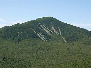
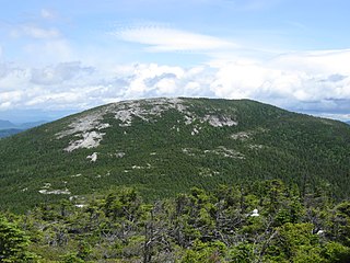
Crocker Mountain is a 4,228 ft (1,289 m) peak located in Carrabassett Valley, Franklin County, Maine, in the United States. Crocker Mountain is the fourth highest mountain in the state after the Katahdins and Sugarloaf Mountain, and is part of the Appalachian Mountains. Crocker Mountain is traversed by the Appalachian Trail (AT), a 2,170 mi (3,490 km) National Scenic Trail from Georgia to Maine.

Smarts Mountain is a 3,238-foot-high (987 m) mountain in the town of Lyme in Grafton County, New Hampshire, United States. Smarts is flanked to the north by Mount Cube, at 2,909 feet (887 m), and to the southwest by Holts Ledge, at 2,110 feet (640 m). Although of only moderate elevation, Smarts is separated from the southwestern White Mountains by Oliverian Notch, a fairly low pass traversed by New Hampshire Route 25 southwest of Mount Moosilauke. That gives Smarts a relative height of 2,190 ft (670 m), which makes it one of twelve mountains in New Hampshire with a prominence over 2,000 ft (610 m).
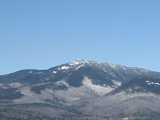
Sunday River Whitecap is a 3,335 ft (1,017 m) mountain located in Oxford County, Maine, United States. It is flanked to the west by Slide Mountain, and to the southeast by Stowe Mountain.
Mount Whiteface is a 4,019 ft (1,225 m) mountain located in Grafton County, New Hampshire. The mountain is part of the Sandwich Range of the White Mountains. Whiteface is flanked to the northwest by Mount Tripyramid, and to the northeast by Mount Passaconaway. Whiteface is on the eastern border of the Sandwich Range Wilderness. To the east, between Whiteface, Passaconaway, and Mt. Wonalancet, lies The Bowl natural area, an unlogged cirque.

North Brother is a mountain located in Baxter State Park, Piscataquis County, Maine. North Brother is flanked to the northeast by Fort Mountain, and to the southwest by South Brother; collectively the two are called "The Brothers."
Snow Mountain is a mountain located in Franklin County, Maine, about 5 mi (8 km) from the Canada–United States border. Snow Mtn. is flanked to the northeast by Bag Pond Mountain, and to the southeast by Round Mountain.
Baldpate Mountain is a mountain located in Oxford County, Maine. Baldpate has two prominent peaks; West Peak has 3,662 feet (1,116 m) of elevation, and stands 222 feet (68 m) above the col between them.
Elephant Mountain is a mountain located in Township C, Oxford County, Maine. Its northeastern end is in Township D, Franklin County. Elephant Mountain is flanked to the northeast by Bemis Mountain, and to the southeast by Old Blue Mountain.

Goose Eye Mountain, also known as Mt. Goose High, is a mountain located in Oxford County, Maine, about 1 mi (1.6 km). (2 km) east of the New Hampshire-Maine border. The mountain is the second-highest peak of the Mahoosuc Range of the White Mountains.

Grafton Notch is a notch, or mountain pass, located in Oxford County, Maine. The notch demarks the northeastern end of the Mahoosuc Range, and thus of the White Mountains. Maine State Route 26 passes through the notch.

Stratton Mountain is a mountain located in Windham County, Vermont, in the Green Mountain National Forest. The mountain is the highest point of Windham County, and of the southern Green Mountains generally. A fire tower located on the summit is generally open for climbing by the public. There is also a small caretaker cabin at the summit that is inhabited in season by a caretaker from the Green Mountain Club. The northern end of the mountain is occupied by Stratton Mountain Resort.
West Kennebago Mountain is a mountain located in Oxford County, Maine. West Kennebago is flanked to the north by Twin Mountains, and to the southwest by Burnt Mountain.

Dixville Notch State Park is a park in northern New Hampshire, United States. The park encompasses 127 acres (51 ha) in Dixville Township where New Hampshire State Route 26 passes through Dixville Notch.