| Noyes Mountain | |
|---|---|
 Noyes Mountain | |
| Highest point | |
| Elevation | 1,503 ft (458 m) [1] |
| Prominence | 743 ft (230 m) [2] |
| Coordinates | 44°17′30″N70°38′19″W / 44.291735°N 70.6386748°W Coordinates: 44°17′30″N70°38′19″W / 44.291735°N 70.6386748°W [1] |
| Geography | |
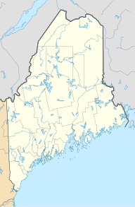
| Location | Oxford County, Maine, U.S. |
| Topo map | USGS Greenwood, ME |
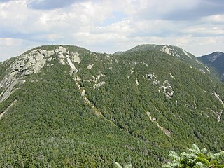
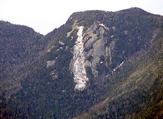
Noyes Mountain is a mountain located in Maine near the town of South Paris. It is named after George Lorenzo Noyes, who built and operated Harvard Quarry located nearby.

Maine is a state in the New England region of the northeastern United States. Maine is the 12th smallest by area, the 9th least populous, and the 38th most densely populated of the 50 U.S. states. It is bordered by New Hampshire to the west, the Atlantic Ocean to the southeast, and the Canadian provinces of New Brunswick and Quebec to the northeast and northwest respectively. Maine is the easternmost state in the contiguous United States, and the northernmost state east of the Great Lakes. It is known for its jagged, rocky coastline; low, rolling mountains; heavily forested interior; and picturesque waterways, as well as its seafood cuisine, especially lobster and clams. There is a humid continental climate throughout most of the state, including in coastal areas such as its most populous city of Portland. The capital is Augusta.

South Paris is a census-designated place (CDP) located within the town of Paris in Oxford County, Maine, in the United States. The population was 2,237 at the 2000 census. While the CDP refers only to the densely settled area in the southern part of the town of Paris, the entire town is located within the South Paris ZIP code, resulting in many residents referring to the entire town as South Paris.
George "Shavey" Lorenzo Noyes was an American mineralogist, naturalist, development critic, writer and landscape artist.
Noyes Mountain stands within the watershed of the Little Androscoggin River, which drains into the Androscoggin River, and thence into Merrymeeting Bay in the Kennebec River estuary. The east and south sides of Noyes Mtn. drain into Pennesseewassee Lake, and thence into Pennesseewassee Stream and the Little Androscoggin River. The northeast side of Noyes Mtn. drains into Niles Brook, and the Little Androscoggin. The west side of Noyes Mtn. drains into Mud Pond, thence into Hicks Pond and Niles Brook.

A drainage basin is any area of land where precipitation collects and drains off into a common outlet, such as into a river, bay, or other body of water. The drainage basin includes all the surface water from rain runoff, snowmelt, and nearby streams that run downslope towards the shared outlet, as well as the groundwater underneath the earth's surface. Drainage basins connect into other drainage basins at lower elevations in a hierarchical pattern, with smaller sub-drainage basins, which in turn drain into another common outlet.
The Little Androscoggin River is a 51.4-mile-long (82.7 km) river in Maine. It flows from Bryant Pond in Woodstock to its confluence with the Androscoggin River in Auburn. The Androscoggin flows into Merrymeeting Bay in the Kennebec River estuary.

The Androscoggin River is a river in the U.S. states of Maine and New Hampshire, in northern New England. It is 178 miles (286 km) long and joins the Kennebec River at Merrymeeting Bay in Maine before its water empties into the Gulf of Maine on the Atlantic Ocean. Its drainage basin is 3,530 square miles (9,100 km2) in area. The name "Androscoggin" comes from the Eastern Abenaki term /aləssíkɑntəkw/ or /alsíkɑntəkw/, meaning "river of cliff rock shelters" ; or perhaps from Penobscot /aləsstkɑtəkʷ/, meaning "river of rock shelters". The Anglicization of the Abenaki term is likely an analogical contamination with the colonial governor Edmund Andros.