Doubletop Mountain (Maine)

Last updated
Doubletop Mountain
Doubletop (2).jpg
Westward view from OJI to Doubletop before Storm August 12, 2004
Highest point
Elevation 3,489 ft (1,063 m)  NGVD 29 [1]
Prominence 2,069 ft (631 m) [1]
Listing New England Fifty Finest #39
Coordinates 45°56′09″N69°03′40″W / 45.9358781°N 69.061159°W / 45.9358781; -69.061159 [2]
Geography
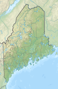
USA Maine relief location map.svg
Red triangle with thick white border.svg
Doubletop Mountain
Parent range Appalachians
Topo map USGS Doubletop Mountain

Doubletop Mountain is a mountain located in Piscataquis County, Maine, in Baxter State Park. According to Fannie Hardy Eckstorm, the mountain's Indigenous name was Psinskihegan-I-Outop. Psinskihegan means notch and I-Outop means head. in 1828 in the Survey of Maine, Moses Greenleaf called the mountain a variation Chinskihegan or Outop. It eventually became Doubletop, named for its two peaks. [3]

Contents

The mountain's two peaks are a north peak (3,489 ft or 1,063 m) and a south peak (3,455 ft or 1,053 m). From the north a trail from the Nesowednehunk Campground to the north peak is 3.1 miles (5.0 km) long and another 0.2 miles (0.32 km) to the south peak. From Foster Field, to the south, a 4-mile (6.4 km) trail leads to the summit. The last third of mile (0.53 km) is steep and climbs about 900 feet (270 m). [4] The north peak is wooded while the south peak is more open.

Beneath north peak, set in the rock, is a south facing bronze memorial tablet which reads:

KEPPELE HALL
JUNE 10, 1872—APRIL 25, 1926
HIS ASHES WERE GIVEN TO THE WINDS
AT THIS PLACE AUGUST 20, 1926, AT
SUNSET, BY HIS WIFE.
LOVE ONLY IS ETERNAL

Keppele Hall's wife, Fanny Hall, was the first American woman to serve as foreman of a grand jury. [5]
Geography

Doubletop Mountain stands within the watershed of Nesowadnehunk Stream, which drains into the West Branch of the Penobscot River, and into Penobscot Bay. It is flanked to the southwest by Squaw's Bosom.

See also

Related Research Articles

<span class="mw-page-title-main">Mount Katahdin</span> Highest mountain in Maine, US

Mount Katahdin is the highest mountain in the U.S. state of Maine at 5,269 feet (1,606 m). Named Katahdin, which means "Great Mountain", by the Penobscot Native Americans, it is within Northeast Piscataquis, Piscataquis County, and is the centerpiece of Baxter State Park. It is a steep, tall massif formed from a granite intrusion weathered to the surface. The flora and fauna on the mountain are typical of those found in northern New England, with the summit hosting fragile and endangered alpine tundra.

<span class="mw-page-title-main">Grays Peak</span> Mountain in the state of Colorado, United States

Grays Peak is the tenth-highest summit of the Rocky Mountains of North America and the U.S. state of Colorado. The prominent 14,278-foot (4352 m) fourteener is the highest summit of the Front Range and the highest point on the Continental Divide and the Continental Divide Trail in North America. Grays Peak is located in Arapahoe National Forest, 3.9 miles (6.2 km) southeast by east of Loveland Pass on the Continental Divide between Clear Creek and Summit counties. The peak is the highest point in both counties.

<span class="mw-page-title-main">Torreys Peak</span> Mountain in the state of Colorado, United States

Torreys Peak is a mountain in the Front Range region of the Rocky Mountains in Colorado. It is one of 53 fourteeners in Colorado. Its nearest major city is Denver. Torreys Peak is located along the Continental Divide, as well as the division between Clear Creek County and Summit County. In the Arapaho language Torrey's Peak and the adjacent Gray's Peak are named, Heeniiyoowuu or "Ant Hills".

<span class="mw-page-title-main">Ben Lomond Mountain (Utah)</span> Mountain in the American state of Utah

Ben Lomond, just north of Ogden, Utah, is a peak in the northern portion of the Wasatch Mountains. A popular trail passes over its summit, accessible from four different trailheads to the north, south, and east.

<span class="mw-page-title-main">Mount Sopris</span> Twin-Peak Mountain in Colorado, United States

Mount Sopris is a twin-summit mountain in the northwestern Elk Mountains range of the Rocky Mountains of North America. The prominent 12,965-foot (3,952 m) mountain is located in the Maroon Bells-Snowmass Wilderness of White River National Forest, 6.6 miles (10.7 km) north by northeast of the community of Redstone in Pitkin County, Colorado, United States.

<span class="mw-page-title-main">Sugarloaf Mountain (Maine)</span> Mountain located in Franklin County, Maine

Sugarloaf Mountain is a ski mountain located in Carrabassett Valley, Franklin County, Maine. It is the third highest peak in the state, after Mount Katahdin's Baxter and Hamlin peaks. Sugarloaf is flanked to the south by Spaulding Mountain.

<span class="mw-page-title-main">North Brother</span>

North Brother is a mountain located in Baxter State Park, Piscataquis County, Maine. North Brother is flanked to the northeast by Fort Mountain, and to the southwest by South Brother; collectively the two are called "The Brothers."

South Brother is a mountain located in Piscataquis County, Maine, in Baxter State Park. South Brother is flanked to the southwest by Mount Coe, and to the northeast by North Brother; collectively the two are called "The Brothers".

<span class="mw-page-title-main">White Cap Mountain (Piscataquis County, Maine)</span> Mountain in Maine

White Cap Mountain is a mountain located in Piscataquis County, Maine. White Cap Mountain is flanked to the east by Hay Mountain, to the south by Big Spruce Mountain and to the southeast by Little Spruce Mountain.

<span class="mw-page-title-main">Traveler Mountain</span> Mountain in Maine, United States

Traveler Mountain is a mountain located in Piscataquis County, Maine, in Baxter State Park. The Traveler, is the eighth-most prominent in Maine. Subsidiary peaks include the Peak of the Ridges 3,225 ft (983 m) North and South Traveler Mountain 3,144 ft (958 m) and 2,677 ft (816 m), respectively.

<span class="mw-page-title-main">Hamlin Peak</span> Mountain in Maine, United States

Hamlin Peak is a 4,756-foot (1,450 m) mountain located in Baxter State Park in Piscataquis County, Maine. Hamlin Peak is a northern spur of the greater Mount Katahdin massif and is flanked to the south by Baxter Peak, and to the north by the Howe Peaks. Since it rises nearly 500 feet (150 m) above the col joining it to the higher Baxter Peak, Hamlin Peak qualifies as a four-thousand footer based on the topographic prominence criterion used by the Appalachian Mountain Club, and is ranked as the second-highest peak in Maine.

<span class="mw-page-title-main">Goose Eye Mountain</span> Mountain in Maine, United States of America

Goose Eye Mountain, also known as Mt. Goose High, is a mountain located in Oxford County, Maine, about 1 mi (1.6 km). (2 km) east of the New Hampshire-Maine border. The mountain is the second-highest peak of the Mahoosuc Range of the White Mountains.

<span class="mw-page-title-main">Mount Coe</span> Mountain in Maine, United States

Mount Coe is a mountain located in Piscataquis County, Maine, within Baxter State Park, about 5.5 mi (9 km) northwest of Mount Katahdin. Mt. Coe is flanked to the northeast by South Brother, and to the southwest by Mount O-J-I. The Mount Coe trail starts at Slide Dam on Newsowdnehunk Stream east bank at around 1,190 ft (360 m). The trail goes up to the east for about 1.2 mi (1.9 km) and then goes right (south) along the drainage from the Mt. Coe slide bending to the east and then northeast. The last 0.5 mi (0.80 km) is up the slide featured on the left margin of the photo where the trail gains around 800 ft (240 m).

Maintop Mountain is a mountain in Nelson County, Virginia. The mountain is a peak on a spur off the main Blue Ridge Mountains, about 2 miles (3 km) east of Elk Pond Mountain, and about 3.5 miles (5.5 km) west of The Priest. The mountain is located in the George Washington National Forest.

<span class="mw-page-title-main">Graham Mountain (New York)</span> Highest privately owned summit in New Yorks Catskill Mountains

Graham Mountain is the seventh highest of the Catskill High Peaks and the highest privately owned mountain in the range. It is located in the town of Hardenburgh, New York, United States.

<span class="mw-page-title-main">Ampersand Mountain</span> Mountain in New York state, United States

Ampersand Mountain is a 3,352 ft (1,021.7 m) mountain in Franklin County in the High Peaks Wilderness Area of the northeastern Adirondacks, west of the High Peaks proper in New York State. The trail up the mountain begins on New York State Route 3 8.1 miles (13.0 km) southwest of the village of Saranac Lake, near Middle Saranac Lake; it is a popular day hike. The mountain takes its name from nearby Ampersand Creek, so named because it twists and turns like the ampersand symbol. The summit is bare rock, with extensive views of the High Peaks to the east and the Saranac Lakes to the west. Stony Creek Mountain is located west-southwest of Ampersand Mountain. The mountain is notable as the land surrounding its hiking trail's initial ascent is generally acknowledged as unlogged old growth forest.

<span class="mw-page-title-main">Braddock Peak</span> Mountain in Colorado, United States

Braddock Peak is a mountain summit in the Never Summer Mountains range of the Rocky Mountains of North America. The 11,972-foot (3,649 m) peak is located in State Forest State Park, 3.0 miles (4.8 km) south-southwest of Cameron Pass in Jackson County, Colorado, United States.

<span class="mw-page-title-main">Sherburne Pass</span>

Sherburne Pass, is a mountain pass in the Green Mountains of Vermont, between 3,957-foot (1,206 m) Pico Peak to the south and 2,782-foot (848 m) Deer Leap Mountain to the north. The height of land of the pass is located in the town of Killington, while its western ascent begins in the town of Mendon.

Borestone Mountain is a mountain in Piscataquis County, Maine. It is a popular hiking spot near the center of the state, with a trailhead located on Mountain Road near Willimantic. The mountain is part of the Borestone Mountain Audubon Sanctuary There are several historic lodges on Midday Pond, run by Maine Audubon.

<span class="mw-page-title-main">West Branch Penobscot River</span> River in the United States

The West Branch Penobscot River is a 117-mile-long (188 km) tributary of the Penobscot River through the North Maine Woods in Maine. The river is also known as Abocadneticook, Kahgognamock, and Kettegwewick.

References

  1. 1 2 "Doubletop Mountain, Maine". Peakbagger.com. Retrieved 2011-05-09.
  2. "Doubletop Mountain". Geographic Names Information System . United States Geological Survey, United States Department of the Interior . Retrieved 2011-05-09.
  3. Pinkham, Steven R. (2009). Mountains of Maine: intriguing stories behind their names (1st ed.). [Camden, ME]: Down East. ISBN   9780892727889. OCLC   297145691.
  4. "Doubletop Mountain". SummitPost.org. Retrieved 2011-05-09.
  5. "Hall, Fanny Southard Hay, 1872- . Papers, 1860-1967: A Finding Aid". Harvard University Library. Retrieved 2011-05-09.