Saddleback Mountain (Piscataquis County, Maine)

Last updated
Saddleback Mountain
Maine16.JPG
Saddleback Mountain, seen from South Twin Lake, 15 miles (25 km) to the northeast
Highest point
Elevation 2,999 ft (914 m) [1]
Prominence 1,854 ft (565 m)
Listing 48 New England Fifty Finest
Coordinates 45°30′34″N69°08′10″W / 45.5095°N 69.136°W / 45.5095; -69.136 Coordinates: 45°30′34″N69°08′10″W / 45.5095°N 69.136°W / 45.5095; -69.136
Geography
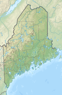
USA Maine relief location map.svg
Red triangle with thick white border.svg
Saddleback Mountain
Topo map USGS Big Shanty Mountain

Saddleback Mountain is a mountain located in Piscataquis County, Maine. [2]

Saddleback Mountain stands within the watershed of the Pleasant River, which drains into the Penobscot River, and then into Penobscot Bay. The northeast end of Saddleback Mountain drains from Crater Pond into South Inlet Brook, then into B Pond, Guernsey Brook, and the East Branch of the Pleasant River. The easternmost part of Saddleback drains into Mud Gauntlet Brook, then into Ebeemee Lake, and the East Branch of the Pleasant River. The southeast side of Saddleback drains into the Middle Branch of the Pleasant River. The southwest end of Saddleback drains into Saddleback Brook, then into Silver Lake, and the West Branch of the Pleasant River. The northwest side of Saddleback drains into Big White Brook, then into Silver Lake.
Related Research Articles

Moosehead Lake

Moosehead Lake is a deep, coldwater lake located in Northwestern Maine. It is the second-largest lake in New England, and the largest mountain lake in the eastern United States. Situated in the mostly undeveloped Longfellow Mountains, the lake is the source of the Kennebec River. Several rural Townships border the lake. Greenville is by far the largest settlement on the lake, with a small downtown area that includes banks, shops, and restaurants. There are over 80 islands in the lake, the largest being Sugar Island with the almost as large Deer Island to the west.

Saddleback Mountain (Rangeley, Maine) Mountain in Maine, United States of America

Saddleback Mountain is a mountain located in Sandy River Plantation, Franklin County, Maine, near the resort town of Rangeley. Saddleback is one of the highest mountains in the State of Maine, and one of the fourteen with more than 2,000 ft (610 m) of topographic prominence. The mountain is the site of Saddleback ski resort.

South Brother

South Brother is a mountain located in Piscataquis County, Maine, in Baxter State Park. South Brother is flanked to the southwest by Mount Coe, and to the northeast by North Brother; collectively the two are called "The Brothers".

White Cap Mountain (Piscataquis County, Maine)

White Cap Mountain is a mountain located in Piscataquis County, Maine. White Cap Mountain is flanked to the east by Hay Mountain, to the south by Big Spruce Mountain and to the southeast by Little Spruce Mountain.

Traveler Mountain

Traveler Mountain is a mountain located in Piscataquis County, Maine, in Baxter State Park. The Traveler, is the eighth-most prominent in Maine. Subsidiary peaks include the Peak of the Ridges 3,225 ft (983 m) North and South Traveler Mountain 3,144 ft (958 m) and 2,677 ft (816 m), respectively.

Baker Mountain (Piscataquis County, Maine) Mountain in Maine, United States of America

Baker Mountain is a wild, trail-less mountain located in Beaver Cove, Piscataquis County, Maine. It is flanked to the northwest by Lily Bay Mountain. Elephant Mountain is about 2 miles (3 km) to the southwest, and White Cap Mountain is about 5 miles (8 km) to the east.

Boundary Bald Mountain

Boundary Bald Mountain is a mountain located in Somerset County, Maine, about 7.5 mi (12.1 km) southeast of the Canada–US border with Quebec. Boundary Bald Mountain is flanked to the east by Ironbound Mountain, and to the west by Sandy Bay Mountain.

Big Spencer Mountain

Big Spencer Mountain is a mountain located in Piscataquis County, Maine. Big Spencer Mtn. is flanked to the west by Little Spencer Mountain.

Fort Mountain (Maine)

Fort Mountain is a mountain located in Piscataquis County, Maine, within Baxter State Park. Fort Mountain is flanked to the southeast by North Brother Mountain, and to the north by Mullen Mountain. Although officially trailless, a well-defined herd path leads to the summit of Fort from North Brother.

Snow Mountain (Oxford County, Maine)

Snow Mountain is a mountain located in Oxford County, Maine, about 4 mi (6.4 km) south of the Canada–United States border with Québec. The mountain is sometimes called "Cupsuptic Snow", to distinguish it from another "Snow Mountain" about 10 mi (16 km) to the northeast. Snow Mountain is flanked to the north by Kennebago Divide Mountain, and to the south by Twin Mountains and West Kennebago Mountain.

Saddleback Mountain (Keene, New York)

Saddleback Mountain is a mountain located in Essex County, New York. The mountain is part of the Great Range of the Adirondack Mountains. The 0.2 mi (0.32 km) long summit ridge has peaks at each end with a pronounced dip between, giving it the profile of a saddle. Saddleback Mtn. is flanked to the southwest by Basin Mountain, and to the east by Gothics.

Baker Branch Saint John River

The Baker Branch Saint John River is a 48.0-mile-long (77.2 km) river. This river is a tributary of the Saint John River, flowing in the Maine North Woods, in Maine, in the Northeastern United States.

The South Branch Penobscot River is a river in Somerset County, Maine. Its source, Penobscot lake, the north end of which at is about 1,000 feet (300 m) from the Canada–United States border in Sandy Bay. This section of the border runs along the height of land separating the watersheds of the Penobscot River and the Monument River, which feeds into the Saint Lawrence River.

West Branch Penobscot River

The West Branch Penobscot River is a 117-mile-long (188 km) tributary of the Penobscot River through the North Maine Woods in Maine. The river is also known as Abocadneticook, Kahgognamock, and Kettegwewick.

Elephant Mountain (Piscataquis County, Maine)

Elephant Mountain is a mountain located in Bowdoin College Grant West Piscataquis County, Maine. It is about 5 miles (8 km) southeast of Moosehead Lake, 2 miles southwest of Baker Mountain, and 5 miles west of White Cap Mountain.

Chamberlain Lake

Chamberlain Lake is one of the largest and deepest lakes in the North Maine Woods. The lake originally drained north through Eagle Lake and Churchill Lake into the Allagash River tributary to the Saint John River. Nineteenth-century logging operations diverted the lake into the Penobscot River before designation of the Allagash Wilderness Waterway in 1966.

Caucomgomoc Lake

Caucomgomoc Lake is in the North Maine Woods at the corner of townships 6 and 7 in ranges 14 and 15. Loon Stream flows into the southern end of the lake from Loon Lake, Bear Pond, Big Hurd Pond, Little Hurd Pond, Bear Brook Pond, McDougal Pond, and tributaries from the southwest. Overflow from Little Shallow Lake through Shallow Lake, Daggett Pond, and Round Pond enters the east side of Caucomgomoc Lake through Ciss Stream. Smaller tributaries Avery Brook, Middle Brook, and Ramsell Brook flow into the north end of the lake. There is a dam at the lake outlet on the eastern shore a short distance south of Ciss Stream. Discharge through the dam flows down Caucomgomoc Stream through Black Pond and Chesuncook Lake to the West Branch Penobscot River at Ripogenus Gorge. White perch and yellow perch have largely replaced historic trout populations in the lake.

Debsconeag Lakes

The chain of Debsconeag Lakes in the North Maine Woods is a tributary to the West Branch Penobscot River. The flow sequence is from the Sixth Debsconeag Lake through the Fifth, Fourth, Third, Second, and First into the Debsconeag Deadwater on the West Branch.

Saint John Ponds Shallow lakes in Maine, United States

The Saint John Ponds are a chain of shallow lakes at the headwaters of the Baker Branch Saint John River in the North Maine Woods. The flow sequence is from the Upper First Saint John Pond, through the Lower First Saint John Pond, Second Saint John Pond, Third Saint John Pond, and Fourth Saint John Pond to the Fifth Saint John Pond. Flow from one pond to the next is sometimes called Baker Stream rather than the Baker Branch Saint John River. Great Northern Paper Company dug a canal from Fifth Saint John Pond 2 miles (3.2 km) eastward to the North Branch Penobscot River in 1939, and built a dam at the north end of Fifth Saint John Pond so pulpwood logs harvested in the upper Saint John River watershed could be floated down the Penobscot River to Millinocket, Maine. The canal and dam have fallen into disrepair so most drainage from the ponds again flows down the Saint John River. All upstream ponds with the exception of the first had dams to regulate discharge flow for log driving, but those dams have similarly fallen into disrepair. Moose use the ponds as summer refuge from heat and biting insects.

References

See also