None official. "An Appeal to Heaven" and "Nunquam libertas gratior extat" (Latin for 'Never does liberty appear in a more gracious form') are common de facto mottos.
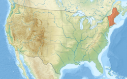
Location of New England (orange) in the United States
In the late 18th century, political leaders from the New England colonies initiated resistance to Britain's taxes without the consent of the colonists. Residents of Rhode Island captured and burned a British Royal Navy ship which was enforcing unpopular trade restrictions, and residents of Boston threw British tea into the harbor. Britain responded with a series of punitive laws stripping Massachusetts of self-government which the colonists called the "Intolerable Acts". These confrontations led to the first battles of the American Revolutionary War in 1775 and the expulsion of the British authorities from the region in spring 1776. The region played a prominent role in the movement to abolish slavery in the United States, and it was the first region of the U.S. transformed by the Industrial Revolution, initially centered on the Blackstone and Merrimack river valleys.
The physical geography of New England is diverse. Southeastern New England is covered by a narrow coastal plain, while the western and northern regions are dominated by the rolling hills and worn-down peaks of the northern end of the Appalachian Mountains. The Atlantic fall line lies close to the coast, which enabled numerous cities to take advantage of water power along the many rivers, such as the Connecticut River, which bisects the region from north to south.
Each state is generally subdivided into small municipalities known as towns, many of which are governed by town meetings. Unincorporated areas exist only in portions of Maine, New Hampshire, and Vermont, and village-style governments common in other areas are limited to Vermont and Connecticut. New England is one of the U.S. Census Bureau's nine regional divisions and the only multi-state region with clear and consistent boundaries. It maintains a strong sense of cultural identity,[5] although the terms of this identity are often contrasted, combining Puritanism with liberalism, agrarian life with industry, and isolation with immigration.
Humans reached the current-day New England region by at least 10,500 years ago and likely earlier, occupying a recently de-glaciated environment. Pre-contact Native American groups in New England did not have market economies and physical artifacts tended to change very slowly. However, technological shifts brought agriculture and ceramics to the region prior to the arrival of European settlers in the 17th century.[6]
Algonquian
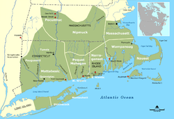
Indigenous territories, circa 1600 in present-day southern New England
The Penobscots lived along the Penobscot River in Maine. The Narragansetts and smaller tribes under their sovereignty lived in Rhode Island, west of Narragansett Bay, including Block Island. The Wampanoags occupied southeastern Massachusetts, Rhode Island, and the islands of Martha's Vineyard and Nantucket. The Pocumtucks lived in Western Massachusetts, and the Mohegan and Pequot tribes lived in Connecticut. The Connecticut River Valley linked numerous tribes culturally, linguistically, and politically.[7]
As early as 1600CE, French, Dutch, and English traders began exploring the New World, trading metal, glass, and cloth for local beaver pelts.[7][10]
Soldier and explorer John Smith coined the name "New England" in 1616.
On April 10, 1606, King James I of England issued a charter for the Virginia Company, which consisted of the London Company and the Plymouth Company. These two privately funded ventures were intended to claim land for England, to conduct trade, and to return a profit. In 1620, the Pilgrims arrived on the Mayflower and established Plymouth Colony in Massachusetts, beginning the history of permanent European colonization in New England.[11]
In 1616, English explorer John Smith named the region "New England".[12] The name was officially sanctioned on November 3, 1620,[13] when the charter of the Virginia Company of Plymouth was replaced by a royal charter for the Plymouth Council for New England, a joint-stock company established to colonize and govern the region.[14] The Pilgrims wrote and signed the Mayflower Compact before leaving the ship,[15] and it became their first governing document.[16] The Massachusetts Bay Colony came to dominate the area and was established by royal charter in 1629[17][18] with its major town and port of Boston established in 1630.[19]
Massachusetts Puritans started to establish themselves in Connecticut as early as 1633.[20]Roger Williams was banished from Massachusetts for theological reasons; he led a group south where they founded Providence Plantations, which grew into the Colony of Rhode Island and Providence Plantations in 1636.[21][22] At this time, Vermont was uncolonized, and the territories of New Hampshire and Maine were claimed and governed by Massachusetts. As the region grew, it received many immigrants from Europe due to its religious tolerance and economy.[23]
French and Indian Wars
Relationships alternated between peace and armed skirmishes between colonists and local Native American tribes, the bloodiest of which was the Pequot War in 1637 which resulted in the Mystic massacre.[24] On May 19, 1643, the colonies of Massachusetts Bay, Plymouth, New Haven, and Connecticut joined in a loose compact called the New England Confederation (officially "The United Colonies of New England"). The confederation was designed largely to coordinate mutual defense, and it gained some importance during King Philip's War[25] which pitted the colonists and their Indian allies against a widespread Indian uprising from June 1675 through April 1678, resulting in killings and massacres on both sides.[26] In the aftermath of settler-Native conflicts, hundreds of captive Indians were sold into slavery.[27][28] Up until 1700, Native Americans comprised a majority of the non-white labor force in colonial New England.[29]
During the next 74 years, there were six colonial wars that took place primarily between New England and New France,[30] during which New England was allied with the Iroquois Confederacy and New France was allied with the Wabanaki Confederacy. Mainland Nova Scotia came under the control of New England after the Siege of Port Royal (1710), but both New Brunswick and most of Maine remained contested territory between New England and New France. The British eventually defeated the French in 1763, opening the Connecticut River Valley for British settlement into western New Hampshire and Vermont.
The New England Colonies were settled primarily by farmers who became relatively self-sufficient. Later, New England's economy began to focus on crafts and trade, aided by the Puritan work ethic, in contrast to the Southern colonies which focused on agricultural production while importing finished goods from England.[31]
By 1686, King James II had become concerned about the increasingly independent ways of the colonies, including their self-governing charters, their open flouting of the Navigation Acts, and their growing military power. He therefore established the Dominion of New England, an administrative union including all of the New England colonies.[37] In 1688, the former Dutch colonies of New York, East New Jersey, and West New Jersey were added to the dominion. The union was imposed from the outside and contrary to the rooted democratic tradition of the colonies, and it was highly unpopular among the colonists.[38]
The dominion significantly modified the charters of the colonies, including the appointment of royal governors to nearly all of them. There was an uneasy tension among the royal governors, their officers, and the elected governing bodies of the colonies. The governors wanted unlimited authority, and the different layers of locally elected officials would often resist them. In most cases, the local town governments continued operating as self-governing bodies, just as they had before the appointment of the governors.[39]
After the dissolution of the Dominion of New England, the colonies of New England ceased to function as a unified political unit but remained a defined cultural region. There were often disputes over territorial jurisdiction, leading to land exchanges such as those regarding the Equivalent Lands and New Hampshire Grants.[41]
By 1784, all of the states in the region had taken steps towards the abolition of slavery, with Vermont and Massachusetts introducing total abolition in 1777 and 1783, respectively.[42] The nickname "Yankeeland" was sometimes used to denote the New England area, especially among Southerners and the British.[43]
Vermont was admitted to statehood in 1791 after settling a dispute with New York. The territory of Maine had been a part of Massachusetts, but it was granted statehood on March 15, 1820, as part of the Missouri Compromise.[44] Today, New England is defined as the six states of Maine, Vermont, New Hampshire, Massachusetts, Rhode Island, and Connecticut.[45]
New England's economic growth relied heavily on trade with the British Empire,[46] and the region's merchants and politicians strongly opposed trade restrictions. As the United States and the United Kingdom fought the War of 1812, New England Federalists organized the Hartford Convention in the winter of 1814 to discuss the region's grievances concerning the war, and to propose changes to the United States Constitution to protect the region's interests and maintain its political power.[47] Radical delegates within the convention proposed the region's secession from the United States, but they were outnumbered by moderates who opposed the idea.[48]
Politically, the region often disagreed with the rest of the country.[49] Massachusetts and Connecticut were among the last refuges of the Federalist Party, and New England became the strongest bastion of the new Whig Party when the Second Party System began in the 1830s. The Whigs were usually dominant throughout New England, except in the more Democratic Maine and New Hampshire.
The Connecticut River Valley became a crucible for industrial innovation, particularly the Springfield Armory, pioneering such advances as interchangeable parts and the assembly line which influenced manufacturing processes all around the world.[53] From early in the nineteenth century until the mid-twentieth, the region surrounding Springfield, Massachusetts and Hartford, Connecticut served as the United States' epicenter for advanced manufacturing, drawing skilled workers from all over the world.[54][55]
The rapid growth of textile manufacturing in New England between 1815 and 1860 caused a shortage of workers. Recruiters were hired by mill agents to bring young women and children from the countryside to work in the factories. Between 1830 and 1860, thousands of farm girls moved from rural areas where there was no paid employment to work in the nearby mills, such as the Lowell Mill Girls. As the textile industry grew, immigration also grew. By the 1850s, immigrants began working in the mills, especially French Canadians and Irish.[56]
New England as a whole was the most industrialized part of the United States. By 1850, the region accounted for well over a quarter of all manufacturing value in the country and over a third of its industrial workforce.[57] It was also the most literate and most educated region in the country.[57]
Political and demographic shift
During the same period, New England and areas settled by New Englanders (upstate New York, Ohio's Western Reserve, and the upper midwestern states of Michigan and Wisconsin) were the center of the strongest abolitionist and anti-slavery movements in the United States, coinciding with the Protestant Great Awakening in the region.[58] Abolitionists who demanded immediate emancipation had their base in the region, such as William Lloyd Garrison, John Greenleaf Whittier, and Wendell Phillips. So too did anti-slavery politicians who wanted to limit the growth of slavery, such as John Quincy Adams, Charles Sumner, and John P. Hale. The anti-slavery Republican Party was formed in the 1850s, and all of New England became strongly Republican, including areas that had previously been strongholds for both the Whig and the Democratic parties. New England remained solidly Republican until Catholics began to mobilize behind the Democrats, especially in 1928. This led to the end of "Yankee Republicanism" and began New England's relatively swift transition into a consistently Democratic stronghold in national elections.[59]
The flow of immigrants continued at a steady pace from the 1840s until cut off by World War I. The largest numbers came from Ireland and Britain before 1890, and after that from Quebec, Italy, and Southern Europe. The immigrants filled the ranks of factory workers, craftsmen, and unskilled laborers. The Irish and Italians assumed a larger and larger role in the Democratic Party in the cities and statewide, while the rural areas remained Republican.
The Great Depression and post-World War II changes
The Great Depression in the United States of the 1930s hit the region hard, with high unemployment in the industrial cities. The Boston Stock Exchange rivaled the New York Stock Exchange in 1930. The Democrats appealed to factory workers and especially Catholics, pulling them into the New Deal coalition and making the once-Republican region into one that was closely divided. However, the enormous spending on munitions, ships, electronics, and uniforms during World War II caused a burst of prosperity in every sector.
The region lost most of its factories starting with the loss of textiles in the 1930s and getting worse after 1960. The New England economy was radically transformed after World War II. The factory economy practically disappeared. Once-bustling New England communities fell into economic decay following the flight of the region's industrial base. The textile mills one by one went out of business from the 1920s to the 1970s. For example, the Crompton Company went bankrupt in 1984 after 178 years in business, costing the jobs of 2,450 workers in five states. The major reasons were cheap imports, the strong dollar, declining exports, and a failure to diversify.[60] The shoe industry subsequently left the region as well.
What remains is very high technology manufacturing, such as jet engines, nuclear submarines, pharmaceuticals, robotics, scientific instruments, and medical devices. The Massachusetts Institute of Technology invented the format for university-industry relations in high tech fields and spawned many software and hardware firms, some of which grew rapidly.[61] By the 21st century, the region had become famous for its leadership roles in the fields of education, medicine, medical research, high-technology, finance, and tourism.[62]
Some industrial areas were slow in adjusting to the new service economy. In 2000, New England had two of the ten poorest cities in the U.S. (by percentage living below the poverty line): the state capitals of Providence, Rhode Island and Hartford, Connecticut.[63] They were no longer in the bottom ten by 2010; Connecticut, Massachusetts, and New Hampshire remain among the ten wealthiest states in the United States in terms of median household income and per capita income.[64]
A political and geographical map of New England shows the coastal plains in the southeast, and hills, mountains and valleys in the west and the north.A portion of the north-central Pioneer Valley in Sunderland, Massachusetts
The states of New England have a combined area, including water surfaces, of 71,988 square miles (186,447km2),[65] making the region slightly larger than the state of Washington and slightly smaller than Great Britain.[66][67] Maine alone constitutes nearly one-half of the total area of New England, yet is only the 39th-largest state, slightly smaller than Indiana. The remaining states are among the smallest in the U.S., including the smallest state—Rhode Island.
The areas of the states (including water area) are:
New England's long rolling hills, mountains, and jagged coastline are glacial landforms resulting from the retreat of ice sheets approximately 18,000 years ago, during the last glacial period.[69][70]
The Appalachians extend northwards into New Hampshire as the White Mountains, and then into Maine and Canada. Mount Washington in New Hampshire is the highest peak in the Northeast, although it is not among the ten highest peaks in the eastern United States.[73] It is the site of the second highest recorded wind speed on Earth,[74][75] and has the reputation of having the world's most severe weather.[76][77]
The coast of the region, extending from southwestern Connecticut to northeastern Maine, is dotted with lakes, hills, marshes and wetlands, and sandy beaches.[70] Important valleys in the region include the Champlain Valley, the Connecticut River Valley and the Merrimack Valley.[70] The longest river is the Connecticut River, which flows from northeastern New Hampshire for 407mi (655km), emptying into Long Island Sound, roughly bisecting the region. Lake Champlain, which forms part of the border between Vermont and New York, is the largest lake in the region, followed by Moosehead Lake in Maine and Lake Winnipesaukee in New Hampshire.[70]
The climate of New England varies greatly across its 500 miles (800km) span from northern Maine to southern Connecticut:
Maine, New Hampshire, Vermont, and western Massachusetts have a humid continental climate (Dfb in Köppen climate classification). In this region the winters are long and cold, and heavy snow is common (most locations receive 60–120 inches (150–300cm) of snow annually in this region). The summer's months are moderately warm, though summer is rather short and rainfall is spread through the year.
In central and eastern Massachusetts, northern Rhode Island, and northern Connecticut, the same humid continental climate prevails (Dfa), though summers are warm to hot, winters are shorter, and there is less snowfall (especially in the coastal areas where it is often warmer).
Southern and coastal Connecticut is the broad transition zone from the cold continental climates of the north to the milder subtropical climates to the south. The frost free season is greater than 180 days across far southern/coastal Connecticut, coastal Rhode Island, and the islands (Nantucket and Martha's Vineyard). Winters also tend to be much sunnier in southern Connecticut and southern Rhode Island compared to the rest of New England.[78]
New England contains forested ecosystems with a variety of terrestrial vertebrates. Land-use patterns and land disturbance, such as the dramatic increase in land clearing for agriculture in the mid eighteenth century to nineteenth century, greatly altered the ecosystem and resulted in extinctions, local extirpations, and recolonizations.[79]
According to an analysis of USDA Forest Service data, tree species diversity increases from north to south at about two to three species per degree in latitude. In addition, taller trees are associated with higher tree species diversity, and tree height is a better predictor than general forest age or biomass. Due to an increasing the amount of nitrogen in the soil from climate change, the red maple is becoming one of the most abundant trees in the region, and outcompeting other maples such as the sugar maple.[80]
Largest self-reported ancestry groups in New England. Americans of Irish descent form a plurality in most of Massachusetts, while Americans of English descent form a plurality in much of the central parts of Vermont and New Hampshire as well as nearly all of Maine.
In 2020, New England had a population of 15,116,205, a growth of 4.6% from 2010.[85] Massachusetts is the most populous state with 7,029,917 residents, while Vermont is the least populous state with 643,077 residents.[85] Boston is by far the region's most populous city and metropolitan area.
Although a great disparity exists between New England's northern and southern portions, the region's average population density is 234.93 inhabitants/sq mi (90.7/km2). New England has a significantly higher population density than that of the U.S. as a whole (79.56/sq mi), or even just the contiguous 48 states (94.48/sq mi). Three-quarters of the population of New England, and most of the major cities, are in southern New England—the states of Connecticut, Massachusetts and Rhode Island—where the combined population density is 786.83/sq mi (2000 census). In northern New England—the states of Maine, New Hampshire, and Vermont—the combined population density is 63.56/sq mi (2000 census).
According to the 2006–08 American Community Survey, 48.7% of New Englanders were male and 51.3% were female. Approximately 22.4% of the population were under 18 years of age; 13.5% were over 65 years of age. The six states of New England have the lowest birth rate in the U.S.[86]
Ethnic origins in New EnglandWorld's largest Irish flag in Boston. People who claim Irish descent constitute the largest ethnic ancestry in New England.
White Americans make up the majority of New England's population at 73.4% of the total population, Hispanic and Latino Americans are New England's largest minority, and they are the second-largest group in the region behind non-Hispanic European Americans. As of 2014, Hispanics and Latinos of any race made up 10.2% of New England's population. Connecticut had the highest proportion at 13.9%, while Vermont had the lowest at 1.3%. There were nearly 1.5 million Hispanic and Latino individuals reported in New England in 2014.
Puerto Ricans were the most numerous of the Hispanic and Latino subgroups. Over 660,000 Puerto Ricans lived in New England in 2014, forming 4.5% of the population. The Dominican population is over 200,000, and the Mexican and Guatemalan populations are each over 100,000.[87]Americans of Cuban descent are scant in number; there were roughly 26,000 Cuban Americans in the region in 2014. People of all other Hispanic and Latino ancestries, including Salvadoran, Colombian and Bolivian, formed 2.5% of New England's population and numbered over 361,000 combined.[87]
According to the 2014 American Community Survey, the top ten largest reported European ancestries were the following:[88]Irish: 19.2% (2.8 million); English (includes "American" ancestry): 16.7% (2.4 million); Italian: 13.6% (2.0 million); French and French Canadian: 13.1% (1.9 million);[89]German: 7.4% (1.1 million); Polish: 4.9% (roughly 715,000); Portuguese: 3.2% (467,000); Scottish: 2.5% (370,000); Russian: 1.4% (206,000); and Greek: 1.0% (152,000).
Southeastern New England is home to a number of Lusophone ethnic enclaves.
English is, by far, the most common language spoken at home. Approximately 81.3% of all residents (11.3 million people) over the age of five spoke only English at home. Roughly 1,085,000 people (7.8% of the population) spoke Spanish at home, and roughly 970,000 people (7.0% of the population) spoke other Indo-European languages at home. Over 403,000 people (2.9% of the population) spoke an Asian or Pacific Island language at home.[91] Slightly fewer (about 1%) spoke French at home,[92] although this figure is above 20% in northern New England, which borders francophone Québec.[citation needed] Roughly 99,000 people (0.7% of the population) spoke languages other than these at home.[91]
As of 2014, approximately 87% of New England's inhabitants were born in the U.S., while over 12% were foreign-born.[93] Of foreign-born residents, 35.8% were born in Latin America, 28.6% were born in Asia,[94] 22.9% were born in Europe, and 8.5% were born in Africa.[95]
Southern New England forms an integral part of the BosWashmegalopolis, a conglomeration of urban centers that spans from Boston to Washington, D.C. The region includes three of the four most densely populated states in the U.S.; only New Jersey has a higher population density than the states of Rhode Island, Massachusetts, and Connecticut.
Greater Boston, which includes parts of southern New Hampshire, has a total population of approximately 4.8 million,[81] while over half the population of New England falls inside Boston's Combined Statistical Area of over 8.2 million.[96]
Several factors combine to make the New England economy unique. The region is distant from the geographic center of the country, and it is a relatively small region but densely populated. It historically has been an important center of industry and manufacturing and a supplier of natural resource products, such as granite, lobster, and codfish. The service industry is important, including tourism, education, financial and insurance services, and architectural, building and construction services. The U.S. Department of Commerce has called the New England economy a microcosm for the entire U.S. economy.[97]
The region underwent a long period of deindustrialization in the first half of the 20th century, as traditional manufacturing companies relocated to the Midwest, with textile and furniture manufacturing migrating to the South. In the late-20th century, an increasing portion of the regional economy included high technology, military defense industry, finance and insurance services, and education and health services. As of 2018, the GDP of New England was $1.1 trillion.[98]
New England exports food products ranging from fish to lobster, cranberries, potatoes, and maple syrup. About half of the region's exports consist of industrial and commercial machinery, such as computers and electronic and electrical equipment. Granite is quarried at Barre, Vermont,[99] guns made at Springfield, Massachusetts, Exeter, New Hampshire and Saco, Maine, submarines at Groton, Connecticut, surface naval vessels at Bath, Maine, and hand tools at Turners Falls, Massachusetts.
In 2017, Boston was ranked as having the ninth-most competitive financial center in the world and the fourth-most competitive in the United States.[100] Boston-based Fidelity Investments helped popularize the mutual fund in the 1980s and has made Boston one of the top financial centers in the United States.[101] The city is home to the headquarters of Santander Bank and a center for venture capital firms. State Street Corporation specializes in asset management and custody services and is based in the city.
The General Electric Corporation announced its decision to move the company's global headquarters to the Boston Seaport District from Fairfield, Connecticut, in 2016, citing factors including Boston's preeminence in the realm of higher education.[104] The city also holds the headquarters to several major athletic and footwear companies, including Converse, New Balance and Reebok. Rockport, Puma and Wolverine World Wide have headquarters or regional offices[105] just outside the city.[106]
Fairfield County, Connecticut, has a large concentration of investment management firms in the area, most notably Bridgewater Associates (one of the world's largest hedge fund companies), Aladdin Capital Management and Point72 Asset Management. Moreover, many international banks have their North American headquarters in Fairfield County, such as NatWest Group and UBS.
Agriculture is limited by the area's rocky soil, cool climate, and small area. Some New England states, however, are ranked highly among U.S. states for particular areas of production. Maine is ranked ninth for aquaculture,[108] and has abundant potato fields in its northeast part. Vermont is fifteenth for dairy products,[109] and Connecticut and Massachusetts seventh and eleventh for tobacco, respectively.[110][111] Cranberries are grown in Massachusetts' Cape Cod-Southcoast-South Shore area, and blueberries in Maine.
The region is mostly energy-efficient compared to the U.S. at large, with every state but Maine ranking within the ten most energy-efficient states;[112] every state in New England also ranks within the ten most expensive states for electricity prices.[113] Wind power, mainly from offshore sources, is expected to gain market share in the 2020s.
Overall tax burden
In 2023, three of the six New England states were among the top ten states in the country in terms of taxes paid per taxpayer, while one was among the top five least. The rankings being #3 Maine (11.14%), #4 Vermont (10.28%), #5 Connecticut (9.83%), #11 Rhode Island (9.07%), #20 Massachusetts (8.48%), and #48 New Hampshire (6.14%). While overall tax burden varies widely, all six states sport exceptionally high property taxes with five of the six states being within the nationwide top 10. The rankings being #1 Maine (5.33%), #2 Vermont (4.98%), #3 New Hampshire (4.94%), #6 Connecticut (4.24%), #7 Rhode Island (4.17%), and #13 Massachusetts (3.42%).[114]
New England town meetings were derived from meetings held by church elders, and are still an integral part of government in many New England towns. At such meetings, any citizen of the town may discuss issues with other members of the community and vote on them. This is the strongest example of direct democracy in the U.S. today, and the strong democratic tradition was even apparent in the early 19th century, when Alexis de Tocqueville wrote in Democracy in America:
New England, where education and liberty are the daughters of morality and religion, where society has acquired age and stability enough to enable it to form principles and hold fixed habits, the common people are accustomed to respect intellectual and moral superiority and to submit to it without complaint, although they set at naught all those privileges which wealth and birth have introduced among mankind. In New England, consequently, the democracy makes a more judicious choice than it does elsewhere.[115]
By contrast, James Madison wrote in Federalist No. 55 that, regardless of the assembly, "passion never fails to wrest the scepter from reason. Had every Athenian citizen been a Socrates, every Athenian assembly would still have been a mob."[116] The use and effectiveness of town meetings is still discussed by scholars, as well as the possible application of the format to other regions and countries.[117]
State and national elected officials in New England recently have been elected mainly from the Democratic Party.[118] The region is generally considered to be the most liberal in the United States, with more New Englanders identifying as liberals than Americans elsewhere. In 2010, four of six of the New England states were polled as the most liberal in the United States.[119]
Flag of the New England Governor's Conference (NEGC)
As of 2021, five of the six states of New England have voted for every Democratic presidential nominee since 1992. In that time, New Hampshire has voted for Democratic nominees in every presidential election except 2000, when George W. Bush narrowly won the state. 2020 was a particularly strong year for Democratic nominee Joe Biden in New England, winning 61.2% of the total vote in the six states, the highest percentage for Democrats since the landslide election of 1964.[120] As of the 117th Congress, all members of the U.S. House of Representatives from New England are members of the Democratic Party, and all but one of its senators caucus with the Democrats. Two of those senators, although caucusing with Democrats, are the only independents currently serving in Congress: Bernie Sanders, a self-described democratic socialist,[121][122] representing Vermont, and Angus King, an Independent representing Maine.
In the 2008 presidential election, Barack Obama carried all six New England states by 9 percentage points or more.[123] He carried every county in New England except for Piscataquis County, Maine, which he lost by 4% to Senator John McCain (R-AZ). Pursuant to the reapportionment following the 2010 census, New England collectively has 33 electoral votes.
2024 United States Presidential Election Results in
The following table presents the vote percentage for the popular-vote winner for each New England state, New England as a whole, and the United States as a whole, in each presidential election from 1900 to 2020, with the vote percentage for the Republican candidate shaded in red and the vote percentage for the Democratic candidate shaded in blue:
Though New England is today considered a Democratic Party stronghold, much of the region was staunchly Republican before the mid-twentieth century. This changed in the late 20th century, in large part due to demographic shifts[128] and the Republican Party's adoption of socially conservative platforms as part of its strategic shift towards the South.[59] For example, Vermont voted Republican in every presidential election from 1856 through 1988 with the exception of 1964, and has voted Democratic every election since. Maine and Vermont were the only two states in the nation to vote against Democrat Franklin D. Roosevelt all four times he ran for president. Republicans in New England are today considered by both liberals and conservatives to be more moderate (socially liberal) compared to Republicans in other parts of the U.S.[129]
Historically, the New Hampshire primary has been the first in a series of nationwide political party primary elections held in the United States every four years. Held in the state of New Hampshire, it usually marks the beginning of the U.S. presidential election process. Even though few delegates are chosen from New Hampshire, the primary has always been pivotal to both New England and American politics. One college in particular, Saint Anselm College, has been home to numerous national presidential debates and visits by candidates to its campus.[130]
New England contains some of the oldest and most renowned institutions of higher learning in the United States and the world. Harvard College was the first such institution, founded in 1636 at Cambridge, Massachusetts, to train preachers. Yale University was founded in Old Saybrook, Connecticut, in 1701, and awarded the nation's first doctoral (PhD) degree in 1861. Yale moved to New Haven, Connecticut, in 1718, where it has remained to the present day.
New England is home to four of the eight Ivy League universities. Pictured here is Memorial Hall of Harvard University.
Brown University was the first college in the nation to accept students of all religious affiliations, and is the seventh oldest U.S. institution of higher learning. It was founded in Providence, Rhode Island, in 1764. Dartmouth College was founded five years later in Hanover, New Hampshire, with the mission of educating the local American Indian population as well as English youth. The University of Vermont, the fifth oldest university in New England, was founded in 1791, the same year that Vermont joined the Union.
At the pre-college level, New England is home to most of the nation's upscale private schools. The concept of the elite "New England prep school" (preparatory school) and the "preppy" lifestyle is an iconic part of the region's image.[131]
New England is home to some of the oldest public schools in the nation and was the first region in the United States to implement universal compulsory schooling. Boston Latin School is the oldest public school in America and was attended by several signatories of the Declaration of Independence.[132]Hartford Public High School is the second oldest operating high school in the U.S.[133]
As of 2005, the National Education Association ranked Connecticut as having the highest-paid teachers in the country. Massachusetts and Rhode Island ranked eighth and ninth, respectively. New Hampshire, Rhode Island, and Vermont have cooperated in developing a New England Common Assessment Program test under the No Child Left Behind guidelines. These states can compare the resultant scores with each other.
Flag of New England flying in Massachusetts. New Englanders maintain a strong sense of regional and cultural identity.
New England has a shared heritage with England and a culture primarily shaped by waves of immigration.[136] In contrast to other American regions, most of New England's earliest Puritan settlers came from eastern England, contributing to the region's distinctive accents, foods, customs, and social structures.[137]:30–50 Within modern New England a cultural divide exists between urban New Englanders living along the densely populated coastline, and rural New Englanders in western Massachusetts, northwestern and northeastern Connecticut, Vermont, New Hampshire, and Maine, where population density is low.[138] There is also a substantial divide between Connecticut and the other states of the region, owing to the former's close cultural and economic ties with the New York metropolitan area.[139][140]
Today, New England is the least religious region of the U.S. In 2009, less than half of those polled in Maine, Massachusetts, New Hampshire, and Vermont claimed that religion was an important part of their daily lives. Connecticut and Rhode Island are among the ten least religious states, where 55% and 53% of those polled (respectively) claimed that it was important.[141] According to the American Religious Identification Survey, 34% of Vermonters reported having no religion; nearly one out of every four New Englanders identifies as having no religion, more than in any other part of the U.S.[142] New England had one of the highest percentages of Catholics in the U.S. This number declined from 50% in 1990 to 36% in 2008.[142]
Cultural roots
Many of the first European colonists of New England had a maritime orientation toward whaling (first noted about 1650)[143] and fishing, in addition to farming. New England has developed a distinct cuisine, dialect, architecture, and government. New England cuisine has a reputation for its emphasis on seafood and dairy; clam chowder, lobster, and other products of the sea are among some of the region's most popular foods.
New England has largely preserved its regional character, especially in its historic places. The region has become more ethnically diverse, having seen waves of immigration from Ireland, Quebec, Italy, Portugal, Germany, Poland, Scandinavia, Asia, Latin America, Africa, other parts of the U.S., and elsewhere. The enduring European influence can be seen in the region in the use of traffic rotaries; the bilingual French and English towns of northern Vermont, Maine, and New Hampshire; the unique, often non-rhotic traditional coastal dialect akin to the southeastern half of England; and the region's heavy prevalence of English town- and county-names. These repeat from state to state, primarily due to settlers throughout the region having named their new towns after their old ones. For example, the town of North Yarmouth, Maine, was named by settlers from Yarmouth, Massachusetts, which was in turn named for Great Yarmouth (still locally called Yarmouth) in England. Every New England state has a town named Warren (a French-English noble family of wealthy settlers), and each except Rhode Island has a city/town named Franklin and Washington (constitutional founding fathers), Andover, Bridgewater, Chester, Manchester, Plymouth, and Windsor (these six were towns in England). Every state except Connecticut has a Lincoln and has a Richmond. Massachusetts, Vermont, and Maine each contain a Franklin County.
New England maintains a distinct cuisine and food culture. Early foods in the region were influenced by Native American and English cuisines. The early colonists often adapted their original cuisine to fit with the available foods of the region. New England staples reflect the convergence of American Indian and Pilgrim cuisine, such as johnnycakes, succotash, cornbread and various seafood recipes. The Wabanaki tribal nations made nut milk.[144]
New England also has a distinct food language. A few of the unique regional terms include "grinders" for submarine sandwiches and "frappes" for thick milkshakes, referred to as "Cabinets" in Rhode Island. Other foods native to the region include steak tips (marinated sirloin steak), bulkie rolls, maple syrup, cranberry recipes and clam chowder.[145]
A type of India pale ale known as New England India Pale Ale (NEIPA) was developed in Vermont in the 2010s.[146][147] Other regional beverages include Moxie, one of the first mass-produced soft drinks in the United States, introduced in Lowell, Massachusetts, in 1876; it remains popular in New England, particularly in Maine.[148]Coffee milk is associated with Rhode Island as the official state drink.[149]
There are several characteristics of spoken American English in the region, most famously the Boston accent,[151] which is native to the northeastern coastal regions of New England. The most identifiable features of the Boston accent originated from England's Received Pronunciation, which shares features such as the broad A and dropping the final R. Another source was 17th century speech in East Anglia and Lincolnshire, where many of the Puritan immigrants had originated. The East Anglian "whine" developed into the Yankee "twang".[137] Boston accents were most strongly associated at one point with the so-called "Eastern Establishment" and Boston's upper class, although today the accent is predominantly associated with blue-collar natives, as exemplified by movies such as Good Will Hunting and The Departed. The Boston accent and those accents closely related to it cover eastern Massachusetts, New Hampshire and Maine.[152]
Some Rhode Islanders speak with a non-rhotic accent that many compare to a "Brooklyn" accent or a cross between a New York and Boston accent, where "water" becomes "wata". Many Rhode Islanders distinguish the aw sound [ɔː], as one might hear in New Jersey; e.g., the word "coffee" is pronounced /ˈkɔːfi/KAW-fee.[153] This type of accent was brought to the region by early settlers from eastern England in the Puritan migration in the mid-seventeenth century.[137]:13–207
Social activities and music
Acadian and Québécois culture are included in music and dance in much of rural New England, particularly Maine. Contra dancing and country square dancing are popular throughout New England, usually backed by live Irish, Acadian or other folk music. Fife and drum corps are common, especially in southern New England and more specifically Connecticut, with music of mostly Celtic, English, and local origin. New England leads the U.S. in ice cream consumption per capita.[154][155]Candlepin bowling is essentially confined to New England, where it was invented in the 19th century.[156]
The leading U.S. cable TV sports broadcaster ESPN is headquartered in Bristol, Connecticut. New England has several regional cable networks, including New England Cable News (NECN) and the New England Sports Network (NESN). New England Cable News is the largest regional 24-hourcable news network in the U.S., broadcasting to more than 3.2 million homes in all of the New England states. Its studios are located in Newton, Massachusetts, outside of Boston, and it maintains bureaus in Manchester, New Hampshire; Hartford, Connecticut; Worcester, Massachusetts; Portland, Maine; and Burlington, Vermont.[157] In Connecticut's Litchfield, Fairfield, and New Haven counties, it also broadcasts New York based news programs—this is due in part to the immense influence New York has on this region's economy and culture, and also to give Connecticut broadcasters the ability to compete with overlapping media coverage from New York-area broadcasters.
New Englanders have made significant contributions to literature. The first printing press in America was set up in Cambridge, Massachusetts, by Stephen Daye in the 17th century. Writers in New England produced many works on religious subjects, particularly on Puritan theology and poetry during colonial times and on Enlightenment ideas during the American Revolution. The literature of New England has had an enduring influence on American literature in general, with themes that are emblematic of the larger concerns of American letters, such as religion, race, the individual versus society, social repression and nature.[163]
New England has a rich history in filmmaking dating back to the dawn of the motion picture era at the turn of the 20th century, sometimes dubbed Hollywood East by film critics. A theater at 547 Washington Street in Boston was the second location to debut a picture projected by the Vitascope, and shortly thereafter several novels were being adapted for the screen and set in New England, including The Scarlet Letter and The House of Seven Gables.[166] The New England region continued to churn out films at a pace above the national average for the duration of the 20th century, including blockbuster hits such as Jaws, Good Will Hunting and The Departed, all of which won Academy Awards.
The New England area became known for a number of themes that recurred in films made during this era, including the development of yankee characters, small town life contrasted with city values, seafaring tales, family secrets and haunted New England.[167] These themes are rooted in centuries of New England culture and are complemented by the region's diverse natural landscape and architecture, from the Atlantic Ocean and brilliant fall foliage to church steeples and skyscrapers.
Since the turn of the millennium, Boston and the greater New England region have been home to the production of numerous films and television series, thanks in part to tax incentive programs put in place by local governments to attract filmmakers to the region.[168]
There are also many historical societies in the region. Historic New England operates museums and historic sites in the name of historical preservation. Many properties belonging to HNE include preserved house museums of prominent figures in New England and American history. Other societies include the Massachusetts Historical Society, the Essex Institute, the American Antiquarian Society, and The Bostonian Society. The Massachusetts Historical Society, founded in 1791, is the oldest operating in the United States.[170] Many cities and towns across New England operate their own historical societies focused on historical preservation of local sites and the recording of local history.
New England has a strong heritage of athletics, and many internationally popular sports were invented and codified in the region, including basketball, volleyball, and American football.
Football is the most popular sport in the region and was developed by Walter Camp in New Haven, Connecticut, in the 1870s and 1880s. The New England Patriots are based in Foxborough, Massachusetts, and are the most popular professional sports team in New England. The Patriots have won six Super Bowl championships and are one of the most winning teams in the National Football League. There are also high-profile collegiate and high school football rivalries in New England. These games are most often played on Thanksgiving Day and are some of the oldest sports rivalries in the United States. The high school rivalry between Wellesley High School and Needham High School in Massachusetts is considered to be the nation's oldest football rivalry, having started in 1882.[171][172][173][174]
Volleyball was invented in Holyoke, Massachusetts, in 1895 by William G. Morgan. Morgan was an instructor at a YMCA and wanted to create an indoor game for his athletes. The game was based on badminton and was spread as a sport through YMCA facilities. The international Volleyball Hall of Fame is located in Holyoke.
A Hartford Line train at Hartford Union StationThe MBTA Commuter Rail serves eastern Massachusetts and parts of Rhode Island, radiating from downtown Boston, with planned service to New Hampshire. The CTrail system operates the Shore Line East and Hartford Line, covering coastal Connecticut, Hartford, and Springfield, Massachusetts.
Amtrak provides interstate rail service throughout New England. Boston is the northern terminus of the Northeast Corridor. The Vermonter connects Vermont to Massachusetts and Connecticut, while the Downeaster links Maine to Boston. The long-distance Lake Shore Limited train has two eastern termini after splitting in Albany, one of which is Boston. This provides rail service on the former Boston and Albany Railroad which runs between its namesake cities. The rest of the Lake Shore Limited continues to New York City.
Bus transportation is available in most urban areas and is governed by regional and local authorities. The Pioneer Valley Transit Authority and the MetroWest Regional Transit Authority are examples of public bus transportation which support more suburban and rural communities.
↑Hoffman, Curtiss R. E. (1990). People of the Fresh Water Lake: A Prehistory of Westborough, Massachusetts. Peter Lang. p.1.
1234Bain, Angela Goebel; Manring, Lynne; and Mathews, Barbara. Native Peoples in New England. Retrieved July 21, 2010, from Pocumtuck Valley Memorial Association.
↑"Abenaki History". abenakination.org. Retrieved March 28, 2011.{{cite web}}: |archive-url= is malformed: timestamp (help)CS1 maint: url-status (link)
↑Cressy, David (1987). Coming Over: Migration and Communication Between England and New England in the Seventeenth Century. p. 4. Cambridge University Press.
↑Swindler, William F., ed; Sources and Documents of United States Constitutions 10 Volumes; Dobbs Ferry, New York; Oceana Publications, 1973–1979. Volume 5: pp. 16–26.
↑"joint stock company organized in 1620 by a charter from the British crown with authority to colonize and govern the area now known as New England." New England, Council for. (2006). In Encyclopædia Britannica. Retrieved July 13, 2006, from Encyclopædia Britannica Premium Service: Britannica.comArchived February 12, 2005, at the Wayback Machine
↑Peace, Nancy E. (November 1976). "Roger Williams—A Historiographical Essay"(PDF). Rhode Island History. Providence RI: The Rhode Island Historical Society. pp.103–115. Retrieved March 28, 2011.
↑"1675 - King Philip's War". The Society of Colonial Wars in the State of Connecticut. Retrieved December 14, 2013.
↑Peterson, Mark A. (2019). The City-State of Boston: The Rise and Fall of an Atlantic Power, 1630-1865. Princeton, New Jersey: Princeton University Press. pp.129–133. ProjectMUSEbook64409.
↑Newell, Margret Ellen (2015). Brethren by Nature: New England Indians, Colonists, and the Origins of American Slavery. Ithaca, New York: Cornell University Press. pp.1–158. ProjectMUSEbook57597.
↑Newell, M. E. (2009). "Indian slavery in colonial America." In A. Gallay (Ed.), Indian slavery in colonial America (pp. 33–66). University of Nebraska Press.
↑Bagnall, William R. The Textile Industries of the United States: Including Sketches and Notices of Cotton, Woolen, Silk, and Linen Manufacturers in the Colonial Period. Vol. I. pg. 97. The Riverside Press, 1893.
↑"Forging Arms for the Nation". Springfield Armory National Historic Site, Massachusetts. National Park Service. Retrieved April 4, 2016.
↑Wyatt-Brown, Bertram. "American Abolitionism and Religion". Divining America: Religion in American History. National Humanities Center TeacherServe. Retrieved April 4, 2016.
↑"Part 1: Population and Housing Unit Counts"(PDF). 2000 Census of Population and Housing – United States Summary: 2000. United States Census Bureau. April 2004. Retrieved April 4, 2016.
↑"Glacial Features of the Exotic Terrane". The Teacher-Friendly Guide to the Earth Science of the Northeastern US. Paleontological Research Institution. Retrieved April 4, 2016.
↑De Tocqueville, Alexis. Democracy in America. Quotation attributed at Archived June 7, 2010, at the Wayback Machine . Retrieved July 20, 2010.
↑Madison, James. Federalist No. 55. Quotation attributed at Ilsr.orgArchived January 13, 2020, at the Wayback Machine . Retrieved July 19, 2006.
↑See Harvard lecturer Robert I. Rotberg review Real Democracy: the New England town meeting and how it works at Democraciaparticipativa.net (Retrieved July 19, 2006) (in Spanish and English). Archived September 28, 2007, at the Wayback Machine
↑"In marathoning, it has a foothold– History means Boston can give any race in the world a run for its money", by John Powers, The Boston Globe, April 10, 2005
New York: Atlas of Historical County Boundaries, John H. Long, Editor; Compiled by Kathryn Ford Thorne; A Project of the Dr. William M. Scholl Center for Family and Community History, The Newberry Library, Simon & Schuster, 1993.
Berman, Eleanor. Eyewitness Travel Guides New England. ISBN0-7566-2697-8
Chenoweth, James. Oddity Odyssey: A Journey Through New England's Colorful Past. Holt, 1996. Humorous travel guide. ISBN0-8050-3671-7
Hall, Donald, Burt Feintuch, and David H. Watters, eds. Encyclopedia of New England (Yale U.P. 2005), 1596 pp; the major scholarly resource to the geography, history and culture of the region. ISBN0-300-10027-2
Koistinen, David. Confronting Decline: The Political Economy of Deindustrialization in Twentieth-Century New England (2013)
Muse, Vance. The Smithsonian Guide to Historic America: Northern New England. Stewart, Tabori & Chang, 1998. A photographic guide to historic sites in New England. ISBN1-55670-635-9
Riess, Jana. The Spiritual Traveler Boston and New England: A Guide to Sacred Sites and Peaceful Places, HiddenSpring ISBN1-58768-008-4
Sayen, Jamie. Children of the Northern Forest: Wild New England's History from Glaciers to Global Warming (Yale UP, 2023) online book review
Sletcher, Michael. New England: The Greenwood Encyclopedia of American Regional Cultures (2004)
Wiencek, Henry. The Smithsonian Guide to Historic America: Southern New England. Stewart, Tabori & Chang, 1998. A photographic guide to historic sites in New England. ISBN1-55670-633-2
This page is based on this Wikipedia article Text is available under the CC BY-SA 4.0 license; additional terms may apply. Images, videos and audio are available under their respective licenses.


