Dublin, New Hampshire

Last updated

Dublin, New Hampshire
Town
DublinNH Rotary.jpg
Church and rotary in the town center
Dublin Town Seal.png
Cheshire-Dublin-NH.png
Coordinates: 42°54′21″N72°03′39″W / 42.90583°N 72.06083°W / 42.90583; -72.06083
Country United States
State New Hampshire
County Cheshire
Incorporated 1771
Villages
  • Dublin
  • Bonds Corner
Government
   Board of Selectmen
  • Carole Monroe, Chair
  • Susan Peters
  • Chris Raymond
  Town AdministratorKate Fuller
Area
[1]
  Total29.0 sq mi (75.1 km2)
  Land27.9 sq mi (72.2 km2)
  Water1.1 sq mi (2.8 km2)  3.78%
Elevation
1,440 ft (440 m)
Population
 (2020) [2]
  Total1,532
  Density53/sq mi (20/km2)
Time zone UTC-5 (Eastern)
  Summer (DST) UTC-4 (Eastern)
ZIP code
03444
Area code 603
FIPS code 33-19140
GNIS feature ID0873581
Website www.townofdublin.org

Dublin is a town in Cheshire County, New Hampshire, United States. The population was 1,532 at the 2020 census. [2] It is home to Dublin School and Yankee magazine.

Contents

History

Town center in 1906 General View of Dublin, NH.jpg
Town center in 1906

In 1749, the Masonian proprietors granted the town as "Monadnock No. 3" (or North Monadnock) to Matthew Thornton and 39 others. The 40 grantees came mostly from middle and eastern parts of New Hampshire; none of them became settlers in the township. The deed of grant, which dated November 3, 1749, was given by Col. Joseph Blanchard of Dunstable. [3]

The French and Indian War thwarted permanent settlement until the 1760s, when Irishman Henry Strongman moved from Peterborough. Other early settlers arrived from Sherborn, Massachusetts. In 1771, Governor John Wentworth incorporated the town, naming it after Strongman's birthplace: Dublin, Ireland. [4]

Like all towns in this area, the terrain features hills and valleys. Farmers found the soil hard and rocky, but with effort it yielded maize, oats, barley and potatoes, with some wheat and rye. Orchards were common. The first census, taken in 1790, reported 901 residents. [5] By 1859, there were 1,088. [4] In 1870, the small mill town of Harrisville voted to separate from Dublin, leaving the latter with only 455 residents during the 1880 census. [6]

Geography

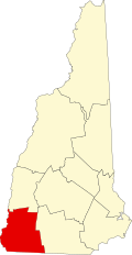
According to the United States Census Bureau, the town has a total area of 29.0 square miles (75.1 km2), of which 27.9 square miles (72.2 km2) are land and 1.1 square miles (2.8 km2) are water, comprising 3.78% of the town. [1] The northern slopes of Mount Monadnock occupy the southern part of town. The highest point in Dublin is along Monadnock's northeast ridge, where the elevation reaches 2,834 feet (864 m) above sea level at the town line. Roughly the western half of Dublin lies within the Connecticut River watershed, drained by tributaries of the Ashuelot River, with the eastern half located in the Merrimack River watershed, drained by tributaries of the Contoocook River. [7]

The ponds in Dublin include Monadnock Lake (now known as Dublin Pond), Farnum (Dark) Pond, and Wight Pond, as well as Howe, Knight, and Electric Company reservoirs. [3]

Dublin Pond is a clean sheet of water that has brought many families of wealth to the area. It is surrounded by a vast area of woods leading to the edge of the summit of Mount Monadnock, and from its surface the summit and northwest sides of the mountain are visible. At the right hour on the right kind of day, the mountain is clearly reflected upon the surface of the pond. [3]

The town is crossed by New Hampshire Route 101 and New Hampshire Route 137. NH 101 leads east 6 miles (10 km) to Peterborough and west 8 miles (13 km) to Marlborough and 13 miles (21 km) to Keene. NH 137 leads north 7 miles (11 km) to Hancock and south 6 miles (10 km) to Jaffrey.

Adjacent municipalities

Climate

Climate data for Dublin, New Hampshire
MonthJanFebMarAprMayJunJulAugSepOctNovDecYear
Record high °F (°C)61
(16)
61
(16)
78
(26)
84
(29)
86
(30)
95
(35)
93
(34)
90
(32)
90
(32)
77
(25)
69
(21)
62
(17)
95
(35)
Mean daily maximum °F (°C)29
(−2)
32
(0)
41
(5)
53
(12)
66
(19)
73
(23)
78
(26)
75
(24)
67
(19)
57
(14)
45
(7)
34
(1)
54
(12)
Mean daily minimum °F (°C)8
(−13)
10
(−12)
20
(−7)
30
(−1)
41
(5)
50
(10)
55
(13)
53
(12)
45
(7)
33
(1)
26
(−3)
15
(−9)
32
(0)
Record low °F (°C)−23
(−31)
−21
(−29)
−9
(−23)
8
(−13)
23
(−5)
32
(0)
41
(5)
40
(4)
24
(−4)
13
(−11)
4
(−16)
−11
(−24)
−23
(−31)
Average precipitation inches (mm)3.86
(98)
3.04
(77)
3.96
(101)
3.91
(99)
4.57
(116)
4.05
(103)
4.18
(106)
4.30
(109)
3.88
(99)
4.03
(102)
4.17
(106)
3.90
(99)
47.84
(1,215)
Average snowfall inches (cm)16.5
(42)
19.6
(50)
12.4
(31)
5.3
(13)
0.5
(1.3)
0
(0)
0
(0)
0
(0)
0
(0)
0.4
(1.0)
6.4
(16)
16.4
(42)
77.5
(197)
Source: [8]

Architecture

The history of Dublin's architecture starts with the foundation of the United States, and the development of the Federal style of architecture. The style in Dublin can be attributed to one Rufus Piper, who served as the town moderator and was a carpenter at the time. Piper was responsible for adding fans to various houses in the town, which included his own home and his grandfather's house. [9]

Demographics

Historical population
CensusPop.Note
1790 901
1800 1,18831.9%
1810 1,184−0.3%
1820 1,62036.8%
1830 1,218−24.8%
1840 1,075−11.7%
1850 1,0881.2%
1860 1,0960.7%
1870 930−15.1%
1880 456−51.0%
1890 58227.6%
1900 6206.5%
1910 571−7.9%
1920 408−28.5%
1930 50624.0%
1940 62122.7%
1950 6758.7%
1960 6841.3%
1970 83722.4%
1980 1,30355.7%
1990 1,47413.1%
2000 1,4760.1%
2010 1,5978.2%
2020 1,532−4.1%
U.S. Decennial Census [2] [10]

At the 2000 census, [11] there were 1,476 people, 560 households and 417 families residing in the town. The population density was 52.7 inhabitants per square mile (20.3/km2). There were 686 housing units at an average density of 24.5 per square mile (9.5/km2). The racial makeup of the town was 97.29% White, 0.34% African American, 0.54% Native American, 0.95% Asian, 0.41% from other races, and 0.47% from two or more races. Hispanic or Latino of any race were 1.15% of the population.

There were 560 households, of which 32.5% had children under the age of 18 living with them, 65.4% were married couples living together, 6.6% had a female householder with no husband present, and 25.4% were non-families. 21.1% of all households were made up of individuals, and 6.6% had someone living alone who was 65 years of age or older. The average household size was 2.51 and the average family size was 2.89.

23.4% of the population were under the age of 18, 5.9% from 18 to 24, 25.0% from 25 to 44, 32.5% from 45 to 64, and 13.2% who were 65 years of age or older. The median age was 43 years. For every 100 females, there were 101.1 males. For every 100 females age 18 and over, there were 99.5 males.

The median household income was $52,150 and the median income for a family was $57,578. Males had a median income of $36,853 compared with $25,859 for females. The per capita income was $27,028. About 6.0% of families and 10.6% of the population were below the poverty line, including 16.8% of those under age 18 and 5.0% of those age 65 or over.

Economy

Dublin is the base for Yankee Publishing Inc., the publisher of the Old Farmer's Almanac and Yankee magazine.

Education

The visit from ‘Abdu’l‑Bahá

Photograph of 'Abdu'l-Baha Picture of Abdul-Baha.jpg
Photograph of ‘Abdu’l‑Bahá

In 1912, ʻAbdu'l-Bahá, the son and chosen successor of the Baháʼu'lláh, the Prophet-Founder of the Baháʼí Faith, visited Dublin for 23 days, from 25 July to 16 August, on his journey through the United States to spread the Bahá’í teachings after his release from 40 years of imprisonment. [12] [13] Spending the most consecutive days of his journey in Dublin, he gave many talks ranging from gender equality, the immortality of the soul, industrial and economic justice, the elimination of racial prejudice, spiritual and material education, Biblical symbolism, theology, the coming together of people from the East and the West, and other Bahá’í principles. [13] [12]

Louis G. Gregory and his wife Louisa Mathew Gregory Louis-and-Louisa-Gregory.png
Louis G. Gregory and his wife Louisa Mathew Gregory

In Dublin, ‘Abdu’l‑Bahá stayed with Agnes Parsons, a Bahá’í socialite from Washington, DC, and a summer resident of Dublin whose home once stood on Windmill Hill Road. [14] The first of his two high-profile addresses in Dublin was at a gathering at the Parsons' boathouse on Dublin Pond, owned now by the Dublin School, with local non-resident African-American servants who worked in town. [13] [12] In this gathering he spoke on the need for unity and amity between blacks and whites [12] and announced the interracial marriage of two young Bahá’ís, Louis Gregory, an African-American lawyer, and Louisa Mathew, a white English woman, whom he had previously suggested to marry each other. [15] [16] [13] This act was considered radical at the time, with interracial marriage still illegal in many states. [13]

Asked to speak at the local Unitarian church one Sunday, an event attracting some 300 people, [13] ‘Abdu’l‑Bahá spoke on the subject of spiritual education. The anniversary of his historic visit and address is commemorated annually by the church, known now as the Dublin Community Church. [17] Rev. Howard Colby Ives, a Unitarian minister, [18] wrote of that day,

What His subject was I do not recall, nor does a single word of His address remain with me. My memory is all of the quiet New England church; the crowded pews, and ‘Abdu’l‑Bahá on the platform. His cream-colored robe; His white hair and beard; His radiant smile and courteous demeanor... And His voice! Like a resonant bell of finest timbre; never loud but of such penetrating quality that the walls of the room seemed to vibrate with its music. [19]

‘Abdu’l‑Bahá spent time at the Dublin Inn, which has since been purchased and donated to the Bahá’í community as a space for gathering, prayer, meditation, and historic preservation. [20] [14]

Current events

2019 is the 48th year for the Dublin Gas Engine Meet on Cricket Hill Farm, which is the longest lasting tradition in Dublin after Town Meeting. Every year, the town prepares starting in October for the Halloween events around town that occur each year. [21]

See also

Notable people

Related Research Articles

<span class="mw-page-title-main">New Hampton, New Hampshire</span> Town in New Hampshire, United States

New Hampton is a town in Belknap County, New Hampshire, United States. The population was 2,377 at the 2020 census. A winter sports resort area, New Hampton is home to George Duncan State Forest and to the New Hampton School, a private preparatory school established in 1821.

<span class="mw-page-title-main">Fitzwilliam, New Hampshire</span> Town in New Hampshire, United States

Fitzwilliam is a town in Cheshire County, New Hampshire, United States. The population was 2,351 at the 2020 census. Fitzwilliam is home to Rhododendron State Park, a 16-acre (6.5 ha) grove of native rhododendrons that bloom in mid-July.

<span class="mw-page-title-main">Harrisville, New Hampshire</span> Town in New Hampshire, United States

Harrisville is a town in Cheshire County, New Hampshire, United States. Besides the town center, it also includes the villages of Chesham and Eastview. The population of the town was 984 at the 2020 census.

<span class="mw-page-title-main">Nelson, New Hampshire</span> Town in New Hampshire, United States

Nelson is a town in Cheshire County, New Hampshire, United States. The population was 629 at the 2020 census, down from 729 at the 2010 census. Nelson includes the village of Munsonville.

<span class="mw-page-title-main">Richmond, New Hampshire</span> Town in New Hampshire, United States

Richmond is a town in Cheshire County, New Hampshire, United States. The population was 1,197 at the 2020 census.

<span class="mw-page-title-main">Rindge, New Hampshire</span> Town in New Hampshire, United States

Rindge is a town in Cheshire County, New Hampshire, United States. The population was 6,476 at the 2020 census, up from 6,014 at the 2010 census. Rindge is home to Franklin Pierce University, the Cathedral of the Pines and part of Annett State Forest.

<span class="mw-page-title-main">Stoddard, New Hampshire</span> Town in New Hampshire, United States

Stoddard is a town in Cheshire County, New Hampshire, United States. The population was 1,374 at the 2020 census, up from 1,232 at the 2010 census.

<span class="mw-page-title-main">Sullivan, New Hampshire</span> Town in New Hampshire, United States

Sullivan is a town in Cheshire County, New Hampshire, United States. The population was 658 at the 2020 census. It includes the villages of East Sullivan and Ellisville.

<span class="mw-page-title-main">Troy, New Hampshire</span> Town in New Hampshire, United States

Troy is a town in Cheshire County, New Hampshire, United States. The population was 2,130 at the 2020 census. It is situated west of Mount Monadnock.

<span class="mw-page-title-main">Errol, New Hampshire</span> Town in New Hampshire, United States

Errol is a town in Coös County, New Hampshire, United States. The population was 298 at the 2020 census. It is located north of the White Mountains along Route 16 at its intersection of Route 26. It has a municipal airport with a single, unpaved runway.

<span class="mw-page-title-main">Piermont, New Hampshire</span> Town in New Hampshire, United States

Piermont is a town in Grafton County, New Hampshire, United States. The population was 769 at the 2020 census. It is home to Camp Walt Whitman and Kingswood Camp for Boys.

<span class="mw-page-title-main">Bennington, New Hampshire</span> Town in New Hampshire, United States

Bennington is a town in Hillsborough County, New Hampshire, United States. The population was 1,501 at the 2020 census.

<span class="mw-page-title-main">Brookline, New Hampshire</span> Town in New Hampshire, United States

Brookline is a town in Hillsborough County, New Hampshire, United States. The population was 5,639 at the 2020 census, up from 4,991 at the 2010 census. Brookline is home to the Talbot-Taylor Wildlife Sanctuary, Potanipo Pond, and the Brookline Covered Bridge.

<span class="mw-page-title-main">Greenfield, New Hampshire</span> Town in New Hampshire, United States

Greenfield is a town in Hillsborough County, New Hampshire, United States. The population was 1,716 at the 2020 census. Greenfield is home to the Crotched Mountain Rehabilitation Center, to Greenfield State Park, and to part of the Wapack Trail.

<span class="mw-page-title-main">Lyndeborough, New Hampshire</span> Town in New Hampshire, United States

Lyndeborough is a town in Hillsborough County, New Hampshire, United States. The population was 1,702 at the 2020 census.

<span class="mw-page-title-main">Temple, New Hampshire</span> Town in New Hampshire, United States

Temple is a town in Hillsborough County, New Hampshire, United States. The population was 1,382 at the 2020 census. It is home to Temple Mountain State Reservation, formerly the Temple Mountain Ski Area.

<span class="mw-page-title-main">Epsom, New Hampshire</span> Town in New Hampshire, United States

Epsom is a town in Merrimack County, New Hampshire, United States. The population was 4,834 at the 2020 census.

<span class="mw-page-title-main">Jaffrey, New Hampshire</span> Town in New Hampshire, United States

Jaffrey is a town in Cheshire County, New Hampshire, United States. The population was 5,320 at the 2020 census.

<span class="mw-page-title-main">Marlborough, New Hampshire</span> Town in New Hampshire, United States

Marlborough is a town in Cheshire County, New Hampshire, United States. The population was 2,096 at the 2020 census. The town is home to the Kensan-Devan Wildlife Sanctuary at Meetinghouse Pond.

<span class="mw-page-title-main">Peterborough, New Hampshire</span> Town in New Hampshire, United States

Peterborough is a town in Hillsborough County, New Hampshire, United States. The population was 6,418 at the 2020 census. The main village, with 3,090 people at the 2020 census, is defined as the Peterborough census-designated place (CDP) and is located along the Contoocook River at the junction of U.S. Route 202 and New Hampshire Route 101. Peterborough is 38 miles (61 km) west of Manchester and 72 miles (116 km) northwest of Boston.

References

  1. 1 2 "2021 U.S. Gazetteer Files – New Hampshire". United States Census Bureau. Retrieved November 3, 2021.
  2. 1 2 3 "Dublin town, Cheshire County, New Hampshire: 2020 DEC Redistricting Data (PL 94-171)". U.S. Census Bureau. Retrieved November 3, 2021.
  3. 1 2 3 Dublin (N.H.) (1920). The History of Dublin, N.H.: Containing the Address by Charles Mason, and the Proceedings at the Centennial Celebration, June 17, 1852, with a Register of Families. Town of Dublin.
  4. 1 2 Coolidge, Austin J.; John B. Mansfield (1859). A History and Description of New England. Boston, Massachusetts: A.J. Coolidge. pp.  474–477. coolidge mansfield history description new england 1859.
  5. New Hampshire Economic and Labor Market Information Bureau Profile -- Dublin, New Hampshire Archived May 22, 2011, at the Wayback Machine
  6. 1 2 "About the Town of Dublin". Town of Dublin, New Hampshire. Retrieved December 23, 2008.
  7. Foster, Debra H.; Batorfalvy, Tatianna N.; Medalie, Laura (1995). Water Use in New Hampshire: An Activities Guide for Teachers. U.S. Department of the Interior and U.S. Geological Survey.
  8. "Zipcode 03444". www.plantmaps.com. Retrieved May 12, 2021.
  9. Morgan, William (2011). Monadnock Summer: The Architectural Legacy of Dublin, New Hampshire. David R. Godine Publisher. ISBN   9781567924220.
  10. "Census of Population and Housing". Census.gov. Retrieved June 4, 2016.
  11. "U.S. Census website". United States Census Bureau . Retrieved January 31, 2008.
  12. 1 2 3 4 "Finishing the Work". bahai-library.com. Retrieved August 8, 2021.
  13. 1 2 3 4 5 6 ""Centennial of Abdu'l – Baha's Visit to Dublin"". Dublin Historical Society. Retrieved August 8, 2021.
  14. 1 2 Gurney, Margaret. "Bahai's Honor 1912 Event – The Dublin Advocate" . Retrieved November 3, 2021.
  15. Stockman, Robert H. (2012). Abdu'l-Bahá in America. Wilmette, Illinois: Baha'i Publishing. p. 223.
  16. Corson, Pete; Journal-Constitution, The Atlanta. "Interracial couples that changed history". ajc. Retrieved August 8, 2021.
  17. The Worcester County Bahá'í Community. "Commemoration of Abdu'l-Baha's Visit at UU Church in Dublin, NH". The Worcester County Bahá'í Community. Archived from the original on August 9, 2021. Retrieved August 7, 2021.
  18. Howard Colby Ives
  19. "Portals to Freedom: Chapter 8". bahai-library.com. Archived from the original on April 5, 2004. Retrieved August 8, 2021.
  20. Dublin, Dublin Inn; NH. "Dublin Inn". 'Abdu'l-Bahá in America. Retrieved August 8, 2021.
  21. "The Dublin Advocate – To Encourage and Strengthen Our Community" . Retrieved October 31, 2019.