Cheshire County, New Hampshire

Last updated

Cheshire County
Cheshire County Courthouse Keene 5.JPG
Cheshire County Courthouse in Keene
Cheshire County, New Hampshire seal.png
Map of New Hampshire highlighting Cheshire County.svg
Location within the U.S. state of New Hampshire
New Hampshire in United States.svg
New Hampshire's location within the U.S.
Coordinates: 42°54′42″N72°14′31″W / 42.9118°N 72.242081°W / 42.9118; -72.242081
CountryFlag of the United States.svg United States
StateFlag of New Hampshire.svg  New Hampshire
Founded1769
Named for Cheshire
Seat Keene
Largest cityKeene
Area
  Total728.9 sq mi (1,888 km2)
  Land706.7 sq mi (1,830 km2)
  Water22.2 sq mi (57 km2)  3.1%
Population
 (2020)
  Total76,458
  Density108.2/sq mi (41.8/km2)
Time zone UTC−5 (Eastern)
  Summer (DST) UTC−4 (EDT)
Congressional district 2nd
Website co.cheshire.nh.us

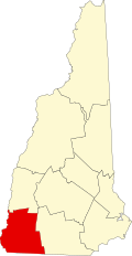
Cheshire County is a county in the southwestern corner of the U.S. state of New Hampshire. As of the 2020 census, the population was 76,458. [1] Its county seat is the city of Keene. [2] Cheshire was one of the five original counties of New Hampshire, and is named for the county of Cheshire in England. It was organized in 1771 at Keene. Sullivan County was created from the northern portion of Cheshire County in 1827.

Contents

Cheshire County comprises the Keene, NH micropolitan statistical area.

Geography

According to the U.S. Census Bureau, the county has an area of 729 square miles (1,890 km2), of which 707 square miles (1,830 km2) is land and 22 square miles (57 km2) (3.1%) is water. [3] The highest point in Cheshire County is Mount Monadnock, in the northwestern part of Jaffrey, at 3,165 feet (965 m).

Adjacent counties

Geographical landmarks

Demographics

Historical population
CensusPop.Note
1790 28,753
1800 38,82535.0%
1810 40,9885.6%
1820 45,37610.7%
1830 27,016−40.5%
1840 26,429−2.2%
1850 30,14414.1%
1860 27,434−9.0%
1870 27,265−0.6%
1880 28,7345.4%
1890 29,5792.9%
1900 31,3215.9%
1910 30,659−2.1%
1920 30,9751.0%
1930 33,6858.7%
1940 34,9533.8%
1950 38,81111.0%
1960 43,34211.7%
1970 52,36420.8%
1980 62,11618.6%
1990 70,12112.9%
2000 73,8255.3%
2010 77,1174.5%
2020 76,458−0.9%
U.S. Decennial Census [4]
1790-1960 [5] 1900-1990 [6]
1990-2000 [7] 2010-2018 [8]

2000 census

As of the census [9] of 2000, there were 73,825 people, 28,299 households, and 18,790 families living in the county. The population density was 104 people per square mile (40 people/km2). There were 31,876 housing units at an average density of 45 per square mile (17/km2). The county's racial makeup was 97.75% White, 0.37% Black or African American, 0.31% Native American, 0.47% Asian, 0.04% Pacific Islander, 0.18% from other races, and 0.89% from two or more races. 0.72% of the population were Hispanic or Latino of any race. 16.2% were of English, 13.1% French, 12.7% Irish, 9.3% American, 8.7% French Canadian, 6.7% Italian and 6.5% German ancestry. 95.5% spoke English, 1.4% French and 1.2% Spanish as their first language.

There were 28,299 households, of which 30.60% had children under the age of 18 living with them, 53.50% were married couples living together, 9.00% had a female householder with no husband present, and 33.60% were non-families. 25.50% of all households were made up of individuals, and 9.60% had someone living alone who was 65 years of age or older. The average household size was 2.47 and the average family size was 2.96.

23.30% of the county's population were under the age of 18, 11.70% were from 18 to 24, 27.00% were from 25 to 44, 24.30% were from 45 to 64, and 13.70% were 65 years of age or older. The median age was 38 years. For every 100 females there were 94.90 males. For every 100 females age 18 and over, there were 91.70 males.

The county's median household income was $42,382, and the median family income was $51,043. Males had a median income of $33,821 versus $25,328 for females. The county's per capita income was $20,685. About 4.40% of families and 8.00% of the population were below the poverty line, including 8.50% of those under age 18 and 6.30% of those age 65 or over.

2010 census

As of the 2010 United States census, there were 77,117 people, 30,204 households, and 19,284 families living in the county. [10] The population density was 109.1 inhabitants per square mile (42.1/km2). There were 34,773 housing units at an average density of 49.2 per square mile (19.0/km2). [11] The county's racial makeup was 96.3% white, 1.2% Asian, 0.5% black or African American, 0.3% American Indian, 0.4% from other races, and 1.4% from two or more races. Those of Hispanic or Latino origin made up 1.4% of the population. [10] In terms of ancestry, 20.7% were English, 19.1% were Irish, 12.0% were German, 8.8% were French Canadian, 8.7% were Italian, 5.0% were Scottish, and 4.7% were American. [12]

Of the 30,204 households, 27.8% had children under the age of 18 living with them, 49.9% were married couples living together, 9.4% had a female householder with no husband present, 36.2% were non-families, and 26.2% of all households were made up of individuals. The average household size was 2.40 and the average family size was 2.88. The median age was 40.7 years. [10]

The county's median household income was $53,828 and the median family income was $65,936. Males had a median income of $46,014 versus $35,864 for females. The county's per capita income was $27,045. About 6.0% of families and 10.0% of the population were below the poverty line, including 10.5% of those under age 18 and 6.8% of those age 65 or over. [13]

Politics and government

United States presidential election results for Cheshire County, New Hampshire [14]
Year Republican Democratic Third party
No.%No.%No.%
2020 17,89840.34%25,52257.52%9502.14%
2016 16,87640.28%22,06452.66%2,9557.05%
2012 15,15636.64%25,38061.36%8241.99%
2008 15,20535.51%26,97162.98%6471.51%
2004 16,46339.82%24,43859.10%4461.08%
2000 13,79341.30%17,38252.05%2,2206.65%
1996 10,25234.52%16,15954.41%3,29011.08%
1992 11,03734.00%15,03746.33%6,38319.67%
1988 15,00254.53%12,33944.85%1710.62%
1984 15,85163.55%8,99036.05%1000.40%
1980 13,24252.00%7,83530.77%4,39017.24%
1976 12,55453.87%10,38844.57%3631.56%
1972 13,39058.98%9,15740.33%1560.69%
1968 10,70252.64%9,13544.93%4952.43%
1964 5,95830.42%13,62669.58%00.00%
1960 11,59457.22%8,66842.78%00.00%
1956 12,58569.26%5,57430.68%110.06%
1952 11,89763.94%6,71036.06%00.00%
1948 9,04358.32%6,33740.87%1260.81%
1944 8,33454.00%7,09845.99%20.01%
1940 8,30254.55%6,91645.45%00.00%
1936 8,05255.25%6,32243.38%2001.37%
1932 7,90457.73%5,66241.35%1260.92%
1928 8,67363.05%5,02536.53%580.42%
1924 7,00869.00%2,72026.78%4284.21%
1920 6,64465.83%3,37433.43%740.73%
1916 3,33753.44%2,77944.51%1282.05%
1912 2,76543.74%2,11433.44%1,44222.81%
1908 4,16064.74%1,91729.83%3495.43%
1904 4,36466.63%2,00230.56%1842.81%
1900 4,43566.73%2,12031.90%911.37%
1896 4,81875.60%1,27219.96%2834.44%
1892 4,02456.34%2,99441.92%1241.74%
1888 4,11855.52%3,16542.67%1341.81%
1884 3,88854.34%2,98141.66%2864.00%
1880 4,34058.61%2,97940.23%861.16%
1876 4,16258.19%2,98441.72%60.08%

County Commission

The executive power of Cheshire County's government is held by three county commissioners, each representing one of the three commissioner districts within the county.

DistrictCommissionerHometownParty
1John Wozmak (chair) Walpole Democratic
2Terry Clark (Clerk) Keene Democratic
3Robert Englund (Vice Chair) Stoddard Democratic

In addition to the County Commission, there are five directly elected officials: they include County Attorney, Register of Deeds, County Sheriff, Register of Probate, and County Treasurer. [15]

OfficeName
County AttorneyChris McLaughlin (D)
Register of DeedsAnna Tilton (D)
County SheriffEli Rivera (D)
Register of ProbateJeremy LaPlante (D)
County TreasurerCharles Weed (D)

[16]

Legislative branch

The legislative branch of Cheshire County is made up of all of the members of the New Hampshire House of Representatives from the county. In total, there are 22 members from 18 different districts. After the 2022 elections, the party distribution and representatives were as follows.

AffiliationMembersVoting share
Democratic Party 1672.7%
Republican Party 627.3%
Total23100%

Communities

City

Towns

Census-designated places

Villages

See also

Related Research Articles

<span class="mw-page-title-main">Chesterfield, New Hampshire</span> Town in New Hampshire, United States

Chesterfield is a town in Cheshire County, New Hampshire, United States. The population was 3,552 at the 2020 census. It includes the villages of Spofford and West Chesterfield. Chesterfield is home to Spofford Lake, Chesterfield Gorge Natural Area, and parts of Pisgah State Park and Wantastiquet Mountain State Forest.

<span class="mw-page-title-main">Fitzwilliam, New Hampshire</span> Town in New Hampshire, United States

Fitzwilliam is a town in Cheshire County, New Hampshire, United States. The population was 2,351 at the 2020 census. Fitzwilliam is home to Rhododendron State Park, a 16-acre (6.5 ha) grove of native rhododendrons that bloom in mid-July.

<span class="mw-page-title-main">Gilsum, New Hampshire</span> Town in New Hampshire, United States

Gilsum is a town in Cheshire County, New Hampshire, United States. The population was 752 at the 2020 census. Home to Bear's Den Natural Area, Gilsum includes Gilsum Lower Village.

<span class="mw-page-title-main">Harrisville, New Hampshire</span> Town in New Hampshire, United States

Harrisville is a town in Cheshire County, New Hampshire, United States. Besides the town center, it also includes the villages of Chesham and Eastview. The population of the town was 984 at the 2020 census.

<span class="mw-page-title-main">Marlow, New Hampshire</span> Town in New Hampshire, United States

Marlow is a town in Cheshire County, New Hampshire, United States. The population was 749 at the 2020 census. Marlow is home to Honey Brook State Forest.

<span class="mw-page-title-main">Richmond, New Hampshire</span> Town in New Hampshire, United States

Richmond is a town in Cheshire County, New Hampshire, United States. The population was 1,197 at the 2020 census.

<span class="mw-page-title-main">Rindge, New Hampshire</span> Town in New Hampshire, United States

Rindge is a town in Cheshire County, New Hampshire, United States. The population was 6,476 at the 2020 census, up from 6,014 at the 2010 census. Rindge is home to Franklin Pierce University, the Cathedral of the Pines and part of Annett State Forest.

<span class="mw-page-title-main">Roxbury, New Hampshire</span> Town in New Hampshire, United States

Roxbury is a town in Cheshire County, New Hampshire, United States. The population was 220 at the 2020 census.

<span class="mw-page-title-main">Sullivan, New Hampshire</span> Town in New Hampshire, United States

Sullivan is a town in Cheshire County, New Hampshire, United States. The population was 658 at the 2020 census. It includes the villages of East Sullivan and Ellisville.

<span class="mw-page-title-main">Surry, New Hampshire</span> Town in New Hampshire, United States

Surry is a town in Cheshire County, New Hampshire, United States. The population was 820 at the 2020 census, up from 732 at the 2010 census.

<span class="mw-page-title-main">Swanzey, New Hampshire</span> Town in New Hampshire, United States

Swanzey is a town in Cheshire County, New Hampshire, United States. The population was 7,270 at the 2020 census. In addition to the town center, Swanzey includes the villages of East Swanzey, West Swanzey, North Swanzey and Westport.

<span class="mw-page-title-main">Troy, New Hampshire</span> Town in New Hampshire, United States

Troy is a town in Cheshire County, New Hampshire, United States. The population was 2,130 at the 2020 census. It is situated west of Mount Monadnock.

<span class="mw-page-title-main">West Swanzey, New Hampshire</span> Census-designated place in New Hampshire, United States

West Swanzey is a census-designated place (CDP) in the town of Swanzey within Cheshire County, New Hampshire, United States. The population was 1,281 at the 2020 census. It is the largest village in the town of Swanzey.

<span class="mw-page-title-main">Westmoreland, New Hampshire</span> Town in New Hampshire, United States

Westmoreland is a town in Cheshire County, New Hampshire, United States. The population was 1,706 at the 2020 census, down from 1,874 at the 2010 census. Westmoreland is historically an agricultural town, with much arable farmland.

<span class="mw-page-title-main">Sharon, New Hampshire</span> Town in New Hampshire, United States

Sharon is a town in Hillsborough County, New Hampshire, United States. The population was 359 at the 2020 census. It was the long-time home to the Sharon Arts Center, a nonprofit which has ceased operations.

<span class="mw-page-title-main">Lempster, New Hampshire</span> Place in New Hampshire, United States

Lempster is a town in Sullivan County, New Hampshire, United States. The population was 1,118 at the 2020 census. Settlements include the town center and the village of East Lempster.

<span class="mw-page-title-main">Jaffrey (CDP), New Hampshire</span> Census-designated place in New Hampshire, United States

Jaffrey is a census-designated place (CDP) and the main village in the town of Jaffrey in Cheshire County, New Hampshire, United States. The population of the CDP was 3,058 at the 2020 census, out of 5,320 in the entire town of Jaffrey.

<span class="mw-page-title-main">Jaffrey, New Hampshire</span> Town in New Hampshire, United States

Jaffrey is a town in Cheshire County, New Hampshire, United States. The population was 5,320 at the 2020 census.

<span class="mw-page-title-main">Marlborough (CDP), New Hampshire</span> Census-designated place in New Hampshire, United States

Marlborough is a census-designated place (CDP) and the main village in the town of Marlborough in Cheshire County, New Hampshire, United States. The population of the CDP was 1,066 at the 2020 census, out of 2,096 in the entire town.

<span class="mw-page-title-main">Marlborough, New Hampshire</span> Town in New Hampshire, United States

Marlborough is a town in Cheshire County, New Hampshire, United States. The population was 2,096 at the 2020 census. The town is home to the Kensan-Devan Wildlife Sanctuary at Meetinghouse Pond.

References

  1. "Census - Geography Profile: Cheshire County, New Hampshire". United States Census Bureau . Retrieved November 21, 2021.
  2. "Find a County". National Association of Counties. Archived from the original on May 3, 2015. Retrieved June 7, 2011.
  3. "2010 Census Gazetteer Files". United States Census Bureau. August 22, 2012. Archived from the original on December 27, 2014. Retrieved December 27, 2014.
  4. "U.S. Decennial Census". United States Census Bureau. Retrieved December 27, 2014.
  5. "Historical Census Browser". University of Virginia Library. Archived from the original on August 11, 2012. Retrieved December 27, 2014.
  6. "Population of Counties by Decennial Census: 1900 to 1990". United States Census Bureau. Retrieved December 27, 2014.
  7. "Census 2000 PHC-T-4. Ranking Tables for Counties: 1990 and 2000" (PDF). United States Census Bureau. Archived (PDF) from the original on March 27, 2010. Retrieved December 27, 2014.
  8. "State & County QuickFacts". United States Census Bureau. Archived from the original on August 5, 2011. Retrieved September 24, 2013.
  9. "U.S. Census website". United States Census Bureau . Retrieved January 31, 2008.
  10. 1 2 3 "DP-1 Profile of General Population and Housing Characteristics: 2010 Demographic Profile Data". United States Census Bureau. Archived from the original on February 13, 2020. Retrieved January 12, 2016.
  11. "Population, Housing Units, Area, and Density: 2010 - County". United States Census Bureau. Archived from the original on February 13, 2020. Retrieved January 12, 2016.
  12. "DP02 SELECTED SOCIAL CHARACTERISTICS IN THE UNITED STATES – 2006-2010 American Community Survey 5-Year Estimates". United States Census Bureau. Archived from the original on February 13, 2020. Retrieved January 12, 2016.
  13. "DP03 SELECTED ECONOMIC CHARACTERISTICS – 2006-2010 American Community Survey 5-Year Estimates". United States Census Bureau. Archived from the original on February 13, 2020. Retrieved January 12, 2016.
  14. Leip, David. "Dave Leip's Atlas of U.S. Presidential Elections". uselectionatlas.org. Retrieved April 11, 2018.
  15. "Departments".
  16. "General Election Winners - 11/03/2020" (PDF). New Hampshire Secretary of State's Office. November 11, 2020. Archived (PDF) from the original on May 25, 2021. Retrieved December 8, 2020.
Template:Attached KML/Cheshire County, New Hampshire
KML is from Wikidata

42°55′N72°15′W / 42.92°N 72.25°W / 42.92; -72.25