Woodstock, New Hampshire

Last updated

Woodstock, New Hampshire
Town
Woodstock NH.jpg
Grafton-Woodstock-NH.png
Coordinates: 43°58′40″N71°41′09″W / 43.97778°N 71.68583°W / 43.97778; -71.68583
Country United States
State New Hampshire
County Grafton
Incorporated 1763
VillagesWoodstock
North Woodstock
Government
   Select Board
  • Charyl Reardon, Chair
  • Scott Rice
  • R. Gil Rand
Area
[1]
  Total59.3 sq mi (153.6 km2)
  Land58.8 sq mi (152.2 km2)
  Water0.5 sq mi (1.4 km2)  0.93%
Elevation
741 ft (226 m)
Population
 (2020) [2]
  Total1,434
  Density24/sq mi (9.4/km2)
Time zone UTC−5 (Eastern)
  Summer (DST) UTC−4 (Eastern)
ZIP Codes
03262 (North Woodstock)
03293 (Woodstock)
Area code 603
FIPS code 33-87060
GNIS feature ID0873761
Website www.woodstocknh.org

Woodstock is a town in Grafton County, New Hampshire, United States. The population was 1,434 at the 2020 census. [2] Woodstock includes the village of North Woodstock, the commercial center. Its extensive land area is largely forested, and includes the Hubbard Brook Experimental Forest. Parts of the White Mountain National Forest are in the east and west. The Appalachian Trail crosses the town's northwestern corner. Russell Pond Campground is in the east. West of North Woodstock is the Lost River Reservation.

Contents

History

First granted in 1763, colonial Governor Benning Wentworth named the town "Peeling" after an English town. Many of the first colonists were originally from Lebanon, Connecticut. In 1771, his nephew, Governor John Wentworth, gave it the name "Fairfield", after Fairfield, Connecticut. The town was renamed "Woodstock" in 1840 for Blenheim Palace in Woodstock, Oxfordshire, England, possibly due to the popularity of the 1826 Walter Scott novel Woodstock . [3] [4]

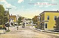
Logging became a principal early industry, with sawmills established using water power from the Pemigewasset River. The entrance of the railroad in the 19th century opened the wilderness to development, carrying away wood products to market. It also brought tourists, many attracted by paintings of the region by White Mountain artists. Several inns and hotels were built to accommodate the wealthy, who sought relief from the summer heat, humidity and pollution of coal-age Boston, Hartford, New York and Philadelphia. They often relaxed by taking carriage rides through the White Mountains, or by hiking along the Lost River in Lost River Reservation. But with the advent of automobiles, patrons were no longer restricted by the limits of rail service. Consequently, many grand hotels established near depots declined and closed. North Woodstock, however, remains a popular tourist destination.

The Hubbard Brook Experimental Forest, an outdoor laboratory for ecological studies founded by the United States Forest Service in 1955, is located in the southern part of town.

Geography

According to the United States Census Bureau, the town has a total area of 59.3 square miles (153.6 km2), of which 58.8 square miles (152.2 km2) are land and 0.54 square miles (1.4 km2) are water, comprising 0.93% of the town. Woodstock is drained by the Pemigewasset River, which crosses the eastern side of town. Tributaries of the Pemigewasset in Woodstock include Hubbard Brook, Glover Brook, Moosilauke Brook and its tributary the Lost River, and the East Branch Pemigewasset River. The highest point in Woodstock is the summit of Mount Jim near the western border of the town, at 4,172 feet (1,272 m) above sea level, a spur of Mount Moosilauke.

Woodstock is crossed by Interstate 93, U.S. Route 3, and state routes 112 and 175.

Demographics

North Woodstock
Woodstock Inn Brewery New Hampshire.jpg
Woodstock Inn Brewery
United States Post Office, North Woodstock New Hampshire.jpg
North Woodstock post office
Historical population
CensusPop.Note
1840 472
1850 418−11.4%
1860 47613.9%
1870 405−14.9%
1880 367−9.4%
1890 341−7.1%
1900 62884.2%
1910 1,08372.5%
1920 684−36.8%
1930 75610.5%
1940 98129.8%
1950 894−8.9%
1960 827−7.5%
1970 8978.5%
1980 1,00812.4%
1990 1,16715.8%
2000 1,139−2.4%
2010 1,37420.6%
2020 1,4344.4%
U.S. Decennial Census [2] [5]
Woodstock Lumber Co. c. 1915 Woodstock Lumber Company's Mill, Woodstock, NH.jpg
Woodstock Lumber Co. c.1915

As of the census of 2010, there were 1,374 people, 624 households, and 353 families residing in the town. There were 1,421 housing units, of which 797, or 56.1%, were vacant. 701 of the vacant units were for seasonal or recreational use. The racial makeup of the town was 96.9% White, 0.1% African American, 0.2% Native American, 0.9% Asian, 0.1% Native Hawaiian or Pacific Islander, 0.1% some other race, and 1.8% from two or more races. 0.3% of the population were Hispanic or Latino of any race. [6]

Of the 624 households, 25.5% had children under the age of 18 living with them, 43.6% were headed by married couples living together, 8.5% had a female householder with no husband present, and 43.4% were non-families. 31.6% of all households were made up of individuals, and 9.2% were someone living alone who was 65 years of age or older. The average household size was 2.20, and the average family size was 2.77. [6]

In the town, 19.2% of the population were under the age of 18, 7.9% were from 18 to 24, 24.2% from 25 to 44, 32.2% from 45 to 64, and 16.4% were 65 years of age or older. The median age was 44.2 years. For every 100 females, there were 102.1 males. For every 100 females age 18 and over, there were 101.5 males. [6]

For the period 2011–2015, the estimated median annual income for a household was $49,063, and the median income for a family was $62,500. Male full-time workers had a median income of $33,750 versus $44,034 for females. The per capita income for the town was $30,671. 8.0% of the population and 2.4% of families were below the poverty line. 7.5% of the population under the age of 18 and 5.0% of those 65 or older were living in poverty. [7]

Related Research Articles

<span class="mw-page-title-main">Lincoln, New Hampshire</span> Town in New Hampshire, United States

Lincoln is a town in Grafton County, New Hampshire, United States. It is the second-largest town by area in New Hampshire. The population was 1,631 at the 2020 census. The town is home to the New Hampshire Highland Games and to a portion of Franconia Notch State Park. Set in the White Mountains, large portions of the town are within the White Mountain National Forest. The Appalachian Trail crosses the western and northeastern parts of the town. Lincoln is the location of Loon Mountain Ski Resort and associated recreation-centered development.

<span class="mw-page-title-main">Grafton County, New Hampshire</span> County in New Hampshire, United States

Grafton County is a county in the U.S. state of New Hampshire. As of the 2020 census, the population was 91,118. Its county seat is the town of Haverhill. In 1972, the county courthouse and other offices were moved from Woodsville, a larger village within the town of Haverhill, to North Haverhill.

<span class="mw-page-title-main">Ashland, New Hampshire</span> Town in New Hampshire, United States

Ashland is a town in Grafton County, New Hampshire, United States. The population was 1,938 at the 2020 census, down from 2,076 at the 2010 census. Located near the geographical center of the state, Ashland is home to Scribner-Fellows State Forest.

<span class="mw-page-title-main">Benton, New Hampshire</span> Town in New Hampshire, United States

Benton is a town in Grafton County, New Hampshire, United States. The population was 374 at the 2020 census. Located in the White Mountains, Benton is largely surrounded by the White Mountain National Forest. The town is crossed by the Appalachian Trail.

<span class="mw-page-title-main">Campton, New Hampshire</span> Town in New Hampshire, United States

Campton is a town in Grafton County, New Hampshire, United States. The population was 3,343 at the 2020 census. Campton, which includes the villages of Blair, Campton Hollow, Lower Campton and West Campton, is home to Blair State Forest and Livermore Falls State Forest. It is located in the foothills of the White Mountains, and parts of the White Mountain National Forest are in the northeast and northwest.

<span class="mw-page-title-main">Ellsworth, New Hampshire</span> Town in New Hampshire, United States

Ellsworth is a town in Grafton County, New Hampshire, United States. The population was 93 at the 2020 census.

<span class="mw-page-title-main">Franconia, New Hampshire</span> Town in New Hampshire, United States

Franconia is a town in Grafton County, New Hampshire, United States. The population was 1,083 at the 2020 census. Set in the White Mountains, Franconia is home to the northern half of Franconia Notch State Park. Parts of the White Mountain National Forest are in the eastern and southern portions of the town. The Appalachian Trail crosses the town.

<span class="mw-page-title-main">Grafton, New Hampshire</span> Town in New Hampshire, United States

Grafton is a town in Grafton County, New Hampshire, United States. The population was 1,385 at the 2020 census.

<span class="mw-page-title-main">Orange, New Hampshire</span> Town in New Hampshire, United States

Orange is a town in Grafton County, New Hampshire, United States. The population was 277 at the 2020 census, down from 331 at the 2010 census.

<span class="mw-page-title-main">Orford, New Hampshire</span> Town in New Hampshire, United States

Orford is a town in Grafton County, New Hampshire, United States. The population was 1,237 at the 2020 census, unchanged from the 2010 census. The Appalachian Trail crosses in the east.

<span class="mw-page-title-main">Thornton, New Hampshire</span> Town in New Hampshire, United States

Thornton is a town in Grafton County, New Hampshire, United States. The population was 2,708 at the 2020 census, up from 2,490 at the 2010 census.

<span class="mw-page-title-main">Warren, New Hampshire</span> Town in New Hampshire, United States

Warren is a town in Grafton County, New Hampshire, United States. The population was 825 at the 2020 census, down from 904 at the 2010 census. Warren includes the village of Glencliff. The Appalachian Trail crosses the town in the west.

<span class="mw-page-title-main">Danbury, New Hampshire</span> Town in New Hampshire, United States

Danbury is a town in Merrimack County, New Hampshire, United States. The population was 1,250 at the 2020 census.

<span class="mw-page-title-main">Hill, New Hampshire</span> Town in New Hampshire, United States

Hill is a town in Merrimack County, New Hampshire, United States. The population was 1,017 at the 2020 census. It is home to William Thomas State Forest.

<span class="mw-page-title-main">Springfield, New Hampshire</span> Place in New Hampshire, United States

Springfield is a town in Sullivan County, New Hampshire, United States. The population was 1,259 at the 2020 census. Gile State Forest is located within the town.

<span class="mw-page-title-main">Wentworth, New Hampshire</span> Town in New Hampshire, United States

Wentworth is a town in Grafton County, New Hampshire, United States. The population was 845 at the 2020 census, down from 911 at the 2010 census. The town is home to Plummer's Ledge Natural Area, and part of the White Mountain National Forest is in the northeast. The town has a picturesque common, presided over by a Federal-style church and bordered by antique homes.

<span class="mw-page-title-main">Plymouth (CDP), New Hampshire</span> Census-designated place in New Hampshire, United States

Plymouth is a census-designated place (CDP) and the main village in the town of Plymouth in Grafton County, New Hampshire, United States. Its population was 4,730 at the 2020 census, out of 6,682 in the entire town. The CDP includes the campus of Plymouth State University.

<span class="mw-page-title-main">Plymouth, New Hampshire</span> Town in New Hampshire, United States

Plymouth is a rural town in Grafton County, New Hampshire, United States, in the White Mountains Region. It has a unique role as the economic, medical, commercial, and cultural center for the predominantly rural Plymouth, NH Labor Market Area. Plymouth is located at the confluence of the Pemigewasset and Baker rivers and sits at the foot of the White Mountains. The town's population was 6,682 at the 2020 census. It is home to Plymouth State University, Speare Memorial Hospital, and Plymouth Regional High School.

<span class="mw-page-title-main">North Woodstock, New Hampshire</span> Census-designated place in New Hampshire, United States

North Woodstock is a census-designated place (CDP) and the primary village in the town of Woodstock in Grafton County, New Hampshire, United States. It had a population of 739 at the 2020 census.

Lincoln is a census-designated place (CDP) and the main village in the town of Lincoln in Grafton County, New Hampshire, United States. The population of the CDP was 969 at the 2020 census, out of 1,631 in the entire town.

References

  1. "2021 U.S. Gazetteer Files – New Hampshire". United States Census Bureau. Retrieved November 30, 2021.
  2. 1 2 3 "Woodstock town, Grafton County, New Hampshire: 2020 DEC Redistricting Data (PL 94-171)". U.S. Census Bureau. Retrieved November 30, 2021.
  3. Coolidge, Austin J.; John B. Mansfield (1859). A History and Description of New England. Boston, Massachusetts. pp. 702–703.{{cite book}}: CS1 maint: location missing publisher (link)
  4. Congress, United States (2013). Congressional Record: Proceedings and Debates of the ... Congress. U.S. Government Printing Office.
  5. "Census of Population and Housing". Census.gov. Retrieved June 4, 2016.
  6. 1 2 3 "Profile of General Population and Housing Characteristics: 2010 Census Summary File 1 (DP-1): Woodstock town, Grafton County, New Hampshire". American Factfinder. U.S. Census Bureau. Archived from the original on February 13, 2020. Retrieved October 31, 2017.
  7. "Selected Economic Characteristics: 2011-2015 American Community Survey 5-Year Estimates (DP03): Woodstock town, Grafton County, New Hampshire". American Factfinder. U.S. Census Bureau. Archived from the original on February 13, 2020. Retrieved October 31, 2017.