Orford, New Hampshire | |
---|---|
Town | |
Coordinates: 43°54′18″N72°08′15″W / 43.90500°N 72.13750°W | |
Country | United States |
State | New Hampshire |
County | Grafton |
Incorporated | 1761 |
Villages |
|
Government | |
• Selectboard |
|
Area | |
• Total | 47.9 sq mi (124.1 km2) |
• Land | 46.5 sq mi (120.4 km2) |
• Water | 1.4 sq mi (3.6 km2) 2.93% |
Elevation | 407 ft (124 m) |
Population (2020) [2] | |
• Total | 1,237 |
• Density | 27/sq mi (10.3/km2) |
Time zone | UTC-5 (Eastern) |
• Summer (DST) | UTC-4 (Eastern) |
ZIP code | 03777 |
Area code | 603 |
FIPS code | 33-58500 |
GNIS feature ID | 0873693 |
Website | www |
Orford is a town in Grafton County, New Hampshire, United States. The population was 1,237 at the 2020 census, [2] unchanged from the 2010 census. The Appalachian Trail crosses in the east.
First called "Number Seven" in a line of Connecticut River fort towns, Orford was incorporated in 1761 by Governor Benning Wentworth and named for Robert Walpole, Earl of Orford, who was the first prime minister of Great Britain. The town was settled in 1765 by Daniel Cross and wife from Lebanon, Connecticut. [3] By 1859, it had 1,406 inhabitants, most involved in agriculture. There was a large tannery, a chair factory, ten sawmills, a starch factory, a gristmill, a sash, blind and door factory, and two boot and shoe factories. [3]
An original grantee was General Israel Morey, whose son Samuel Morey discovered a way to separate hydrogen from oxygen in water, making possible the first marine steam engine. He recognized the potential of steam power after working at his father's ferry. In 1793, on the river at Orford, he was first to demonstrate the use of a paddlewheel to propel a steam boat.
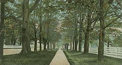
Author Washington Irving visited Orford in 1832 and is quoted as saying, "In all my travels in this country and in Europe, I have seen no village more beautiful than this. It is a charming place—nature has done her utmost here." [4] Of the famous sequence of seven early homes built on The Ridge, Dartmouth Professor of Architecture Hugh Morrison said, "As a row and counting the setting, this is the finest group of Federal-style houses in the United States." [5] Built between 1773 and 1839, the dwellings show the influence of architect Asher Benjamin.
According to the United States Census Bureau, the town has a total area of 47.9 square miles (124.1 km2), of which 46.5 square miles (120.4 km2) are land and 1.4 square miles (3.6 km2) are water, comprising 2.93% of the town. [1] The Connecticut River, which serves as the boundary between New Hampshire and Vermont, forms the western edge of the town. Most of Orford is drained by Jacobs Brook and other small tributaries of the Connecticut. The northeastern corner of the town, around Upper and Lower Baker Ponds, drains via the Baker River and Pemigewasset River into the Merrimack River.
The town has two population centers. The main village of Orford, with the town's schools and post office, is located on New Hampshire Route 10 along the banks of the Connecticut River. The town hall, however, is located in the smaller village of Orfordville, on New Hampshire Route 25A several miles east of the river.
The highest point in Orford is the summit of Mount Cube, at 2,909 feet (887 m) above sea level, in the eastern part of town. The northern slopes of Smarts Mountain, whose 3,240-foot (990 m) summit lies in the neighboring town of Lyme, occupy the southeastern corner of town.
Camps Merriwood and Moosilauke are situated on Upper Baker Pond in Orford.
Census | Pop. | Note | %± |
---|---|---|---|
1790 | 540 | — | |
1800 | 988 | 83.0% | |
1810 | 1,265 | 28.0% | |
1820 | 1,568 | 24.0% | |
1830 | 1,829 | 16.6% | |
1840 | 1,707 | −6.7% | |
1850 | 1,406 | −17.6% | |
1860 | 1,255 | −10.7% | |
1870 | 1,119 | −10.8% | |
1880 | 1,050 | −6.2% | |
1890 | 916 | −12.8% | |
1900 | 890 | −2.8% | |
1910 | 799 | −10.2% | |
1920 | 661 | −17.3% | |
1930 | 636 | −3.8% | |
1940 | 701 | 10.2% | |
1950 | 726 | 3.6% | |
1960 | 667 | −8.1% | |
1970 | 793 | 18.9% | |
1980 | 928 | 17.0% | |
1990 | 1,008 | 8.6% | |
2000 | 1,091 | 8.2% | |
2010 | 1,237 | 13.4% | |
2020 | 1,237 | 0.0% | |
U.S. Decennial Census [2] [6] |
As of the census [7] of 2000, there were 1,091 people, 470 households, and 308 families residing in the town. The population density was 23.4 people per square mile (9.0/km2). There were 561 housing units at an average density of 12.0 per square mile (4.6/km2). The racial makeup of the town was 96.98% White, 0.09% African American, 0.27% Native American, 0.64% Asian, 1.10% from other races, and 0.92% from two or more races. Hispanic or Latino of any race were 0.92% of the population.
There were 470 households, out of which 26.6% had children under the age of 18 living with them, 55.5% were married couples living together, 7.0% had a female householder with no husband present, and 34.3% were non-families. 27.4% of all households were made up of individuals, and 9.1% had someone living alone who was 65 years of age or older. The average household size was 2.32 and the average family size was 2.84.
In the town, the population was spread out, with 21.9% under the age of 18, 6.3% from 18 to 24, 29.8% from 25 to 44, 29.0% from 45 to 64, and 13.0% who were 65 years of age or older. The median age was 40 years. For every 100 females, there were 95.2 males. For every 100 females age 18 and over, there were 94.5 males.
The median income for a household in the town was $46,250, and the median income for a family was $50,577. Males had a median income of $27,500 versus $25,833 for females. The per capita income for the town was $24,196. About 3.1% of families and 5.5% of the population were below the poverty line, including 7.4% of those under age 18 and 4.1% of those age 65 or over.
In the winter of 2011, Orford experienced a rash of street sign theft, at one point leaving the town with only six signs remaining. With an addition of a new police officer, 66 of the signs were recovered and two of the thieves admitted to stealing the signs. [8]
Hanover is a town located along the Connecticut River in Grafton County, New Hampshire, United States. As of the 2020 census, its population was 11,870. The town is home to the Ivy League university Dartmouth College, the U.S. Army Corps of Engineers Cold Regions Research and Engineering Laboratory, and Hanover High School. The Appalachian Trail crosses the town, connecting with a number of trails and nature preserves.
Norwich is a town in Windsor County, Vermont, United States. The population was 3,612 at the 2020 census. Home to some of the state of Vermont's wealthiest residents, the municipality is a commuter town for nearby Hanover, New Hampshire across the Connecticut River. The town is part of the Dresden School District, the first interstate school district in the United States, signed into law by President John F. Kennedy. The town contains the Norwich Mid-Century Modern Historic District.
Walpole is a town in Cheshire County, New Hampshire, United States. The population was 3,633 at the 2020 census.
Clarksville is a town in northern Coös County, New Hampshire, United States. The population was 294 at the 2020 census. It is part of the Berlin, NH–VT Micropolitan Statistical Area.
Dalton is a town in Coös County, New Hampshire, United States. The population was 933 at the 2020 census. It is part of the Berlin, NH–VT Micropolitan Statistical Area.
Pittsburg is a town in Coös County, New Hampshire, United States. The population was 800 at the 2020 census. It is the northernmost town in New Hampshire and the largest town by area in New England. U.S. Route 3 is the only major highway in the town, although the northern terminus of New Hampshire Route 145 also lies within Pittsburg.
Lebanon is the only city in Grafton County, New Hampshire, United States. The population was 14,282 at the 2020 census, up from 13,151 at the 2010 census. Lebanon is in western New Hampshire, south of Hanover, near the Connecticut River. It is the home to Dartmouth–Hitchcock Medical Center and Dartmouth College's Geisel School of Medicine, together comprising the largest medical facility between Boston, Massachusetts, and Burlington, Vermont.
Lyme is a town along the Connecticut River in Grafton County, New Hampshire, United States. The population was 1,745 as of the 2020 census. Lyme is home to the Chaffee Natural Conservation Area. The Dartmouth Skiway is in the eastern part of town, near the village of Lyme Center. The Appalachian Trail passes through the town's heavily wooded eastern end.
Piermont is a town in Grafton County, New Hampshire, United States. The population was 769 at the 2020 census. It is home to Camp Walt Whitman and Kingswood Camp for Boys.
Rumney is a town in Grafton County, New Hampshire, United States. The population was 1,498 at the 2020 census. The town is located at the southern edge of the White Mountain National Forest.
Hill is a town in Merrimack County, New Hampshire, United States. The population was 1,017 at the 2020 census. It is home to William Thomas State Forest.
Cornish is a town in Sullivan County, New Hampshire, United States. The population was 1,616 at the 2020 census. Cornish has four covered bridges. Each August, it is home to the Cornish Fair.
Goshen is a town in Sullivan County, New Hampshire, United States. The population was 796 at the 2020 census.
Unity is a town in Sullivan County, New Hampshire, United States. The population was 1,518 at the 2020 census, down from 1,671 at the 2010 census. The town includes the villages of Unity, East Unity, Quaker City, and West Unity.
Bloomfield is a town in Essex County, Vermont, United States. The population was 217 at the 2020 census. It is part of the Berlin, NH–VT Micropolitan Statistical Area.
Lemington is a town in Essex County, Vermont, United States. The population was 87 as of the 2020 census. It is part of the Berlin, NH–VT Micropolitan Statistical Area.
Fairlee is a town in Orange County, Vermont, United States. The population was 988 at the 2020 census. It includes the village of Ely. Fairlee is home to Lake Morey, which claims to have the longest ice skating trail in the United States.
Wentworth is a town in Grafton County, New Hampshire, United States. The population was 845 at the 2020 census, down from 911 at the 2010 census. The town is home to Plummer's Ledge Natural Area, and part of the White Mountain National Forest is in the northeast. The town has a picturesque common, presided over by a Federal-style church and bordered by antique homes.
Hanover is a census-designated place (CDP) and the main village in the town of Hanover in Grafton County, New Hampshire, United States. The population of the CDP was 9,078 at the 2020 census, out of 11,870 in the entire town. The CDP includes the campus of Dartmouth College.
Westminster is a town in Windham County, Vermont, United States. The population was 3,016 at the 2020 census. It is also the first capital of the Republic of Vermont. It borders the state of New Hampshire.