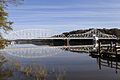
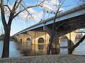
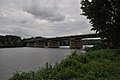
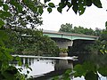
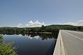
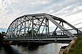
Crossing Carries Location Built Coordinates Image Connecticut Amtrak Old Saybrook–Old Lyme Bridge Amtrak Northeast Corridor Old Saybrook and Old Lyme 1907 41°18′39″N 72°20′57″W / 41.31083°N 72.34917°W / 41.31083; -72.34917 (Amtrak Old Saybrook – Old Lyme Bridge ) Raymond E. Baldwin Bridge I-95 / US 1 1948, 1993 41°19′09″N 72°20′51″W / 41.31917°N 72.34750°W / 41.31917; -72.34750 (Raymond E. Baldwin Bridge ) Chester–Hadlyme Ferry Route 148 Chester and Lyme 1769 41°25′11″N 72°25′50″W / 41.41972°N 72.43056°W / 41.41972; -72.43056 (Chester-Hadlyme Ferry ) East Haddam Bridge Route 82 Haddam and East Haddam 1913 41°27′05″N 72°27′52″W / 41.45139°N 72.46444°W / 41.45139; -72.46444 (East Haddam Bridge ) Middletown–Portland railroad bridge Middletown and Portland 41°34′00″N 72°38′52″W / 41.56667°N 72.64778°W / 41.56667; -72.64778 (Middletown–Portland railroad bridge ) Arrigoni Bridge Route 17 / Route 66 1938 41°34′09″N 72°38′55″W / 41.56917°N 72.64861°W / 41.56917; -72.64861 (Arrigoni Bridge ) Rocky Hill–Glastonbury Ferry Route 160 Rocky Hill and Glastonbury 1655 41°39′57″N 72°37′40″W / 41.66583°N 72.62778°W / 41.66583; -72.62778 (Rocky Hill - Glastonbury Ferry ) William H. Putnam Memorial Bridge Route 3 Wethersfield and Glastonbury 1959 41°42′51″N 72°38′27″W / 41.71417°N 72.64083°W / 41.71417; -72.64083 (William H. Putnam Memorial Bridge ) Charter Oak Bridge US 5 / Route 15 Hartford and East Hartford 1942, 1991 41°45′11″N 72°39′18″W / 41.75306°N 72.65500°W / 41.75306; -72.65500 (Charter Oak Bridge ) Founders Bridge Route 2 1958 41°45′56″N 72°39′55″W / 41.76556°N 72.66528°W / 41.76556; -72.66528 (Founders Bridge ) Morgan G. Bulkeley Bridge I-84 / US 6 / US 44 1908 (widened 1964) 41°46′09″N 72°39′54″W / 41.76917°N 72.66500°W / 41.76917; -72.66500 (Morgan G. Bulkeley Bridge ) Hartford–East Hartford railroad bridge c. 1873 41°46′35″N 72°39′27″W / 41.77639°N 72.65750°W / 41.77639; -72.65750 (Hartford–East Hartford railroad bridge ) Captain John Bissell Memorial Bridge I-291 and pedestrian/bike path Windsor and South Windsor 1957 41°48′47″N 72°38′40″W / 41.81306°N 72.64444°W / 41.81306; -72.64444 (Captain John Bissell Memorial Bridge ) Dexter Coffin Bridge I-91 Windsor Locks and East Windsor 1959 41°55′00″N 72°37′22″W / 41.91667°N 72.62278°W / 41.91667; -72.62278 (Dexter Coffin Bridge ) Bridge Street Bridge Route 140 1992 41°55′45″N 72°37′27″W / 41.92917°N 72.62417°W / 41.92917; -72.62417 (Bridge Street (Windsor Locks, CT) ) Warehouse Point railroad bridge Amtrak New Haven–Springfield Line Suffield and Enfield 1903 41°56′36″N 72°36′50″W / 41.94333°N 72.61389°W / 41.94333; -72.61389 (Amtrak/Springfield Terminal Railroad Bridge ) Enfield–Suffield Covered Bridge (destroyed 1900) 1832 41°58′30.34″N 72°36′22.31″W / 41.9750944°N 72.6061972°W / 41.9750944; -72.6061972 (Enfield–Suffield Covered Bridge ) Enfield–Suffield Veterans Bridge Route 190 1966 41°59′23″N 72°36′13″W / 41.98972°N 72.60361°W / 41.98972; -72.60361 (Enfield–Suffield Veterans Bridge ) Suffield and Thompsonville Bridge (demolished 1971) 1893 41°59′57″N 72°36′25.56″W / 41.99917°N 72.6071000°W / 41.99917; -72.6071000 (Suffield and Thompsonville Bridge ) Massachusetts Julia B. Buxton Bridge (South End Bridge) US 5 Agawam and Springfield 1954 42°04′53″N 72°34′58″W / 42.08139°N 72.58278°W / 42.08139; -72.58278 (Springfield South End Bridge ) Memorial Bridge Route 147 West Springfield and Springfield 1922 42°05′56″N 72°35′42″W / 42.09889°N 72.59500°W / 42.09889; -72.59500 (Springfield Memorial Bridge ) Old Toll Bridge (demolished)1816 42°5′59.68″N 72°35′46.47″W / 42.0999111°N 72.5962417°W / 42.0999111; -72.5962417 (Old Toll Bridge (removed) ) CSX Berkshire Subdivision 1873 42°06′05″N 72°35′57″W / 42.10139°N 72.59917°W / 42.10139; -72.59917 (CSX Berkshire rail bridge ) Arthur J. McKenna Bridge (North End Bridge) US 20 1924 42°06′31″N 72°36′51″W / 42.10861°N 72.61417°W / 42.10861; -72.61417 (Springfield North End Bridge ) I-91 bridge I-91 West Springfield and Chicopee 1966 42°08′07″N 72°36′55″W / 42.13528°N 72.61528°W / 42.13528; -72.61528 (Interstate 91 Bridge ) Chicopee – West Springfield Bridge (demolished 1987) 42°8′38.39″N 72°37′7.11″W / 42.1439972°N 72.6186417°W / 42.1439972; -72.6186417 (Chicopee – West Springfield Bridge ) Massachusetts Turnpike bridge I-90 1957 42°09′14″N 72°37′40″W / 42.15389°N 72.62778°W / 42.15389; -72.62778 (Interstate 90 (Massachusetts Turnpike) bridge ) Jones Ferry Holyoke and Chicopee 42°10′18″N 72°37′43″W / 42.17167°N 72.62861°W / 42.17167; -72.62861 (Jones Ferry ) I-391 bridge I-391 1979 42°11′24″N 72°36′36″W / 42.19000°N 72.61000°W / 42.19000; -72.61000 (Interstate 391 bridge ) Willimansett Bridge Route 116 / Route 141 1891, 2015 42°11′42″N 72°36′05″W / 42.19500°N 72.60139°W / 42.19500; -72.60139 (Willimansett Bridge ) Connecticut River Line 42°11′43″N 72°36′02″W / 42.19528°N 72.60056°W / 42.19528; -72.60056 (Connecticut River Line railroad bridge ) Vietnam Memorial Bridge Route 116 Holyoke and South Hadley 1990 42°12′42″N 72°35′46″W / 42.21167°N 72.59611°W / 42.21167; -72.59611 (Vietnam Memorial Bridge ) Joseph E. Muller Bridge US 202 1958 42°12′58″N 72°36′28″W / 42.21611°N 72.60778°W / 42.21611; -72.60778 (Joseph E. Muller Bridge ) Northampton Toll Bridge Northampton and Hadley 1808 42°20′11″N 72°37′04″W / 42.33639°N 72.61778°W / 42.33639; -72.61778 (Northampton Toll Bridge ) Calvin Coolidge Bridge Route 9 1937 42°20′11″N 72°37′04″W / 42.33639°N 72.61778°W / 42.33639; -72.61778 (Calvin Coolidge Bridge ) Norwottuck Rail Trail Bridge Norwottuck Rail Trail 1887 42°20′14″N 72°37′07″W / 42.33722°N 72.61861°W / 42.33722; -72.61861 (Norwottuck Rail Trail Bridge ) Hatfield Bridge (dismantled 1823) Hatfield and Hadley 1807 42°21′55.44″N 72°35′21.65″W / 42.3654000°N 72.5893472°W / 42.3654000; -72.5893472 (Hatfield Bridge, Bridge Lane, Hatfield, MA ) Sunderland Bridge Route 116 Deerfield and Sunderland 1937 42°28′03″N 72°35′06″W / 42.46750°N 72.58500°W / 42.46750; -72.58500 (Sunderland Bridge ) Deerfield–Montague railroad bridge Fitchburg Route Deerfield and Montague 42°33′44″N 72°33′22″W / 42.56222°N 72.55611°W / 42.56222; -72.55611 (Deerfield–Montague railroad bridge ) Canalside Rail Trail Bridge Deerfield and Montague c. 1880, 1936 42°34′45.30″N 72°34′29.53″W / 42.5792500°N 72.5748694°W / 42.5792500; -72.5748694 (Canalside Rail Trail Bridge ) Montague City Covered Bridge (destroyed 1936) Greenfield and Montague 42°34′49.1″N 72°34′44.9″W / 42.580306°N 72.579139°W / 42.580306; -72.579139 (Montague City Covered Bridge ) Montague trolley bridge (destroyed 1936) 42°34′49.1″N 72°34′45.9″W / 42.580306°N 72.579417°W / 42.580306; -72.579417 (Montague trolley bridge ) General Pierce Bridge 1947 42°34′49″N 72°34′47″W / 42.58028°N 72.57972°W / 42.58028; -72.57972 (General Pierce Bridge ) Turners Falls Road Bridge 1936 42°36′33″N 72°33′41″W / 42.60917°N 72.56139°W / 42.60917; -72.56139 (Turner Falls Road Bridge ) Gill–Montague Bridge Gill and Montague 1937 42°36′40″N 72°33′11″W / 42.61111°N 72.55306°W / 42.61111; -72.55306 (Gill–Montague Bridge ) French King Bridge Route 2 Gill and Erving 1931 42°35′52″N 72°29′48″W / 42.59778°N 72.49667°W / 42.59778; -72.49667 (French King Bridge ) Bennett's Meadow Bridge Route 10 Northfield 1969 42°41′00″N 72°28′18″W / 42.68333°N 72.47167°W / 42.68333; -72.47167 (Route 10 bridge ) Railroad bridge New England Central Railroad 1903 42°42′22.40″N 72°27′33″W / 42.7062222°N 72.45917°W / 42.7062222; -72.45917 (Railroad bridge ) Schell Bridge (closed) 1903 42°42′44″N 72°27′12″W / 42.71222°N 72.45333°W / 42.71222; -72.45333 (Schell Bridge (closed) ) Vermont – New Hampshire Rail bridge (demolished) Boston and Maine Railroad Fort Hill Branch (former) Vernon and Hinsdale 1913 42°44′14″N 72°27′45″W / 42.737098°N 72.462587°W / 42.737098; -72.462587 (Fort Hill Branch bridge ) Rail bridge (partially demolished) Boston and Maine Railroad Cheshire Branch (former) Brattleboro and Hinsdale 42°50′16.38″N 72°32′46.21″W / 42.8378833°N 72.5461694°W / 42.8378833; -72.5461694 (Cheshire Branch bridge ) General John Stark Memorial Bridge VT 119 NH 119 2024 [ 1] 42°51′00″N 72°33′07″W / 42.85009°N 72.55185°W / 42.85009; -72.55185 (General John Stark Memorial Bridge ) Charles Dana Bridge and the Anna Hunt Marsh Bridge pedestrians and bicycles (future) 1920 42°51′05″N 72°33′10″W / 42.85139°N 72.55278°W / 42.85139; -72.55278 (Marsh and Dana bridges ) United States Navy Seabees Bridge VT 9 NH 9 Brattleboro and Chesterfield 2003 42°53′02″N 72°33′07″W / 42.88389°N 72.55194°W / 42.88389; -72.55194 (United States Navy Seabees Bridge ) Route 123 bridge VT 123 NH 123 Westminster and Walpole 1910 43°05′04″N 72°26′00″W / 43.08444°N 72.43333°W / 43.08444; -72.43333 (Route 123 bridge ) Vilas Bridge (closed) Bellows Falls and North Walpole 1930 43°08′07″N 72°26′25″W / 43.13528°N 72.44028°W / 43.13528; -72.44028 (Vilas Bridge ) Stone Arch Bridge Vermont Rail (Green Mountain) 43°08′09″N 72°26′25″W / 43.13583°N 72.44028°W / 43.13583; -72.44028 (Stone Arch Bridge ) New England Central railroad bridge 43°08′17″N 72°26′48″W / 43.13806°N 72.44667°W / 43.13806; -72.44667 (New England Central railroad bridge ) Arch Bridge 1984 43°08′17″N 72°26′54″W / 43.13806°N 72.44833°W / 43.13806; -72.44833 (Arch Bridge ) Cheshire Bridge VT 11 NH 11 Springfield and Charlestown 1806,1906,1930 43°15′37″N 72°25′38″W / 43.26028°N 72.42722°W / 43.26028; -72.42722 (Cheshire Bridge ) Route 12 bridge VT 12 NH 12 Ascutney and Claremont 1969 43°24′11″N 72°24′01″W / 43.40306°N 72.40028°W / 43.40306; -72.40028 (Route 12 bridge ) New England Central railroad bridge Windsor and Cornish 43°28′11″N 72°23′19″W / 43.46972°N 72.38861°W / 43.46972; -72.38861 (New England Central railroad bridge ) Cornish–Windsor Covered Bridge 1866 43°28′25″N 72°23′01″W / 43.47361°N 72.38361°W / 43.47361; -72.38361 (Cornish–Windsor Covered Bridge ) I-89 bridge I-89 Hartford and Lebanon 1966 43°38′03″N 72°19′43″W / 43.63417°N 72.32861°W / 43.63417; -72.32861 (Interstate 89 bridge ) Railroad bridge White River Junction and West Lebanon 43°38′49″N 72°18′48″W / 43.64694°N 72.31333°W / 43.64694; -72.31333 (rail bridge (abandoned) ) Lyman Bridge US 4 1936, 2015 43°39′02″N 72°18′51″W / 43.65056°N 72.31417°W / 43.65056; -72.31417 (US Route 4 bridge ) Ledyard Bridge VT 10A NH 10A Norwich and Hanover 1998 43°42′13″N 72°17′59″W / 43.70361°N 72.29972°W / 43.70361; -72.29972 (Ledyard Bridge ) Lyme–East Thetford Bridge VT 113 East Thetford Road East Thetford and Lyme 1937 43°48′43″N 72°10′59″W / 43.81194°N 72.18306°W / 43.81194; -72.18306 (Route 113 bridge ) North Thetford Bridge (closed 1959 - destroyed winter 1972/1973) Bridge Street North Thetford Road North Thetford and Lyme 1822, 1864 43°50′32″N 72°10′58″W / 43.84222°N 72.18278°W / 43.84222; -72.18278 (North Thetford Bridge ) Morey Memorial Bridge VT 25A NH 25A Fairlee and Orford 1937 43°54′25″N 72°08′22″W / 43.90694°N 72.13944°W / 43.90694; -72.13944 (Morey Memorial Bridge ) Piermont Bridge VT 25 NH 25 Bradford and Piermont 1929 43°58′40″N 72°06′43″W / 43.97778°N 72.11194°W / 43.97778; -72.11194 (Piermont Bridge ) Bedell Covered Bridge (destroyed by wind, 1979) South Newbury and Haverhill 1805, 1823, 1862, 1866, 1979 44°02′43″N 72°04′27″W / 44.04528°N 72.07417°W / 44.04528; -72.07417 (Bedell Covered Bridge (missing) ) Newbury Crossing Road Newbury and Haverhill 1970 44°03′58″N 72°03′05″W / 44.06611°N 72.05139°W / 44.06611; -72.05139 (Newbury Crossing Road bridge ) Ranger Bridge US 302 Wells River and Woodsville 1917, 1923 44°09′14″N 72°02′27″W / 44.15389°N 72.04083°W / 44.15389; -72.04083 (Ranger Bridge ) Wells River Bridge (closed) Boston and Maine Corporation 1805, 1853, 1903 44°09′15″N 72°02′26″W / 44.15417°N 72.04056°W / 44.15417; -72.04056 (Wells River Bridge (closed) ) Frazier Road bridge McIndoe Falls and Monroe 1937 44°15′42″N 72°03′32″W / 44.26167°N 72.05889°W / 44.26167; -72.05889 (Frazier Road Bridge ) Barnet Road bridge Barnet and Monroe 1930 44°17′13″N 72°03′25″W / 44.28694°N 72.05694°W / 44.28694; -72.05694 (Barnet Road Bridge ) I-93 bridge I-93 Waterford and Littleton 1976, 1981 44°20′34″N 71°53′27″W / 44.34278°N 71.89083°W / 44.34278; -71.89083 (Interstate 93 bridge ) Route 18 bridge VT 18 NH 18 1934 44°20′33″N 71°53′20″W / 44.34250°N 71.88889°W / 44.34250; -71.88889 (Route 18 bridge ) Whitcomb Bridge Gilman and Dalton 1997 44°24′39″N 71°43′23″W / 44.41083°N 71.72306°W / 44.41083; -71.72306 (Gilman Road ) old Whitcomb Bridge pedestrian traffic only 1928 44°24′40.34″N 71°43′21.45″W / 44.4112056°N 71.7226250°W / 44.4112056; -71.7226250 (old Gilman Road ) Twin State railroad bridge South Lunenburg and Dalton 1928 44°25′38″N 71°40′35″W / 44.42722°N 71.67639°W / 44.42722; -71.67639 (Twin State railroad bridge ) Mount Orne Covered Bridge Lunenburg and South Lancaster 1911 44°27′36″N 71°39′10″W / 44.46000°N 71.65278°W / 44.46000; -71.65278 (Mount Orne Covered Bridge ) Rogers' Rangers Bridge [ 2] US 2 Guildhall and Lancaster 2020 44°29′46″N 71°35′39″W / 44.49611°N 71.59417°W / 44.49611; -71.59417 (Route 2 bridge ) Guildhall Road Guildhall and Northumberland 1984 44°33′51″N 71°33′31″W / 44.56417°N 71.55861°W / 44.56417; -71.55861 (Guildhall Road ) Janice Peaslee Bridge Maidstone and Stratford 1893, 2005 44°39′6.69″N 71°33′45″W / 44.6518583°N 71.56250°W / 44.6518583; -71.56250 (Janice Peaslee Bridge ) St. Lawrence and Atlantic Railroad bridge Bloomfield and North Stratford 44°45′08″N 71°37′52″W / 44.75222°N 71.63111°W / 44.75222; -71.63111 (St. Lawrence and Atlantic Railroad bridge ) Route 105 bridge VT 105 1947 44°45′09″N 71°37′50″W / 44.75250°N 71.63056°W / 44.75250; -71.63056 (Route 105 bridge ) Columbia Bridge Lemington and Columbia 1912 44°51′11″N 71°33′05″W / 44.85306°N 71.55139°W / 44.85306; -71.55139 (Columbia Bridge ) Route 26 bridge VT 26 NH 26 Lemington and Colebrook 1953 44°53′56″N 71°30′27″W / 44.89889°N 71.50750°W / 44.89889; -71.50750 (Route 26 bridge ) Route 114 bridge VT 114 Main Street Canaan and West Stewartstown 1990 44°59′45″N 71°32′05″W / 44.99583°N 71.53472°W / 44.99583; -71.53472 (Route 114 bridge ) Railroad bridge (former) Baltimore truss bridge Maine Central Railroad and North Stratford Railroad [ 3] [ 4] [ 5] c. 1903 [ 6] 44°59′59.2″N 71°31′45.4″W / 44.999778°N 71.529278°W / 44.999778; -71.529278 (unknown through-truss bridge ) Canaan–Stewartstown Bridge Beecher Falls and Stewartstown 1930 45°00′28″N 71°30′27″W / 45.00778°N 71.50750°W / 45.00778; -71.50750 (Canaan–Stewartstown Bridge ) New Hampshire Route 3 bridge US 3 Pittsburg and Clarksville 1931 45°01′15″N 71°27′50″W / 45.02083°N 71.46389°W / 45.02083; -71.46389 (Route 3 bridge ) Pittsburg–Clarksville Covered Bridge (closed 1981) c. 1876 45°03′16″N 71°24′25″W / 45.05444°N 71.40694°W / 45.05444; -71.40694 (Pittsburg–Clarksville Covered Bridge ) Route 145 bridge NH 145 2006 [ 7] 45°02′57″N 71°23′29″W / 45.04917°N 71.39139°W / 45.04917; -71.39139 (Route 145 bridge ) Murphy Dam Road unpaved access road 1938 [ 8] 45°02′56.5″N 71°22′57.5″W / 45.049028°N 71.382639°W / 45.049028; -71.382639 (Murphy Dam Road ) Forest Access Road logging traffic Pittsburg 45°04′22″N 71°18′08″W / 45.07278°N 71.30222°W / 45.07278; -71.30222 (Pittsburg Forest Access Road ) Magalloway Road logging traffic 45°07′05″N 71°12′31″W / 45.11806°N 71.20861°W / 45.11806; -71.20861 (Magalloway Road ) Scott Brook Road logging traffic 45°10′54″N 71°10′38″W / 45.18167°N 71.17722°W / 45.18167; -71.17722 (Scott Brook Road ) Route 3 bridge US 3 1961 45°11′23″N 71°11′24″W / 45.18972°N 71.19000°W / 45.18972; -71.19000 (Route 3 bridge )